-2")
Heavy rain possible tonight, upper level low lingers
Good evening and happy Friday!
A large upper level low that is currently over the Southeast US looks to plague our sensible weather with multiple chances of rain throughout the holiday weekend!
Today has been quite the mild day as impressive mid level flow overspread the entire NYC area. Conditions started off rather cloudy this morning due to a very moist air mass moving in from the south. Thankfully, some brief breaks in the clouds right around noon allowed highs to shoot up quite a bit. Temps reached the middle to upper 70’s across western portions of the area, with middle to lower 60’s out over Long Island. Some patchy areas of drizzle/light rain will be possible over the area into the late evening as weak lift passes through.
Unfortunately, things look to go downhill around 9pm or so for much of the NYC area. Residual thunderstorm activity and increased areas of lift will close in–likely resulting in overall rain coverage expanding. Pockets of moderate to heavy rainfall will gradually move from south to north for the majority of the night, with a risk of flash flooding (mainly for areas with poor drainage). Lows tonight will will be notably mild and muggy, with upper 50’s to lower 60’s likely!
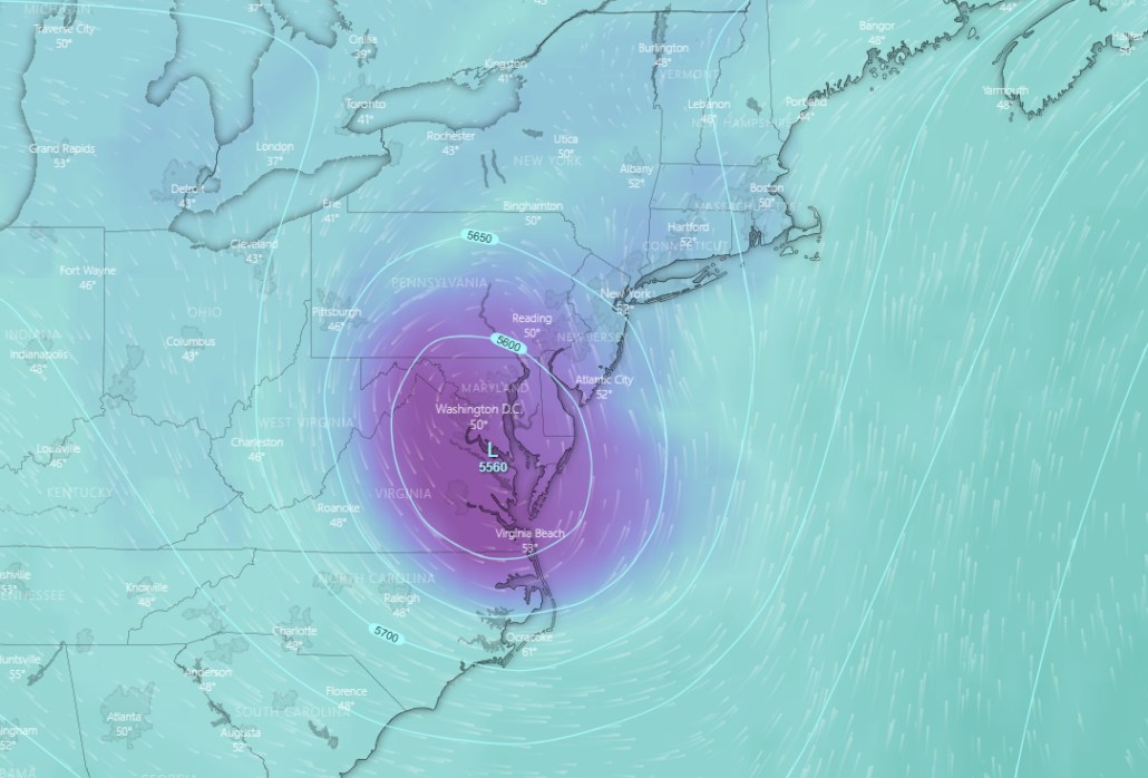
This evening’s high resolution HRRR showing the potential evolution of this evening’s rain threat
Upper level low drifts aimlessly around the Northeast through this weekend
Tomorrow morning (Saturday) will likely start off mild and wet as our upper level low moves over Tennessee/Kentucky. This will put much of the Mid-Atlantic and Northeast firmly within an area ripe for another period of moderate to heavy rain. The moisture feed for this second batch of rain will gradually shift east over portions of Long Island during the late morning/early afternoon hours. This will cause any remaining steady rain to shift to the east during the day-with a few residual showers possible. Highs tomorrow will be somewhat above average, with readings expected to be in the lower to middle 60’s. It appears that the shower threat will linger into the evening and overnight hours as the upper level low moves just off to our southwest. Lows will be cooler and less muggy tomorrow night with upper 40’s and lower 50’s likely.
Unfortunately, conditions look to remain mostly cloudy and rather “iffy” for Easter Sunday. Our upper level low will be severely weakened, but will also be moving near/over the area. Weak residual moisture from the core of the low will approach the area, likely setting off at least a few isolated showers on Sunday. The low will also keep a rather stale, but somewhat mild airmass in place. Expect highs to reach the middle to upper 60’s, with some 70’s possible if there are some breaks in the clouds. More showers may develop during the late afternoon hours as daytime heating causes some very weak instability to develop. Expect lows to once again drop into the upper 40’s to lower 50’s overnight, with mainly cloudy skies and residual showers possible.
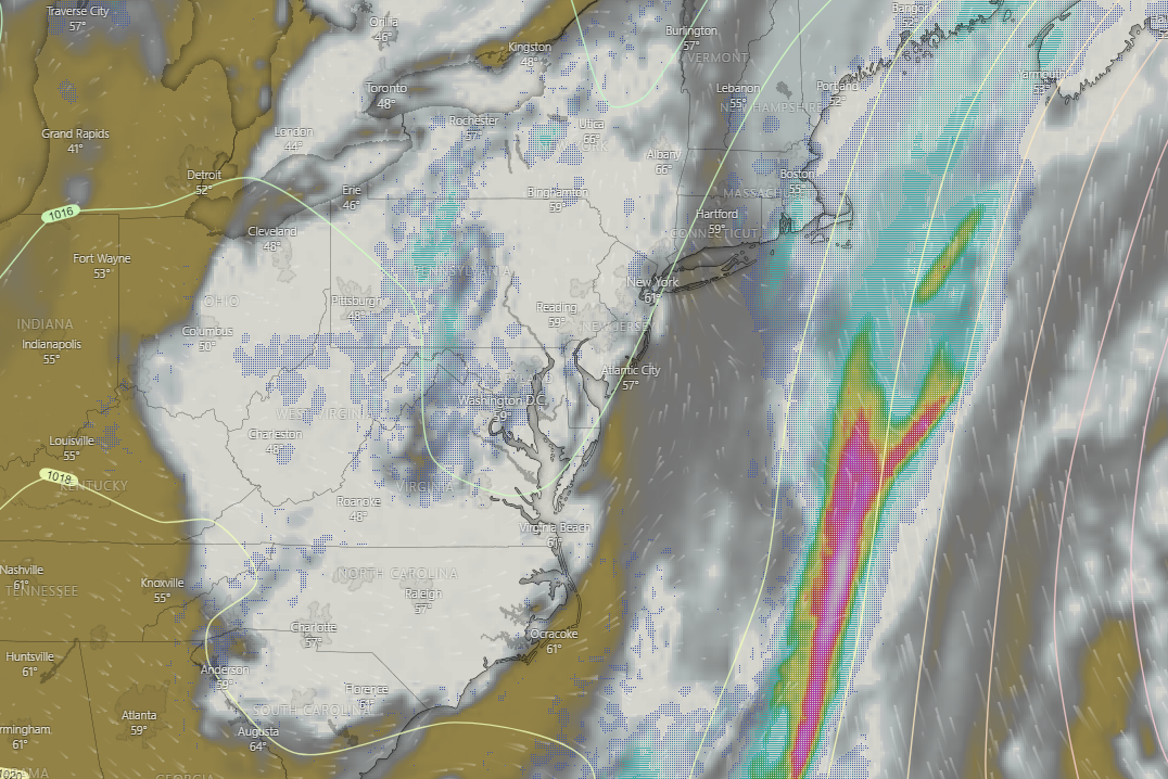
This evening’s GFS model showing the upper level low lingering over the Northeast during the day on Sunday
Upper low finally leaves…but there’s a catch!
Model guidance begins to diverge on the exact timing/location of the decaying/weak upper level low by Monday morning. However, it appears possible that this system could still be lingering over the area come Monday, with the continued potential for clouds/showers. Conditions then look to briefly improve on Tuesday as a mid level ridge sets up over the East. Tuesday will likely be mostly sunny and quite warm/mild with highs in the lower to middle 70’s. Things may break down as early as Tuesday night as a northern stream disturbance approaches from Canada. This weak system will have the potential for some light showers across the area while another system brews over the Southeast.
This second system may eventually impact the Northeast with more rain/clouds around Thursday/Friday, but this will have to be refined during subsequent updates.
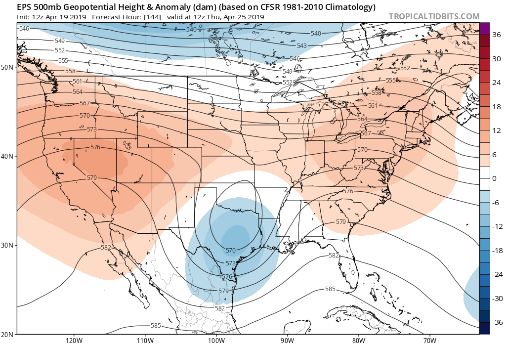
This afternoon’s ECMWF Ensemble showing the potential for another period of unsettled conditions next week
Thanks for reading and have a great weekend!
-Steve Copertino
Leave a Reply
Want to join the discussion?Feel free to contribute!