-2")
High pressure exits, next storm system not far behind
Good afternoon!
A weak area of high pressure has built into the region today, allowing for sunny skies and warm temperatures. However, these conditions will not last long as another system approaches tomorrow.
Today has been a very pleasant and tranquil day across the entire metro area as a result of increased mid level ridging. The dry northwesterly flow behind yesterday’s storm system has resulted in somewhat cooler highs across the area. Readings have generally been in the middle to upper 60’s, with spotty 70’s over portions of New Jersey. Mostly sunny skies with some occasionally breezy conditions at times look to continue well into the evening and overnight hours. The combination of dry air, light winds, and cooler temperatures aloft will allow for good radiational cooling conditions. Low temperatures should fall into the middle to upper 40’s, with cooler readings off to the north and west.
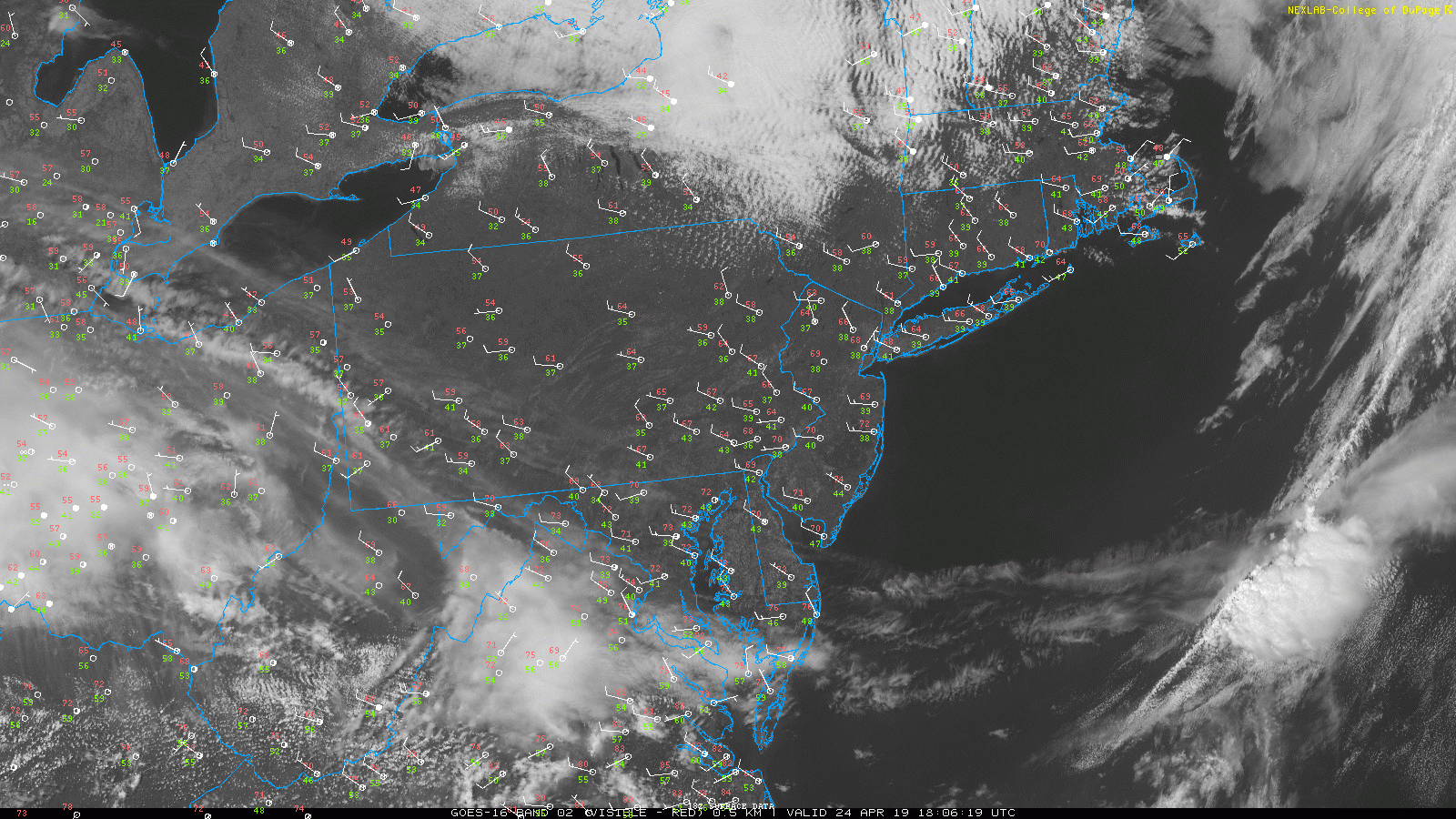
Visible satelite loop from this afternoon showing mainly clear and warm conditions across the Northeast
Weak high exits to the east tomorrow, showers possible Thursday PM through Friday
Tomorrow (Thursday) should start off much like how today did for the entire area. Mostly sunny skies and temperatures in the middle to upper 60’s will once again be likely across the region. As we head deeper into the afternoon, a weak warm front associated with a developing system over the Southeast will approach our area. Our mid level flow will gradually shift over from northwesterly to southwesterly during this time, allowing moisture to move into the area. At the very least this will cause a steady increase in clouds for the afternoon. While some showers will be possible after 2pm or so, some residual dry air in the lower levels of the atmosphere may keep these confined mainly south of NYC. Showers will be possible into the evening hours, but the bulk of any sustained precipitation should wait until after midnight.
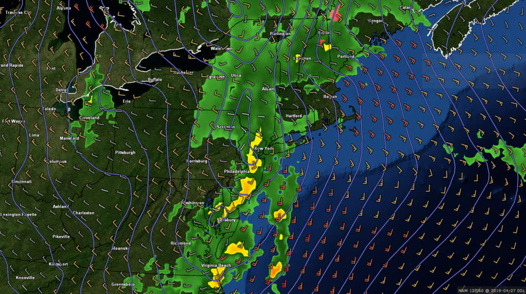
More widespread showers will become likely after 2am or so, as more significant lift and moisture move in. The Friday morning commute will likely be a wet and dreary one as low pressure moves into the Ohio Valley. Yet another large and very impressive moisture feed from the Gulf of Mexico will set over our area during the afternoon hours of Friday. Despite the increased moisture, shower activity may become more sporadic Friday afternoon as the best lift becomes displaced. More substantial shower activity may set up during the evening hours as the system moves off to our northwest. Some of this activity may even contain some gusty thunderstorms, but we’ll look into this more during our next update.
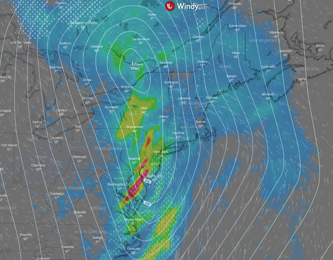
Model image showing the potential for a period of heavy rain Friday night
Storm system exits Saturday, zonal flow sets up next week
The system set to impact much of the area over the next few days looks to exit off to our northeast on Saturday morning. As this system pulls away, deep northwesterly flow will overspread the area. As a result, Saturday should be a greatly improved day with clear skies, highs in the lower to middle 60’s, and some gusty winds. Fast-moving west to east (zonal) flow will then likely set up across the country by Sunday. A weak shortwave trough may move through the Northeast on Sunday with some light rain, but this system will likely have little in the way over overall moisture.
High pressure will likely develop over the Northeast on Monday, making for a rather nice start to the work week. Zonal flow looks to last at least into the middle of the week, with the potential for another quick-moving system to impact the area on Tuesday. Otherwise, highs look to stay right around normal over the next week or so (lower to middle 60’s).
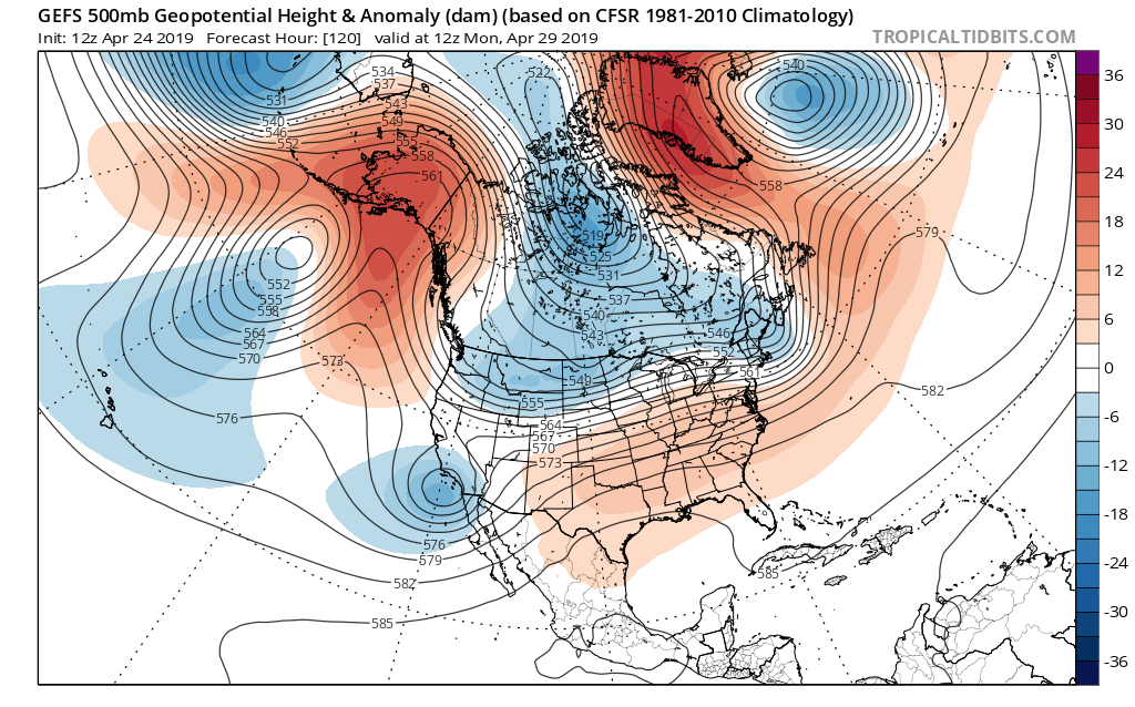
Today’s GFS ensemble showing a period of zonal (west to east) flow setting up for next week
Thanks for reading and we’ll have an update on Friday!
-Steve Copertino
I just hope the onshore flow will decide to leave us alone so that Tuesday and Wednesday can be nicer and brighter than what is currently being forecast. Hope Sunday’s forecast improves to because wanted to go to the park by my friend’s house and I really don’t want it staying cold with 40s and rain all day