-2")
Heavy rain and thunderstorms likely tonight
Good afternoon and happy Friday!
Widespread showers and thunderstorms have developed across much of the Mid-Atlantic and Northeastern states this afternoon. Heavy rain, gusty winds, and frequent lightning will all be possible later this evening/tonight for much of the NYC area!
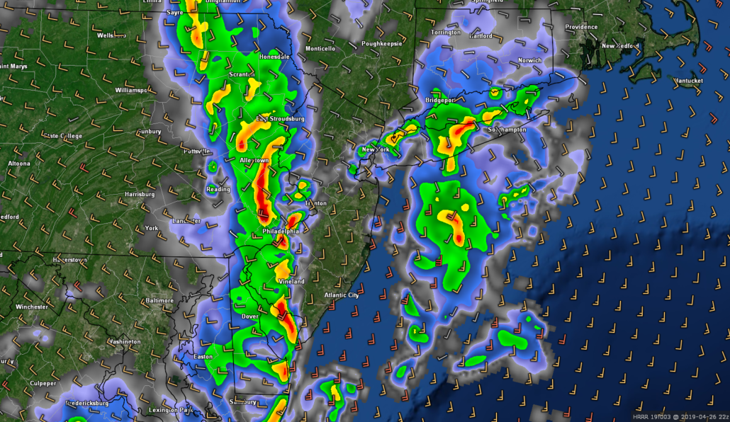
The energetic upper level system that we have been talking about for about a week now has made its way into the region. As a result, a large and impressive surface low has moved into the Northeast. Widespread precipitation has developed with this low as deep moisture from the Gulf of Mexico continues to stream northward. Additionally, some weak instability and moderate wind shear has allowed for the development of severe thunderstorms over the Mid-Atlantic states. As of 5pm, a line of strong to severe thunderstorms extended from southeastern Pennsylvania to eastern Virginia. While there is a Tornado Watch in place until 9pm, the main hazard with these storms has been strong winds in excess of 70mph.
This line will continue to move northeastward over the next few hours, likely impacting much of our area this evening/tonight. While there is some threat of severe weather for our area later, the highest risk remains further south over portions of southern New Jersey. This is due to the relatively cool and stable environment currently in place over the NYC area. As it stands, the main line of storms should move into portions of New Jersey around 5-6pm. As this line moves east, it should begin to gradually weaken. Nonetheless, heavy downpours, strong winds, and frequent lightning will all be possible tonight.
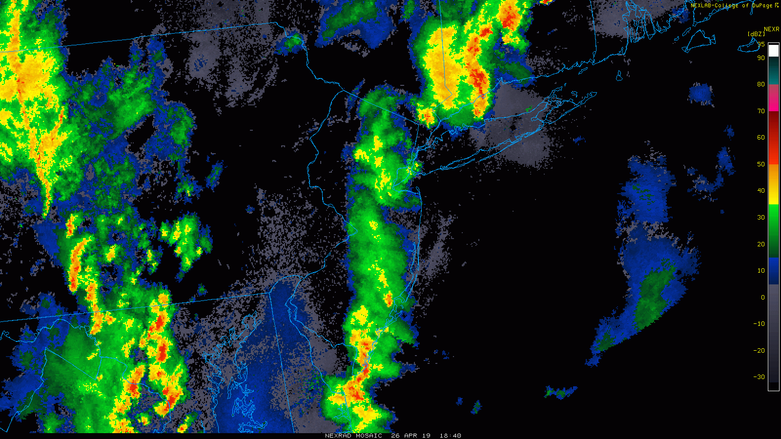
Local radar composite showing a line of strong thunderstorms moving into the area (click to animate)
Heavy showers and storms move out late tonight
All remaining showers and thunderstorms will continue to weaken later tonight and into the overnight hours as they push east. The bulk of the activity should be out of the area right around midnight or so, with only a few showers remaining. Northwesterly flow should quickly filter in later tonight and into the overnight hours, bringing in cooler conditions. Lows will likely fall into the upper 40’s for the entire area, with mostly cloudy skies.
Tomorrow (Saturday) should start off dry with some residual clouds in the morning. Dry northwesterly flow from Canada will help to clear out the vast majority of the leftover clouds for the area during the afternoon hours. Partly sunny skies and cooler air aloft should allow temperatures to only reach into the lower 50’s for highs tomorrow-which will be below normal for this time of year. There will likely also be some periods of breezy/gusty winds tomorrow afternoon as the low moves off to the northeast. Much of the same is expected into the evening and overnight hours tomorrow night as the upper level system moves out of the Northeast. Lows tomorrow night will be quite cool, with upper 30’s to lower 40’s likely.
Another weak upper level system will be moving quickly across the Great Lakes region and into the Northeast on Sunday. This system will likely produce an area of light rain across the area Sunday morning and into the afternoon hours. Highs will be marginally warmer, with temps in the middle to upper 50’s expected. Any remaining light rain showers should move off the coast during the late evening hours, with gradually decreasing clouds into the overnight hours. Lows Sunday night will once again be quite cool, with upper 30’s to lower 40’s likely.
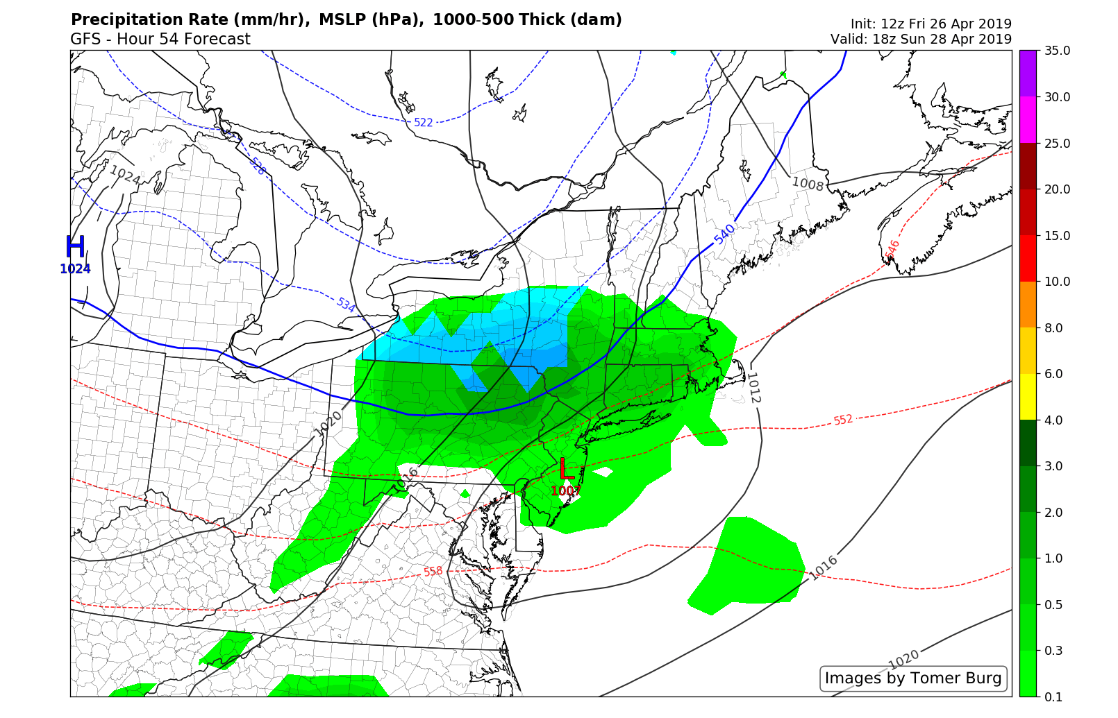
GFS model showing the potential for some light rain over the Northeast on Sunday
Thanks for reading and we’ll have an update on Monday!
-Steve Copertino
Trackbacks & Pingbacks
3decades
Leave a Reply
Want to join the discussion?Feel free to contribute!