-2")
Wild temperature fluctuations into the weekend
Good evening!
A complex forecast is setting up for the area as a backdoor cold front looks to plague our high temperatures!
Today has unfortunately been a rather dull and dreary day across much of the Northeast. Despite deep southwesterly flow aloft, offshore flow continues off of the cool Atlantic. This combination has made for sensible weather conditions better fit for March as opposed to May. Virtually the entire day has featured dense overcast with some patchy drizzle over much of the area. Additionally, temperatures have been quite a bit below normal, with highs coming in only around the lower to middle 50’s! Conditions were even more bleak over portions of Long Island, where persistent onshore flow and overcast kept temperatures down into the middle to upper 40’s.
Much of the same is likely into the evening and overnight hours. A mid level warm front will slowly be moving into southern portions of the area tonight-with a few showers possible. The rest of the area may have to contend with some periods of fog developing during the overnight hours. While the fog will likely not be widespread, it could be locally dense across portions of NE NJ. Overcast and continued onshore flow will ensure that temperatures remain rather stagnant tonight. Expect lows to only get down into the middle 40’s to lower 50’s for much of the area.
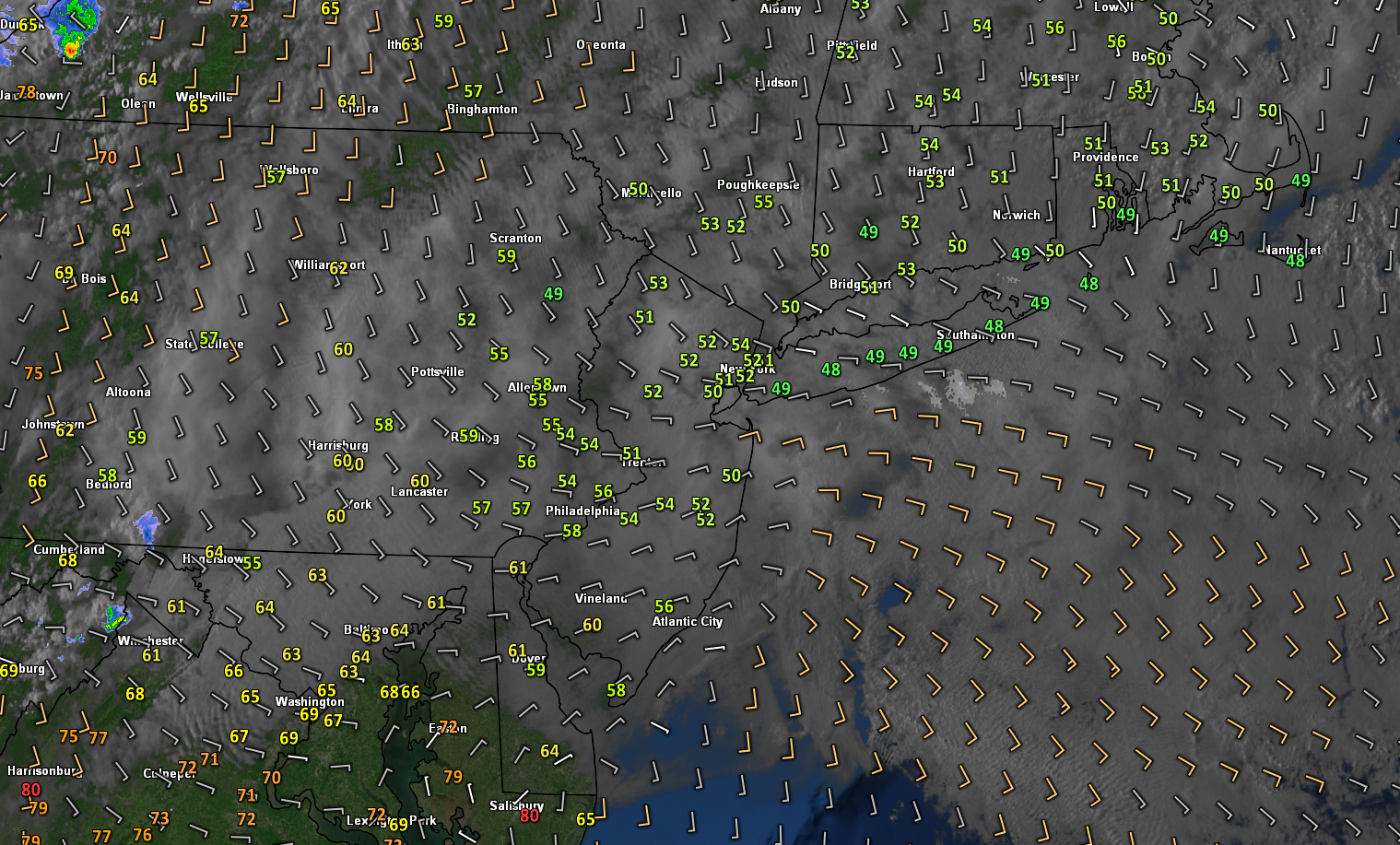
Snapshot of this evening’s conditions showing the general cool and cloudy theme over much of the area
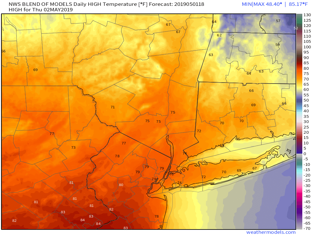
Thursday’s Tricky Temperature Forecast & Backdoor Front
Tomorrow (Thursday) will likely start with partly to mostly cloudy skies during the AM commute-with some fog possible. Winds should gradually shift more to the south and west during the late morning and afternoon hours. As a result, temperatures will likely rise quite a bit across much of the area. Despite partly to mostly cloudy skies, highs will likely peak into the lower to middle 70’s across much of the area. Portions of New Jersey could easily see highs rise into the upper 70’s to lower 80’s if there are some prolonged periods of sun during the afternoon hours.
Things begin to get a bit more interesting during the late afternoon and evening hours as a backdoor cold front approaches from the northeast. Temperatures will likely fall quite a bit as this front passes-with some locations falling 25 degrees in a matter of a few hours! In addition to the falling temperatures, there will be a good chance of showers across much of the NYC metro into the evening hours. Some of these showers could be rather heavy in nature depending on the timing of the warm front. Lows tomorrow night will drop back down into the upper 40’s to lower 50’s with a continued threat for light rain.
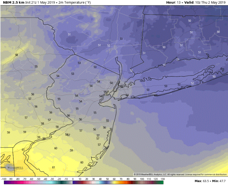
This evening’s National Blend of Models (NBM) showing a very quick transition of temperatures tomorrow as a backdoor cold front swings through (click to animate)
Another wet weekend ahead?
Unfortunately, things look pretty bleak and wet over the next few days across much of the Northeast. A weak mid level system will move quickly through the Ohio Valley and Northeast on Friday-bringing our first chance of rain. Showers will likely continue into the evening/overnight hours of Friday as a weak frontal system swings through. There may be a very brief period of calmer weather during the second half of Saturday. However, things will likely go downhill pretty quickly as another storm system develops over the Southeast. This system has the potential to affect the region starting Sunday morning, and possibly lasting into the evening hours. While its a bit too early to say, it does appear that this system does have a good chance at producing a washout for the day.
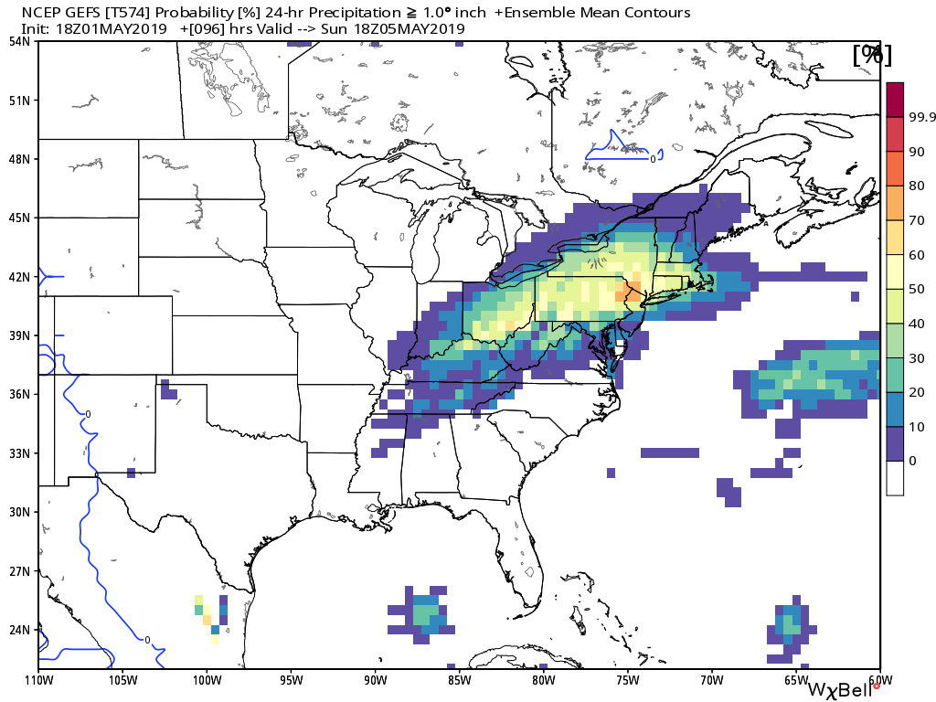
This evening’s GFS ensemble showing a high chance at moderate to heavy rain during the later half of this weekend
We’ll continue to monitor these rain threat over the next few days and will have an update on Friday!
-Steve Copertino
Leave a Reply
Want to join the discussion?Feel free to contribute!