-2")
Shower threat continues for majority of the weekend
Good evening and happy Friday!
Unfortunately, this weekend is setting up to be a rather dull and dreary one for the entire area. A series of disturbances will be moving through the area bringing the threat of rain for most of the weekend.
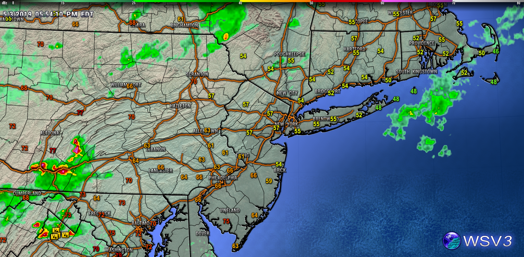
Well unfortunately the beautiful summer-like warmth of Thursday is now just a memory thanks to the backdoor cold front that moved last evening. In its place we are now once again trapped in conditions more fit for March than May. Dense mid to lower level clouds have ruled the day with the occasional shower for some added misery. Temperatures have been stagnant and unseasonably cool this afternoon, with highs in the middle to upper 50’s. This is an impressive (and depressing) 20-25 degree drop since Thursday afternoon. Cool temperatures and cloudy skies will likely continue well into the late evening/overnight hours as a weak shortwave approaches from the Mid-Atlantic region.
This weak system has already been responsible for the development of some showers and thunderstorms across portions of the Mid-Atlantic states this afternoon. The concern is that some residual rain showers could move into the NYC metro area from 10pm to around 2am or so. Some of these showers could contain periods of heavy rain and even a rumble of thunder. Regardless, lows tonight will remain in the lower to middle 50’s for the immediate metro area-with cooler conditions along the coast.
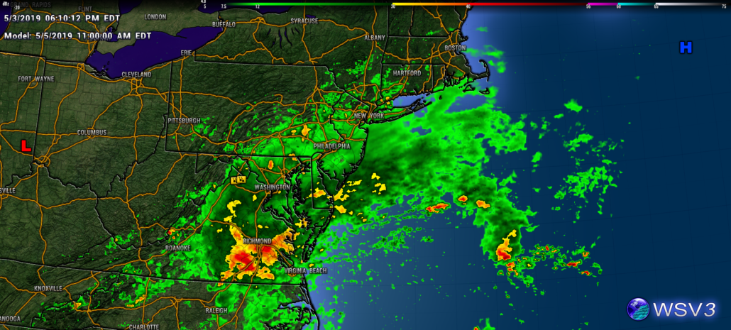
This evening’s current conditions over the Northeast. Cool, stagnant temperatures remain over the NYC area with showers approaching form the southwest
Brief break Saturday before another disturbance arrives
Any residual shower activity should gradually move out of the area by early tomorrow (Saturday) morning. Partly to mostly cloudy skies will be common across the region as low level moisture remains in place. Thankfully, increased southwesterly flow and a few brief breaks in the clouds should allow for improved highs tomorrow. Temperatures will likely be able to recover into the lower to middle 70’s for the vast majority of the area. While we’ll be getting rid of one weak disturbance, another will be hot on its heels later in the day. This will likely keep much of the day unsettled, with a chance at some rain showers developing around noon.
This threat will be enhanced for portions of central and southern NJ where some weak elevated instability may set up. Generally unsettled and mild conditions look to last into the evening and overnight hours. While sufficient moisture looks to remain in place tomorrow night, the lack of forcing will limit any precip potential to rain showers. Lows will once again remain in the lower to middle 50’s thanks to increased clouds and a stale airmass.
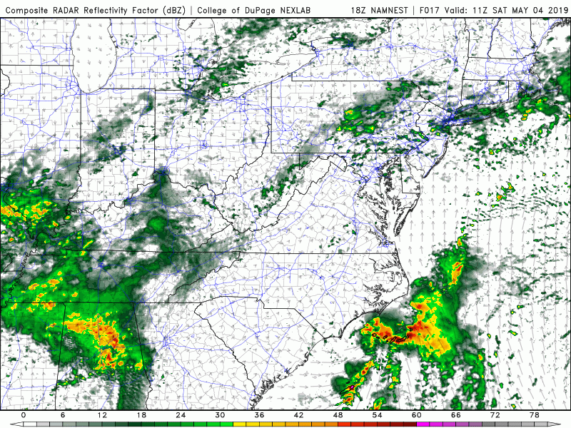
This evening’s NAM model showing the general theme of an unsettled day on Saturday with a threat for showers
Threat of some more substantial rain likely for Sunday
Things should start off quite wet and dreary from the start on Sunday morning. A wave of low pressure will be moving just to the south of the area during the morning, guaranteeing at least steady light/moderate rain. As if the prospects of more rain wasn’t enough, it’s also looking like Sunday will be a good deal cooler as well. Highs on Sunday will likely stay in the middle to upper 50’s, with a few locations breaking into the 60’s. The weak area of low pressure looks to quickly move to our east and off the coast by the late afternoon/early evening hours. As it does so, the bulk of the rain threat should head off the coast as well. Conditions should begin to gradually improve during the late evening and overnight hours. Partly to mostly cloudy skies and lows in the upper 40’s to lower 50’s are expected Sunday night.
While this weekend looks to be a bust, signs point to the beginning of next week starting off dry for a change. We’ll have an update on Monday for a deeper look into next week!
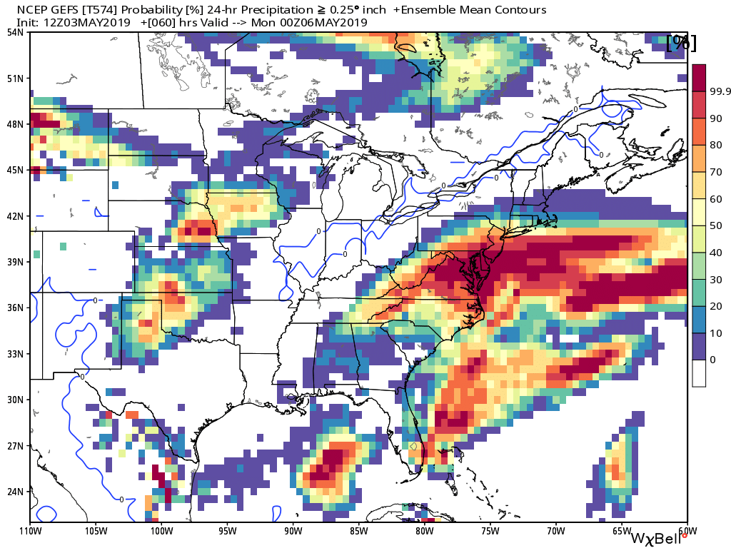
This evening’s GFS ensemble showing a relatively high chance at a yet another wet and gloomy day on Sunday
Thanks for reading and have a great night!
-Steve Copertino
Good blog! All the predicted forecast for the week turned out to be accurate.