-2")
Volatile conditions last throughout Mother’s Day weekend
Good evening and happy Friday!
Unfortunately, the fickle weather conditions that have plagued our area look to continue through Mothers Day weekend. While Saturday may start off decent, more wet and unseasonably cool conditions are on the horizon!
Today started off rather dreary and muggy across much of the New York City as moist southwesterly flow overspread the area. Conditions stayed rather dreary into the late morning/early afternoon hours, with some showers observed. Skies began to gradually clear from southwest to northeast this afternoon, allowing temperatures to slowly rebound. The combination of significantly reduced clouds and deep southwesterly flow has allowed for temperatures to climb into “above normal” territory. Highs have made it into the middle to upper 70’s across much of the immediate NYC metro, with some 80’s to the south. Cooler onshore winds brought highs in a little cooler over portions of Long Island and Connecticut, with mainly 60’s reported.
Relatively sunny skies and warm conditions will likely continue for the next couple of hours. An area of showers has been heading slowly to the east over portions of SE PA this afternoon/evening. Thankfully, this area has been gradually weakening as it moves into the area. Conditions may once again turn mostly cloudy for central and southern portions of New Jersey as the remnants of this activity moves through. There is a risk of some more showers & possibly a thunderstorm later on tonight–mainly north and west of NYC. Lows tonight will be seasonable, with lower to middle 50’s expected for much of the area.
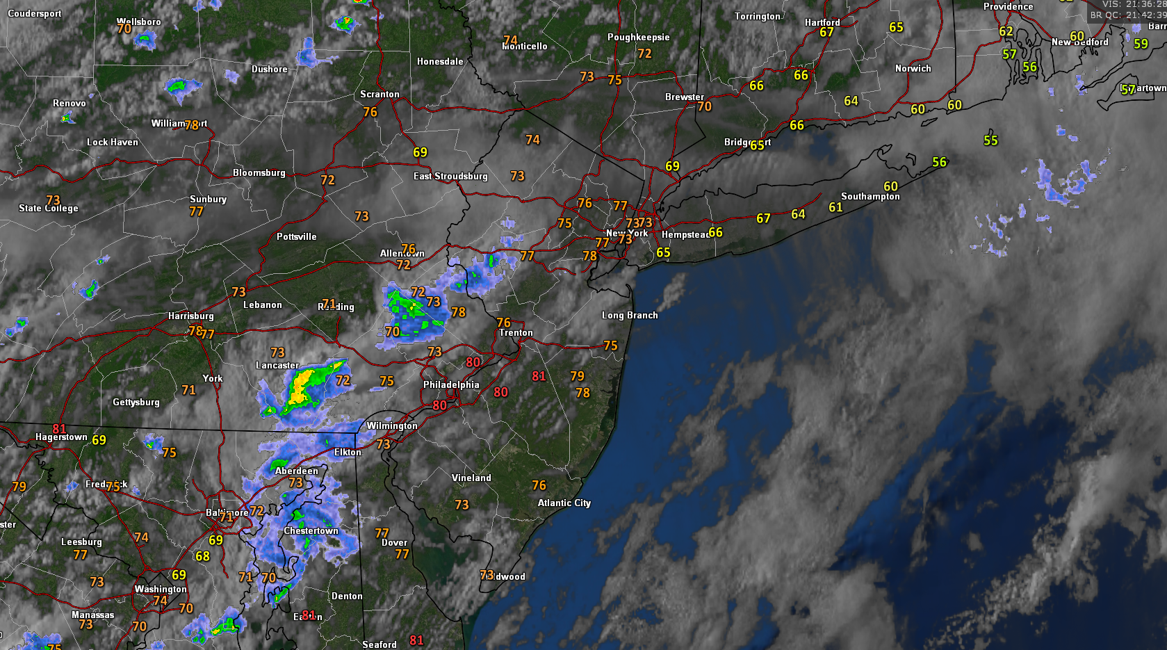
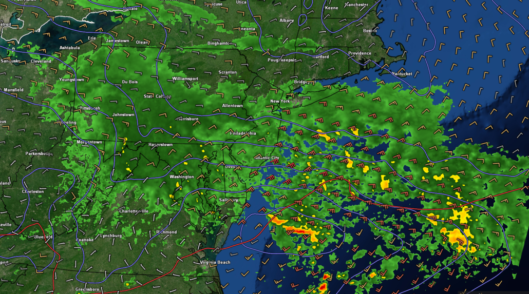
Snapshot of this evening’s regional radar, satellite, and surface temperatures showing rather decent conditions over the area
Saturday likely the only salvageable day of this weekend
Tomorrow morning (Saturday) looks to start off quite pleasant for much of the Northeast as a cold front moves off the coast. High pressure will be building just off to our west for much of the day, providing mainly dry and calm conditions. Westerly flow aloft and partly/mostly sunny skies should allow highs to easily reach seasonable levels. Temperatures will likely reach the middle to upper 60’s for much of the area, with lower 70’s possible over NE NJ. Warm & pleasant conditions look to continue into the early evening hours before our next period of unsettled weather arrives.
Cloud cover will likely be on the rise tomorrow night as a weak shortwave moves into the Mid Atlantic states. While this shortwave will be weak in nature, it will be transporting an impressive amount of Gulf moisture. Cloudy and unstable conditions will extend into the overnight hours with showers likely over portions of New Jersey. Expect lows to be a bit cooler for much of the area, with readings in the middle to upper 40’s.
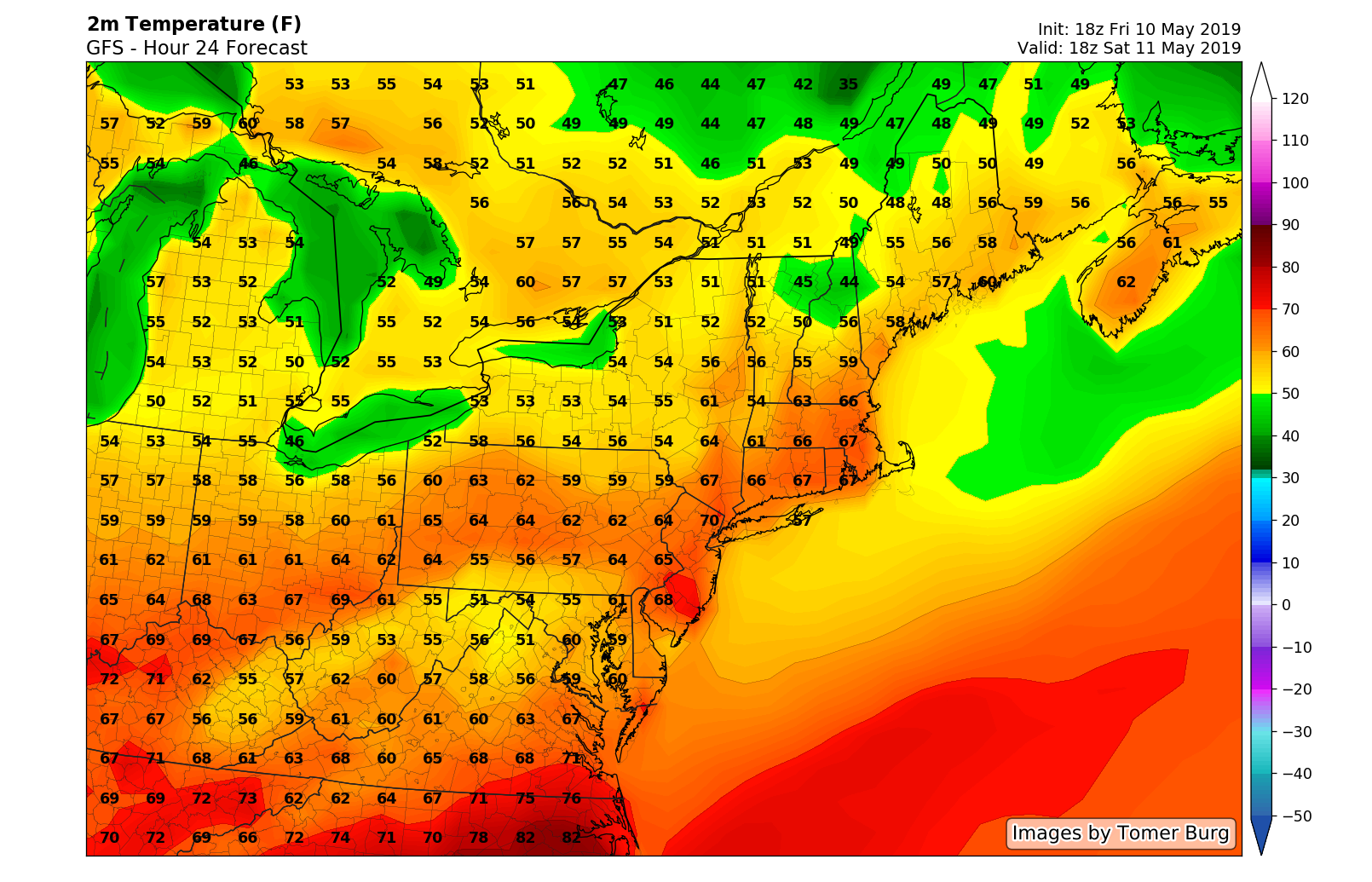
This evening’s GFS model showing seasonable temperatures over much of the Northeast on Saturday afternoon
Dreary and unsettled conditions set up once again over much of the East by Sunday
Sunday morning (Mother’s Day) unfortunately looks to start off on a polar opposite note compared to Saturday. A series of shortwaves will be traveling from the Southeast to Mid-Atlantic states during the day, ensuring dreary & damp conditions. Additionally, an unseasonably cool airmass will be in place at this time (as if a complete washout wasn’t enough). Highs will likely struggle to reach the middle-upper 50’s for the entire NYC metro area (which will be 5-10 degrees below normal). Damp, dreary, and unseasonably cool conditions will likely dominate our sensible weather into the evening overnight hours. Lows Sunday night will remain below normal, with temps in the middle to upper 40’s.
Much of the same looks to continue through Tuesday, with both days likely featuring showers & highs only in the 50’s! Monday may contain more substantial rain than currently indicated, but this solution is subject to change over the next few days. Conditions may try to briefly clear out on Wednesday, but we could be looking at yet another period of unsettled weather later in the week.
We feel like this article already has enough bad news in it, so we’ll have more details on Monday regarding next week’s weather!
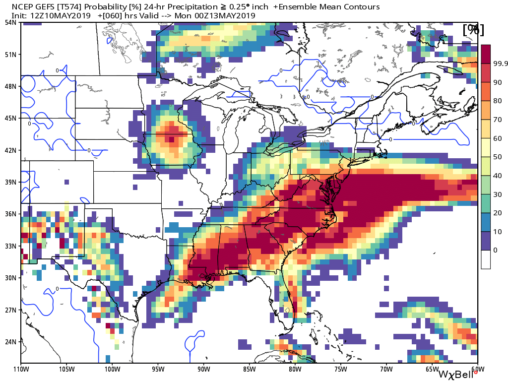
This evening’s GFS ensembles showing a very wet and unsettled weekend shaping up over much of the East Coast
Have a great weekend!
-Steve Copertino
Leave a Reply
Want to join the discussion?Feel free to contribute!