-2")
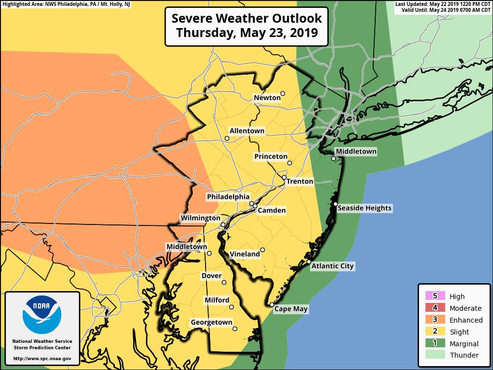
Strong thunderstorms possible Thursday afternoon
Good evening!
Today has been another excellent across the entire area! While the mild/seasonable temperatures look to stay, we may have to deal with some strong thunderstorms on Thursday!
This morning started off quite pleasant across the entire area with clear skies and a light breeze from the northwest. Mid-level ridging has been progressively increasing throughout the day today, allowing westerly flow to gradually ease in. The combination of westerly flow and clear skies today allowed highs to reach into the middle to upper 70’s, which is right around normal for this time of year. Conditions are expected to remain generally calm and mild throughout the rest of this evening and into the overnight hours. We may see some increase in clouds over the area tonight as high pressure slides off the Mid-Atlantic coast. Otherwise, expect another pleasant night with lows falling back into the middle 50’s for much of the metro area.
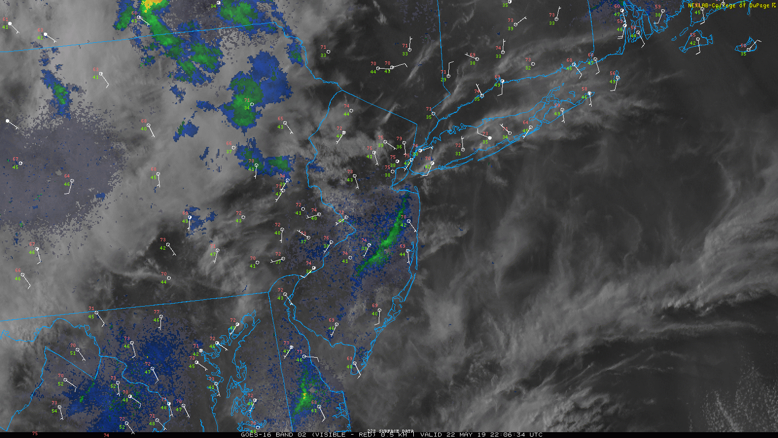
This evening’s local weather snapshot showing mainly clear skies over the NYC area.
Strong thunderstorms possible Thursday afternoon
Tomorrow morning (Thursday) should start off a bit unsettled as remnant showers and thunderstorms from the Ohio Valley slide through portions of Pennsylvania & New York. While any showers/thunderstorms will likely be weakening, there could still be some brief downpours before the morning commute. Conditions should begin to gradually clear out around 8-10am with partly sunny skies developing.
Impressive westerly flow will then overspread much of the area as we head into the afternoon hours. This will lead to highs rising once again into the middle to upper 70’s. The combination of warm temperatures & a moist airmass will lead to moderate destabilization of the atmosphere off to our west. A shortwave trough moving north of the Great Lakes should provide the “spark” for thunderstorms to develop later tomorrow afternoon. Model guidance has been indicating that initial development should take place over central Pennsylvania & over portions of south/central New York. Thunderstorms that develop over this region will have the potential for damaging winds, large hail, and possibly a tornado or two.
Thunderstorms should remain generally off to the west of the NYC metro through the late afternoon hours. Conditions should remain favorable for at least a few of these thunderstorms to move into the area around 5-9pm. While the best risk for severe thunderstorms will be off to the north and west of NYC, some of these thunderstorms could still produce strong winds and small hail. Things should quickly wind down tomorrow night around 10pm as any remaining showers and thunderstorms move off to the south and east. Skies should gradually clear overnight from NW to SE with lows in the upper 50’s.
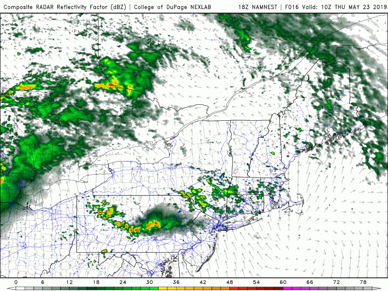
This evening’s NAM model showing the development of showers & strong thunderstorms tomorrow afternoon
Excellent end to the week, a look ahead at Memorial Day weekend
Conditions should calm down quite a bit as we head into the day on Friday. Northwesterly flow aloft will begin to develop in the wake of Thursday’s system with high pressure forming at the surface. Friday will likely feature sunny skies and seasonable highs in the middle to upper 70’s. High pressure will continue to develop over the area Friday night, with clear skies and lows in the mid 50’s expected.
The first half of Saturday looks to remain rather calm for the most part. Highs are expected to reach the middle to upper 70’s once again with mostly sunny skies. Conditions may become a little more unsettled later in the evening/overnight hours as showers and thunderstorms develop off to our northwest. This activity should wait until dark to move through the area, but we’ll continue to monitor this system over the next few days.
Sunday is setting up to be much warmer as an impressive ridge sets up shop over the East. Highs on Sunday should easily rise into the 80’s, with middle to upper 80’s possible across portions of New Jersey. Conditions look to stay mostly calm and dry through Sunday night–with indications that Memorial Day will also remain calm, clear, and warm!
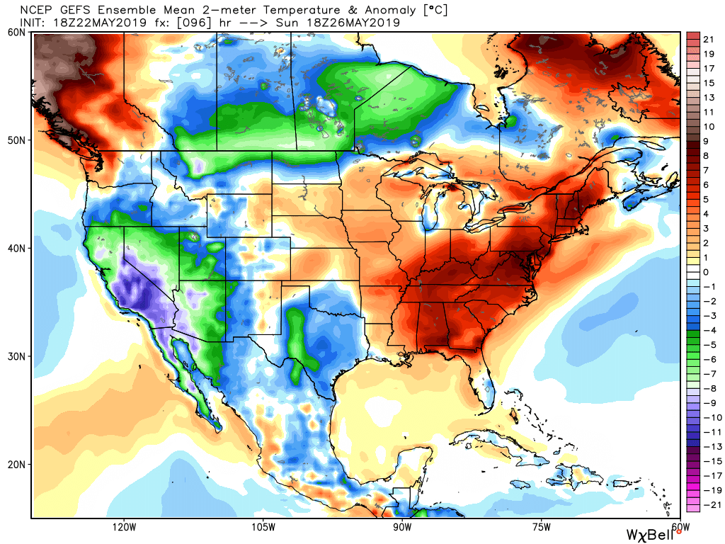
This evening’s GFS Ensemble showing the potential for a very warm Memorial Day weekend
Thanks for reading and we’ll have a full look at this weekend by Friday evening!
-Steven Copertino
Trackbacks & Pingbacks
2tacitly
Leave a Reply
Want to join the discussion?Feel free to contribute!