-2")
Warm and pleasant Memorial Day weekend ahead!
Good evening and happy Friday!
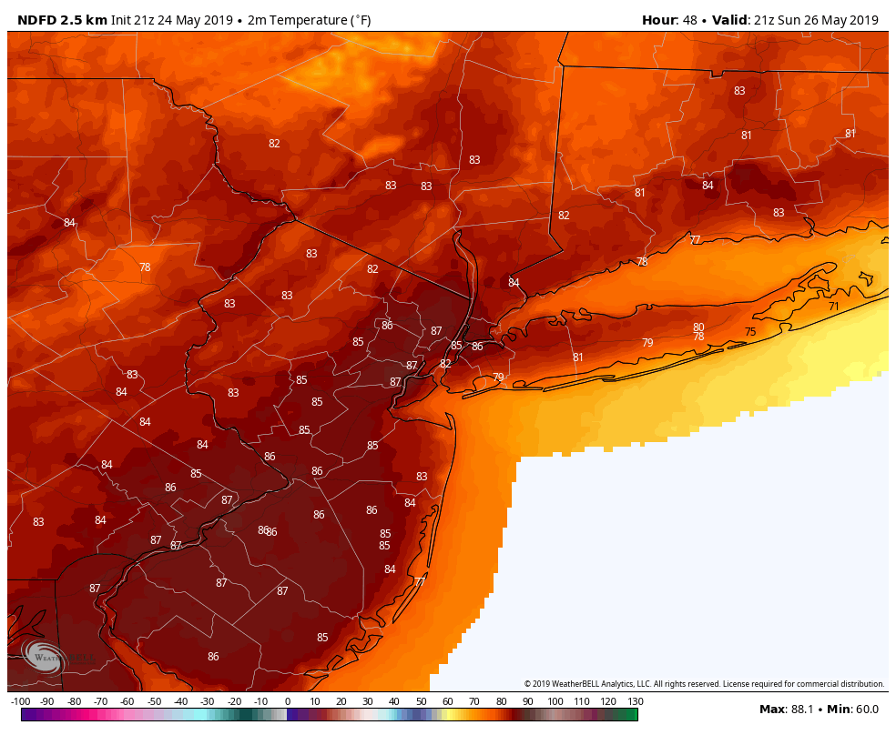
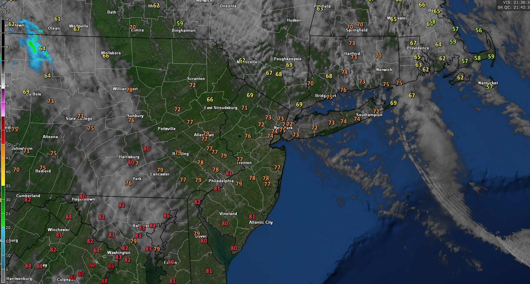
Today started off on an excellent note this morning with widespread sunny skies over much of the NYC metro area. Northwesterly flow out ahead of an approaching mid level ridge allowed for slightly cooler temps compared to the past few days. Regardless, highs were still able to rise into the lower to middle 70’s–with upper 70’s & lower 80’s over southern New Jersey.
Surface high pressure continues to develop over the area allowing for light winds and dry conditions. Continued warm and pleasant conditions are expected for the remainder of this evening and into the overnight hours. Mid level ridging in conjunction with surface high pressure should allow for excellent radiational cooling tonight. As a result, temperatures will likely fall back down into the lower to middle 50’s across the entire area. Clear skies, light winds, dry conditions will make for an enjoyable night across virtually the entire metro area.
Snapshot of today’s conditions showing warm temperatures and clear skies
Near-perfect day Saturday, above normal temperatures arrive Sunday
Tomorrow (Saturday) should start off much like today, with clear skies and mild temperatures. Mid-level ridging will be pushing overhead tomorrow afternoon, providing near-normal highs once again. Temperatures should easily climb into the lower to middle 70’s, with slightly warmer temps off to the south. Surface high pressure will remain in control through the afternoon hours, ensuring dry conditions. Things should begin to shift a bit by tomorrow evening as a mid level warm front moves in from the southwest. This warm front should cause a steady increase in clouds around sunset tomorrow evening. In addition, surface high pressure will be moving off the coast, allowing for some moisture to stream in.
As a result, some showers will be possible across the area after 8pm. Any rain activity should remain light in nature with no real impacts expected. Lows tomorrow night will be a little more warm, with upper 50’s to lower 60’s likely.
Sunday will likely be one of the warmer (if not the warmest) day so far this year. Deep/impressive westerly flow will overspread the entire Northeast during the afternoon hours. Any residual clouds from Saturday night will quickly burn off. With clear skies and warm mid levels, temperatures should be able to respond very quickly. Highs will likely spike into the middle to upper 80’s across the entire area–with portions of NE NJ having a shot at 90F! Warm temperatures and mostly sunny skies should last well into the evening hours, making for an excellent BBQ day! There will be a slight chance of some showers/thunderstorms later in the evening across most of the area. Thankfully, a lack of forcing should keep any showers/thunderstorms quite isolated in nature. Lows will remain rather warm Sunday night, with temps in the lower 60’s expected.
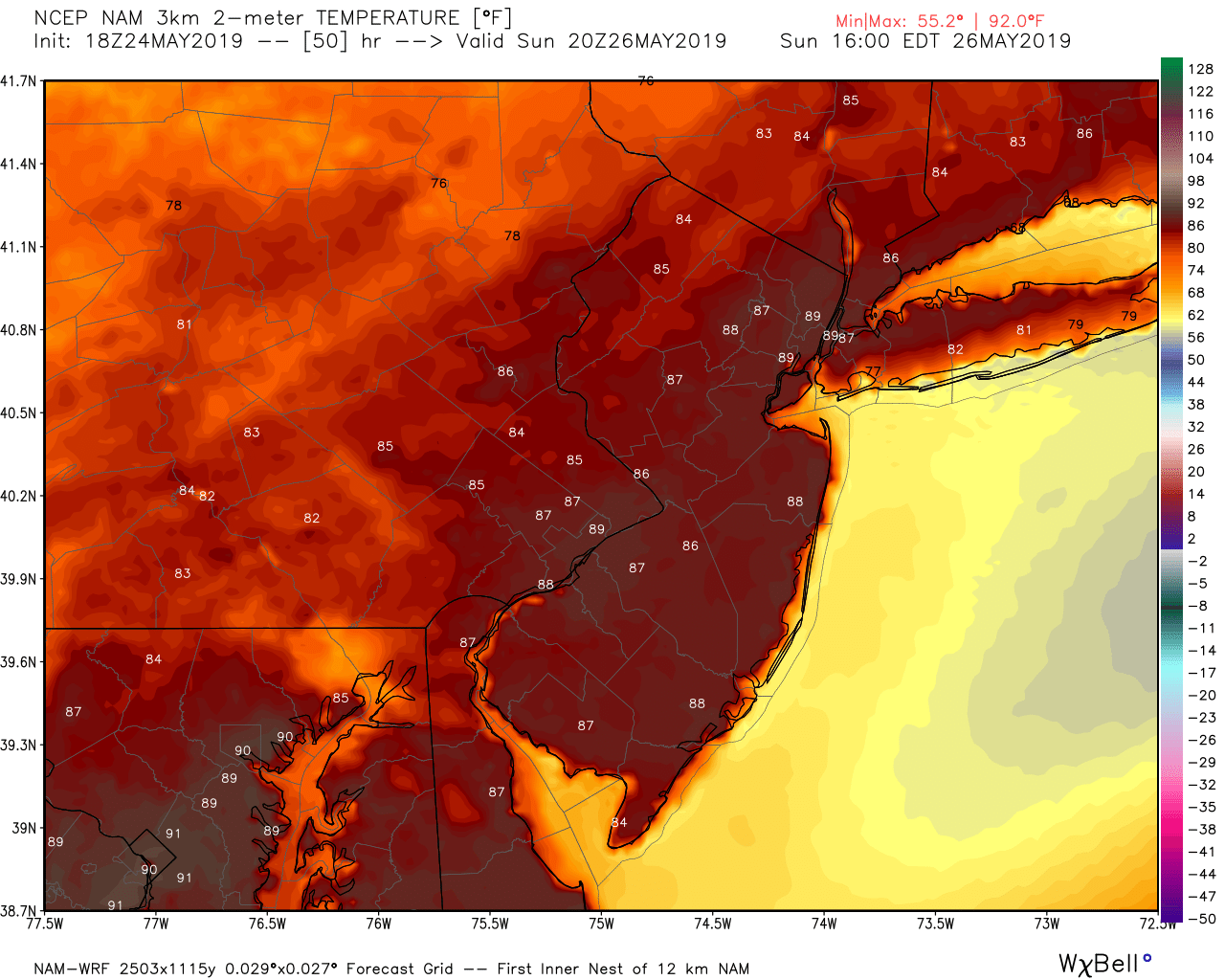
This evening’s high resolution NAM showing very warm temperatures across the area on Sunday
Excellent weather to last through Memorial Day
Another mid level ridge will be approaching the area on Monday (Memorial Day) with northwesterly flow aloft. This should allow warm temperatures to once again develop, but will likely be a few degrees cooler than Sunday. A weak area of high pressure will also likely develop over the area during the afternoon. This will pretty much ensure sunny skies, light winds, and generally beautiful conditions throughout the entire day on Monday. Highs will likely stay in the upper 70’s to lower 80’s across the entire region. Warm conditions look to stay throughout the evening and into the overnight hours with lows in the lower 60’s.
Much of the same is expected into the middle of next week, with a taste of summer potentially coming on Wednesday!
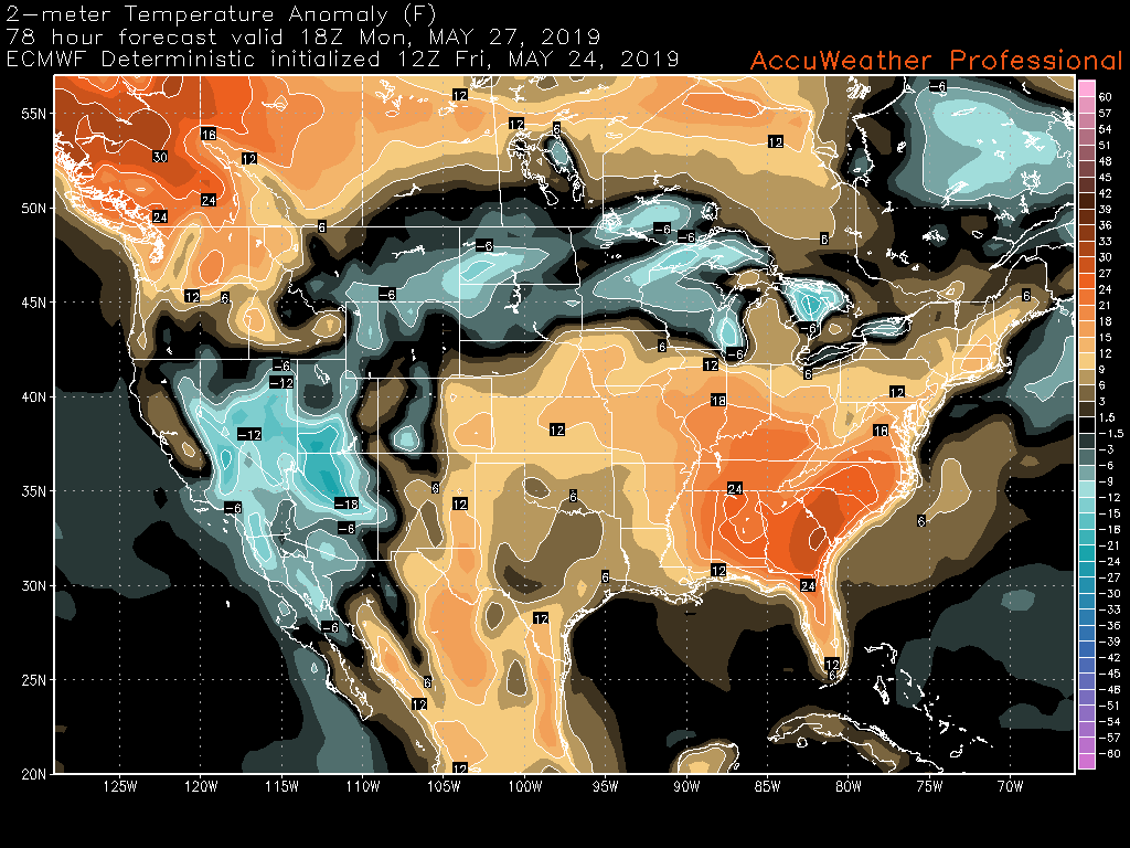
This afternoon’s European model showing above normal temperatures lasting into Memorial Day!
Thanks for reading and have a great holiday weekend!
-Steve Copertino
Trackbacks & Pingbacks
1baptised
Leave a Reply
Want to join the discussion?Feel free to contribute!