-2")
Additional showers and thunderstorms expected Thursday
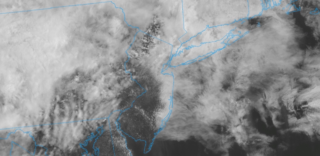
To the shock of absolutely nobody, showers and thunderstorms are again anticipated today. This will be the third straight day with a risk of severe weather in the Northern Mid Atlantic states. While the risk for widespread severe thunderstorms will be a bit lower than it was on Tuesday and Wednesday, a threat for heavy rain and localized flooding will exist.
The threat for storms is being driven by another atmospheric disturbance which is set to approach the region later today. Instability is expected to redevelop across Southeast Pennsylvania, New Jersey and parts of Southeast New York by this afternoon. With strong wind shear in place, thunderstorms that do develop will be able to organize.
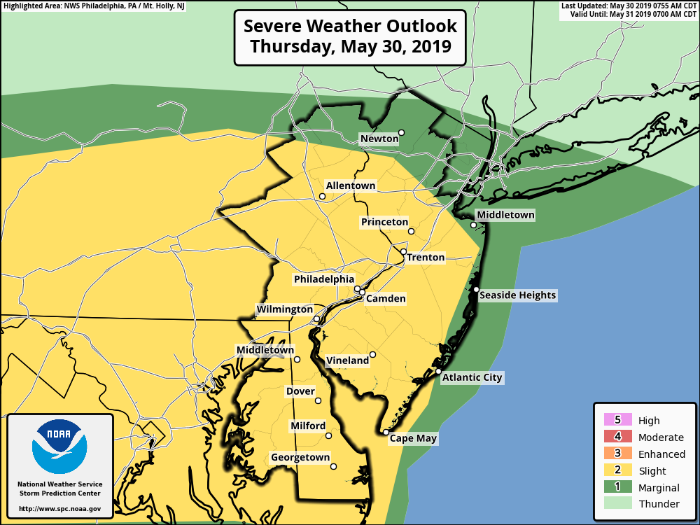
SPC has placed parts of the area in a Slight Risk for severe weather today.
Showers and thunderstorms should shift eastward from Pennsylvania from the early afternoon into the early evening hours. The best threat for organized thunderstorms will be over Southeast Pennsylvania and New Jersey, where instability and wind shear will most favorably align. Strong wind gusts and hail will be possible with thunderstorms there.
There will also be the risk for an isolated tornado or two, although this risk will also be lower and more isolated than the past few days. This risk is likely to be maximized in Southeast Pennsylvania, near a frontal boundary that may enhance wind shear in the lower levels. Short term model guidance also suggests the most impressive thunderstorm activity will be in this region, to the west/southwest of the Philadelphia metro area.
Throughout the entire area, though, tons of moisture in the atmosphere will promote the threat for flash flooding. This heavy rainfall will exacerbate issues created by the rainfall over the past two days, leading to flood potential in both the suburbs and urban corridors.
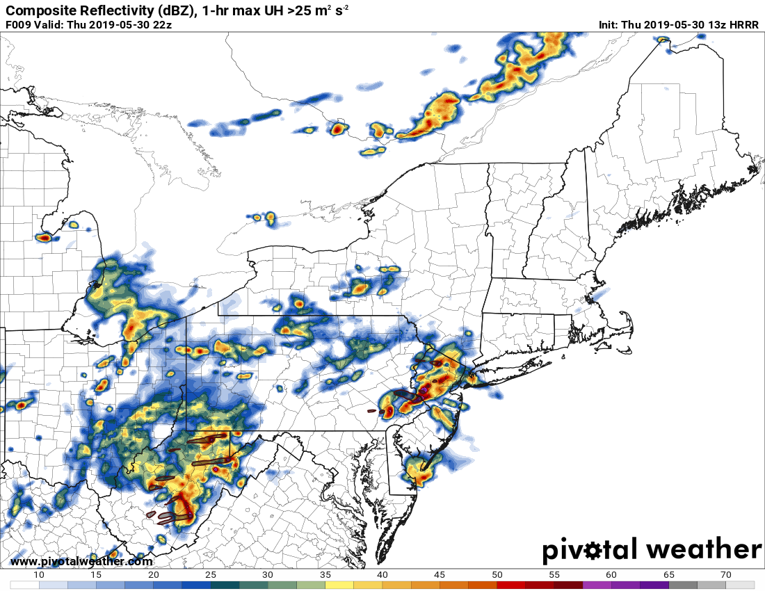
HRRR model suggesting strong to severe thunderstorms again this afternoon.
The Storm Prediction Center has placed the majority of the aforementioned region in a Slight Risk for severe thunderstorms. Additionally, flash flood watches have been issued in parts of New Jersey and New York to account for the heavy rain and associated flooding risk.
Storms will sweep off the coast by this evening, finally taking the persistent frontal boundary with it. This will result in clearing and improving conditions by Friday. Calmer and cooler weather will settle in, at least until later Saturday when another disturbance appears likely to approach the area. There is the potential for another round of showers and storms beginning late Saturday evening and continuing into Sunday, but uncertainties continue in regards to timing and the potential intensity of any storms.
Trackbacks & Pingbacks
2banners
Leave a Reply
Want to join the discussion?Feel free to contribute!