-2")
Weekend Outlook: Calmer weather settles in, isolated storms still possible
After three days of heavy rainfall and severe thunderstorm chances, the weather pattern has finally settled down today. This comes as welcome news to almost everyone – including meteorologists! – who are in desperate need of a break and some sunshine. Friday will be a beautiful day, really, with high temperatures in the upper 70’s to lower 80’s and plentiful sunshine. You can thank high pressure for that, which built in behind the frontal boundary that was finally pushed out of the area on Thursday evening.
The calm and warm weather is likely to persist until Saturday. Most forecast models are in good agreement that high pressure will remain in control and ridging aloft will gradually build into the area through Saturday morning. This essentially means that the weather will remain warm and calm through that time frame.
Most guidance suggests the chance for a few showers and storms on Saturday evening.
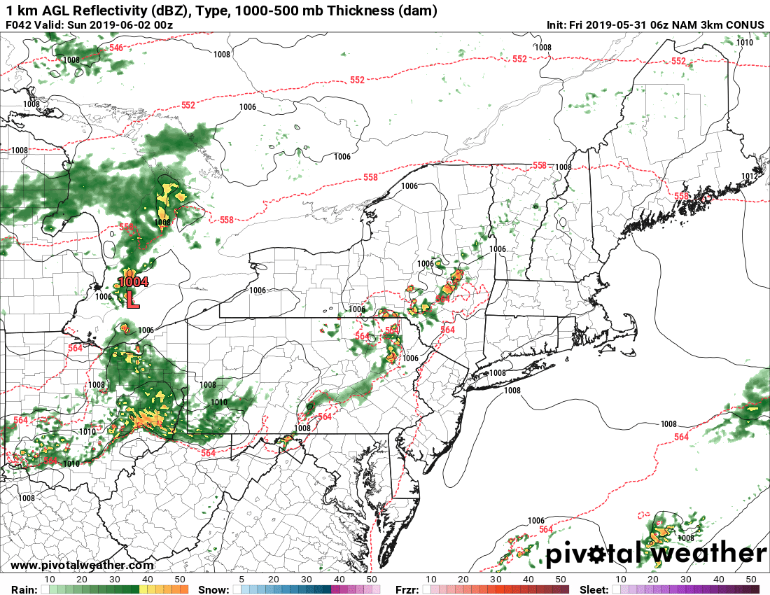
Later Saturday evening, the potential exists for some showers and thunderstorms. This will be most prevalent across the Interior Northeast, and can be traced back to the movement of a disturbance from the Great Lakes into the Northeast. Enough instability exists in the atmosphere that if thunderstorms do form, a few could trend stronger in parts of New York and Pennsylvania. Models are flipping back and forth in regards to the potential coverage of these storms – and so confidence is low as to any impacts.
The weather remains calm on Sunday morning, but another chance for showers and thunderstorms may approach during the afternoon and evening hours. This will depend on the timing of a frontal boundary. Again, guidance is not consistent with the timing of the frontal boundary. If it hangs up back to our west, showers and storms may fire during the afternoon and evening. If it swings through on Sunday morning, expect calmer and cooler conditions. We’ll be watching closely!
Calm and relatively warm weather is expected to continue into early next week, but the ebb and flow will continue as chances for showers and storms may return by midweek once again. We’ll be stuck in this active pattern for a while, and temperatures will remain near or slightly below normal for this time of year.
Leave a Reply
Want to join the discussion?Feel free to contribute!