-2")
Showers likely tonight, pleasant weather lasts through the weekend!
Good afternoon!
The cooler/dry airmass that has been present over the Northeast is now a thing of the past! Warmer/more humid conditions are now in place, along with the threat of some showers this evening. High pressure will gradually build into the Northeast this weekend, making for an overall great weekend.
This morning started off mostly cloudy across northern portions of the metro area as a mid-level warm front moved from south to north. Clouds were slow to move out at first, but skies were able to clear up significantly around noon. Interestingly enough, some smoke from the Canadian wildfires moved over the NYC area as skies were clearing. While this residual smoke is still evident on visible satellite imagery, it is not concentrated enough to cause any impacts. Mostly sunny (hazy) skies and warm mid-level temperatures have allowed for slightly above normal highs. Readings have very a bit from west to east, but a large portion of the area is seeing temps in the lower to middle 80’s. Offshore flow over Long Island and Connecticut has allowed for slightly cooler temps in the lower to middle 70’s.
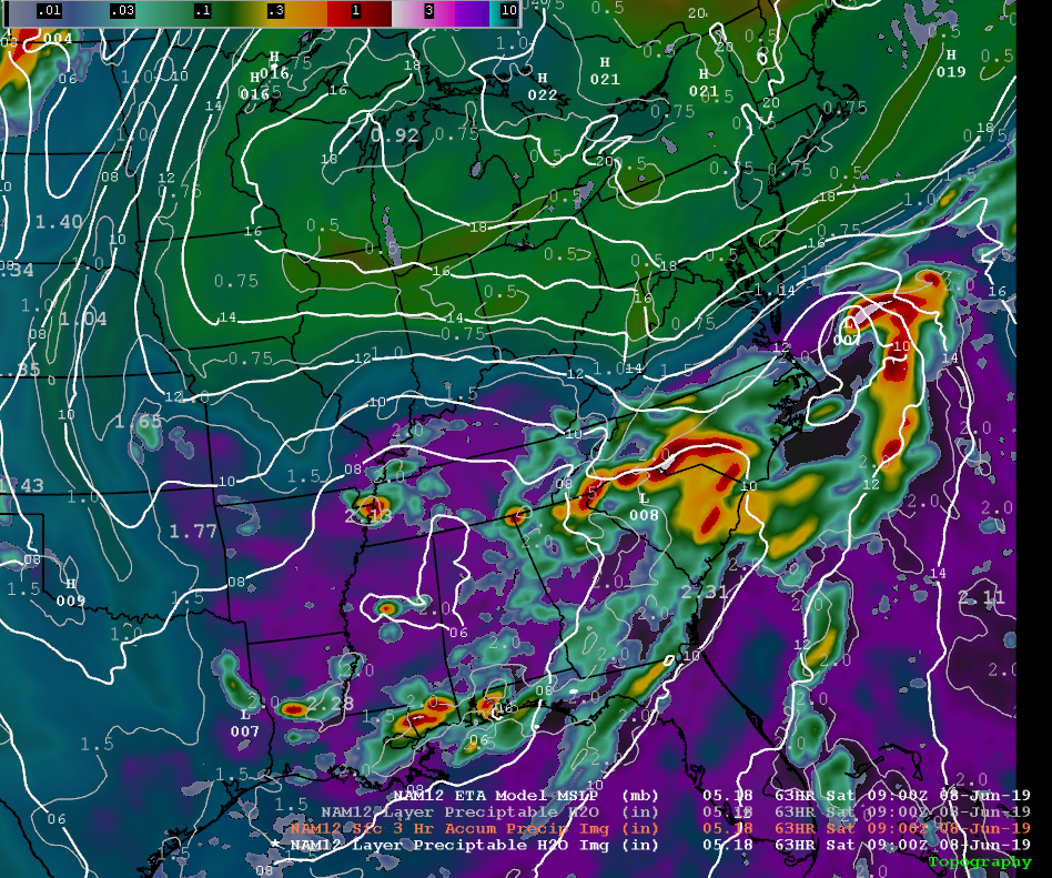
Warm/humid conditions will last into the evening hours as an area of low pressure moves into the Northeast. This system will have the potential to produce some scattered showers/thunderstorms this evening & into the overnight hours. Limited instability and weak kinematic support should cap overall thunderstorm potential across the region. Overall threat this evening is for scattered showers capable of brief/heavy downpours & some gusty winds. Locations off to the west of the city appear to have the best chance for an isolated strong thunderstorm into the overnight hours.
Threat of showers and abnormally warm conditions will likely last well into the overnight hours tonight. Lows mainly in the middle to upper 60’s are likely along with mostly cloudy skies.
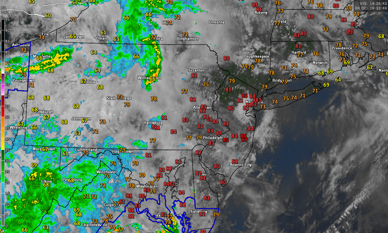
Overview of this afternoon’s current conditions across the area with mostly warm/sunny skies over the NYC metro area.
Warm and pleasant conditions to end the work week!
Tomorrow (Thursday) morning will likely start out mostly cloudy across much of the area. A few widely scattered showers will be possible tomorrow morning as a weak cold front pushes it’s way through. Mid level flow will be shifting to the northwest by the early afternoon hours, allowing for gradually clearing skies. Dry mid-levels and sunny skies should allow highs to easily reach into upper 70’s and lower 80’s tomorrow afternoon. There could be one or two pop-up showers tomorrow afternoon with the combination of residual surface moisture and steep lapse rates. Any showers that manage to develop will likely be short-lived and relatively unremarkable.
Generally pleasant conditions should last into the late afternoon/evening hours as northwesterly flow expands over the region. Temperatures tomorrow night should be somewhat cooler, with lows in the upper 50’s to lower 60’s expected.
Friday looks to be a beautiful day through and through as mid-level ridging sets up to our north. Conditions should start out mostly sunny and warm early in the day with temps steadily rising through noon. Clear/mostly sunny skies and dry conditions aloft should help highs to rise into the upper 70’s to lower 80’s once again. Near-perfect conditions should last through the Friday commute and into the evening hours. The combination of low relative humidity, clear skies, warm temps, and light winds should make for an excellent night for any outdoor activities! Mostly clear skies are likely to continue into the overnight hours, with lows likely coming in around 60.
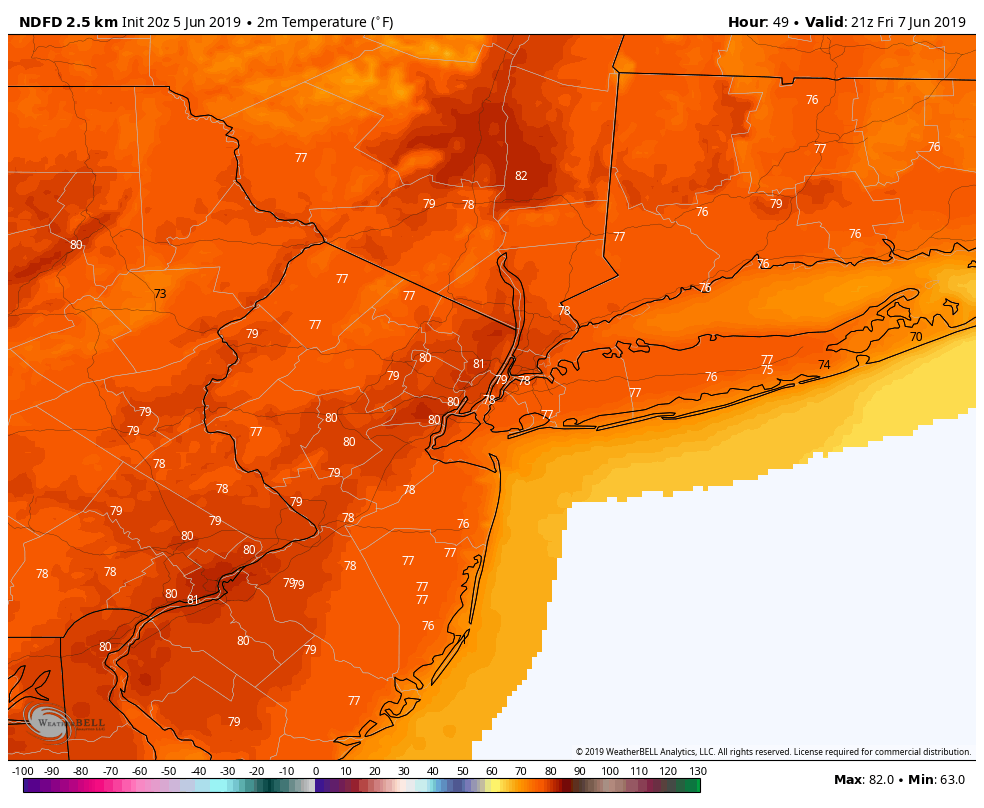
NWS temperature forecast for Friday afternoon showing an exceptional end to the work week
High pressure to provide exceptional conditions through the weekend
All indications point to mid-level ridging continuing to build into the first half of this weekend. This will allow surface high pressure to build in from the Great Lakes and into the Northeast. At the same time, a large cut-off low pressure system will be meandering over the south. Deep/exceptionally moist air from the Gulf of Mexico will filter into that region, allowing for very heavy rain to develop. Thankfully, the developing high over our area will keep any substantial moisture/shower threat well off to the south.
Sunny skies and warm temperatures look to dominate much of our sensible weather this weekend. Thankfully, both Saturday and Sunday should feature temperatures in the upper 70’s to lower 80’s during the day. Overnight lows should stay right around normal, with upper 50’s to lower 60’s. To sum everything up, it appears that another banner weekend is on tap for much of the NYC area!
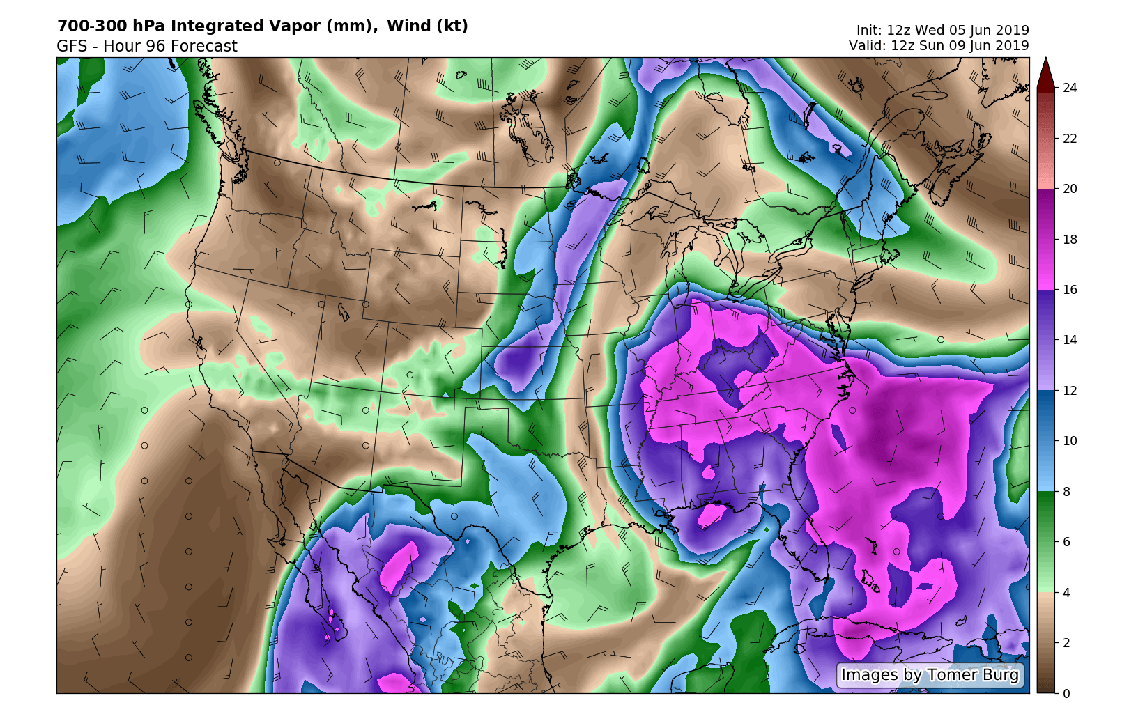
This afternoon’s GFS model showing a substantial amount of moisture trapped over the Southeast. Notice the much drier conditions located over the Northeast
–Thanks for reading and have a great night! We’ll have an update on Friday taking a more in-depth look at the weekend.
Steve Copertino
Leave a Reply
Want to join the discussion?Feel free to contribute!