-2")
Low pressure to bring cool and rainy conditions Thursday
Good evening!
We have a bit of good news and bad news for you. First, the bad news is that after two banner days, rainy and cooler conditions will affect the entire area tomorrow. The good news is that this system should be out of our hair by Friday, with much warmer conditions in store for this weekend! We’ll break it all down for you below!
Today started off about as close to perfect as you can get for this time of year. High pressure was in control across much of the Northeast, with light winds, warm mid-level temps, and dry conditions areawide. This combination allowed for highs to gradually climb into the lower to middle 70’s. Slightly cooler temps in the middle to upper 60’s were common over coastal NJ and Long Island due to cool, onshore flow. Surface & mid-level ridging has been gradually shifting offshore, allowing a moister easterly flow to set up. Despite this, strong dry air/subsidence remains intact over much of the Northeast. This will help ensure that this evening closes out as a pleasant and mostly sunny one.
Later on tonight, a large and anomalous trough will kickstart a large area of showers and thunderstorms over the Southeastern US. Energy over the Great Lakes will then “hand-off” to the Mid-Atlantic states, creating an area of low pressure (much like we see in the winter). At the very least, this low brings an increase in clouds to our area tonight–with some showers possible over southern New Jersey. Low temperatures tonight will be slightly below normal thanks to the increased cloud cover. Expect readings predominately in the middle to upper 50’s, with slightly cooler temps off to the east of the city.
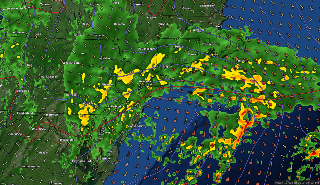
Loop of the HRRR model showing a steady area of precip approaching the region by early tomorrow morning
Periods of moderate to heavy rain likely tomorrow, improving conditions for Friday
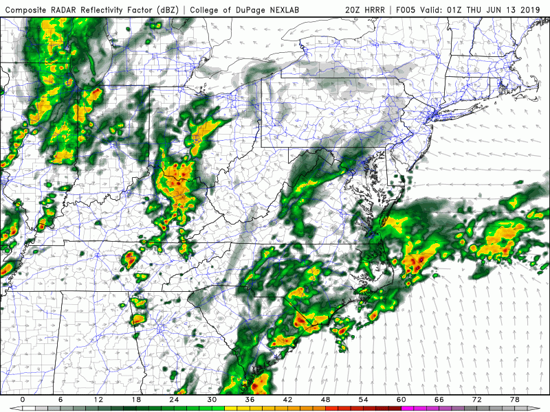
The aforementioned area of low pressure will likely be near/over the Delmarva peninsula by 6 am tomorrow (Thursday). This should allow for widespread showers to envelope much of the NYC metro area just in time for the AM commute. Moderate to occasionally heavy rain will be common across the entire region into the early afternoon hours. While much of the area will likely see rainfall totals around .5″-1″+, the overall flood threat will be quite low. Nevertheless, high precipitable water values will create a slight risk of flash flooding for areas with poor drainage. The bulk of the rain will gradually end from southwest to northeast by the early/mid afternoon hours of tomorrow. However, conditions will likely stay cloudy and unstable into the evening hours as the main upper-level trough remains just to our west.
Highs tomorrow will be below normal, with temps struggling to reach out of the middle to upper 60’s. Broken clouds & overcast are likely to last through the overnight hours tomorrow night. Residual upper-level energy and weak moisture will allow for a slight chance at a light shower or two. Low temperatures tomorrow night look to remain below normal. Expect temps in the middle to upper 50’s once again, with cooler readings to the northwest.
Conditions should be much improved from the get-go on Friday. The upper-level trough will be making its way through the Northeast during the morning hours. This will allow for deep northwesterly flow to set up in its wake. This cool/dry airmass will help to filter any remaining clouds for much of the immediate NYC area. Despite mostly sunny conditions, temps will only be able to rise so much on Friday. Cooler mid-level temps should keep highs generally in the lower to middle 70’s for the entire area. Generally calm, clear, and “cool” conditions are likely into the evening hours.
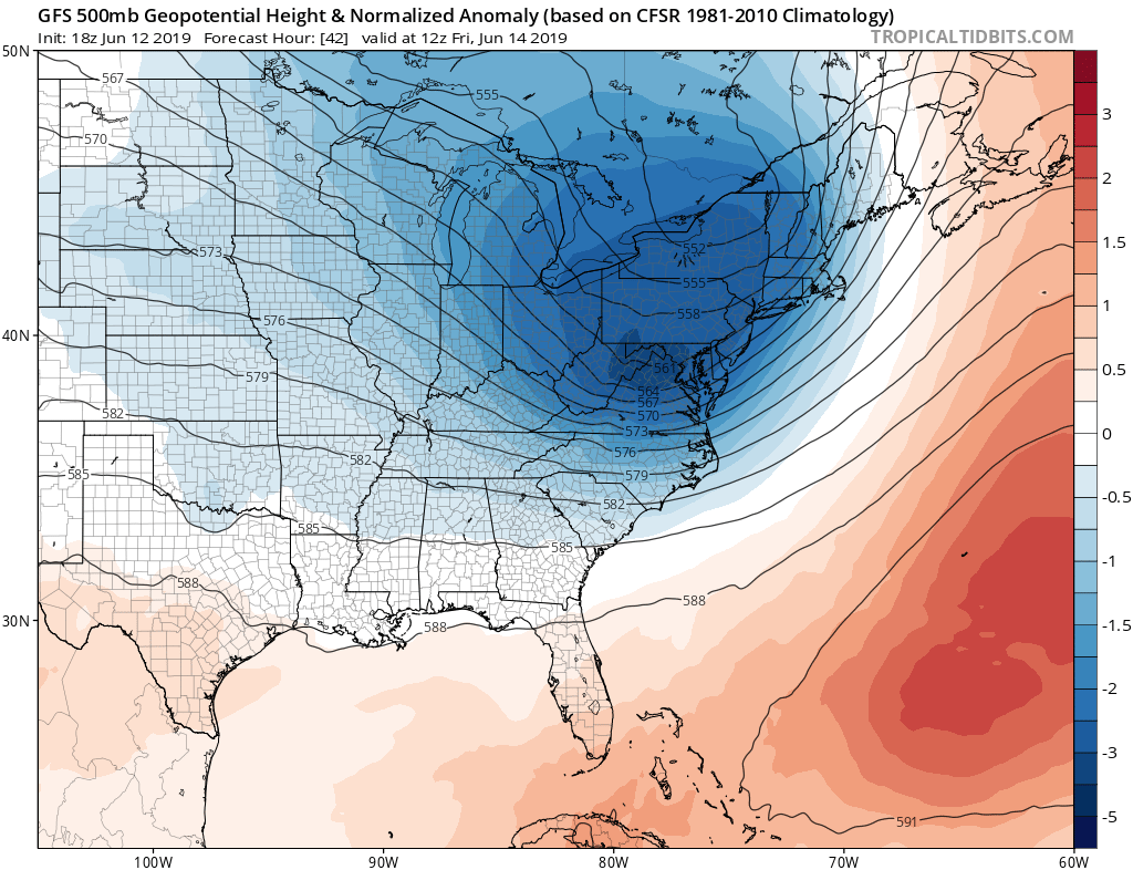
The recently upgraded GFS model showing an anomalously deep trough over the Northeast on Friday morning.
Warmer conditions likely this weekend with some storms possible
Our amplified pattern finally breaks down after Friday’s trough lifts out of the Northeast. Strong zonal flow (west to east) will take shape during the day on Saturday. Additionally, westerly flow in the mid-levels of the atmosphere will bring a substantial warm boost for much of the region. Highs on Saturday will likely climb into the lower to middle 80’s with mostly sunny skies. Much of the same is expected on Sunday as well.
Mid-level flow may shift a bit more to the southwest on Sunday, possibly allowing highs to reach into the middle/upper 80’s. There could also be a threat of showers and thunderstorms come Sunday afternoon as a few weak disturbances approach the area. All in all, this weekend should be rather pleasant, with some great grilling conditions on Fathers Day!
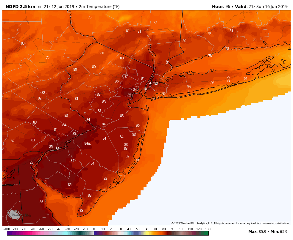
NWS forecast highs for Sunday showing much improved conditions across the area
Thanks for reading and have a great night! We’ll have an update on Friday!
-Steve Copertino
Trackbacks & Pingbacks
2trepidation
Leave a Reply
Want to join the discussion?Feel free to contribute!