-2")
Warm temps return, chance of storms through Monday
Good evening and happy Friday!
Thankfully, conditions have improved quite dramatically today over the entire NYC metro area! Relatively calm conditions are likely through the first half of the weekend before conditions turn muggy & potentially stormy by Sunday!
As expected, today was yet another transition day across much of the Northeast after periods of moderate to heavy rain yesterday. Relatively clear skies were common across the NYC metro area this morning, with temps starting off in the 60’s. Numerous clouds and even some light showers developed towards the afternoon hours as leftover mid-level energy pushed through the area. These were only temporary as dry air from the northwest filtered in. Temps were able to work their way back into the middle/upper 70’s areawide as any remaining clouds moved off the coast. The area of low pressure that produced unsettled conditions yesterday also helped to develop a pressure gradient over our area. This caused occasionally gusty winds–with some locations seeing gusts in the 45-60 mph range!
Regardless, all of this has resulted in rather pleasant conditions across the entire NYC area this evening. Skies will likely remain mostly sunny, with winds gradually dying down as the evening goes on. Lows tonight should be right around normal, with readings in the lower to middle 50’s. All in all, tonight should be an excellent night to end the work week!
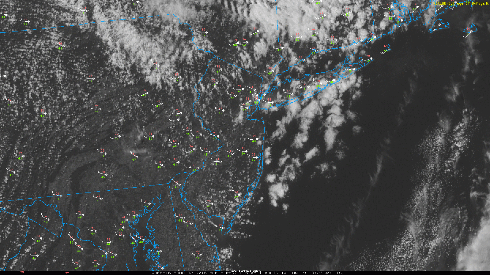
Loop of this evening’s visible satellite imagery along with regional surface observations (click to animate)
Excellent start to the weekend tomorrow
Tomorrow morning (Saturday) will likely start off on an excellent note! Mostly sunny skies are expected as high pressure will be shifting off of the Mid-Atlantic coast. Temperatures may start off a little cool in the AM, but should quickly rise as southwesterly flow overspreads the area. Mostly sunny skies will allow highs to easily rise into the lower to middle 80’s for the entire area. Some mid-level clouds will likely develop later in the afternoon thanks to high pressure continuing to shift offshore. Breezy conditions may develop once again tomorrow as another pressure gradient develops over the area. Winds shouldn’t be anything to write home about tomorrow, with gusts only in the 20-30 mph range. Overall, conditions will be generally pleasant before clouds begin to increase later in the evening. Thankfully any chance of rain/storms looks to hold off at least until after midnight. A weak shortwave trough will approach the area from the west, with a slight chance at some showers/storms off to the north & west. Overnight lows will be much warmer tomorrow night, with temps in the middle 60’s likely.
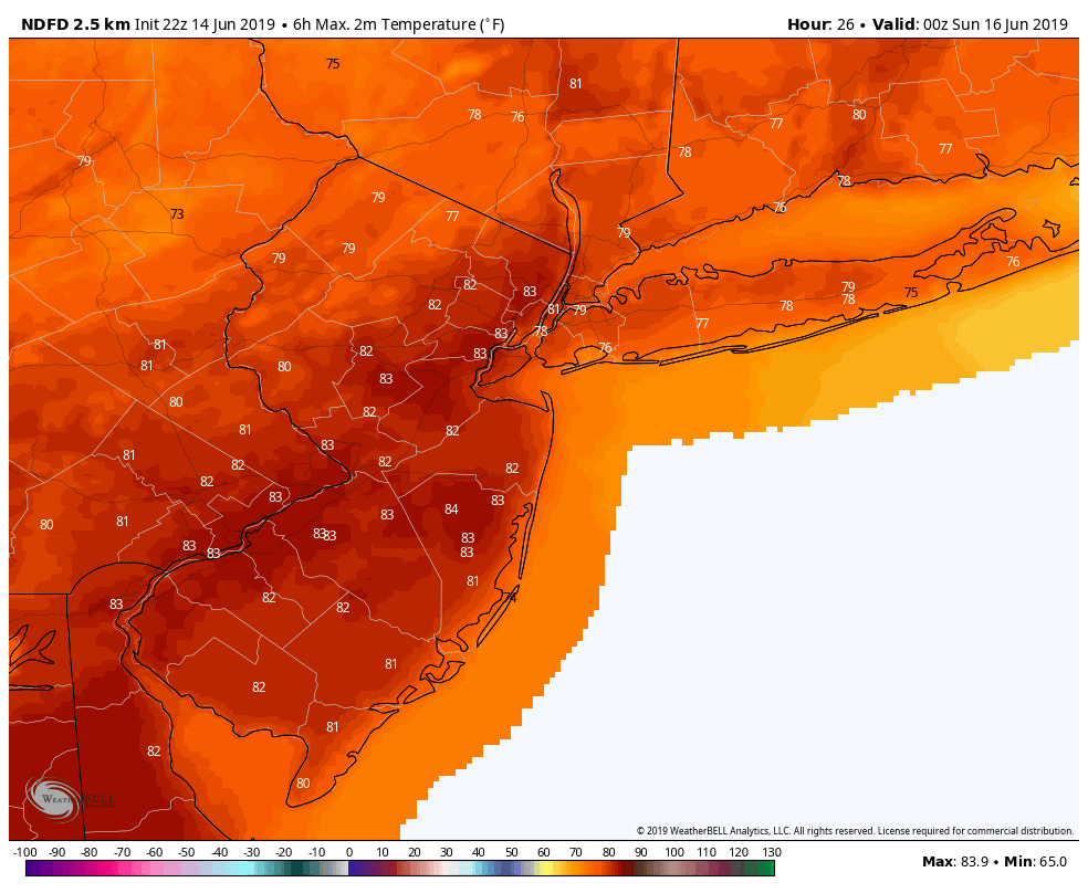
~NWS forecast highs for Saturday
Warm, a bit more unsettled on Sunday
Sunday should start off with some broken clouds/overcast in place as high pressure offshore funnels low-level moisture in. There may even be a residual shower or two early in the morning, but nothing too impactful overall. Some breaks in the clouds may attempt to develop during the afternoon hours as a frontal boundary stalls over Pennsylvania. Highs will likely rise into the lower to middle 80’s once again–with warmer temperatures possible if there are more significant breaks in the clouds. The threat of showers and storms looks to increase during peak daytime heating Sunday (mid-late noon). While severe storms are unlikely, some of the storms could be strong, with gusty winds and heavy rainfall. The threat of heavy showers and storms will likely extend well into the evening/overnight hours as the front remains draped to our west. Unfortunately, we look to close out the weekend the exact opposite of the way we started. Lows Sunday night to be quite warm & muggy, with temps in the middle to upper 60’s.
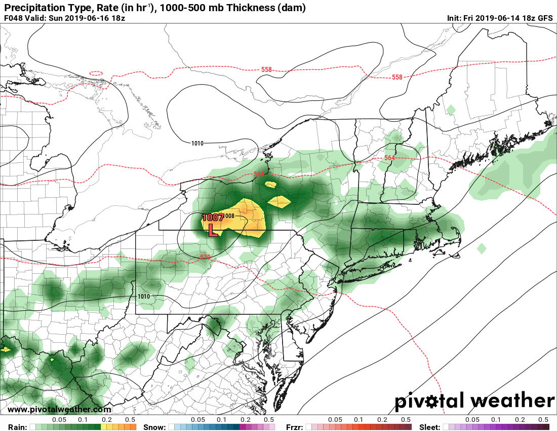
This evening’s GFS model showing an unsettled pattern shaping up for Sunday with the potential for showers and storms across the area
Early indicators are that Monday may try and mirror Sunday depending on the location of the aforementioned frontal boundary. Highs will likely be in the lower to middle 80’s, with another chance of showers and thunderstorms. However, this will have to be looked at in further updates as a small deviation with the front could significantly change the forecast!
Thanks for reading and have a great weekend!
-Steve Copertino
Leave a Reply
Want to join the discussion?Feel free to contribute!