-2")
Unsettled conditions continue, changes on the horizon?
Good evening!
Unfortunately, things haven’t changed much at all since our previous update. Conditions look to remain quite unsettled and dreary through Friday with periods of heavy rain likely. However, significant changes to our sensible weather may be in store for this weekend!
Today has been another in a series of dreary and unsettled days this week. Much of the area has been covered in thick clouds since right around daybreak this morning. Additionally, rather muggy conditions have been persistent across the entire metro area. Dewpoints have been in the upper 60’s to lower 70’s, really adding onto the “gross” factor outside. This has been thanks in part to an area of high pressure over the Western Atlantic providing moist southerly/southwesterly flow. The aforementioned thick cloud cover combined with marginal mid-level temperatures really capped our highs today. Temperatures were quite a bit below normal, with highs only reaching the upper 60s to lower 70s! A frontal system to our south allowed for more clearing, with highs reaching the upper 70s & lower 80’s over SNJ.
Much of the same is expected for the remainder of the day. Cloudy skies and the threat for showers will last well into the overnight hours. The best chance for some more “heavy” showers will exist later tonight as the front to our south begins to make it’s way to the north. There could even be a brief storm or two, but any storms should be sub-severe. Overnight temps will once again be mild, with middle to upper 60’s expecetd for the immediate NYC area.
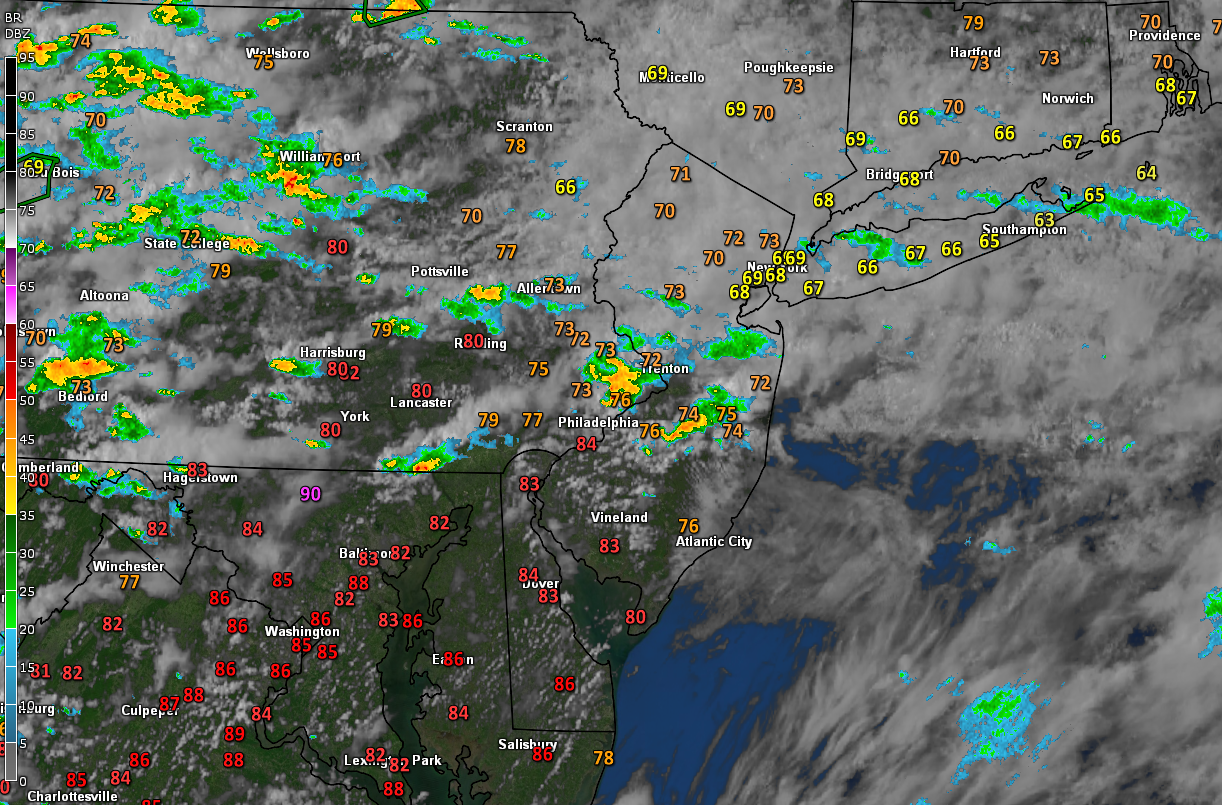
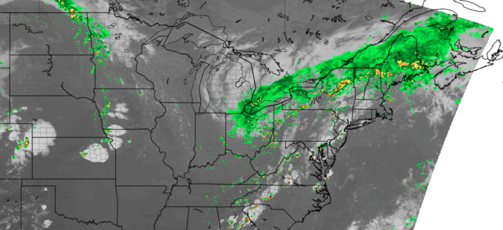
This evening’s latest regional surface temps, radar and satellite imagery showing a generally unsettled day across the NYC metro
Unsettled conditions continue Thursday with a chance of strong storms and heavy rain
Tomorrow (Thursday) should start off mostly cloudy and unsettled. Some showers will be possible across much of the area for the AM commute. Things become a bit more interesting tomorrow afternoon as a warm front associated with low pressure moves on in. This warm front will provide a chance at some breaks in the clouds, which will send temps in the upper 70’s to lower 80’s. Conditions will also destabilize quite a bit over EPA/NJ tomorrow afternoon, with at least moderate instability developing. Additionally, a shortwave trough will be moving through the Ohio Valley, which will help to increase shear over the Northeast.
All of these factors combined point to at least a decent shot of thunderstorms developing tomorrow afternoon. Some of these storms could be strong to severe, with damaging winds, hail, and possibly a brief/weak tornado. Heavy rain will also be a threat, with flash flooding possible for virtually the entire metro area. The threat for heavy rain and thunderstorms should last right up until midnight before most of the activity moves off the NJ coast. Lows tomorrow night will be just about the same as tonight, with lower to middle 60’s likely.
–The Storm Prediction Center has placed portions of the area under a “slight (2/5)* risk for severe weather tomorrow afternoon.
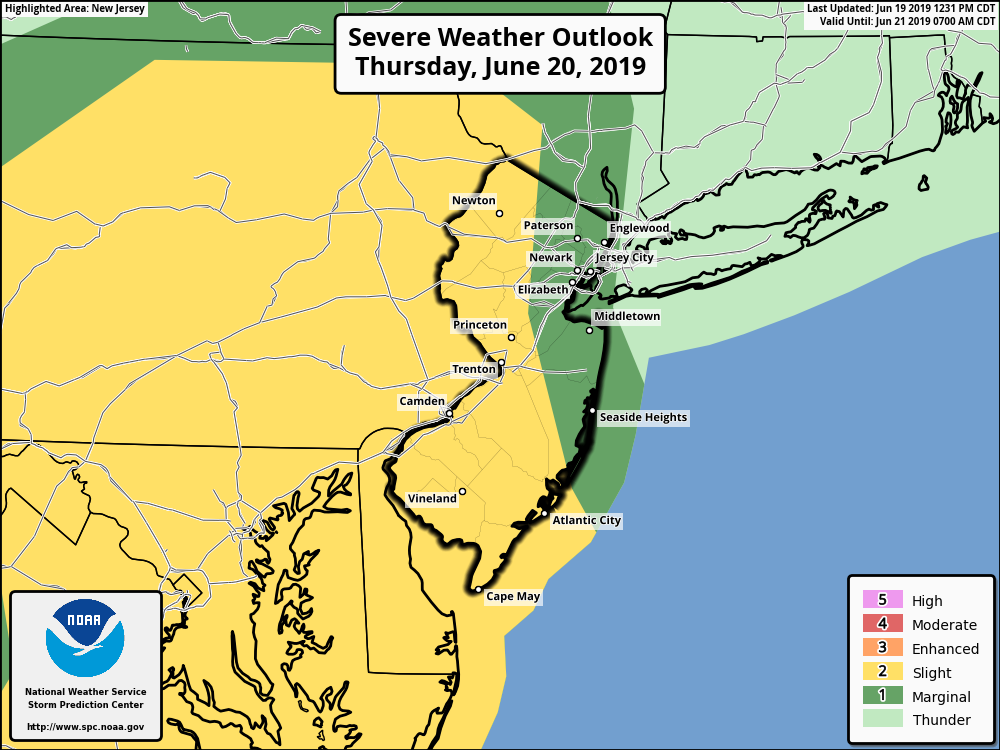
This afternoon’s SPC outlook showing a “slight” risk for severe weather tomorrow afternoon across portions of the area.
Day of transition on Friday, conditions improve dramatically this weekend!
The area of low pressure that will bring a threat of storms on Thursday will be moving off to our east Friday morning. Clouds and some residual showers will be possible across the area to start the day. The main threat of any remaining showers gradually shifts off to the north/east as the day goes on Friday. Thankfully, a much more dry airmass looks to quickly filter in behind this system for Friday afternoon. Clouds will gradually dissipate, allowing highs to rise into the middle to upper 70’s. Some gusty winds may develop later in the afternoon, but otherwise pleasant conditions should prevail. Lows Friday are likely to drop down to more comfortable levels, with middle 50s to lower 60s.
High pressure then dives down into the Northeast on Saturday, signaling in a period of much-improved weather. Clear skies, light winds, and reduced levels of humidity should persist through Sunday. Highs each day will be right around seasonable levels, with upper 70’s to lower 80’s likely. Another large system may try to move into the region by Monday with a return to more unsettled conditions, but we’ll talk more about that at a later time!
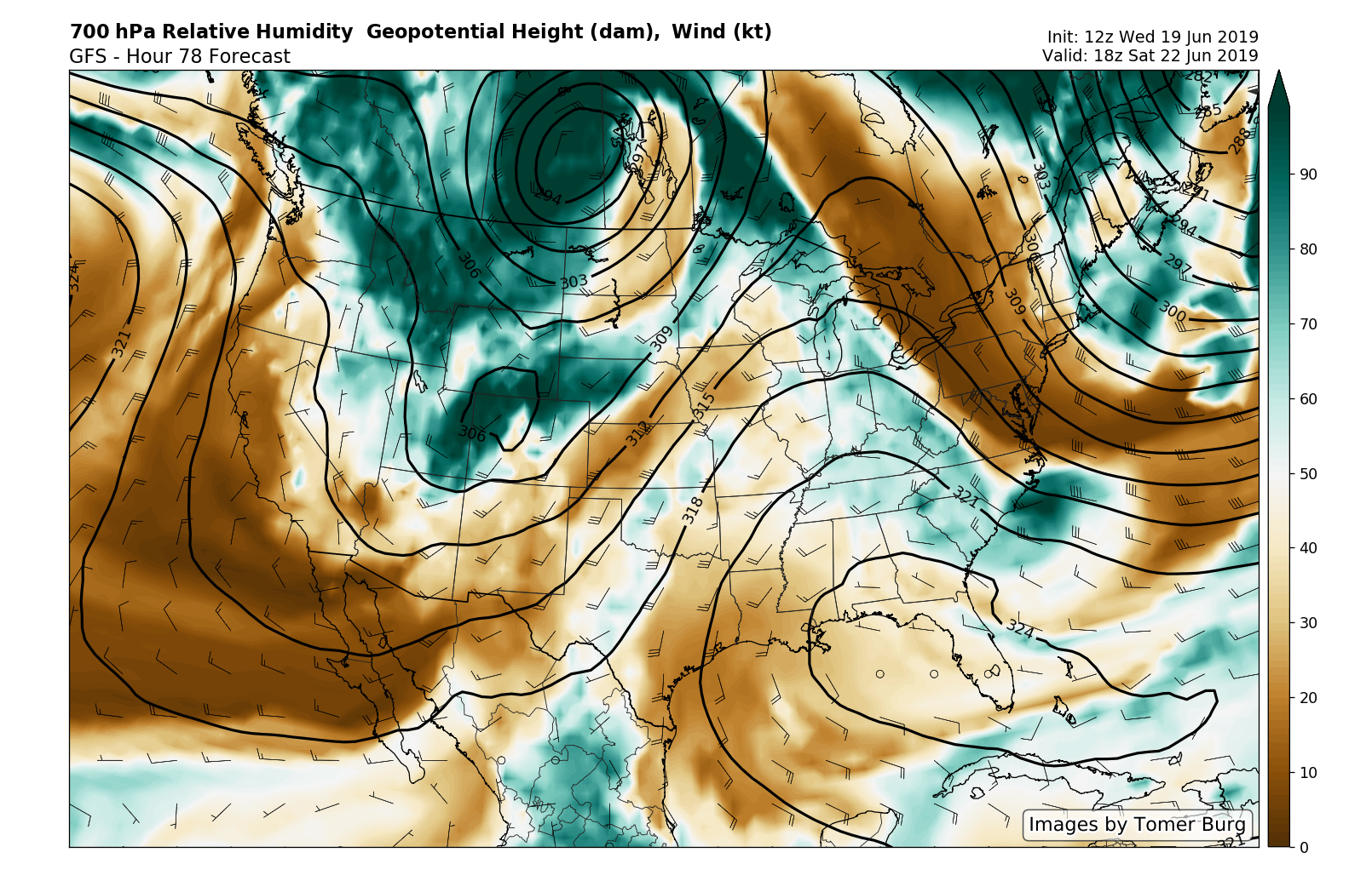
This evening’s GFS model showing a much more pleasant and dry airmass filling into the region on Saturday
Thanks for reading and have a great night!
-Steve Copertino
Trackbacks & Pingbacks
3encumbrance
Leave a Reply
Want to join the discussion?Feel free to contribute!