-2")
Warmth, humidity and unsettled weather expected this week
Beautiful weather from this weekend has carried over in to Monday – finally! High clouds are moving in to the region this afternoon, marking the start of a changing pattern. Light winds have allowed for the development of some seabreezes along the area shores. Otherwise, the weather remains calm and benign. The pattern will kick up again in terms of activity – including the potential for heat, humidity and storms, starting on Tuesday.
Showers and t-storms late tonight and Tuesday
Clouds will increase and thicken Monday Night, as a warm front begins to approach the region. A few stray showers may begin arriving during the evening and early overnight hours, as warm-air advection increases ahead of the warm front. This process leads to the development of precipitation. Showers are most likely as we near sunrise on Tuesday morning.
High precipitable water values near 2.00″ and elevated instability may support some heavy rainfall and thunderstorms on Tuesday morning. These could produce some minor flooding on roadways and in poor drainage areas. Despite higher shear, surface-based instability will be very low – as a result, we are not anticipating any severe weather. Take the umbrella and prepare for a wet commute.
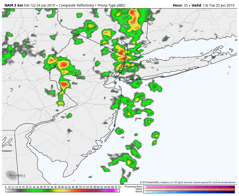
3km NAM model showing showers and perhaps some thunderstorms over the New Jersey and New York City area Tuesday morning
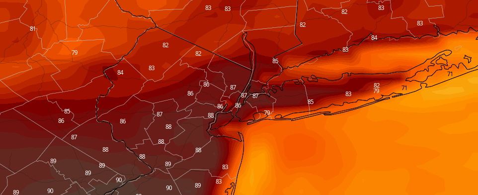
Clouds will break for some sunshine during the late morning and afternoon hours on Tuesday. A few showers and thunderstorms may pop up as a weak cold front approaches, but increasing subsidence aloft (sinking motion) will likely keep much of the area dry. High temperatures may reach the low to mid 80s, with sunshine in the afternoon again.
Improving weather and warming temperatures late week
Ridging builds in from the southwest with summer-like temperatures and humidity expected later in the week. Additional disturbances will be tracking farther north, which will lead to more sunshine and dry weather in the region. High temperatures each day (between Wednesday and Friday) are likely to reach the upper 80s throughout the region with a west-northwest flow. By the time Friday approaches, we could be looking at temperatures in the 90’s.
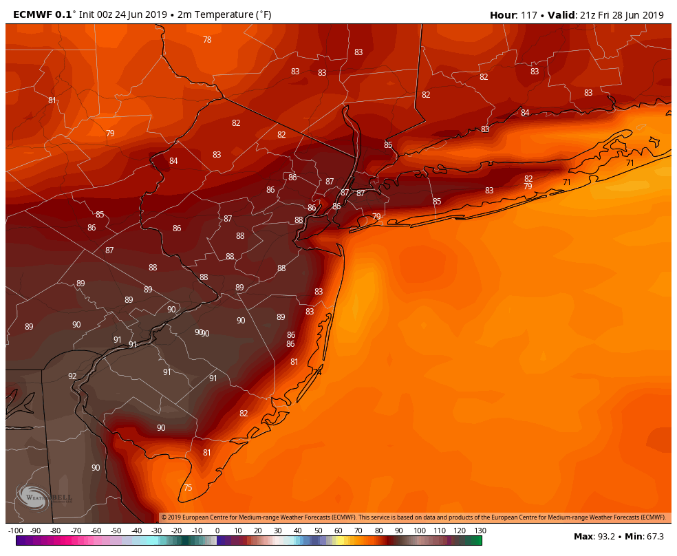
ECMWF model showing highs in the upper 80s to low 90s in parts of New Jersey and Pennsylvania by Friday
The weather pattern will undergo another change this weekend. Very warm and humid conditions will likely continue into much of Saturday. Thereafter, a deep upper-level low in Southeast Canada will drop south with a cold front, bringing a chance of showers and thunderstorms by late Saturday. Improving weather is expected again for Sunday at this time, but temperatures will cool down as a Canadian airmass settles in.
Leave a Reply
Want to join the discussion?Feel free to contribute!