-2")
Severe thunderstorms possible Saturday afternoon!
Good evening and happy Friday!
Hot, but mostly calm conditions remain in place across much of the Northeast today. Things may “spark up” a bit tomorrow afternoon with the development of strong to potentially severe thunderstorms.
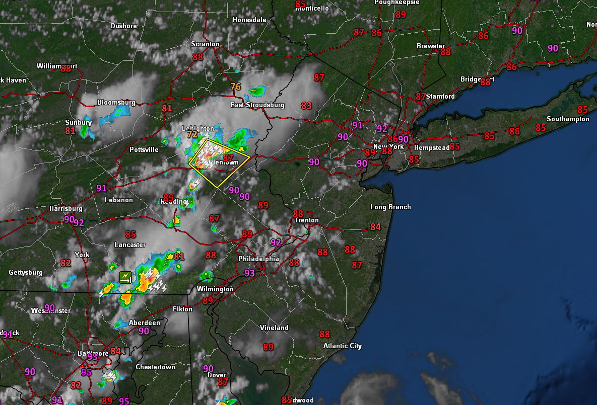
Today has been yet another hot summer day across the entire NYC area. The majority of the Northeast started off relatively cloud-free this morning. With warm mid-level temperatures in place, temps were able to quickly rise during the afternoon hours. Highs easily rose into the upper 80’s to lower 90’s across the metro–with portions of NE NJ reaching 92-94 F! Thankfully, humidity across the region is relatively low–making today feel a bit more bearable. A batch of strong thunderstorms has developed over eastern PA, but this activity is likely to remain to our west. Some residual clouds & showers may wander into western NJ this evening, but mostly clear conditions should prevail.
High pressure shiting offshore will cause a more humid airmass to move in from the south this evening. Overnight lows will remain warm, with readings likely to stay in the upper 60’s to lower 70’s. Overall calm and humid conditions are likely throughout the overnight hours and into tomorrow morning.
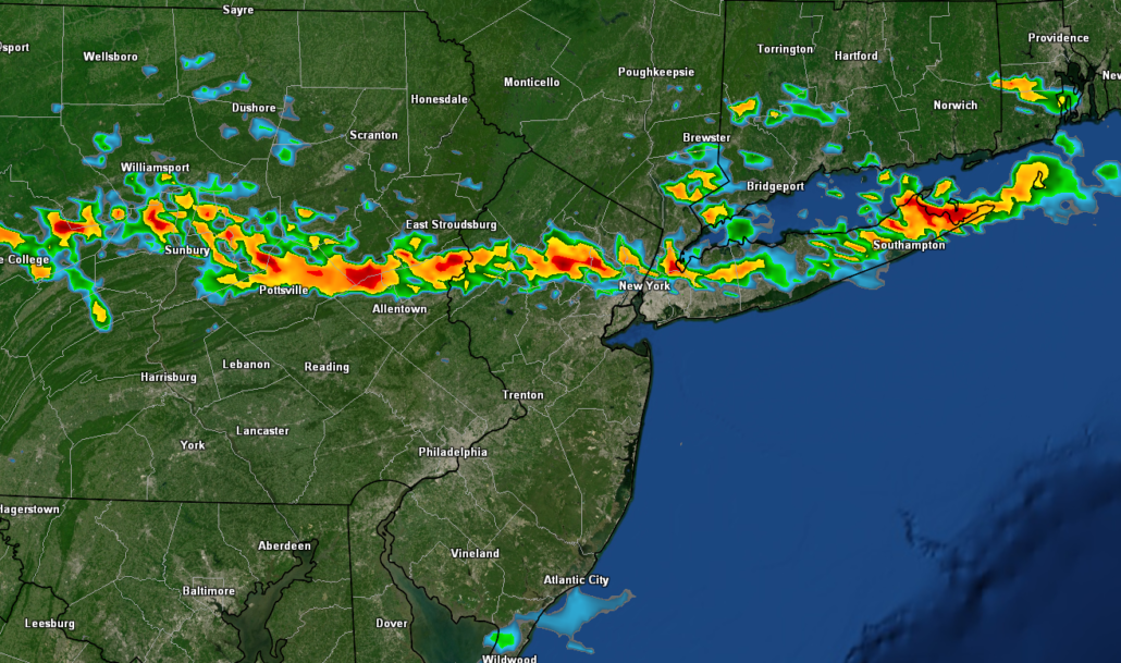
Snapshot of this evening’s current conditions. Generally hot and clear weather over the NYC, with isolated strong to severe thunderstorms over Pennsylvania
Strong to potentially severe thunderstorms possible on Saturday
Tomorrow (Saturday) will start off considerably muggier than today (Friday) did. High pressure will be firmly offshore, with 65-70F dewpoints common across the entire area by 8-10 am. Highs are once again expected to reach into the upper 80’s to lower 90’s tomorrow afternoon. There may be some isolated patches of clouds to start the morning, but generally clear skies are expected to start the day. This combination will allow for at least moderate instability to develop ahead of an approaching cold front. Instability will continue to bubble as the cold front moves into eastern PA. The approaching front will provide the “spark” necessary for clusters/lines of storms to blossom over PA/SNY.
These storms will gradually work their way down into the Lower Hudson Valley and into NE portions of the NYC metro by 2-4 pm. Moderate instability and impressive low-level lapse rates should promote at least isolated severe storms to develop. Any stronger/severe storms could produce damaging winds, hail and frequent lightning. Strong/severe storms will likely sink down into the immediate NYC area around 5-7 pm. These storms will continue to push their way to the south and east tomorrow, with a gradual clearing developing during the early-mid evening.
Conditions will likely turn clear and much less humid tomorrow night behind the cold front. Lows are expected to remain in the middle to upper 60’s.
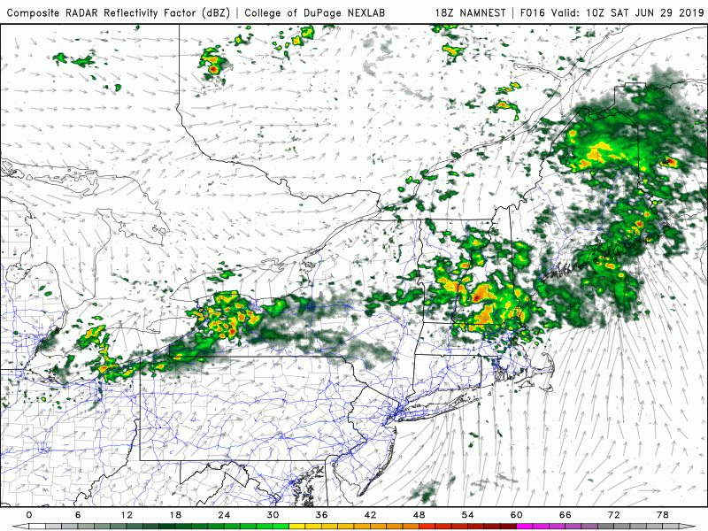
NAM model showing the development of strong to severe thunderstorms tomorrow afternoon
Another chance of storms Sunday, high pressure builds Monday
Sunday morning will be a good deal cooler and less humid thanks to the cold front from Saturday night. Much of the area will likely remain mostly sunny, with generally pleasant conditions. Temps should be noticeably cooler, with highs in the lower to middle 80’s. Some showers and thunderstorms may try and develop during the afternoon hours, but any storms should be focused generally to our north. Any residual showers and thunderstorms will move out of the region by Sunday night, with calm conditions taking over once again. Lows will also be noticeably cooler/less humid with temps falling to right around 60.
Ridging looks to once again develop over the Central US, allowing high pressure to expand into our area on Monday. Dry and warm conditions are likely Monday, with highs getting into the middle 80’s. The next threat of precip looks to be early on Tuesday as a shortwave trough rolls over the top of the ridge and potentially into the Northeast. Conditions look to remain dry and clear once again before a front approaches just in time for the 4th of July.
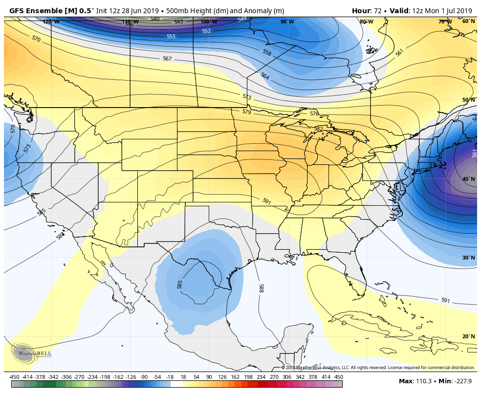
GFS Ensemble showing ridging once again developing over the Central US early next week
Have a great weekend and we’ll have an update on Monday!
-Steve Copertino
Leave a Reply
Want to join the discussion?Feel free to contribute!