-2")
Active weather returns this week with showers and storms
Beautiful weather has settled in to the Northeast states to start the week – and Monday was one to write home about. Temperatures thus far have been warm and weather conditions have been quiet. This comes as welcomed news after a weekend of active weather and severe storms.
As the week goes on, chances for showers and thunderstorms will increase. This will reach a climax this weekend, when the potential for heavy rain is expected to increase.
Warmth and humidity builds on Tuesday
Tuesday is expected to begin with nice weather – partly cloudy skies and warm weather. High pressure will be positioned offshore, with a return southwest flow developing throughout the day. This will cause humidity to increase and temperatures to rise into the mid-upper 80s throughout much of the region. Some spots, especially over Central New Jersey and Southeast Pennsylvania, may reach the lower 90s. Typical afternoon sea-breezes will keep areas along the shore a little cooler.
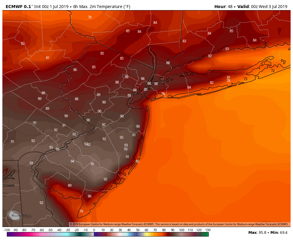
The ECMWF model showing temperatures in the upper 80s to lower 90s throughout Eastern PA, New Jersey and NYC metro
Some scattered showers and thunderstorms are possible later Tuesday afternoon and evening, as an upper-level disturbance approaches from the northwest. Increasing instability and shear could result in some isolated strong to severe thunderstorms with gusty winds and hail, especially over the Interior. Otherwise, the weather will remain warm and humid into Tuesday evening with low temperatures only falling into the 70s.
Warmer, Active Weather for Independence Day
Upper-level ridging will build into the area by midweek, with building heat and humidity through Wednesday and Thursday, July 4th. High temperatures each day will range from the upper 80s to lower 90s. Heat index values are expected to reach at least into the mid 90s. If you’re heading down to the beach or shore, temperatures may be a little cooler with sea-breezes developing each afternoon.
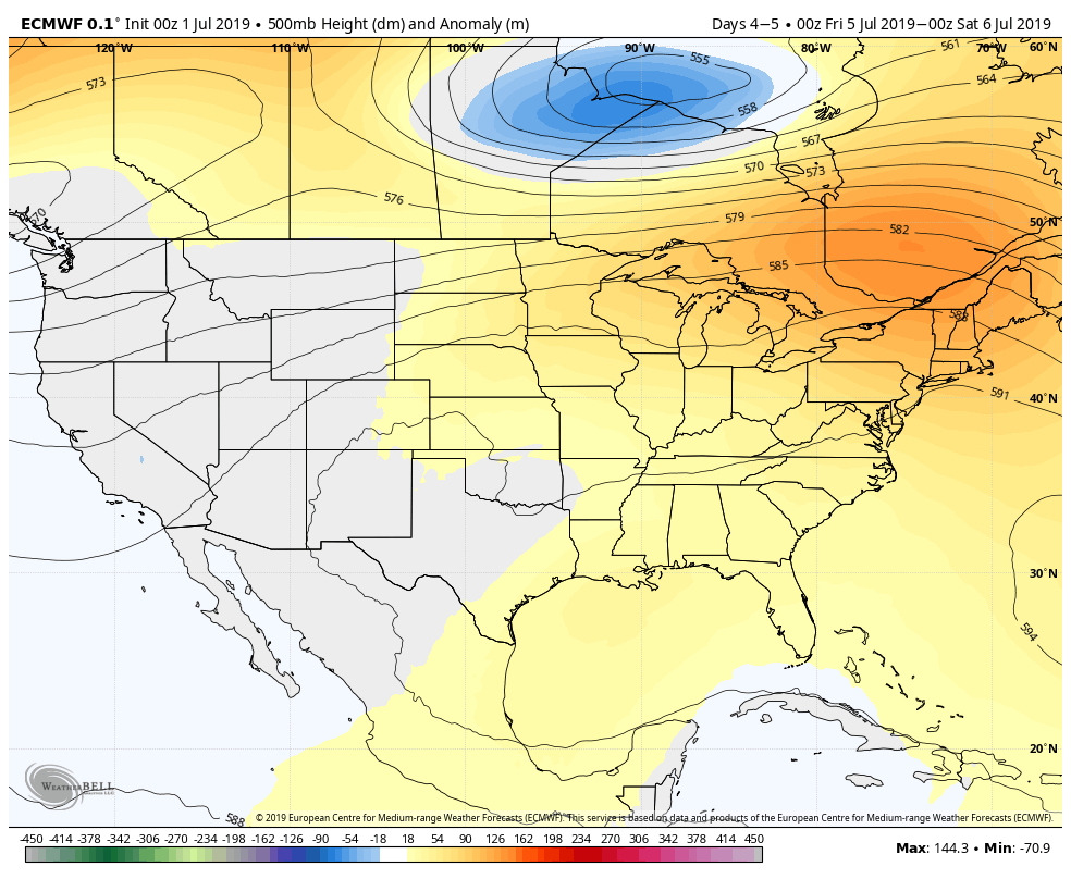
ECMWF model showing the upper-level ridge building into the Northeast late in the week
We’ll be closely monitoring a few disturbances moving along the northern periphery of this ridge. These may trigger scattered showers and thunderstorms on Thursday and Friday, especially as the atmosphere becomes more unstable. A lack of deep-layer shear is likely to mitigate organized/widespread severe weather.
The latest forecast models suggest that a stronger disturbance may approach late Friday into Saturday, with increasing support for widespread rain. We’ll be closely monitoring the potential for steadier or heavier rainfall over the weekend.
Leave a Reply
Want to join the discussion?Feel free to contribute!