-2")
Mostly dry Fourth of July, humid conditions return!
Good afternoon!
Warm and mostly dry conditions continue to dominate much of our sensible weather. While the 4th of July looks to stay relatively dry for our area, warmer temps and more humid conditions are likely. Finally, unsettled conditions are likely to produce widespread showers and thunderstorms by Saturday.
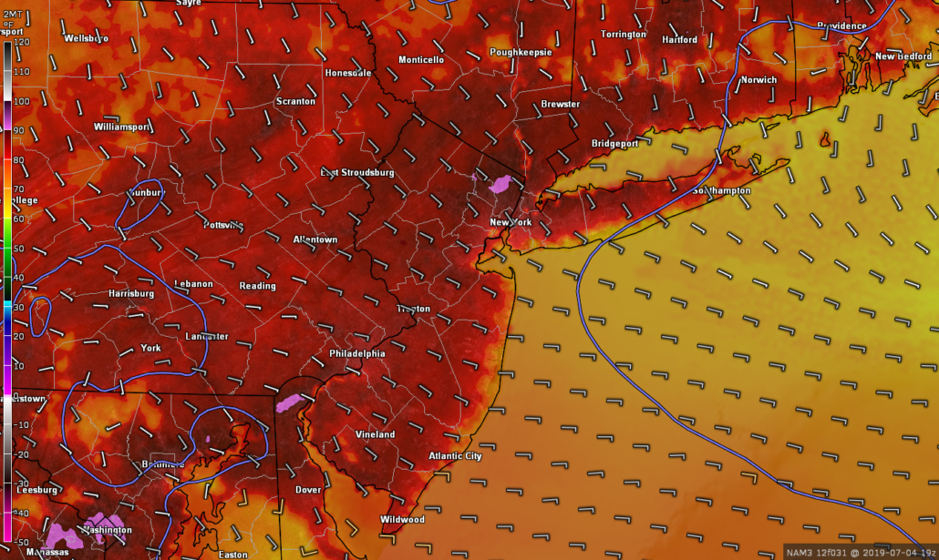
Today started off much like yesterday did with mostly sunny skies gradually giving way to overcast. The culprit for these pesky clouds was a stalled frontal boundary over our area. As the day pressed on, this frontal boundary gradually faded and died off. As a result, remaining cloud cover quickly began to burn off, with mostly sunny skies developing by 1-2pm. Temperatures were able to make up for lost time, with highs reaching into the middle-upper 80’s. Portions of Long Island & coastal NJ saw slightly cooler temps in the lower 80’s thanks to winds coming off the Atlantic. Unfortunately, these warm temperatures were also accompanied by dew points in the lower 70’s. This made temperatures “feel” like they were in the upper 80’s to middle 90’s virtually area-wide.
Some showers have developed off to the south & west of the area–mainly located over PA and SNJ. These showers are likely to remain to the west of the metro area this evening. Otherwise generally warm & humid conditions are expected into the overnight hours. Overnight lows will be rather warm and muggy, with lower 70’s over much of the area
Snapshot of this afternoon’s conditions around the NYC metro area. Mostly sunny skies, warm temps, and humid conditions are likely to persist through this evening
Close call tomorrow, heat and humidity to make an unwanted return to the NYC area
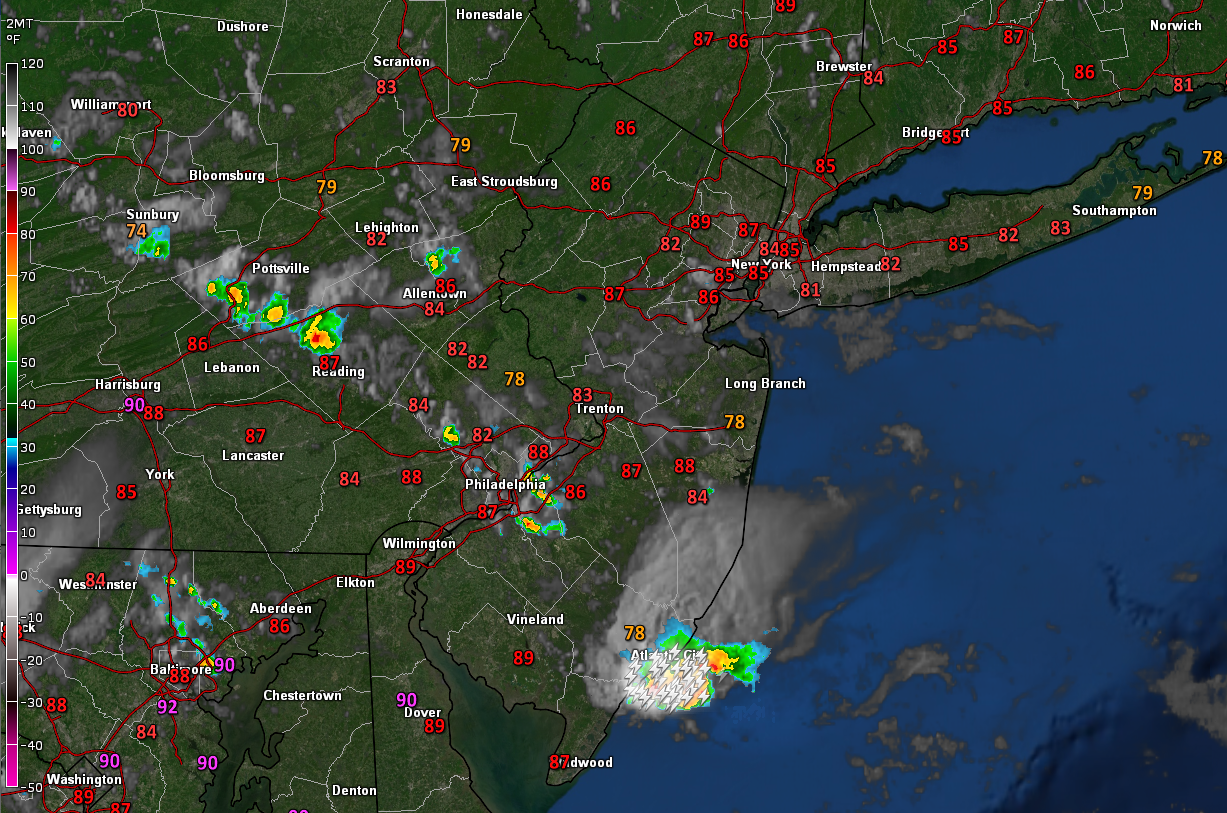
Tomorrow (Thursday) will likely start off quite warm and muggy during the early morning hours. Additionally, there may be a few residual lower to mid-level clouds over the area, but these should burn off by noon. Mid-level ridging will be building over much of the East tomorrow afternoon, guaranteeing very warm high temperatures. Dew points will also be quite high across the entire area once again, making for a muggy/humid 4th of July. Highs tomorrow will likely climb well into the 80’s, with portions of NE NJ likely getting into the lower 90’s. Heat indices may reach the lower to middle 90’s across much of our area.
Now for the billion dollar question…will it rain tomorrow?
Despite all the heat and humidity, easterly winds are expected to push into the NYC area by noon tomorrow. This will bring in a relatively stable airmass, keeping any chance of showers/thunderstorms focused well off to the west of the NYC metro. As always, there may be a few residual showers that move through the area tomorrow, but the general idea is that we miss out on any high-impact weather.
Fourth of July celebrations should be able to go unimpeded tomorrow evening/night with only partly cloudy skies expected. Conditions will remain very warm and humid into the overnight hours, with lows in the lower 70’s likely.
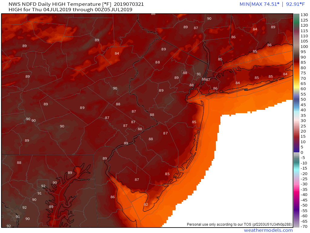
This evening’s NWS forecasted high temperatures for tomorrow (4th of July)
Unsettled conditions likely this weekend
Much of the same is expected for our area on Friday. Mid-level ridging will begin to slide off to our east during the day, allowing moisture to stream north once again. Highs will likely reach into the middle to upper 80’s, with dew points in the lower to middle 70’s. Muggy & humid conditions are likely throughout the afternoon and into the evening hours. There may be a slight chance at some showers/thunderstorms later in the day–but the main activity will likely be located off to the west. The threat for showers and possibly a thunderstorm will last throughout the overnight hours, with lows remaining in the lower 70’s.
Unfortunately, this weekend looks to start off quite unsettled as even more moisture streams into our area from the south. Widespread showers and thunderstorms are likely to develop across much of the Mid-Atlantic and Northeast during the day on Saturday. Localized heavy rain will be possible as storms will likely be slow-moving and loaded with moisture. Sunday may be slightly improved, but the latest model guidance disagrees on the exact timing of a cold front that would bring some relief to the area.
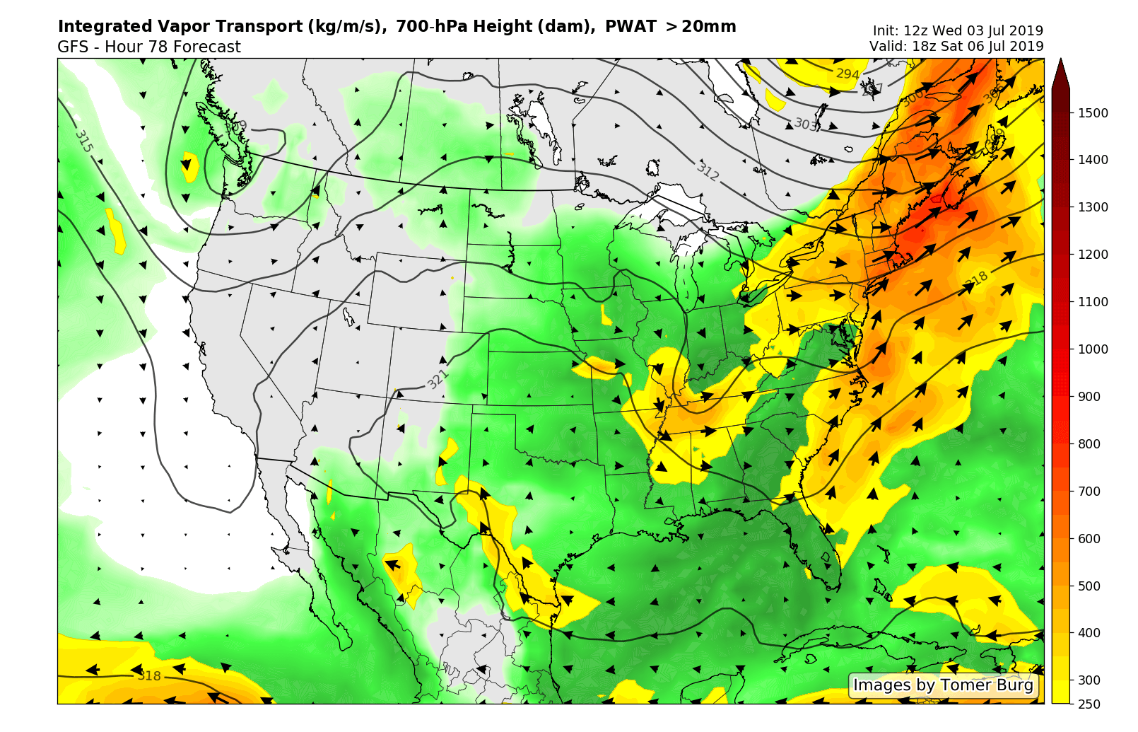
This evening’s GFS model showing a large area of moisture overspreading the Northeast during the day on Saturday. Widespread showers and thunderstorms capable of heavy rain will be likely across much of our area
Thanks for reading and have a great Fourth of July!
-Steve Copertino
Leave a Reply
Want to join the discussion?Feel free to contribute!