-2")
Generally hot and calm conditions through midweek
Good evening!
We started off this week on a rather cloudy and unsettled note, but this looks to change. High pressure will build into the East, allowing for at least a few days of warm and dry conditions. Our attention then shifts to a series of disturbances out west that may bring our next round of unsettled condition!
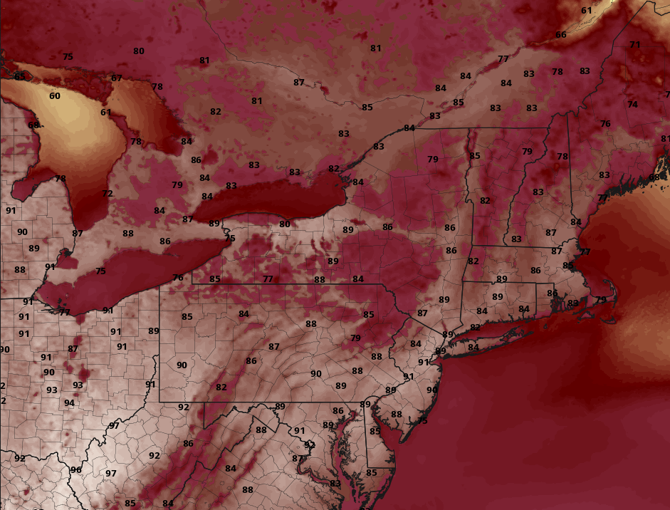
Today started off quite unsettled & cloudy across the entire NYC metro this morning. Widespread showers & a few pockets of moderate to heavy rain moved through during the AM commute thanks to a weak shortwave trough. Thankfully, this trough gradually moved off to our east, putting an end to the damp and dreary conditions. Residual cloudy skies remain in place over portions of the metro, with some clearing noted over SNJ. Temperatures have struggled a bit today but appear to rebounding. Current observations show readings generally in the middle to upper 70’s, with lower 70’s over NEPA and western NJ.
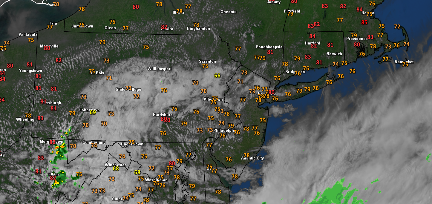
Clouds will give way to partly sunny skies over the next few hours, possibly allowing some locations to reach into the lower 80’s. Despite the unsettled weather, the big story today has been the decrease in humidity levels. A much more dry airmass has finally worked its way south into the area, dramatically lowering dewpoints areawide.
Partly cloudy skies and generally calm conditions are expected through the rest of this evening and into the overnight hours. Temps will remain right around normal, with lows in the lower to middle 60’s. Some patchy fog may be possible for portions of our area due in part from some residual low-level moisture.
Snapshot of this evening’s conditions across the Northeast. Clouds are expected to continue to decrease through the evening hours
Return to hot and mostly clear skies through Wednesday
Tomorrow (Tuesday) will be a much-improved day from the start. High pressure will be gradually building down into the Northeast during the morning hours allowing mostly clear skies to develop. Clear skies and light winds should allow for temps to quickly rise during the early afternoon hours across the entire area. Highs will easily be able to rise into the middle to upper 80’s, with some locations likely breaking 90F. Thankfully, the reduced humidity will make for much more bearable conditions during the afternoon. Mostly clear skies and calm conditions are likely through the evening and into the overnight hours. Lows will once again remain right around normal, with temps in the lower to middle 60’s.
Wednesday will start nearly identical to Tuesday, with mostly sunny skies and warm temps. Mid-level ridging along with surface high pressure will be firmly in place over the Northeast by Wednesday afternoon. This will guarantee mostly sunny skies and low levels of humidity. Temperatures should once again easily rise into the middle-upper 80’s, with some locations rising above that 90-degree mark. Dews will also remain in control, with any “muggy” conditions staying south of the city. Sunny skies and warm temperatures will dominate the remainder of the day on Wednesday. Mostly clear skies will extend into the evening/overnight hours, with lows staying in the middle to upper 70’s.
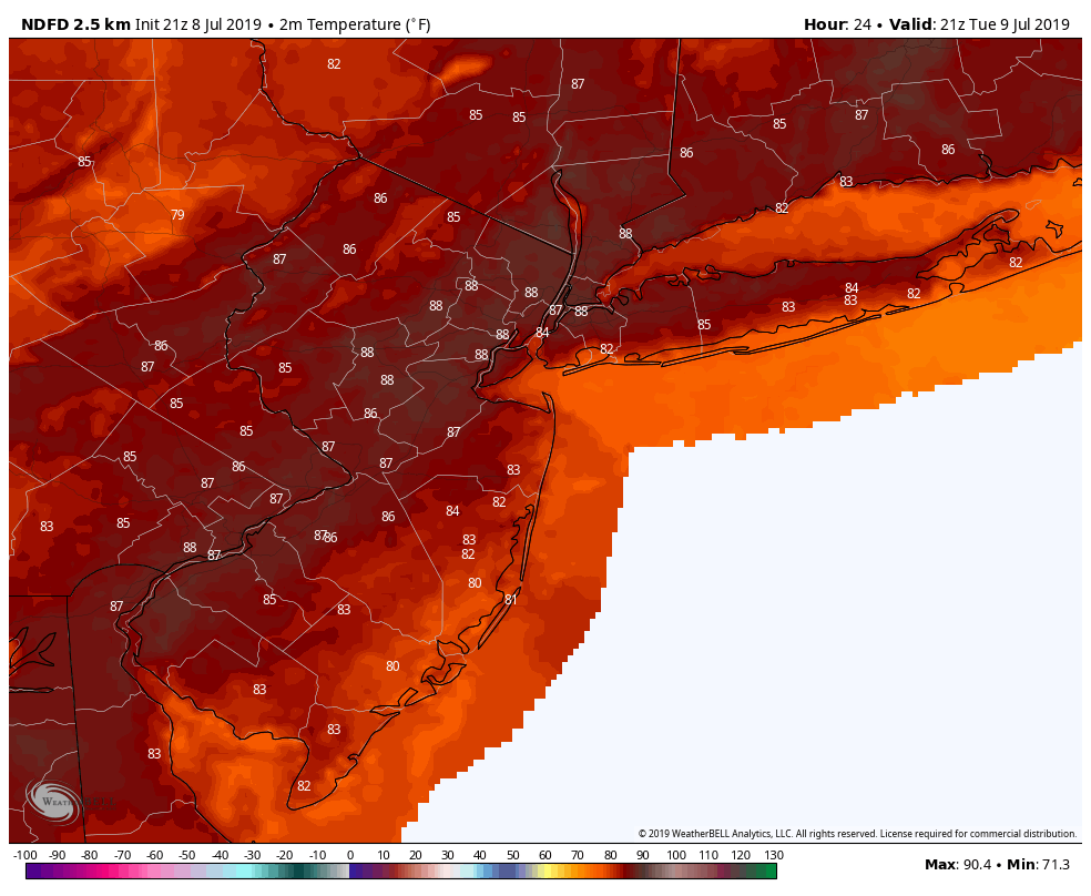
NWS forecasted highs for Tuesday. Some locations over portions of NE NJ could easily break that 90-degree mark!
Unsettled conditions briefly return later this week
Our short-lived string of dry conditions may come to an end as early as Thursday. While most of the day on Thursday should be relatively dry, an approaching mid-level disturbance will bring a chance at some showers/storms later in the day. Generally unsettled conditions will last throughout the overnight hours and possibly into the first half of Friday. While some heavy rain may be possible, no serious impacts appear likely at this time.
Early signs seem to point towards conditions once again clearing out for this weekend. Additionally, much warmer weather also appears to be on the horizon for next week as mid-level ridging begins to build over the Eastern US! We’ll have more on this during our next update!
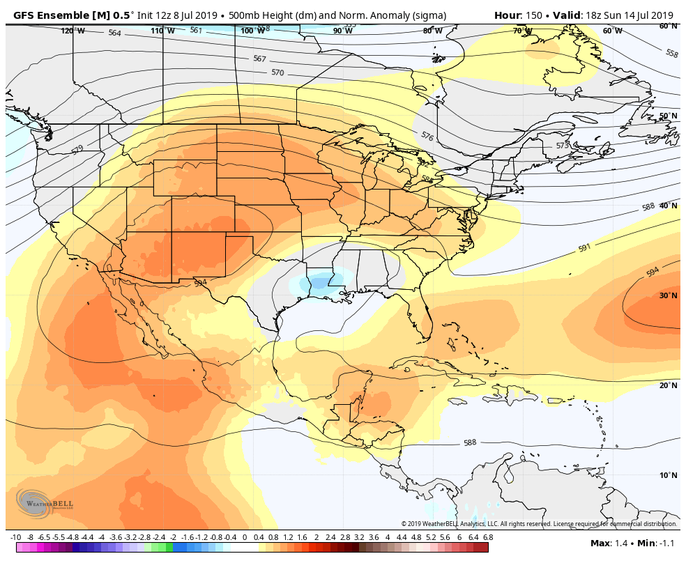
This evening’s GFS ensembles showing the beginning of a potentially hot period of weather shaping up for the Eastern US
Thanks for reading and have a great night!
-Steve Copertino
Trackbacks & Pingbacks
3plantains
Leave a Reply
Want to join the discussion?Feel free to contribute!