-2")
Weekend Briefing: Oppressive & Dangerous Heat and Humidity Likely!
An exceptional heat wave will continue to build for the New Jersey and New York City area this weekend! Temperatures are likely to reach the upper 90s on both Saturday and Sunday with some spots possibly breaking the 100°F mark. The heat will be quite oppressive and dangerous when combined with very high levels of humidity. Heat index values could be as high as 115°F in parts of the immediate NYC metro.
First up, a disturbance passing through may cause a few showers and thunderstorms over northern parts of the region later this evening and into the overnight hours. The Storm Prediction Center has placed Northwest New Jersey and the Lower Hudson Valley in a “Marginal Risk” (Level 2 of 5) for isolated severe thunderstorms with gusty winds. Otherwise, it will continue to be very warm and humid tonight with lows in the mid-upper 70s-with some locations staying in the 80s!
Here are five things of note for this weekend and into early next week:
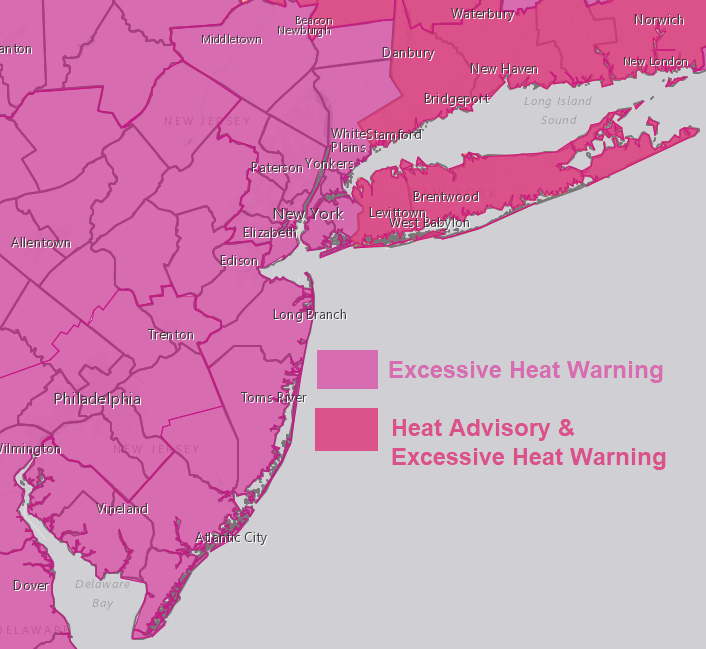
- Excessive Heat Warnings from the National Weather Service are in effect for the entire region for both Saturday and Sunday. High temperatures at least in the upper 90s combined with high dewpoints in the mid-70s will lead to dangerous heat index values between 105 and 115 degrees. Heat exhaustion or a heatstroke may occur with those spending a prolonged period of time outside.
- If you are going to be outside for a long period of time this weekend, please drink plenty of non-alcoholic fluids and avoid any unnecessary, strenuous activities during the afternoon hours! Additionally, check-in on elderly relatives or folks living alone (especially those with no air conditioning). Also, make sure children & pets are staying hydrated!
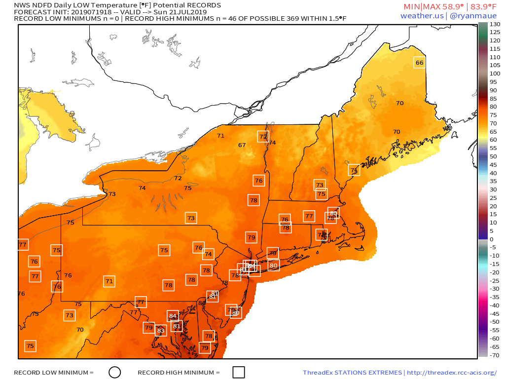
- We may come close to breaking some record high temperatures, especially if highs approach 100 degrees on Saturday. New record maximum low temperatures are also possible. Many areas are likely to only drop into the 80s with very humid conditions on both Friday and Saturday night.
- Mostly calm weather is expected with partly to mostly sunny skies each day this weekend. However, we can’t rule out some isolated showers or thunderstorms popping up, especially as instability increases from the heat and humidity during the afternoon hours. The best chance for any showers and thunderstorms will likely remain over the interior Northeast and Mid-Atlantic states.
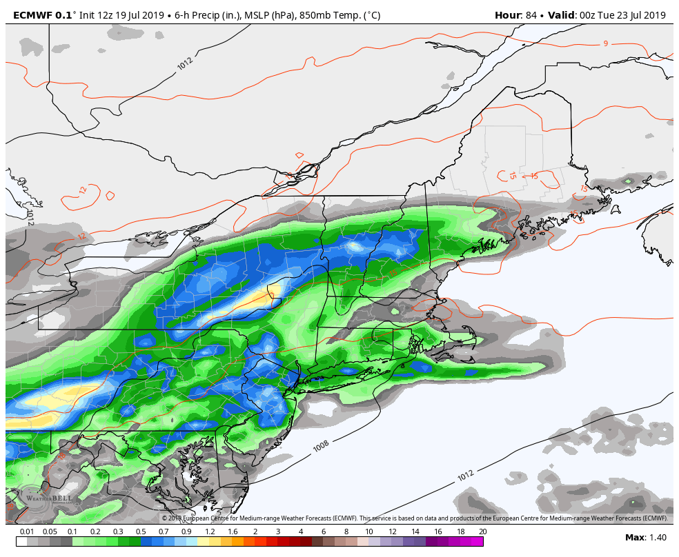
- A strong cold front with a wave of low pressure will arrive with more widespread showers and thunderstorms likely on Monday. Some thunderstorms could be strong/severe, with damaging winds and torrential rainfall. At this time, temperatures on Monday will likely not be quite as hot as over this weekend. Unfortunately, more bearable temperatures and levels of humidity are not expected until around Tuesday.
Another note: If you are going to down to the beach this weekend, check out our beach forecasts for detailed information on the rip current risk & other potential hazards for the New York and New Jersey beaches!
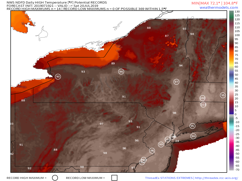
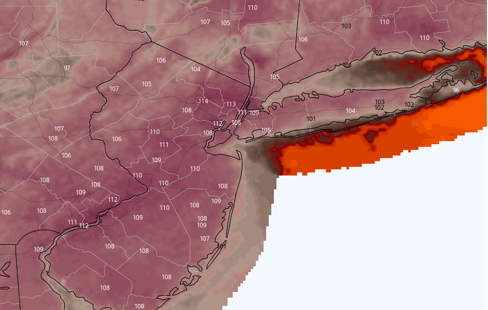
NWS forecast highs during the day on Saturday. The circles denote locations where record high maximum temperatures may be broken!
That’s it for now! Stay cool and hydrated and have a great weekend!
-MP/SC
Trackbacks & Pingbacks
1marginal
Leave a Reply
Want to join the discussion?Feel free to contribute!