Monday Briefing: Severe storms, flooding likely tonight
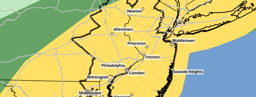
After several days of heat, the weather pattern is finally ready for a change. That will culminate this afternoon and evening, when strong and severe storms develop throughout the area. The Storm Prediction Center has placed our area in a Slight Risk (level 2 of 5) for severe storms through tonight.
These storms will be capable of producing frequent and dangerous lightning, torrential flooding rains, gusty winds and hail. Widespread flooding is likely, with tons of moisture in the atmosphere and a frontal boundary nearby.
Here are the five main things to watch for in the short term forecast:
- Visible satellite shows tons of sunshine and a destabilizing atmosphere this afternoon. This will fuel storms later this afternoon, developing near a cold front. Expect thunderstorms to become strong and severe after 3pm.
- Storms will move from PA and NJ toward NYC and CT between 4pm and 8pm, perhaps continuing beyond that. They’ll be capable of all severe weather hazards: Lightning, hail, wind, and even an isolated tornado.
- Heavy rain will continue overnight, excaserbating the flooding threat. A Flash Flood Watch is in effect through Tuesday morning.
- The weather finally begins to clear up a bit on Tuesday as the system shifts away. Temperatures will trend cooler midweek.
- A gradual warming trend is then expected as we move toward the end of the week, but there are no major heatwaves on the horizon. The worst of that is probably over.
Stay tuned through the afternoon and evening for updates on the evolving storm threat.


Leave a Reply
Want to join the discussion?Feel free to contribute!