-2")

PM Briefing: Coastal storm trends closer to the coast this week
An expansive coastal storm is forecast to develop off the Eastern Seaboard this week, and recent trends suggest rain and wind from the system may reach the coastal plain. The storm is expected to form on Tuesday as an area of low pressure off the Mid-Atlantic coast. It will eventually move northward into the Atlantic Ocean.
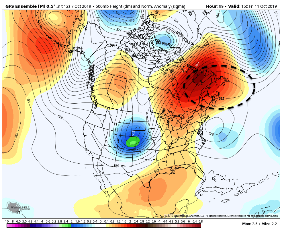
One of the major factors in the storms eventual track and strength is a large blocking ridge north of the storm. These ridges of high pressure are notorious for slowing storms down, and forecast model guidance often struggles with their presence. As a result, it is not entirely surprising to see a wide envelope of potential solutions on forecast models today.
The high pressure to the north of the system, over Eastern Canada, effectively blocks the storms north or eastward escape into the Atlantic Ocean. Instead, it is forced to turn northward and perhaps even back westward, sending precipitation westward towards the East Coast of the Mid Atlantic and New England.
The same blocking high will also exacerbate the threat for coastal flooding. An onshore flow will be enhanced thanks to the low level air flow around the high pressure to the north, and low pressure system to the south. This should allow for increased low level winds and surf moving towards the New Jersey and New York beaches. In addition, wave heights will rise as the low pressure system develops.
Scenarios and Hazards
Uncertainty remains very high in regards to exactly when that will occur. There are some distinct scenarios still possible:
- The storm remains further offshore. Coastal flooding and unsettled weather still occurs, but the core of the system remains out to sea. In the NYC Metro, the weather is unsettled through the end of the week, but no widespread precipitation occurs.
- The system comes far enough west to bring rain to the coast, but it isn’t overly heavy and doesn’t move very far inland. Coastal flooding and rainfall would be enhanced in this scenario, but areas from the NYC Metro and westward would escape the worst of it.
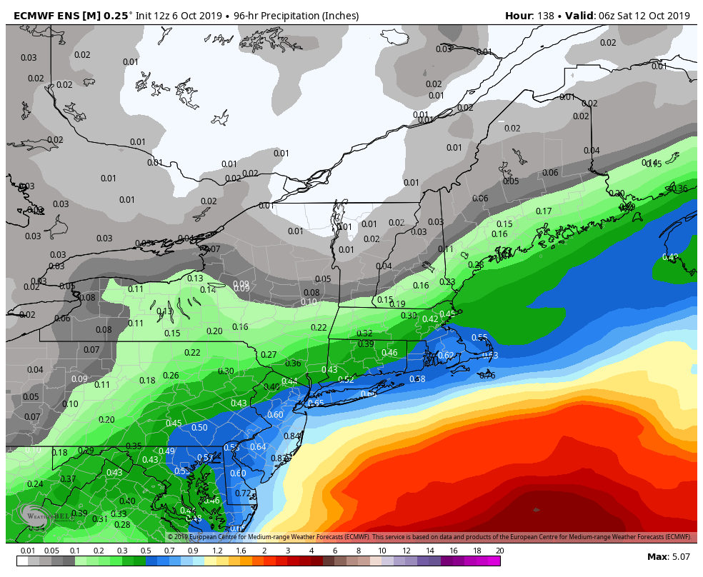
- The storm tracks on the northwest envelope of model solutions. This would lead to heavy rainfall in much of New Jersey, the NYC Metro and New England – with rainfall amounts of 2-4″ possible. Gusty winds and coastal flooding would be likely along the area beaches.
Currently, confidence is highest in scenario #2, but some recent data has been trending towards scenario #3. We’ll likely gain confidence quickly as we move through the next 12 to 24 hours and the development of the system becomes more clear.
Overall, this doesn’t look like an overly hazardous weather event. Still, the potential exists for several inches of rain and wind in some areas. The most notable or appreciable impacts will likely be directly along the coastal plain.
For now, expect unsettled weather in the NYC Metro from essentially today through Thursday, and know that the potential exists for it to continue beyond that. We’ll keep you in the loop on the specifics as we get closer.
Let’s close it with one bit of good news: The weather looks like it will at least improve by the time we move towards the weekend.
Trackbacks & Pingbacks
1assimilation
Leave a Reply
Want to join the discussion?Feel free to contribute!