-2")

Stormy Halloween expected, gusty winds also possible
A broad storm system will develop in the Great Lakes through Thursday, bringing an increasing chance of rain to the Northeast states. In addition to the potential for heavy rainfall, locally strong wind gusts are possible on Thursday evening and early Friday morning.
Moderate rainfall is likely during the morning hours as a warm front shifts northward. There will likely be rain falling throughout the morning commute across New Jersey and the NYC Metro Area. These areas of rain will shift northward with time, continuing until the early afternoon. Localized flooding is a possibility.
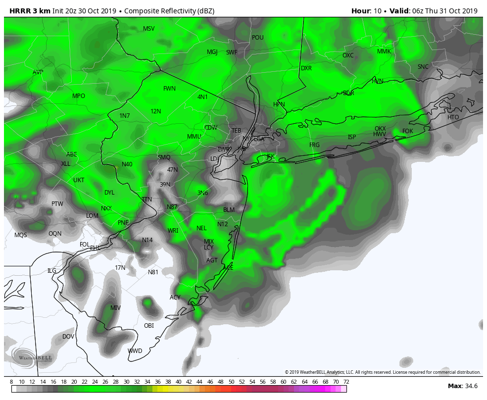
A potential break in the rainfall comes during the mid to late afternoon hours, as the warm front shifts northward. Before the cold front arrives, much of New Jersey and perhaps parts of NYC and Long Island will fall within the “warm sector”. This is an area south of the warm front, but ahead of the cold front.
Often times, this warm sector can be characterized by sunny, warm and humid conditions in the summer. This time, the warm sector will be a bit of a mess. The chance for showers and drizzle will continue. With that being said, the warm sector itself will provide a window for Halloween festivities.
This warm sector is most likely to be overhead between 4:00 and 8:00pm. There should be a window to safely complete outdoor activities during this time, although some showers are still possible and conditions will be damp.
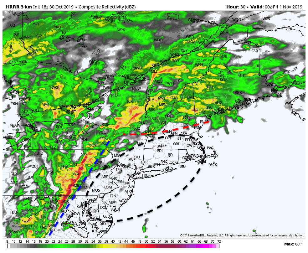
After 8pm, a cold front will begin marching east from Pennsylvania. During the mid to late evening hours, a line of showers and embedded storms will slide through New Jersey and towards New York City. These storms will be capable of producing torrential rain and some gusty winds.
Precluding a larger threat for damaging wind gusts will be a low level inversion, or rising temperature with height. Inversions act like a lid in the atmosphere, and often times prevent the downward momentum transfer of strong winds that are a few thousand feet above our heads.
Nevertheless, a few stronger gusts are possible. The National Weather Service has issued a Wind Advisory for parts of the area as a result. The front shifts east of the area by late Friday morning with clearing occurring from west to east.
So, to summarize the very active weather on Thursday:
- Heavy rainfall likely in the morning, particularly before 10am
- Showers will continue through the early afternoon hours
- A window of opportunity for outdoor activities will exist after 4pm as the warm front clears the region
- Showers and embedded storms return after 8pm and through the evening with strong winds and heavy rain possible
- Clearing occurs by Friday morning as the system departs
Stay tuned for more details through tonight and Thursday as the system draws closer!
Leave a Reply
Want to join the discussion?Feel free to contribute!