-2")
Colder, potentially wintry weather pattern poised to take over
It’s the headline you’ve been dreading since you sat in traffic for 5 hours during last November’s snowstorm. Much colder, potentially wintry weather is poised to move into the Northeast states later this week, with additional shots of cold air continuing through next week.
Let’s back up for a moment. Pleasant, cool weather conditions are expected for the next couple of days, High pressure will remain in control today, with highs generally in the lower to mid 50s. Much of the same is expected to continue through Thursday, with high temperatures in the 50’s and cool overnight low temperatures.
Things start to get busy later this week. A low pressure system develops along a frontal boundary on Thursday, with showers expected to develop throughout the Northeast states. Early in the week, some model data indicated that low pressure would be tracking to the south of our area and pulling more cold air in from the north, which would of resulted in more wintry precipitation in our area. This was always unlikely – and accordingly, models have trended northward, keeping wintry weather relegated to Northern New England.
As colder air begins moving in behind low pressure and the frontal boundary, rain might still change to brief period of wet snow before ending, particularly over higher elevations in the Lower Hudson Valley, Northwest New Jersey, and Connecticut, late Thursday night or early Friday morning. Accumulations will be extremely isolated and non-impactful.
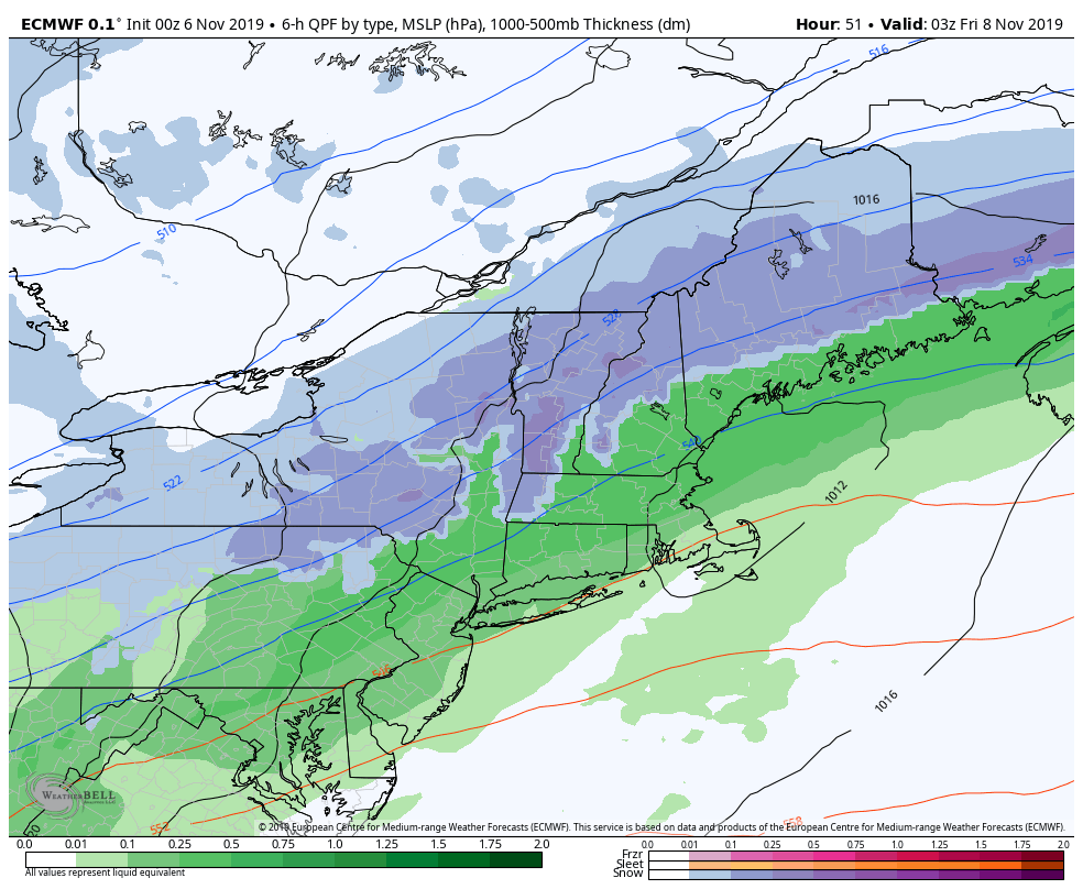
Latest Euro model showing snow relegated to New England late this week.
Then comes the cold
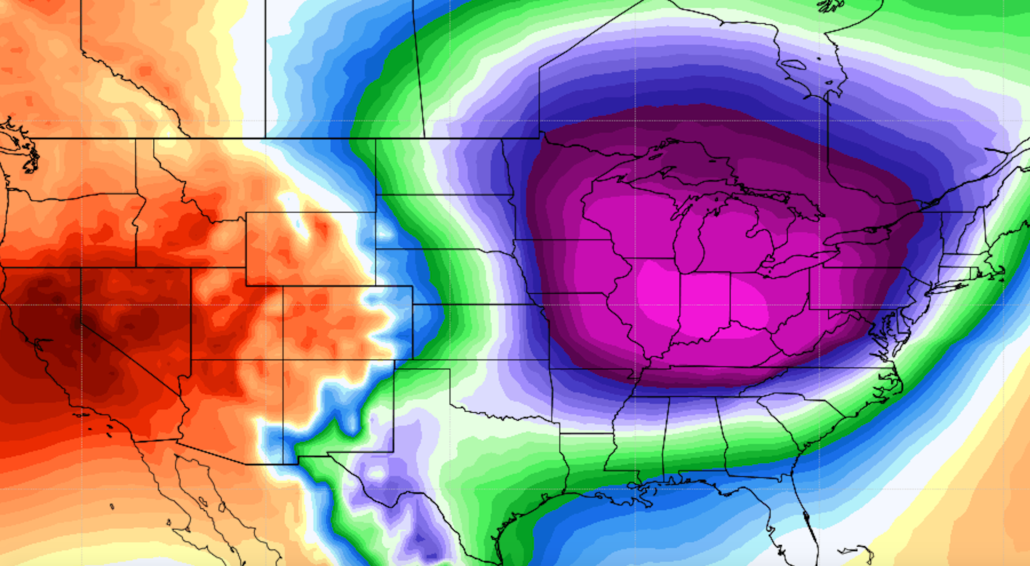
A very cold airmass for this time of year will come surging in behind this system on Friday and Saturday. You can thank a strong ridge over Alaska and the Western USA for this (yes, really). This ridge will dislodge arctic air, typically reserved for Northern Canada, and send it flying southward towards us. Temperatures will average below normal late this week and weekend, with daytime highs possibly just in the upper 30s to lower 40s especially on Friday and Saturday. Nightime lows could get down to below freezing or the low 30s for first time this season in New York City and urban areas, while lows will be in the 20s in many of the suburbs.
Another front is likely move through the Northeast with some rain and/or snow showers early next week. This front will also allow even colder air to surge southward from Northern Canada into the United States. Temperatures could average 15 to 20 degrees below normal as this airmass surges southward.
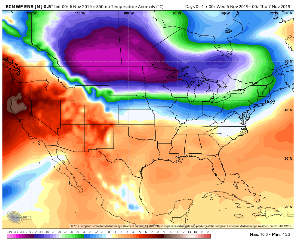
While this is not an unheard of event, it is very anomalous. Temperature departures of this nature are not common, and cold air of this intensity isn’t often observed in November. Ironically enough, we also experienced a shot of anomalously cold air during November of 2018, with a similar ridge developing in Alaska.
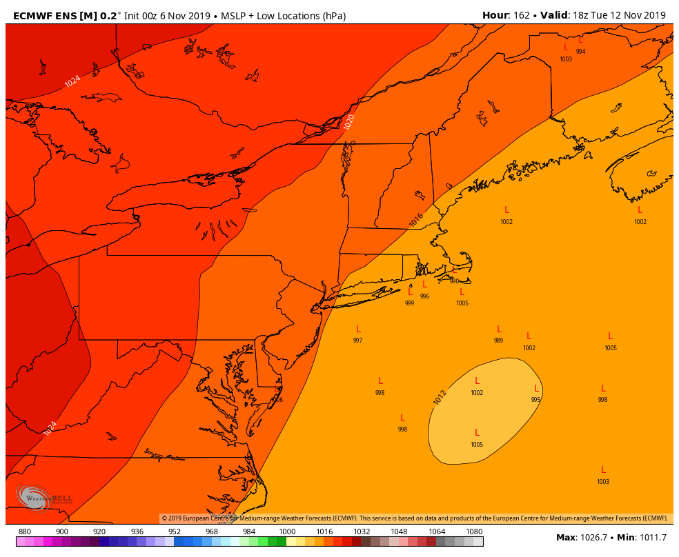
That should be a bit of a hint to all of us that we won’t get out of this pattern without at least a threat for wintry weather. Lo and behold, ensemble guidance is beginning to hint at the potential for a notable low pressure system developing off the East Coast during the middle part of next week
While details remain uncertain, this system has the potential to be more significant than the prior few, and given the cold air that will be in place could bring wintry weather to areas closer to the coast if it does form. We’ll keep a close eye on it over the next few days.
Here are your morning highlights (Tldr;):
- Pleasant, cool weather conditions will continue through tonight and Thursday morning
- Low pressure will bring mainly rain to the region later Thursday afternoon and night
- Friday and Saturday will be much colder with highs only in the upper 30s or lower 40s
- Anomalously cold air moves in to the area early next week with temperatures 10-20 degrees below normal
- A more significant storm could develop during the middle part of next week. Wintry weather is not out of the question
Stay tuned for additional details as we move through the rest of the week!
Leave a Reply
Want to join the discussion?Feel free to contribute!