-2")
Reflecting on a mid-November forecasting nightmare
It was around 3:00pm that things got serious. After days of forecasting light to moderate snowfall accumulations, followed by a transition to rain, a winter storm was over-performing at the worst possible time. It was November 15th, 2018, and the hours that followed would by marked by some of the worst road conditions the NYC Metro has seen in a decade.
Commuters were stuck in traffic for more than five hours. Some of them never got home. Snow piled up on roadways, which became impassable as heavy precipitation continued to fall. Public transportation was overwhelmed. The system which we rely upon so heavily to commute and travel around the city seemed to collapse in a cascade of failures as a result of heavy snowfall.
And it all began with a poorly communicated weather forecast.
“This one has bust potential”
Days before the commute from hell began, meteorologists were honing on the potential for an early-season winter storm in the Northeast states. This time of year, particularly November, is very challenging for weather forecasters. The atmosphere is in a transition between the summer and winter jet stream patterns. This causes more chaos than usual in the atmosphere, and forecast models can struggle as a result.
This one, however, seemed fairly straightforward at the start. The storm was characterized by a process called warm air advection which is as aptly named as it sounds. The movement of warm air in the low and mid levels of the atmosphere acts to enhance lift, resulting in moderate to heavy precipitation. Winter storms that are driven by warm air advection are often marked by the change from snow to rain, as the warm air eventually takes over and melts the snowflakes before they reach the ground.
This process was part of the foundation of the forecast in the days leading up to the event. However, a strong high pressure to the north of the storm led to unusually low confidence. The battle between the warm air advection surging from the south and the high pressure filtering cold from the north meant that a tiny change in either direction could unhinge the entire forecast.
In an article published a few days before the storm, we noted this exact uncertainty. In our office, the remark that kept coming up was “this one has bust potential”. In other words, we were worried about the storm surprising us at the last moment. That would be an understatement.
All of the red flags were up, they were just ignored
As the storm system drew closer, all of the flags that should have been up – the signs that this system would surprise us – were there. The day before the storm, almost all models including the ECMWF, NAM and GFS trended colder with surface temperatures across the Northern Mid Atlantic and New England. The high pressure to our north was over-performing.
As the morning of the event arrived, observations throughout Pennsylvania and the Mid Atlantic confirmed suspicions from the day before. Heavy precipitation rates were resulting in dynamic cooling – the atmosphere was cooling itself as heavy snow fell – and snow was being reported for longer duration than anticipated. Many areas that were only expected to record an inch or two of snow were recording several inches more. This was impressive for November and meteorologists were taking note.

It was at this point that there was a critical error in communication between meteorologists and operations managers around the NYC Metro Area. This is the inflection point where communication absolutely needed to change. It was clear that this event had the potential to over-perform and that winter weather impacts had the potential to be higher than expected. All of the red flags were up, they were just ignored.
The next few hours would seal the fate of the evening commute. As snow started throughout the area, it was far too late for operations managers, DOT’s and other local services to react. The roads were not properly treated and were not ready for the incoming heavy snow rates. Meteorologists and local services had failed.
Heavy snow began to spread over the entire NYC Metro Area and surrounding parts of NJ, NY and CT. With the high pressure to the north over-performing, and more cold air available than initial anticipated, the atmosphere was able to reach a crescendo of heavy snow. Warm air advection continued to enhance precipitation, but cold air to the north kept reinforcing itself and allowing dynamic cooling to produce snow – not rain. Such a process is not unheard of, but was extremely impressive for early in the season, let alone the middle of November.
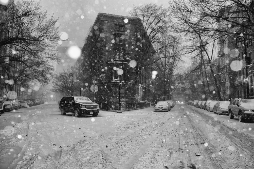
Roads quickly became an absolute nightmare with untreated pavement being impacted by very heavy snowfall rates. Travelers were stuck on roadways for 5-10 hours (sometimes more), accidents were common, public transportation was stymied and commuters were completely stranded. NYC ended up with 6.4″ of snow, the second snowiest November day on record.
What to learn and how to move forward
Meteorology has come a long way, but we still have a long way to go.
We knew of the potential impacts from this storm several days in advance. The risk of potential hazardous weather was communicated. Yet, at the last moment, a change in the expectations of the storm resulted in a catastrophic failure of preparation. Why was this change not communicated? How was there not a backup plan in place?
As meteorologists, our job is to properly communicate the expected impact from a storm system. But in 2019, our job should go beyond that. All meteorologists, especially those working closely with government and local officials that are responsible for DOT’s or local services, should be responsible for detailed and responsible communication of risks.
It is not irresponsible for meteorologists to admit that a certain storm system has a higher “bust” potential. It is not irresponsible for meteorologists to admit that they don’t have a full handle on exactly what is going to happen. It is not irresponsible for meteorologists to admit that a forecast is going off track and needs to be adjusted. Perhaps such an approach would’ve helped in November of 2018.
Think of it this way: If we communicate that 3-6″ is the expected accumulation amount, but that the storm is extremely complex and has the potential to produce more snow, it’s more likely that local agencies will act in an abundance of caution. We can sound that alarm bell as the storm approaches as needed, and the appropriate actions can be taken. If that risk is never communicated, however, the local agencies have no chance to react.
Ultimately, we don’t truly know exactly what went on behind this scenes. We don’t work with the NYC DOT (yet?), and we don’t know how the forecast was communicated. But we can speak for meteorologists when we say that communicating uncertainty in a forecast needs to become a standard procedure.
Our hope is that during the Winter ahead, we’ll begin to see some of these lessons learned in action. We want to communicate risk and uncertainty properly so that our readers (and clients) can act appropriately. That’s how meteorology communication will improve, and that’s how we can prevent a disaster like November of 2018 from occurring again.
Here’s hoping that the first winter storm of 2019-2020 doesn’t end the same way this one did, so that we can all enjoy the snow from somewhere comfortable and warm.
Leave a Reply
Want to join the discussion?Feel free to contribute!