Severe thunderstorms possible again on Wednesday

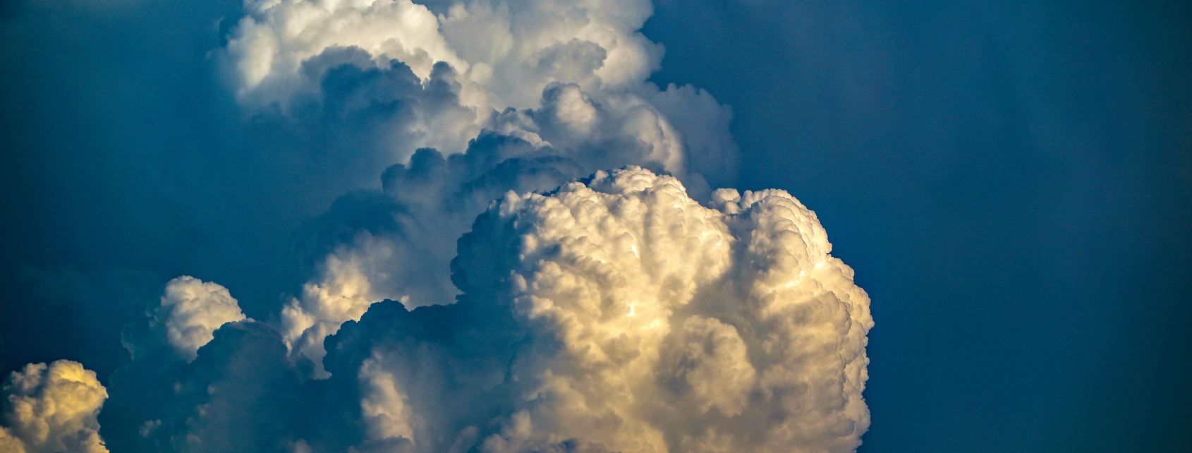
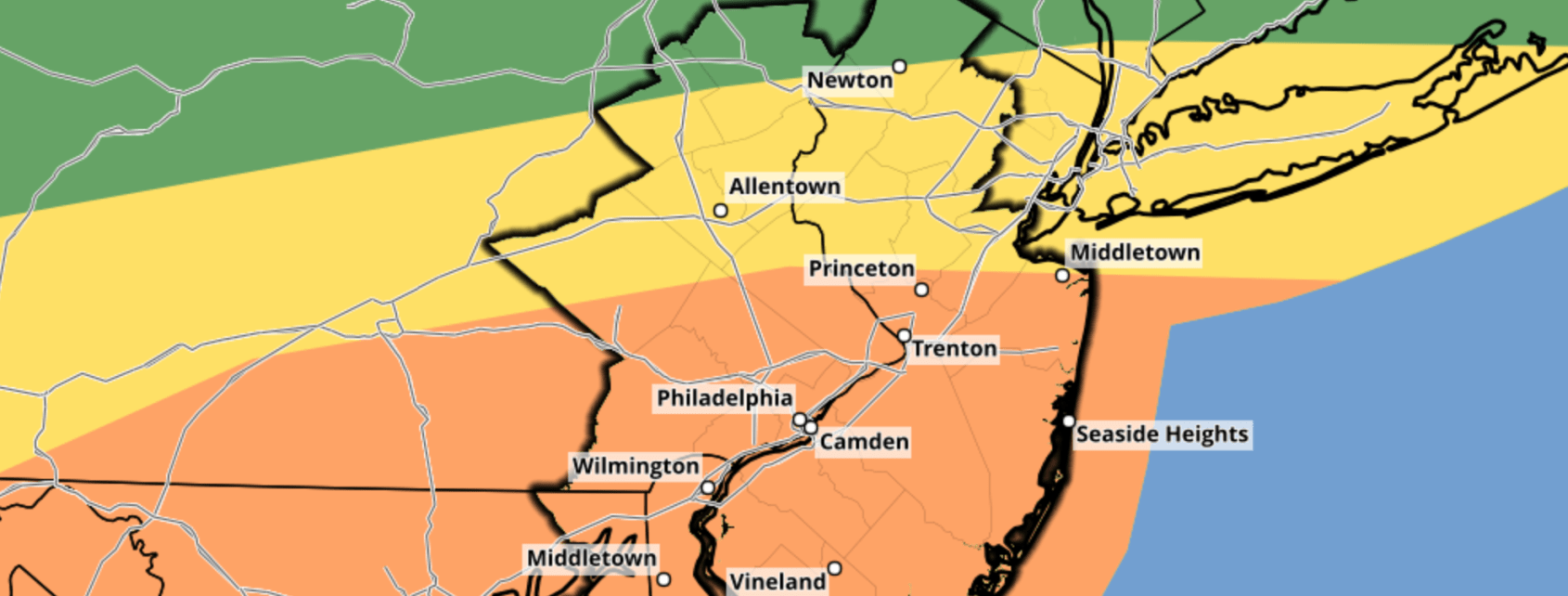
Another disturbance is set to move through the Northeast states on Wednesday, and it will bring showers and thunderstorms with it. With instability and wind shear in place, thunderstorms will turn severe during the afternoon hours. While coverage will be scattered, these storms will produce a myriad of weather hazards. The Storm Prediction Center has placed a large majority of the area in “Slight Risk” for severe weather.

Setup for severe weather remains complicated

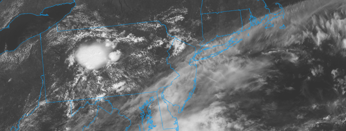
The atmospheric setup that may produce severe weather remains very complicated. While a low pressure system develops, clouds and showers will move through the Northeast states on Wednesday morning. This creates uncertainty in regards to how unstable the atmosphere will get. In addition, model guidance struggles with these intricate systems – creating a lower confidence forecast.

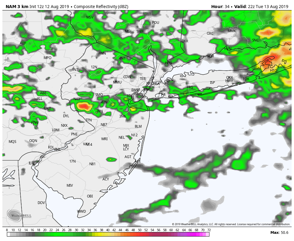
Current expectations are that storms will form during the early afternoon in the Interior, and begin moving eastward. The most likely area for this activity is Northern PA, Southeast NY, and Western New England. Additional thunderstorms will develop on the southern end of this activity in parts of New Jersey and New York. These storms will all shift eastward toward the coast by late afternoon and early evening.

Here are the highlights, focused on the NYC Metro and surrounding areas:

  • Showers and storms are likely on Wednesday, first in the morning. These won’t be severe but will be capable of producing periodic heavy rainfall.
  • The atmosphere will become more unstable during the afternoon. Showers and storms will develop again and move through parts of PA, NJ, NY, CT and MA. The worst of this storm complex may miss the NYC Metro to the north.
  • Additional storms will develop on the southern edge of – and to the south of – the aforementioned storm complex in NJ and NY. These will be capable of producing small hail, strong winds, and dangerous lightning.
  • A localized threat for a few tornadoes may exist across the Lower Hudson and Champlain Valley, but this risk will be conditional and its intensity likely not determined until morning.
  • Conditions improve by the time we move into the evening hours and overnight into Thursday, with lower humidity and calmer weather.

Stay tuned over the next several hours for the latest from our forecasting team. Remember to start using #nycstorm to help aggregate reports and photos of storm activity.

Enhanced Risk of severe weather on Tuesday in PA, NJ

The Storm Prediction Center has placed parts of PA and NJ in an Enhanced Risk for severe thunderstorms on Tuesday. The main threat with strong and severe thunderstorms is expected to be damaging winds, but small hail and tornadoes are also possible. Heavy rain is expected throughout the area.

The threat for strong and severe thunderstorms will be driven by the development of a low pressure system over Pennsylvania. This same low pressure system will then move eastward off the coast. Near and southeast of the low pressure, instability will increase. The combination of instability and ample wind shear will allow storms to form and organize.

The track of the low pressure system will obviously be important. To the north of it, cooler and rainier weather is expected. To the south of it, near more appreciable instability, storms will turn strong and severe on Tuesday afternoon. As of this afternoon, forecast model guidance is in good agreement that the low pressure will track just southwest of NYC.

This suggests that areas like Southeast PA and Central/Southern NJ are at the greatest risk for severe weather, including strong winds and isolated tornadoes. Heavy rain is possible throughout the area.

Here are the highlights over the next few days:

  • Calm weather will persist through the evening today. Temperatures will remain warm and clouds will increase during the evening.
  • Unsettled weather is likely on Tuesday. In NYC, the expectation is that clouds and rain will limit severe weather potential. 
  • Further south in Southeast PA and NJ, strong and severe storms are expected. These will be capable of producing strong winds, flooding and tornadoes. 
  • The weather improves once again after this system passes Tuesday evening.
  •  Calm weather will persist through the end of the week.

As always, stay tuned for more details and alerts as we move closer to Tuesday.

Seasonably warm for now, cooler air on the horizon

Warm conditions are expected to persist this weekend, with a chance of showers and thunderstorms each afternoon. The good news will be the absence of heat, which had been a consistent feature over the past two weeks. Temperatures will average in the middle to upper 80’s through Sunday. Saturday may be the most active day, with afternoon showers and storms anticipated.

Our area will lie in a transitional zone of the jet stream over the next week. This will keep the weather seasonably warm and bring the opportunity for showers and storms every few days. The longer range forecast, however, offers the opportunity for change. Forecast model guidance suggests that a large trough of cooler air could sink southward from Canada by the end of next week.

Here are the highlights for the weekend and beyond:

  • A few showers and storms are likely this afternoon, mainly across Pennsylvania and New Jersey. These aren’t expected to be severe, but could bring localized heavy rainfall and some blustery winds
  • Additional showers and storms are expected on Saturday. After a calm start to the day, expect storms to fire up throughout the area. Again, no widespread severe weather threat is anticipated but storms will pose a threat for heavy rain and gusty winds
  • The weather improves on Sunday, with temperatures in the mid to upper 80’s and plenty of sunshine
  • Calm weather will continue into the early part of next week, with high pressure temporarily in control
  • The pattern takes an unsettled and cooler turn by the end of next week. Model guidance suggests a large trough may sink southward from Canada – and if it does, expect cooler temperatures and plenty of opportunities for rain

We’ll be closely monitoring the weather over the weekend (as we always do, since that’s our job). Stay tuned for further updates.

Have a great Friday!

July 2019 ends warmer and wetter than normal in NYC

Tack another above normal month on to the books. July 2019 ended warmer and wetter than normal in New York City. Temperatures averaged 2 to 4 degrees above normal throughout the area, while precipitation ended at nearly 150% of normal.

July 2019 was the 6th month of this year to finish with above normal temperatures. The persistence of the warm and wet weather pattern has been impressive: Since June of 2018, only two months have finished with below average temperatures in New York City (November 2018 and March 2018).

Temperatures averaged above normal throughout the entire Northeast in July 2019.

It will likely remembered for a late month heatwave, which brought temperatures over 100 degrees. Record warm overnight temperatures were also observed at many reporting stations. Central Park reached 90 degrees nine times in July 2019, the most since 2016.

Precipitation events were frequent, and thunderstorms were common. New York City experienced several days with thunderstorms – some of which were severe. Precipitation averaged 150% of normal from Northern New Jersey into the NYC Metro Area. Areas to the north were much drier, with parts of Connecticut reporting only 50-75% of normal precipitation for the month.

The long range forecast currently features cooler temperatures to start August (cooler is relative to what we’ve been experiencing). The weather pattern is likely to remain active.