-2")
NYC Forecast: Warm and humid, PTC9 forms in Atlantic
Warmth and humidity will persist in the NYC Area for the next few days, with temperatures in the upper 80’s and low 90’s. Potential Tropical Cyclone Nine formed in the Atlantic today, and will move towards the Caribbean this weekend.
QuickCast
This evening: A few showers and storms will move through the area, but coverage will remain low. Conditions are expected to improve this evening, with temporarily lower humidity. Expect lows in the 70’s.
Wednesday (7/29): Warm weather will continue, with light southwest winds. High temperatures will reach into the lower 90’s once again. No weather hazards are anticipated.
Thursday (7/30): Partly cloudy conditions will persist, with high temperatures near 90. Expect the chance for a few isolated storms, but weather hazards should be limited overall.
Forecast Discussion
A few showers and storms are moving through the region this evening, and will clear the NYC Area by early evening. Additional storms should develop across Southern and Central NJ later tonight, before the frontal boundary clears the coast. Expect improving conditions everywhere by morning. Partly cloudy and warm conditions will continue on Wednesday, with highs in the lower 90’s.

The general trend through the weekend will be continued warmth, but slightly less oppressive conditions in terms of actual heat. Temperatures will reach the upper 80’s to near 90 each day, which is at least a few degrees lower than what we have been experiencing. Humidity will briefly decrease, but then rise again as we move towards Saturday and Sunday.
By next week, the chance for unsettled weather will return. Tropical moisture will begin surging northwards along the East Coast, and a disturbance will slowly approach the region from the Central US. Expect conditions to trend wetter and more unsettled by the middle of next week.
PTC9 Forms, Could Impact US East Coast
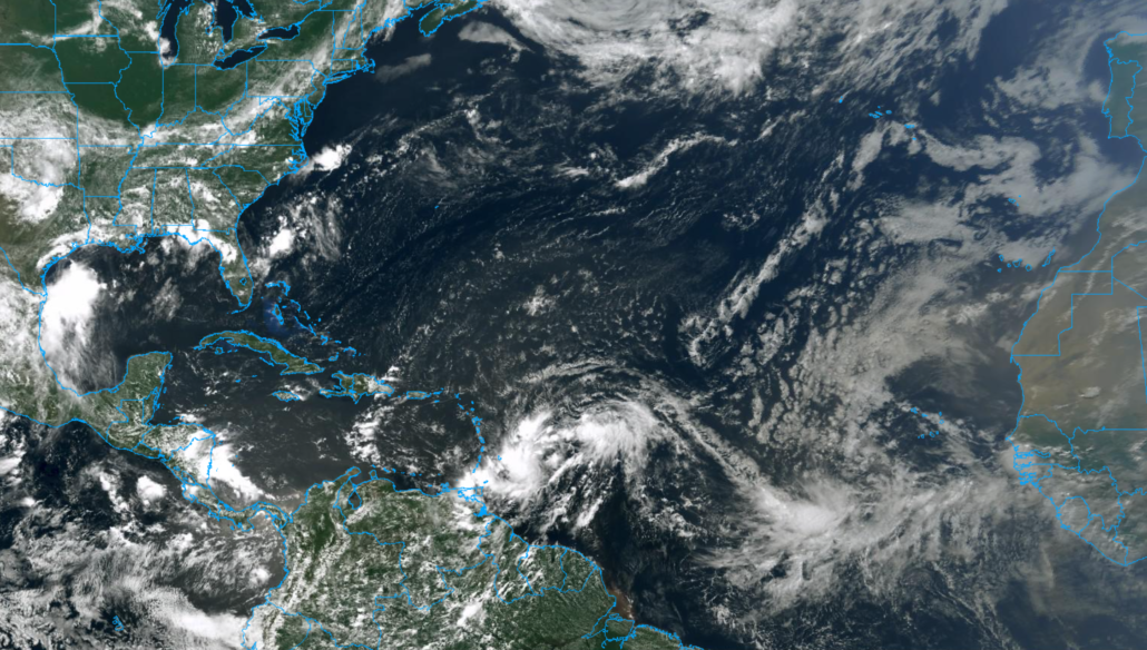
Potential Tropical Cyclone (PTC) Nine formed earlier today, designated by the National Hurricane Center. This system will move generally westwards over the next few days, on a path towards the Caribbean, while strengthening gradually. The system is forecast to strengthen into a Tropical Storm over the next 24-48 hours. If it does reach tropical storm strength, it will be named Isaias.
The eventual fate of the system, in terms of track and intensity, remains uncertain. The system is still in the process of organizing a center of circulation, and is battling the presence of some dry air from the Saharan Air Layer. This drier, often dust-filled air suppresses the development of thunderstorms within tropical cyclones and can lead to weaker systems overall.
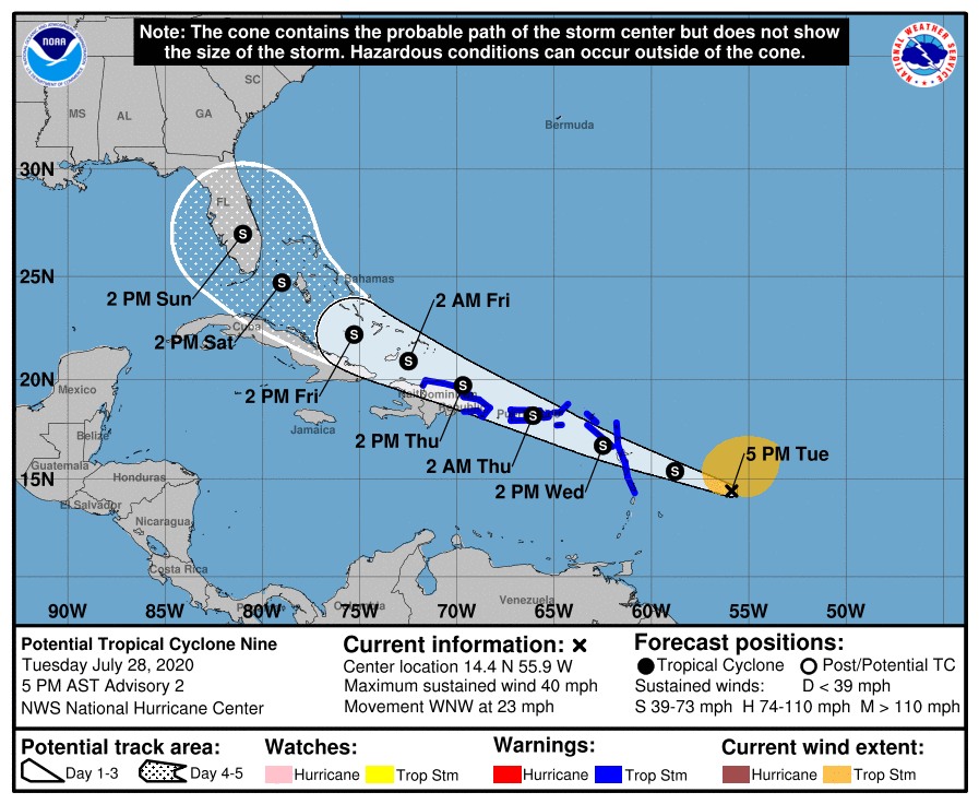
Making matters worse is the fact that the storm will eventually approach the Caribbean Islands, possibly nearing a landfall in Hispaniola or surrounding islands. The rugged terrain of the islands in these areas has been known to weaken tropical cyclones in the past. Whether or not the system impacts these areas will obviously have a major impact on its evolution.
One thing forecast models have bene consistent on is that the system will eventually approach the US East Coast. The systems intensity, and the path it takes to get towards the United States remains to be seen. The National Hurricane Center currently forecasts a tropical storm to be approaching Florida by Saturday.
Trackbacks & Pingbacks
3housewares
Leave a Reply
Want to join the discussion?Feel free to contribute!