NYC Forecast: Storms today, pleasant fourth, warmth ahead
Highlights: Showers and thunderstorms, some strong and severe, are expected this afternoon. A pleasant and somewhat cooler day is likely for the Fourth of July. Heat and humidity will return to the forecast by next week, when a heat wave looks increasingly likely.
QuickCast
Hazards: A few showers and thunderstorms expected this afternoon.
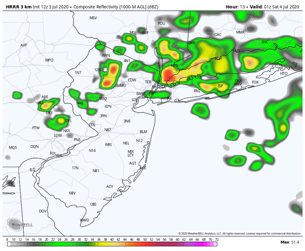
This afternoon: Warm temperatures are likely, with highs in the lower 90’s. The air will feel increasingly humid as the day goes on and showers and thunderstorms will develop by the afternoon. These will move in to the area from the north (different, we know!), and may pose a threat for strong wind gusts and hail, along with dangerous lightning.
- Hazards: Storms, a few strong, could contain heavy rain, gusty winds and hail
- Timing: 2pm – 8pm
Tonight: Showers and storms could persist into the early evening, but will gradually taper off. Lows in the mid 60’s to near 70 in the city.
Independence Day (7/4): Partly cloudy and noticeably cooler. Less humid, too, with highs in the mid 80’s.

Detailed Forecast Discussion
The weather will remain unsettled for one more day, as an upper level low makes its grand exit from the region. This is the same upper level low that has spun around in our area for the entire week, providing several days of showers and thunderstorms. Expect temperatures to become much warmer as we head into the afternoon with humidity rising as well. Atmospheric instability will build, and showers and storms will develop after 1pm, across portions of New England at first. Gradually, these will build southward towards the NYC Area.
Strong, gusty winds and some small hail are possible. While weak wind shear will limit the threat for severe weather overall, the potential will exist for severe storms at times. Local enhancement of these storms could occur along any sea breeze boundaries – like we saw a few days ago.
Independence Day (7/4): The main story on the Fourth of July will be less humidity, as the upper level low will begin shifting away from the area. This will very likely be the coolest day for at least a week. High temperatures will only reach the middle 80’s with a nice, dry breeze.
Sunday (7/5): The airmass near the area will quickly become more humid and warm once again as ridging and high pressure build in. South/southwesterly winds will begin to usher in warmer air and temperatures will rise closer to 90 degrees during the afternoon.

Extended Forecast
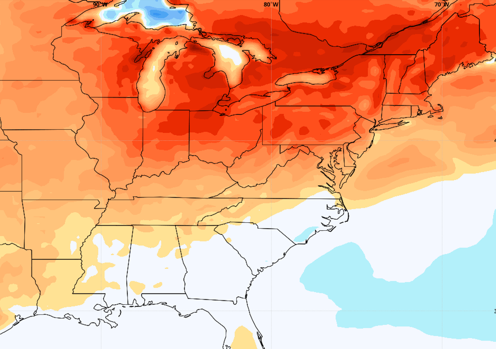
Forecast models are in excellent agreement that for the first time this summer, ridging and high pressure will build into the Northeast without any resistance. This will allow heat and humidity to surge towards the region unabated by next week. The result will be several days of warm, southwest winds. Accordingly, model data agrees that a heat wave is possible during the middle of next week. In fact, there could be several days in a row with high temperatures over 90 degrees in the NYC Metro Area. This heat and humidity looks likely to persist at least towards next weekend, at which point the longevity of it becomes unclear.

