-2")
Public Analysis: Warm End To the Week, Turning Unsettled Once Again
Good Afternoon!
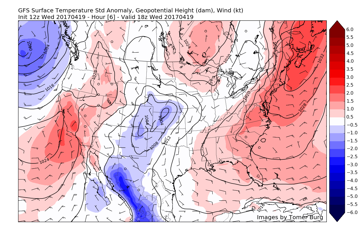
Things are finally clearing up after the cut-off low pressure system that we talked about on Monday came through the region most of the day yesterday. As stated in the earlier outlook, the precipitation was more on the scattered, but heavier side, so some locations did indeed see higher rainfall totals than other locations. For example, portion of Northwestern New Jersey saw around around a quarter of an inch of rain, while areas just south of the city saw close to 2 inches of rain due to training of showers.
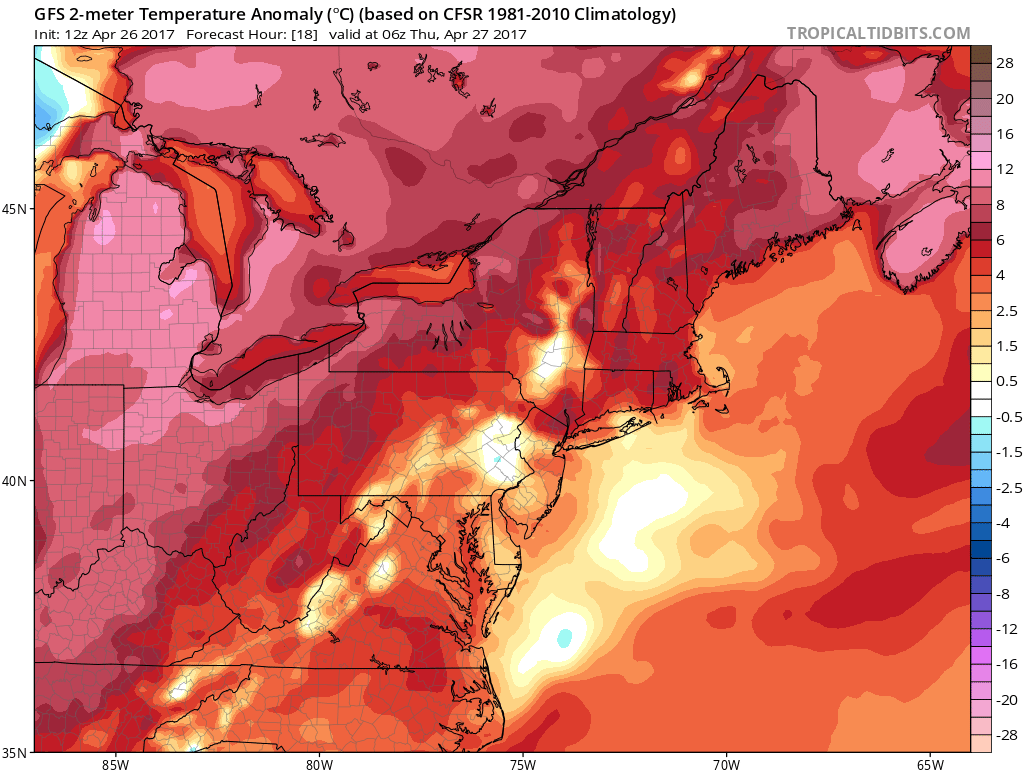
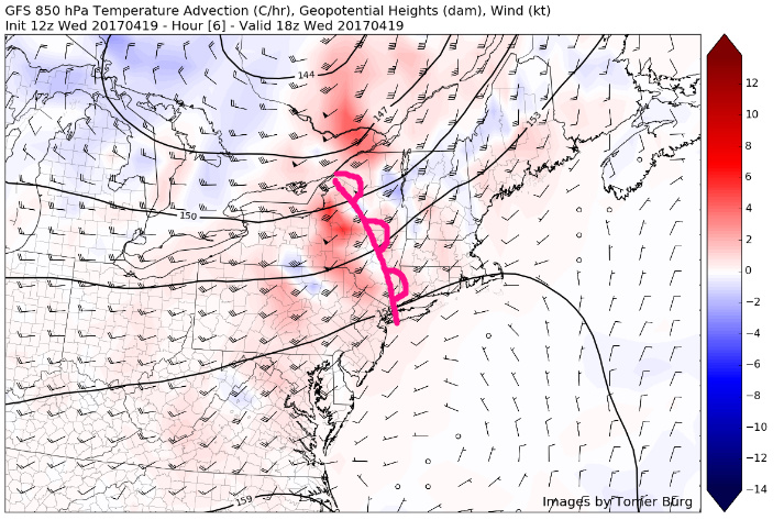
As the area of low pressure continues to decay, it has pretty much rained itself out for the most part, although there is some residual low level moisture hanging around. This residual moisture has brought some light drizzle and even isolated showers to parts of the metro area, but any threat for significant precipitation is pretty much over as dry air works in from the north and west. As the precipitation dies off this afternoon, relatively thick cloud cover associated with the decaying low pressure system will moderate temperatures and keep them limited to the upper 50’s to lower 60’s across the entire area this afternoon.
As we progress into the evening hours, expect the cloudy conditions to continue on through this evening as one last band of moisture trapped in the lower levels of the atmosphere swings through. This last little band of moisture should work to keep skies mostly cloudy and could even produce some areas of fog due to the winds being relatively low this evening. With the cloudiness limiting how much temperatures will be able to fall, lows are expected to remain rather steadfast in the 50’s overnight, which is slightly above normal for this time of year.
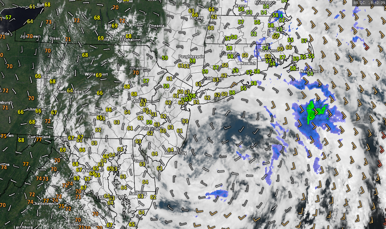
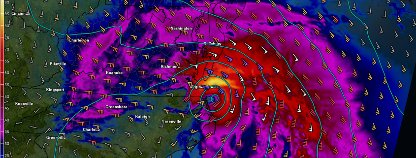
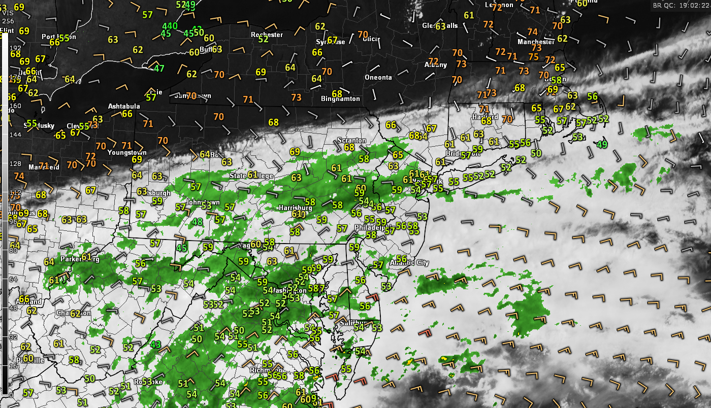
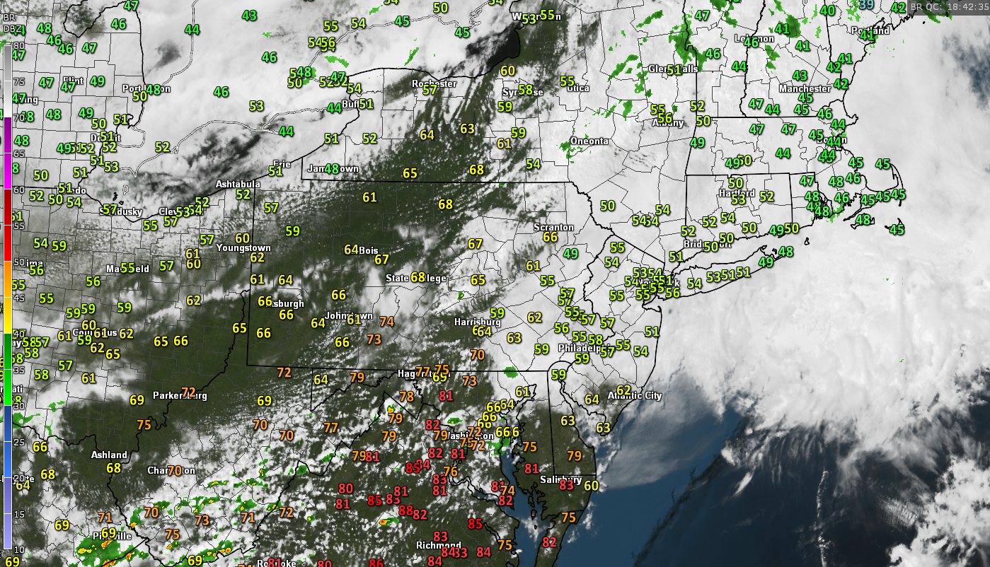
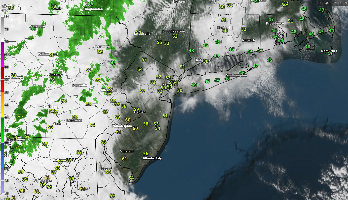
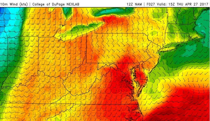
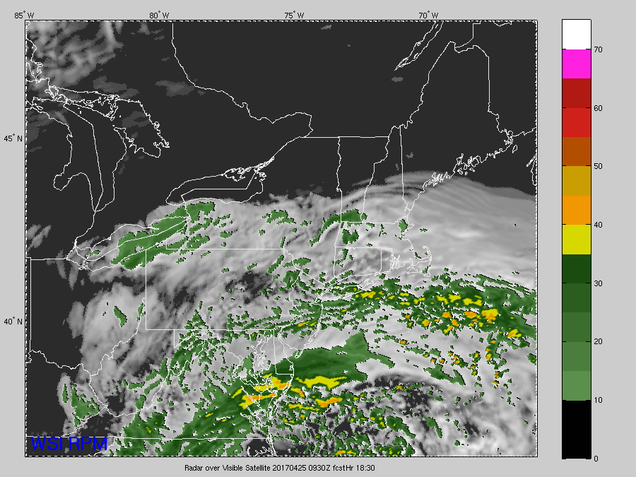
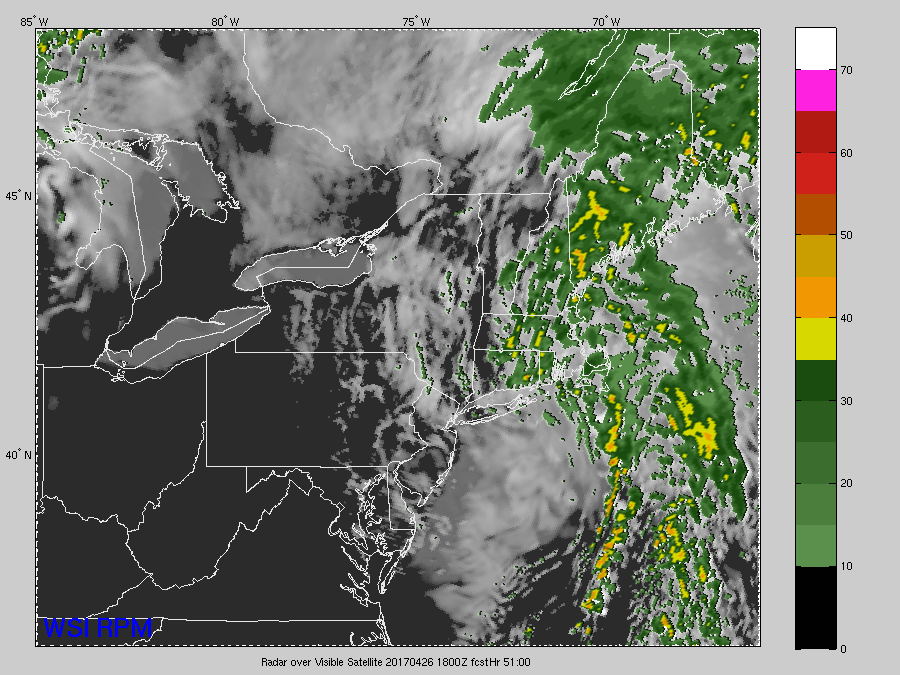
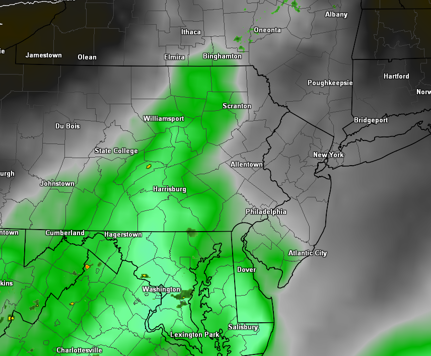
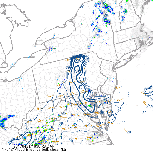
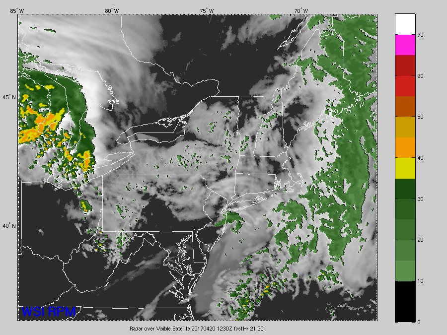
Latest visible satellite imagery, regional radar mosaic, surface temperatures, and surface winds for the Northeast this afternoon (Courtesy of GREarth)
Thursday and Friday
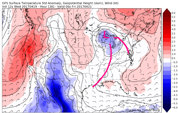
As we head into tomorrow, the cut-off low pressure system should still be located to our east while continuing to dissipate and slowly limp away from the coast. As it does so, the low will still have lingering effects on our area by continuing to bring winds from the southeast off of the Atlantic, which may keep overcast and some broken clouds over the area to start off the first half of the day. Though, as we continue on through the day, more sun should begin to mix in with the clouds and allow things to warm up when compared to today. Highs should reach into the upper 60’s and lower 70’s for most of the area-with the chance at some higher temperatures if the cloud cover is able to erode quicker.
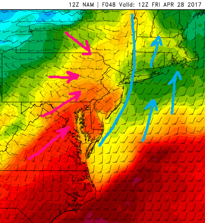
Tomorrow evening should be give way to partly cloudy conditions, especially towards midnight and into very early Friday morning. A weak cold front will be working towards the area from west to east and bring a small chance at some showers and possibly even a weak thunderstorm during the evening hours. Right now it appears that the greatest chance for showers and a weak thunderstorm will be over central and eastern portions of Pennsylvania, but this activity may continue east with time during the early morning hours towards New Jersey and southern New York. However, the rain potential with this front will be severely limited as dry air from Canada works its way into this weak front as it continues east towards the coast by daybreak Friday.
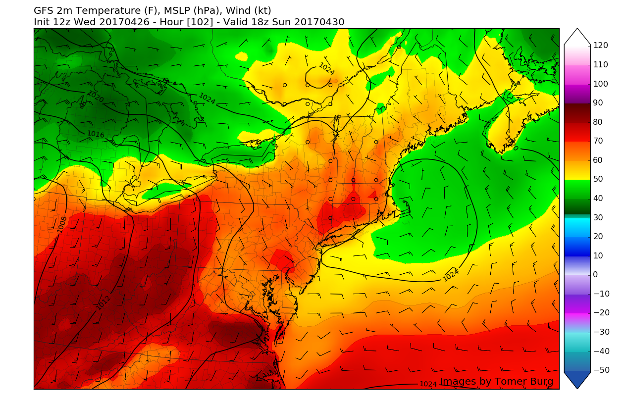
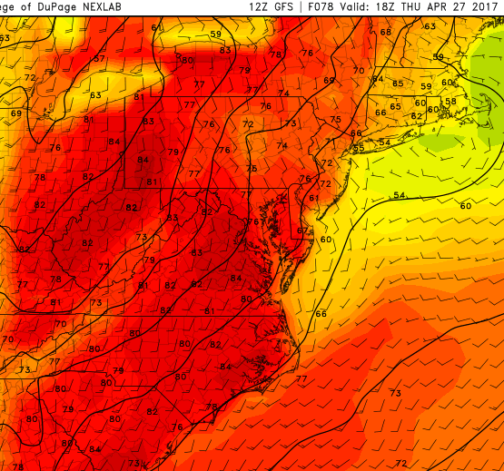
During the late morning on Friday, the remnants of the cold front should be over eastern Long Island and steadily heading out to sea, leaving behind dry and clear conditions. With relatively clear skies and winds from the south/southwest behind the front during Friday afternoon, temperatures should have no problem reaching well into the 70’s and possibly low 80s across portions of southeast Pennsylvania as well as southern New Jersey.
The entire area should see a very nice end to the work week as the warm temperatures and warm skies continue through sunset. Due to a building ridge of high pressure to the south, lows will remain relatively warm, in the 60’s Friday night with light southerly winds.
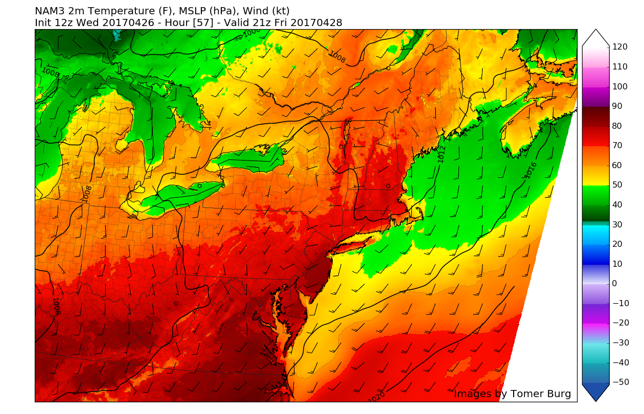
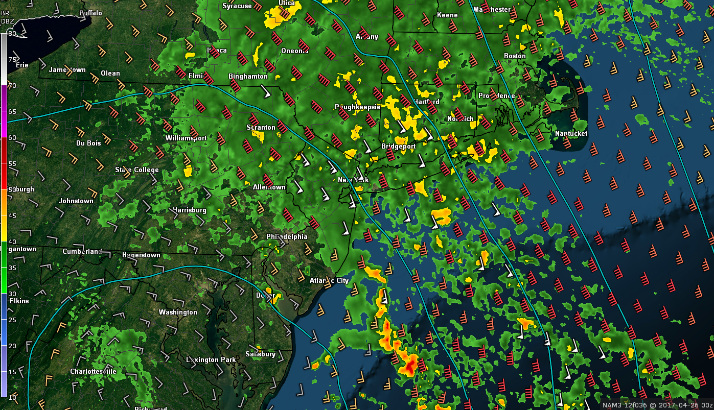
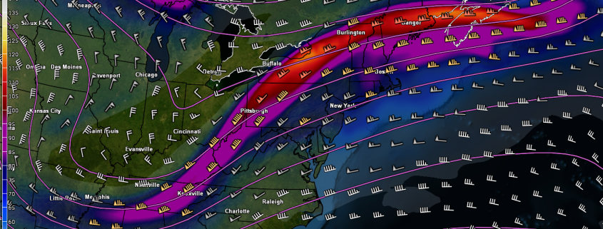
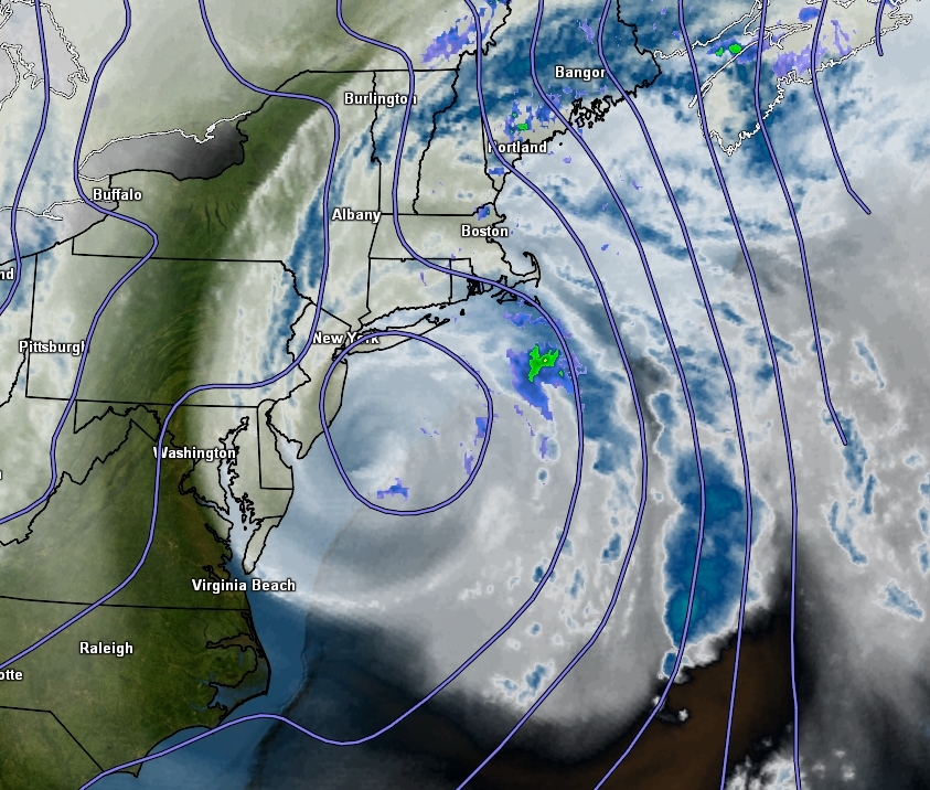
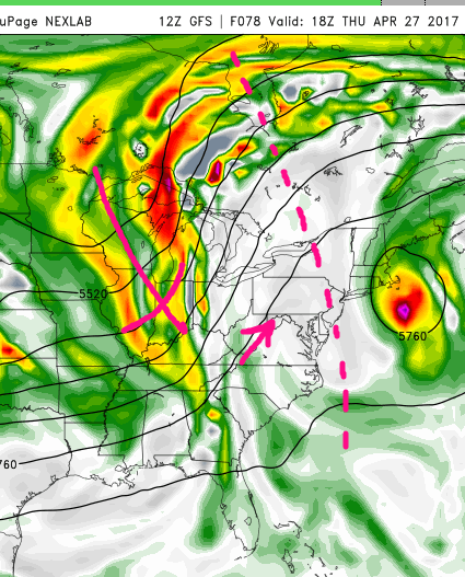
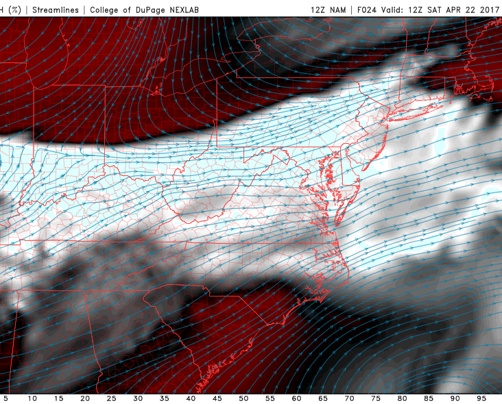
12z 3km North American Model showing a very pleasant and warm Spring day on Friday with highs in the 70’s and 80’s across the Northeast (Valid 4pm Friday)
Saturday and Sunday
With an area of ridging and high pressure building in from the east to west on Saturday morning from off the Mid-Atlantic coast, conditions during the morning hours should be quite warm. Temperatures during the mid morning hours should be in the mid to upper 70’s across the entire area and continuing to climb into the mid 80’s by the afternoon. Due to some winds out of the south, south-facing shores of Long Island and Connecticut may experience somewhat lower temperatures, but overall the majority of Saturday looks to be on track for a very warm Spring day.
As we progress into the mid to late afternoon hours on Saturday, the latest computer model guidance has been showing the possibility of a backdoor cold front moving through the region later in the day. As the cold front begins to push south during the day, there may be enough instability and moisture around for showers and thunderstorms to develop ahead of this frontal system. The exact details of any showers and thunderstorms will have to be worked out over the next few days, but if conditions do come together in the right manner, some strong to possibly severe thunderstorms may exist over portions of the area, with hail and gusty winds.
Otherwise, once the backdoor cold front pushes through the area late Saturday and into Sunday, conditions should once again become much cooler and clear during the day Sunday with high pressure located just to our east. Temperatures will be highly dependant on just how far south the front can get, but right now it seems likely that temperatures across the area should remain in the mid to upper 60’s with isolated areas of 70’s, due to winds coming in from the cooler Atlantic Ocean.
The potential for onshore winds will also bring the chance for some cloudier weather during the day, however if the cold front pushes far enough south then the aforementioned high pressure will be able to position itself over our area, which would allow more sun than clouds. These backdoor fronts are extremely hard to predict, even in the short range, so we will be updating you on the latest over the next few days.
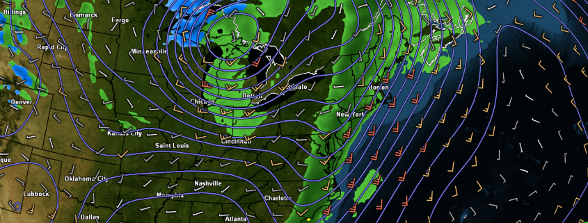
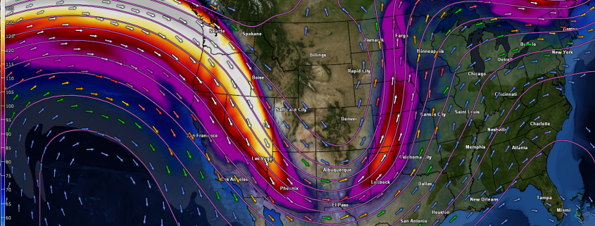
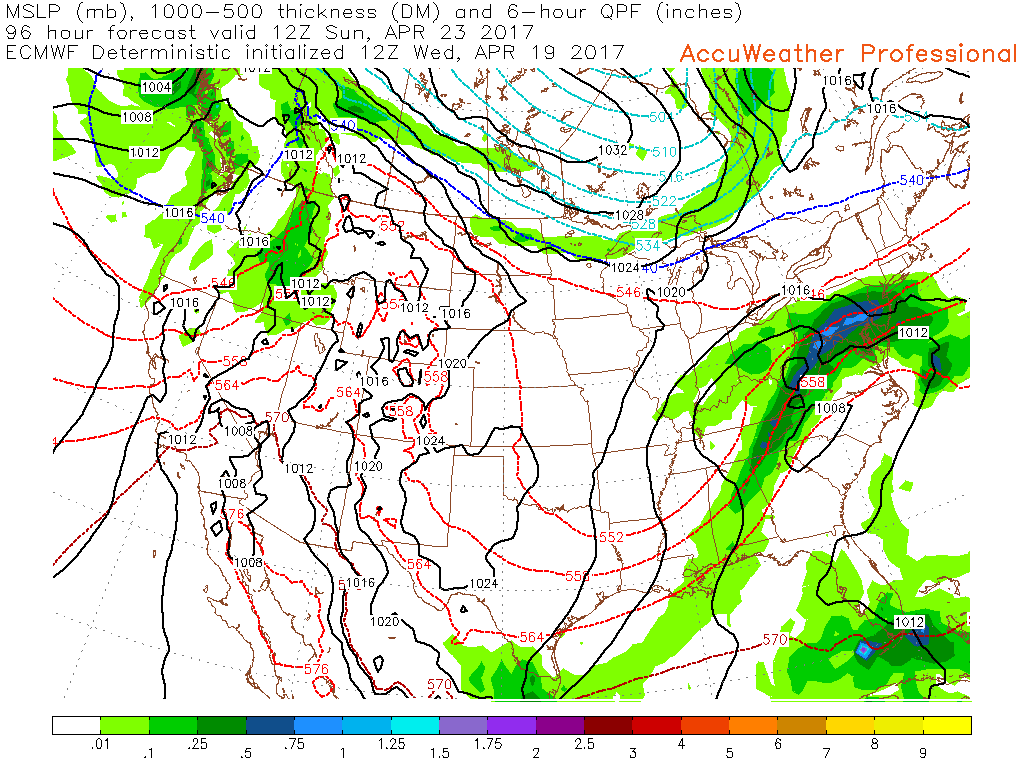
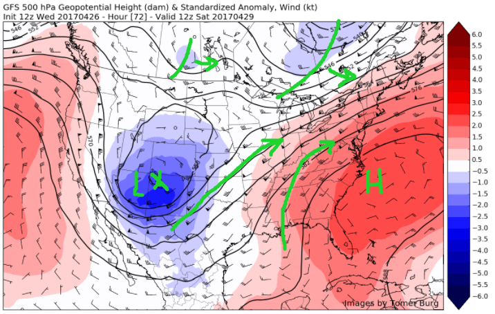
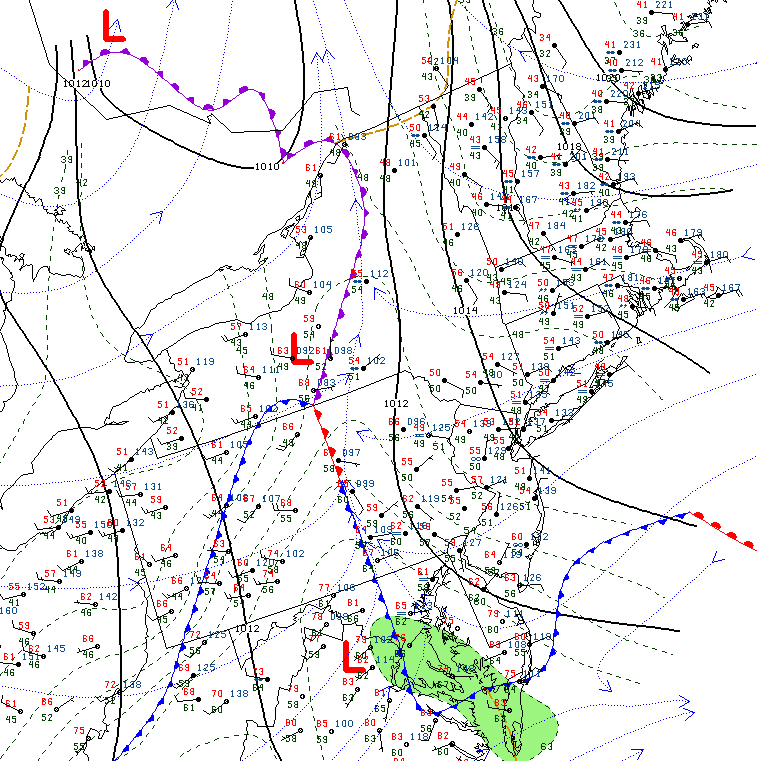
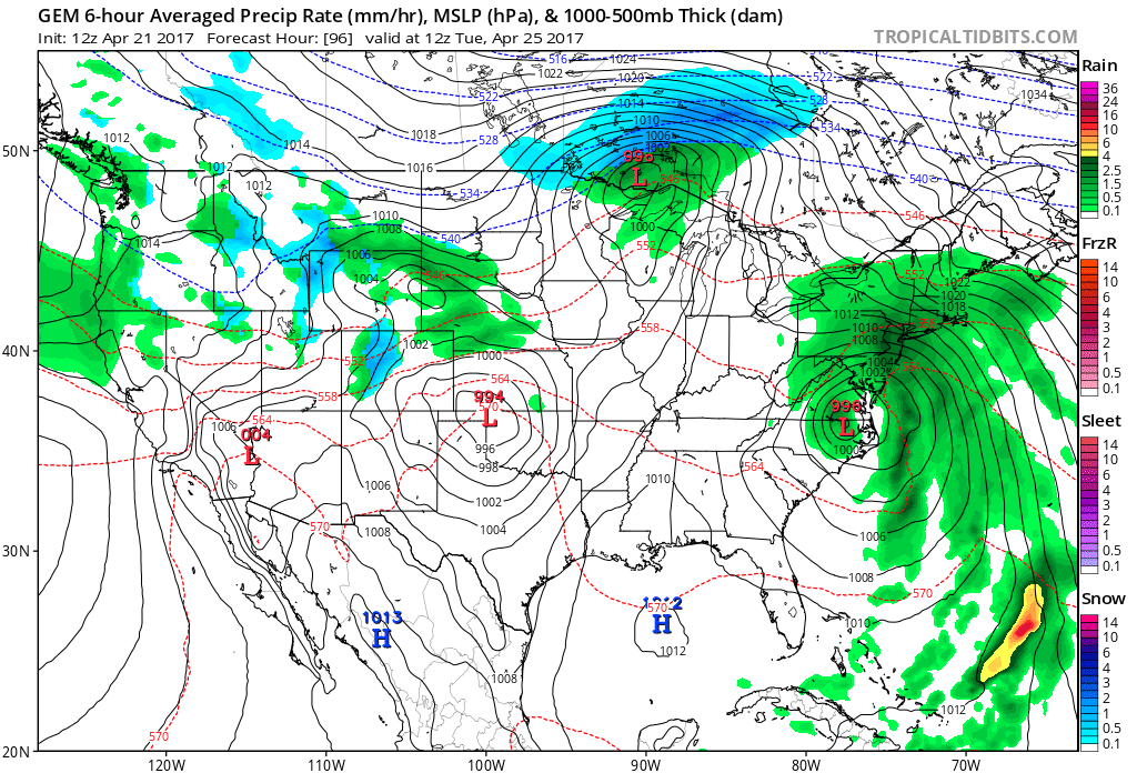
Once we head into Sunday evening a very large and vigorous system will be taking shape over the central part of the country, which is part of this active weather regime we warned of over a week ago now!
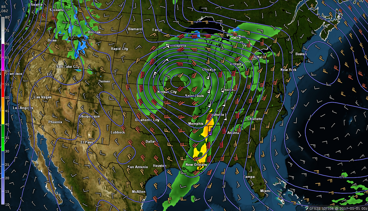
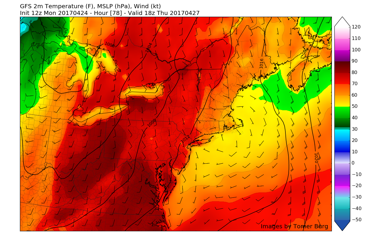
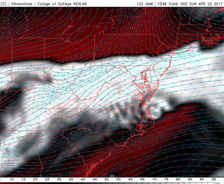
12z GFS model showing a very large and impressive system over the central portion of the country poised to impact the Northeast early next week (Valid 8pm Sunday)
Extended Range
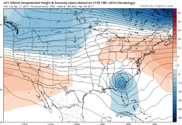
The large and potent storm system located over the North Central portion of the country will have the potential to impact our region well before the low pressure nears the area. As the stalled backdoor cold front from Sunday begins to lift north over our area on Monday, warmer temperatures and some clearing may be possible, however if this front is slower or does not progress as far north as currently progged, then conditions may remain cooler with the threat of some showers with increased cloudiness. At this time, we remain skeptical on the northward progress of the warm front, due to departing high pressure, off the New England coast, supporting more onshore winds and cooler temperatures.
As the system in the Plains begins to move east late Monday and Tuesday, a stronger cold front should be approaching the area. This front will have the potential to produce a myriad of impacts such as heavy rains, thunderstorms, and gusty winds. All of this is highly dependant on the timing of the system once it is located in the Plains this weekend, so make sure to check back on Friday and Monday for future updates on this potential system!
————————————-
For more information and posts like this one, make sure you sign up for Zone Forecasts — where multiple detailed articles, videos, and interactives are posted each day. Also, come interact with our staff and many other weather enthusiasts at 33andrain.com!
Have a great evening!
Steve Copertino
