-2")
High latitude ridging, and the return of a colder pattern
Just a week ago, we spent time in our Public Threat Analysis speaking of about the return of a Southeast Ridge towards the end of December. Just 7 days later, we’ll be discussing the return of a colder, more active weather pattern as we move forward through the next 10 days and into early and middle January.
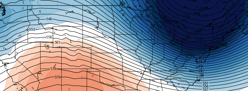
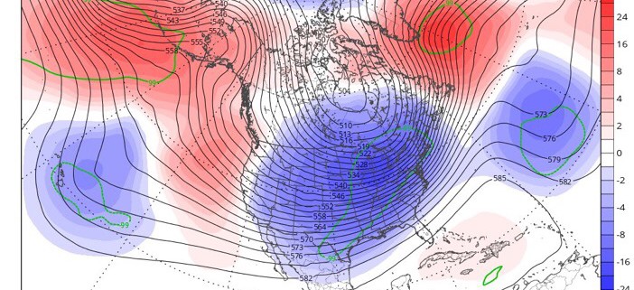
Far away from the Northeast United States, a strong storm system in Eastern Asia is set to kick off a chain of events — a wave breaking event — in the Pacific Ocean, which will help change an otherwise stagnant pattern there. Ridging is forecast to develop over the Northeast Pacific from the Aleutian Islands into Alaska and become quite anomalous by this upcoming weekend.
This may not initially seem overly significant, but it is. Large, anomalous ridges that develop from the Aleutian Islands towards Alaska and build northward work effectively to both dislodge cold air further south, and amplify the weather pattern across the Lower 48 of the United States. The pattern being advertised is much different than the one we have been experiencing over the last week.