-2")
Severe thunderstorms possible this afternoon and evening
12:30pm: This morning, we initially had a strong area of showers and rumbles of thunder in Pennsylvania that was moving toward our area. if it hit us, the atmosphere would have stabilized and the severe threat for thunderstorms would have significantly gone down.
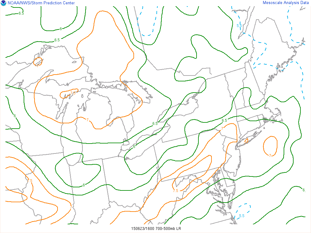
Current SPC Mesoanalysis as of noon shows an area of mid-level lapse rates in excess of 7C/KM in our area. This is very significant, as it leads to plenty of instability in the middle of the atmosphere, as well as providing a capping inversion below it that weakens any weak convection and keeps us sunny and unstable.
However, the EML we discussed yesterday was able to work its way into the region and provide a capping area that completely disintegrated this area of showers. This means that clouds will quickly be disintegrating, and we will quickly be able to destabilize the atmosphere, making it very ripe for severe weather.
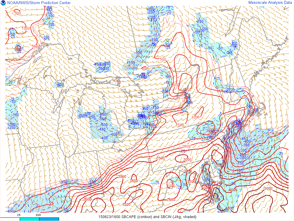
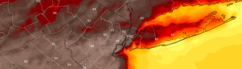
Current Mesoanalysis from the SPC shows already building values of surface-based CAPE.
In fact, surface-based CAPE values are already in excess of 3,000 J/KG in many areas, which is actually ahead of schedule. When this is combined with the strong mid-level lapse rates and strong wind shear, severe weather is expected to hit a decent chunk of our area later this afternoon. The primary threat will be damaging wind gusts and vivid lightning, but large hail is also a threat, and a tornado threat is non-zero.
—–
An energetic mid level disturbance, impressive wind shear, and moderate to significant atmospheric instability will combine to create an enhanced threat for organized severe thunderstorms in the Northeast US on Tuesday. While some uncertainties still exist in regards to exactly how the event will unfold, confidence is rising in the heightened threat for severe thunderstorms — even in the NJ and NYC Metro Area. While not everyone will experience a severe storm, the threat for organized thunderstorms is much higher than normal today.
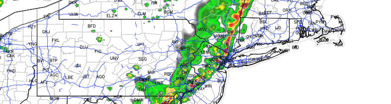
Thunderstorms are forecast to develop over Northern Pennsylvania and New York State, and begin progressing southeastward throughout the day. Meanwhile, atmospheric destabilization will occur over much of New England, the NYC Metro, New Jersey, and the Mid Atlantic. Instability parameters are expected to be quite high, especially by Northeast US standards. With more than adequate wind shear for thunderstorm organization, these storms are expected to spread southeast toward the coast during the late afternoon and evening.
This post will serve as a Live Blog throughout the day for updates and information on the latest analysis as well as a relay point for Watches and Warnings from the Storm Prediction Center and Local NWS offices. A de-brief on the threat is below: