-2")
Analysis: Severe weather possible Tuesday
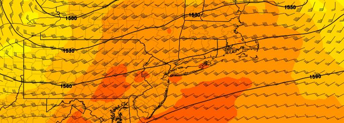
An unusually organized area of low pressure, and an associated mid level disturbance, is expected to track through the Northeast states on Tuesday into early Wednesday morning. Riding on the periphery of a large mid and upper level ridge, this disturbance will gain extra energy along a thermal and height gradient which exists from the Great Lakes into the Northeast states. The low pressure center, at the surface, is expected to track from the Great Lakes into Central and Northern New England.
The track of the low pressure center will, at the surface, push a warm front northward through the Mid Atlantic states from late Monday Night into Tuesday morning. This warm front is likely to push through New Jersey to a position near Northeast New Jersey, New York City, and Long Island by daybreak on Tuesday.