-2")
Severe Weather Possible This Afternoon, Yet Another Unstable Pattern Next Week
Good Afternoon!
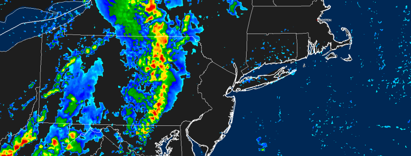
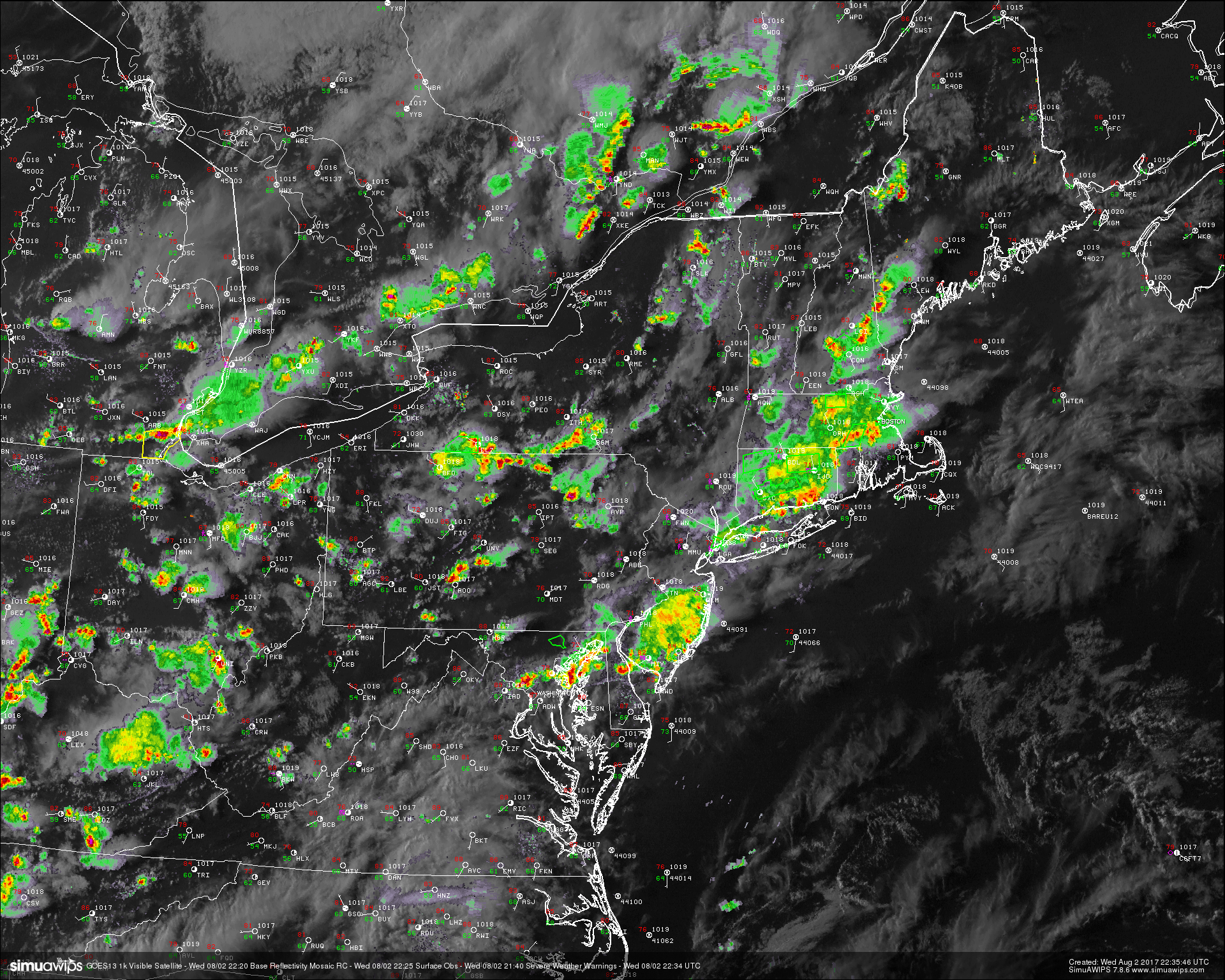
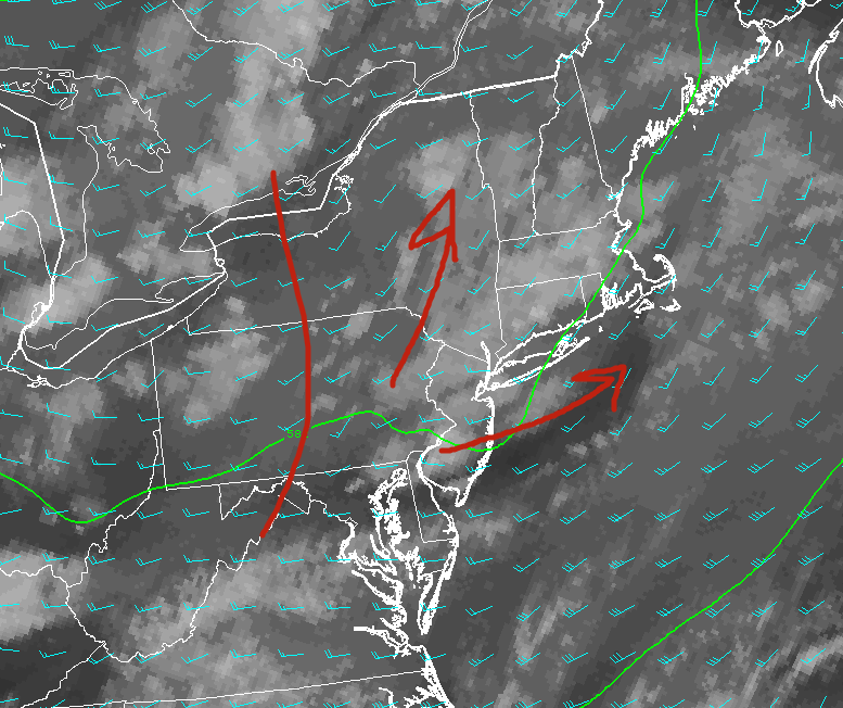
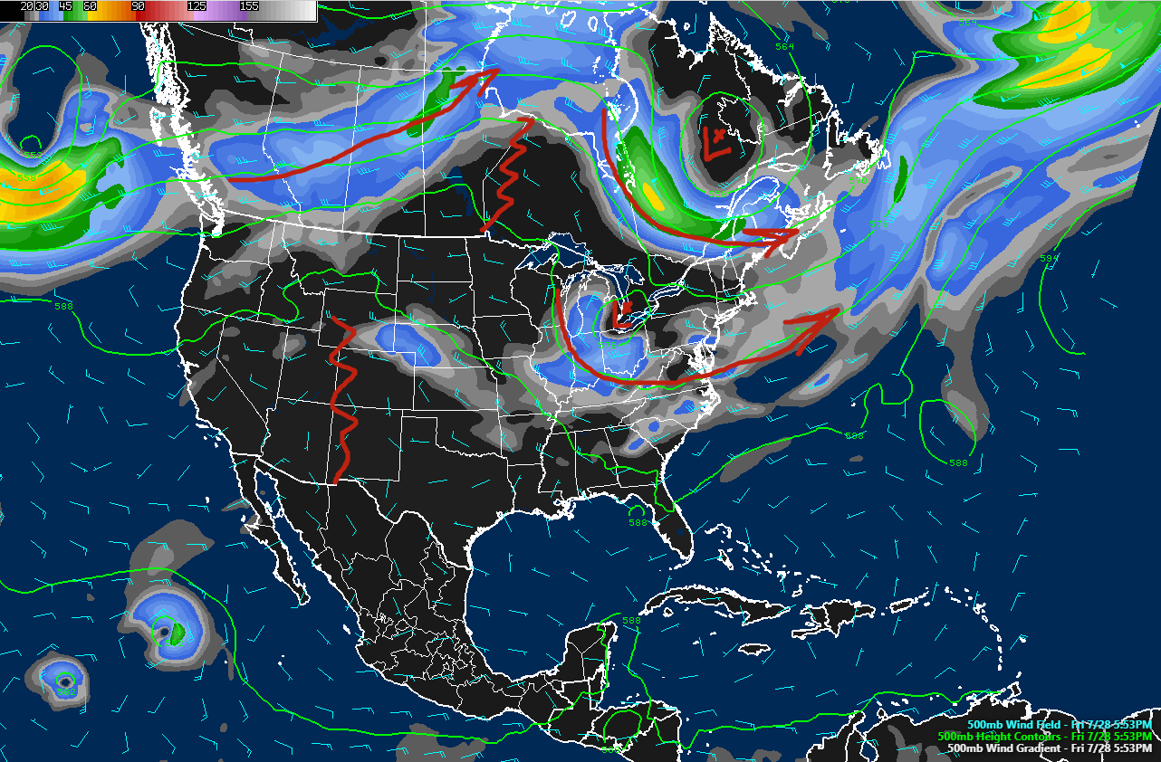
Despite some heavy showers and thunderstorms that moved through the immediate New York metro area this morning, most of the area was able to clear out quite significantly this afternoon. With high humidity in place and full sunshine, we saw the development of numerous cumulus clouds, especially to the north and west of the city. With instability rising gradually through the early afternoon hours, shear kicking in, and forcing from an approaching upper level trough all coming together, we have seen numerous showers and thunderstorms go up over portions of the Mid Atlantic and Northeast regions. Given rather unimpressive lapse rates, unidirectional shear vectors, and a general broad area of forcing, this activity has mainly been limited to multi-cellular and pulse-cell storms. These storms will mainly be capable of damaging winds and possibly a wet micro burst or two, as the weak mid level lapse rates will fail to sustain any significant updrafts over much of the region. As these updrafts collapse over time, they may do so rather quickly, leading to winds up to 60 mph and torrential downpours, which may cause localized flooding.
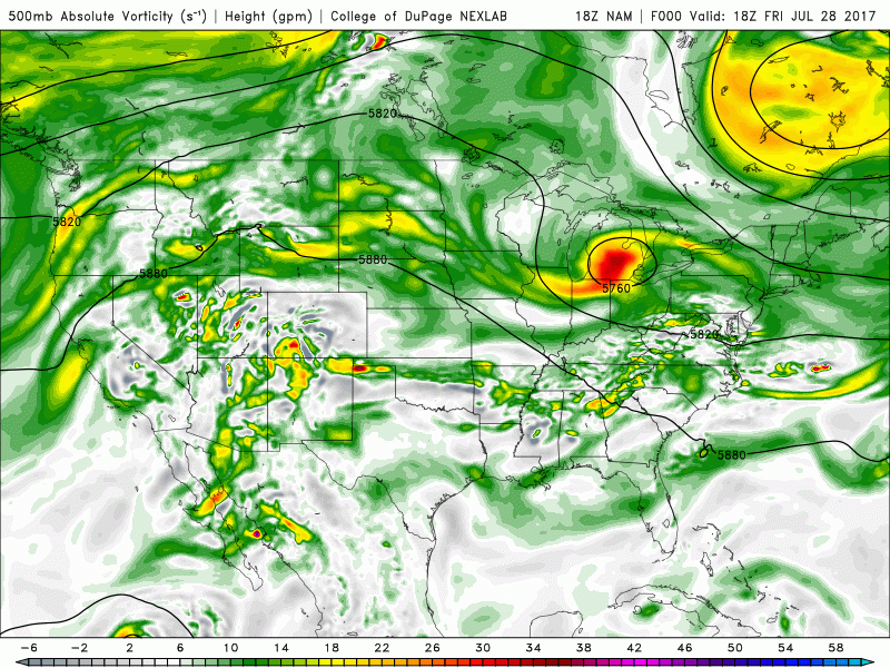
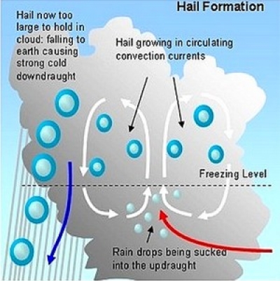
However, as we head deeper into western Pennsylvania and New York state, the vertical wind shear profile becomes a little more favorable for more organized convection, and we have seen some embedded supercell structures form within larger convective masses. These storms will have a much higher threat of damaging winds, large hail, and even a brief tornado or two. This stronger activity will likely remain exclusive to this region, as the severe parameters quickly become less supportive for anything too strong the further east you head.
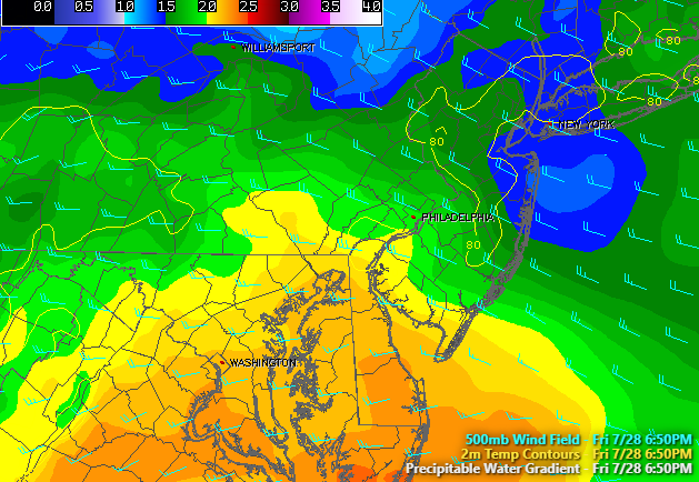
Regardless, the rest of the afternoon should remain quite nice for a typical August day, with highs deep into the 80’s-possibly getting to that 90 degree mark in some locations. As we mentioned before, humidity will be increasing ahead of the front located off to our east, so it will feel quite muggy out, and any locations that saw some of the heaviest rains this morning will have the added moisture in the air from evapotranspiration.
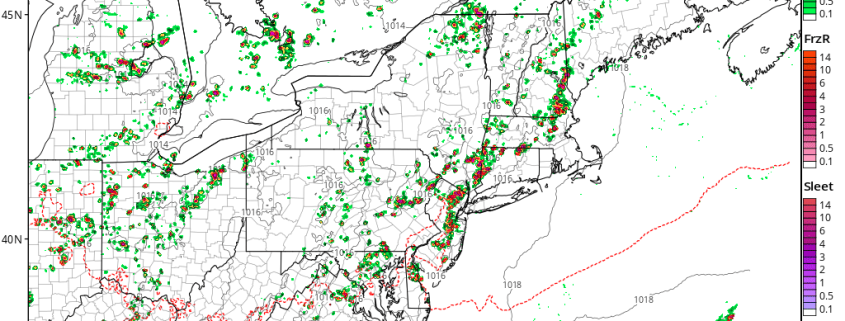
As we head into the evening hours, we should see the development of more showers and thunderstorms over the Northeast, as the previous cells begin to collapse and leave convergent boundaries as to which new thunderstorms can form along. Winds from the south will continue to pump moisture/instability into the area, with CAPE values remaining in the 1200-2800j/kg^2 range until sunset. In addition to the instability in place, a very weak warm front will be passing through the region, and this may work to locally improve wind fields, but only to a small extent. At this time, it appears that the best chance for showers and thunderstorms this evening will be over portions of southern New York, eastern Pennsylvania, and possibly far northwest New Jersey. These showers and thunderstorms should mainly be capable of producing gusty winds and small hail, with heavy rain likely as well.
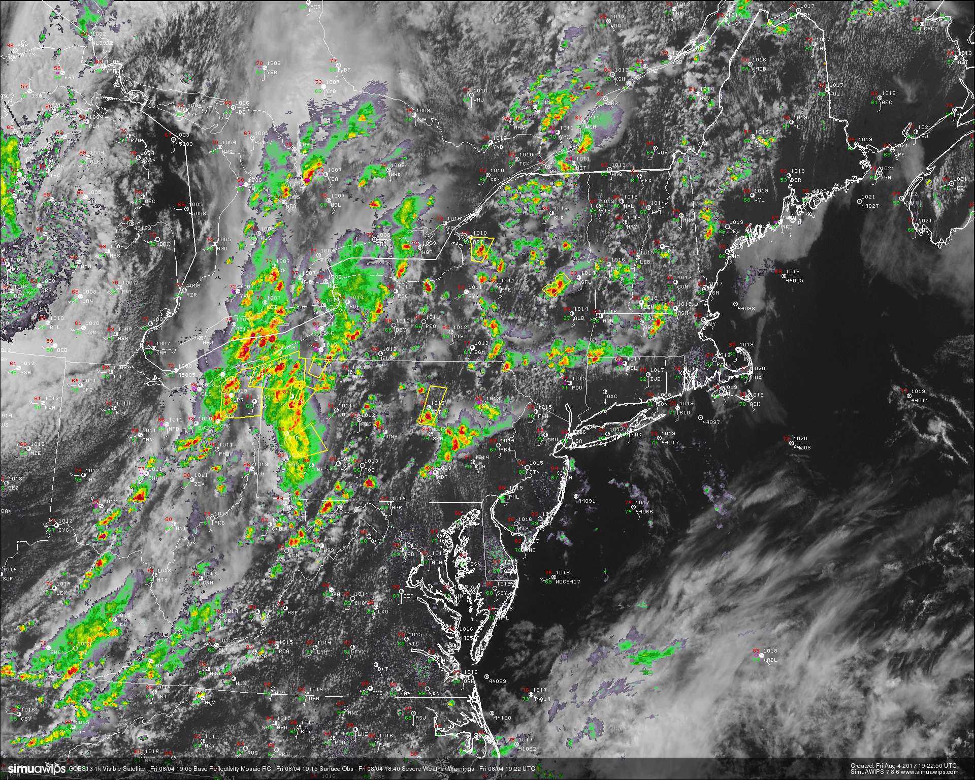
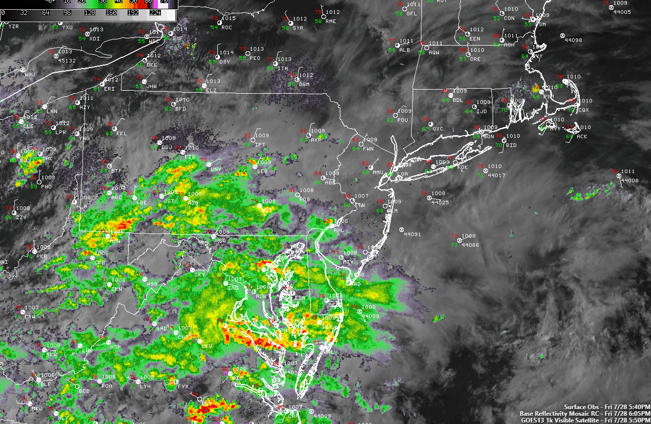
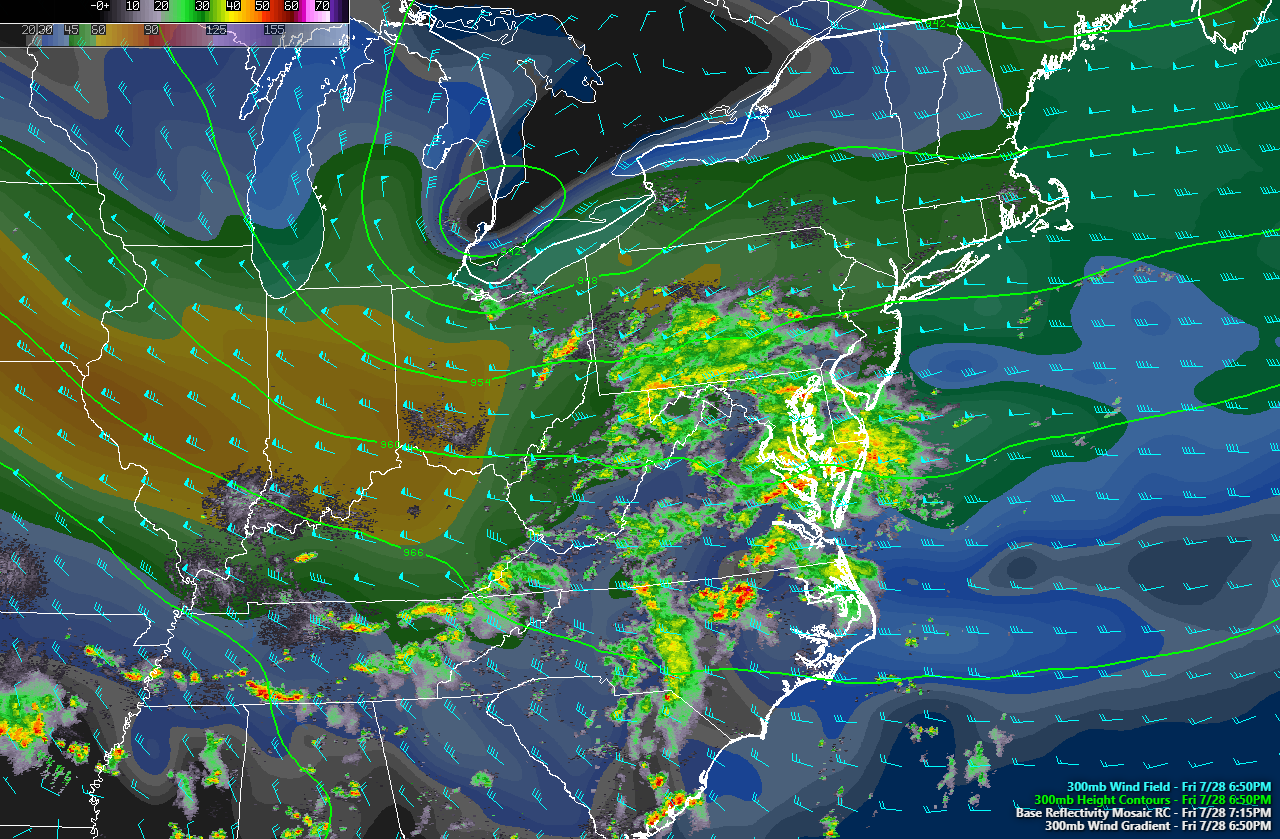
This afternoons latest regional radar mosaic, high resolution visible satellite imagery, surface observations, and severe warnings. Courtesy of Simuawips)
Saturday and Sunday
Saturday may start off cloudy and with a few showers and an isolated thunderstorm in spots as the large upper level trough to our west finally begins to move through. This shower and thunderstorm activity should move rather quickly through the northern portions of the metro area, but brief heavy rain, gusty winds, and small hail may all be possible with any stronger areas of activity.
Afterwards, a cold front associated with the large upper level trough will finally move through the Northeast during the afternoon hours, and will likely clear any residual showers out. Behind this front will be some refreshing Canadian air that will also be packing much lower humidity with it as well, so there should be a noticeable change in airmasses by lunchtime tomorrow. With clearing skies, low humidity, and light westerly winds behind the front, highs should be able to get into the low to middle 80s tomorrow, which is right around normal for this time of year. Tomorrow evening will be a very pleasant one, as the skies begin to clear out and winds out of the north and west continue to usher in cooler air. Conditions will be in place for radiational cooling to take place over the entire Northeast, which is somewhat uncommon for this time of year. This will allow for lows to fall into the upper 50’s to low 60’s across our area-with some locations to the far north and west possibly seeing low 50’s tomorrow evening!
Sunday looks to be the “gem” in this forecast period as light winds, low humidity, and warm temperatures in the 80’s will dominate the day region-wide. Clouds may begin to increase later in the evening, but overall Sunday should be an excellent day for any outdoor activities!
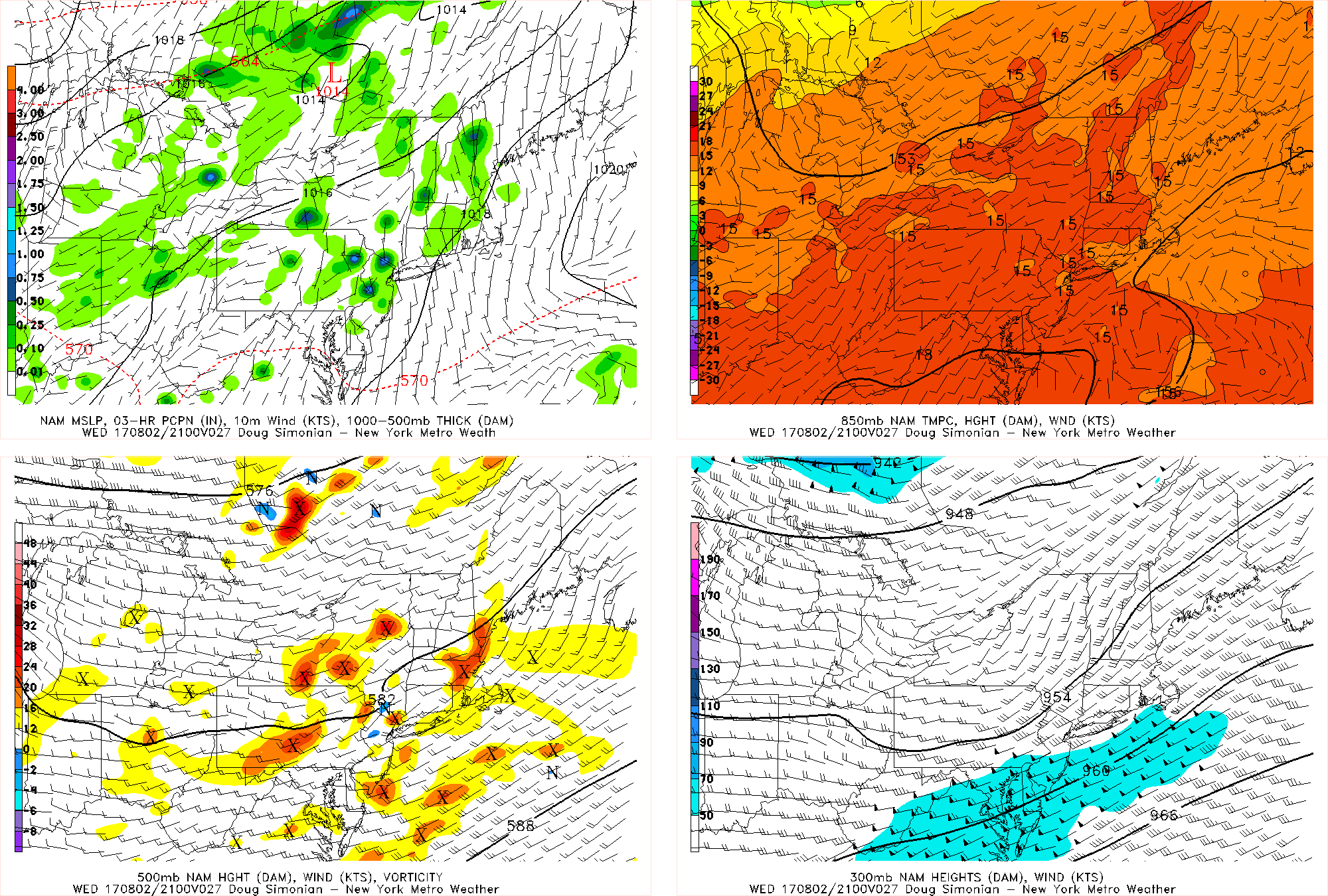
CLICK TO ANIMATE
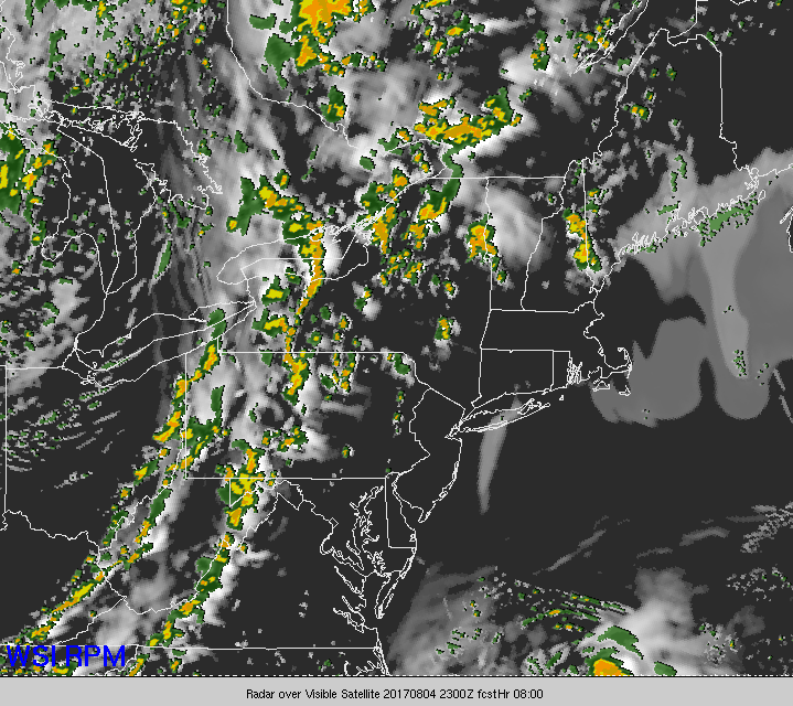
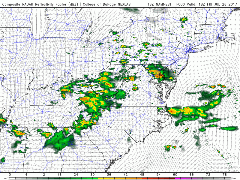
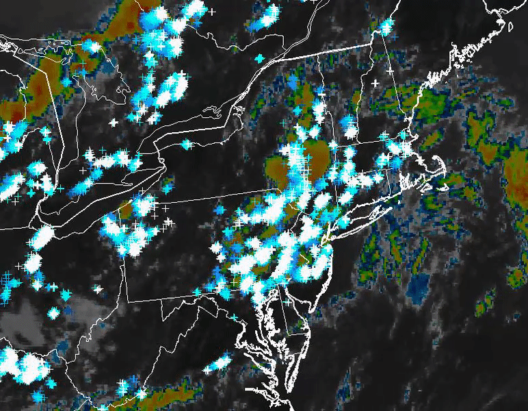
This afternoons RPM model showing the evolution of this evenings storms, as well as the cold front passage tomorrow morning/afternoon (courtesy of WSI)
Next Week
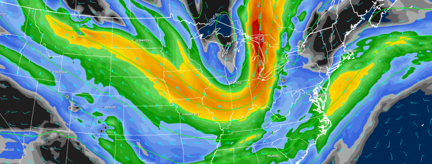
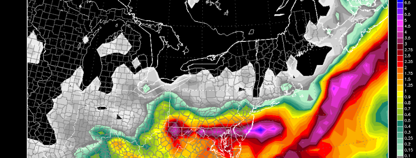
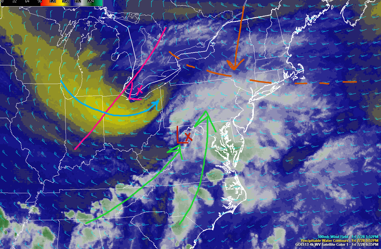
Our eyes will once again shift to the west, as yet another northern stream disturbance begins to approach our area. As this system approaches, it will begin to dig up a serious amount of warm air and moisture from the south and west and direct it towards the Mid Atlantic and Northeastern states. As the mid to upper level system draws closer, a frontal boundary will likely set up. Below this boundary there will be very warm and muggy conditions, while locations to the north experience more seasonable conditions. Above the surface, a large and very impressive upper level jet streak will be nosing in, which is a tell-tale indicator of potential heavy rain for this area. the questions that remain to be answered at this time are where does this frontal boundary set up, how much instability will be in place, and will these ingredients come together at the right time to produce widespread heavy rain? If these conditions do come together on Monday in the correct manner, then we may have to watch for potential flooding rains and much cooler temperatures to start off the week. We will likely have to revisit this system as more data becomes available.
This system should exit the coast late Monday, and an area of high pressure should begin to take over for Tuesday and into Wednesday. However, we may have another rain chance later in the week as the active northern stream regime shows up once more.
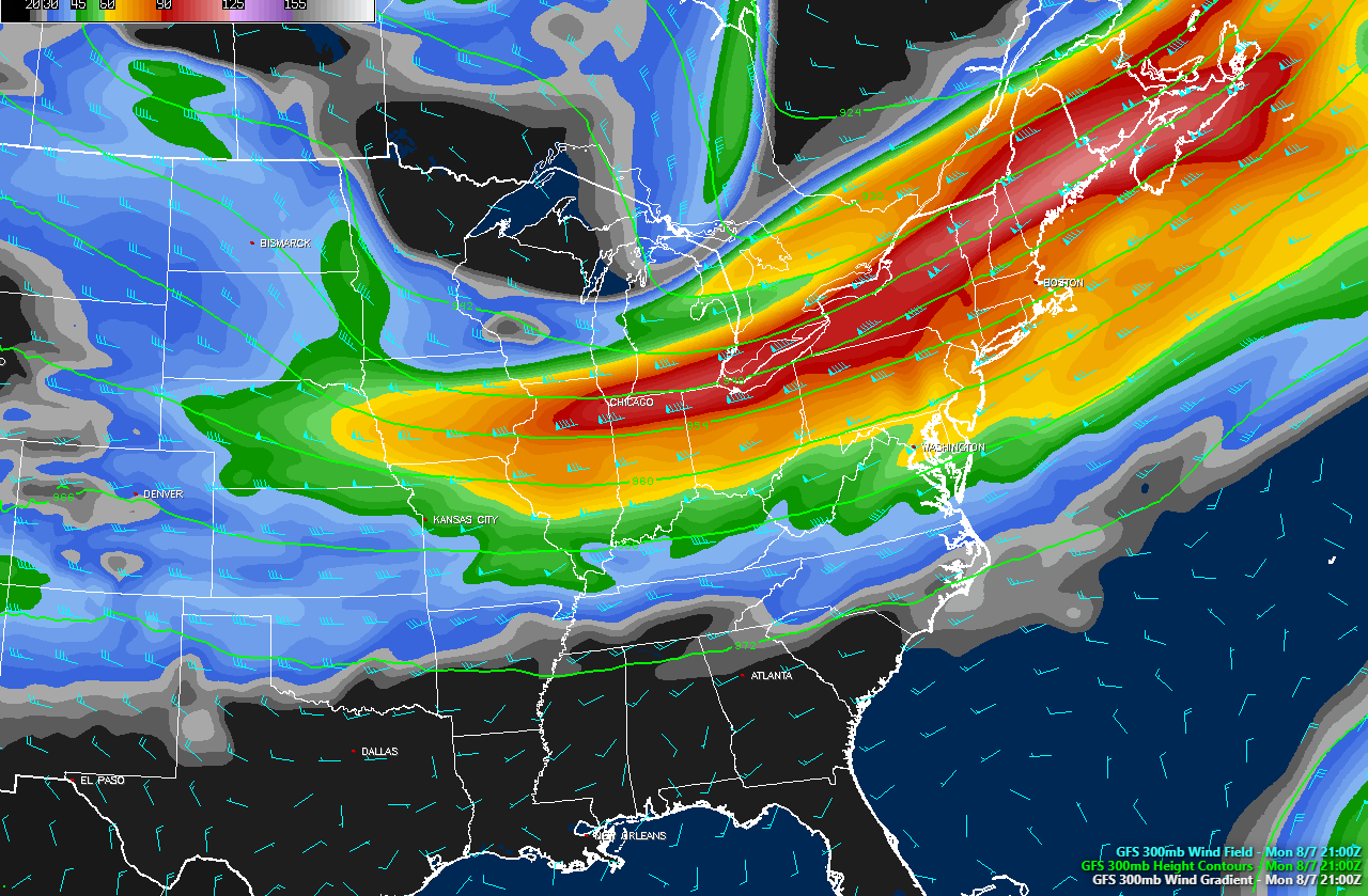
This afternoons GFS model showing the very favorable juxtaposition of an expansive upper level jet streak that could potentially aide in the development of heavy rain on Monday (courtesy of Simuawips)
For more information and posts like this one, make sure you sign up for Premium Forecasts — where multiple detailed articles, videos, and interactives are posted each day. Also, come interact with our staff and many other weather enthusiasts at 33andrain.com!
Have a great evening!
Steve Copertino