-2")
Gorgeous week ahead: 80s on Wednesday
We hope everyone enjoyed the beautiful weather we had today! This trend is expected to continue, but with gradually rising temperatures through Wednesday. A weak backdoor front will cross Wednesday night, cooling temperatures a tad for Thursday and Friday, but highs will still run well above average. An additional weak warm front may develop for Friday night, resulting in a few showers.
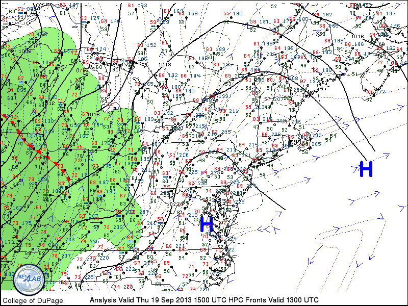
Current surface analysis indicates a departing low pressure system offshore, and building high pressure systems to our south.
Current surface analysis shows a large area of high pressure to our south, helping to deliver pleasant, warm conditions. This ridge of high pressure has gradually been building northward, but had been a bit halted by the departing low pressure to the east. Remember, that storm well offshore was what some models had being a major nor’easter last week — thank goodness it missed! Tonight will be pleasant and cool; clear skies and low temperatures dropping into the 50s.
As the low pressure continues to escape further from our area, that will give more room for the ridge of high pressure to build northward. This will lead to temperatures warming into the upper 70s to around 80 tomorrow, and potentially mid 80s on Wednesday! The building area of high pressure and the clockwise flow around it will bring warmer mid-level temperatures, and westerly winds — downsloping off of the Appalachian Mountains — which yields maximizing warmth, even for coastal locations. Low temperatures will be in the upper 50s for most locations — with lower 60s in more urban areas.
There may be a few stratus and cumulus clouds tomorrow as a weak shortwave traverses on top of the ridge, giving some on-and-off periods of shade and sun, but partly cloudy skies should mostly prevail. Wednesday will be mostly sunny.
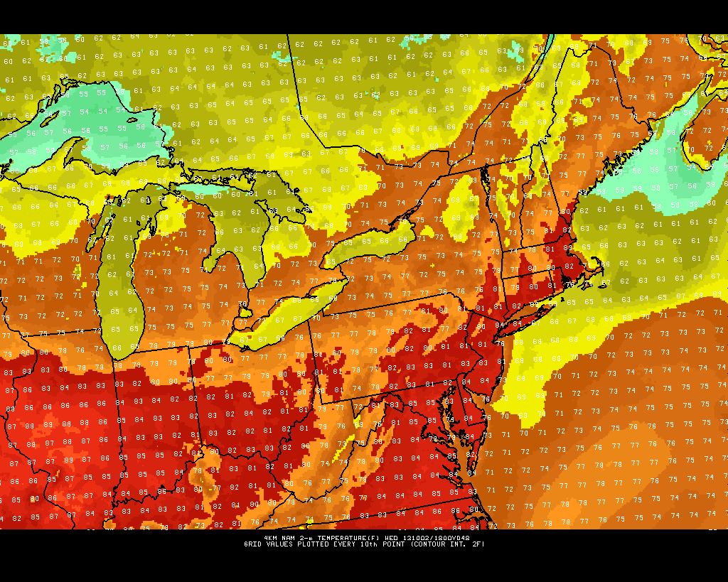
This afternoon’s high resolution NAM model shows temperatures warming into the low and mid 80s for Wednesday afternoon.
As seen in the image above, the entire area is projected to reach the low to mid 80s for Wednesday afternoon.
Thursday will see temperatures cool down to around 80, and Friday will have temperatures in the upper 70s with a few more clouds around ahead of a weak developing warm front. Any potential showers should hold off until Friday evening and night as the warm front crosses the area, but it will not be a washout.
The weekend will continue to feature above-average temperatures due to the passage of the warm front.
The next chance of more organized rain will be on Sunday night and Monday. But this is far out in the future, and there are still many variables at play — the chance is there that the rain could miss to our west.
For now, enjoy the terrific weather this week!