Good Evening!
Though high temperatures this afternoon were not quite as oppressive and did not reach the 90 degree mark to continue to the heat wave, it was still a few degrees above normal across the majority of the region which helped to keep that summer feel around for another day. The theme of much-above normal temperatures is likely to be over for at least the medium range as Thursday and Friday will feature an appreciable drop in high temperatures-with some locations possibly struggling to get out of the upper 60’s on Friday! This weekend looks to have some rebounding of temperatures on Saturday and Sunday, but these will be highly dependent on the degree of unsettled weather that each day will likely feature. Finally, the start to the workweek on Monday be a wet, and possibly stormy one as a frontal system works through the area during the day.
——-
This Evening Into Thursday
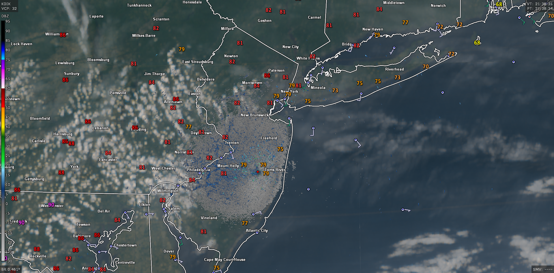
Some scattered showers moved through the immediate New York Metro area early this morning, producing locally moderate to heavy patches of rain. As storms last night died off in Northwestern New Jersey, they left a pool of residual moisture and instability that waited until the sun rose for showers to once again take off.
These showers gradually progressed to the south and west, leaving generally sunny skies over the entire region. Clearing skies and winds from the east due to an area of high pressure over New England led to a warm, but not overly warm day today. Highs generally ranged in the low to mid 80’s, with coastal locations seeing highs a few degrees lower. Some patches of ragged cumulus clouds attempted to pop up during the late afternoon hours, but these were not long for this world as the stable air associated with the maritime airmass quickly knocked these back down before they could develop further. Mostly clear skies, light winds, and decreasing dewpoints should last through sunset and into the evening hours tonight, allowing temperatures to drop down into the upper 50’s to lower 60’s for lows tonight.

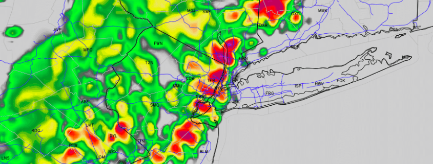
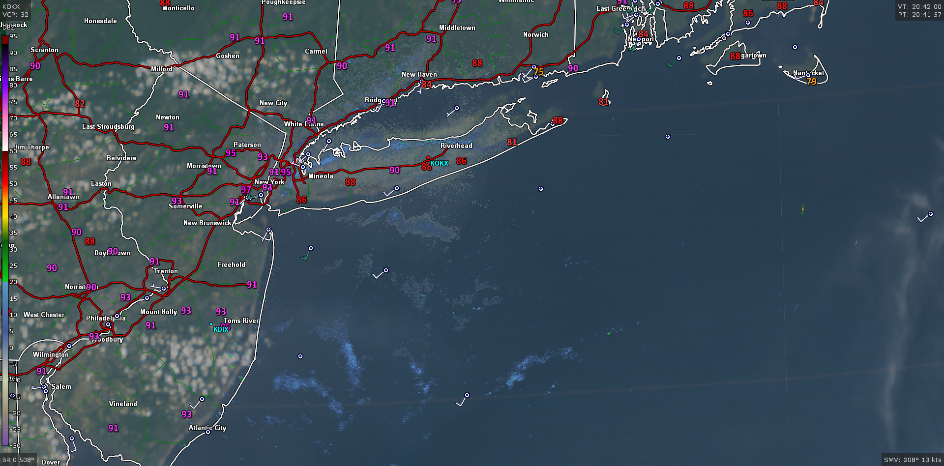
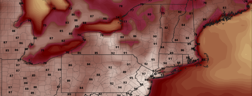
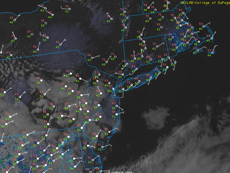
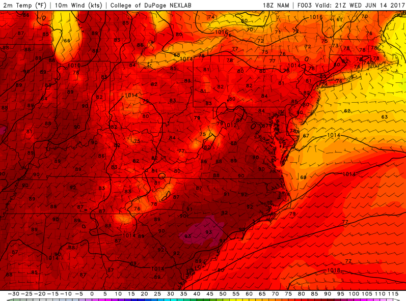
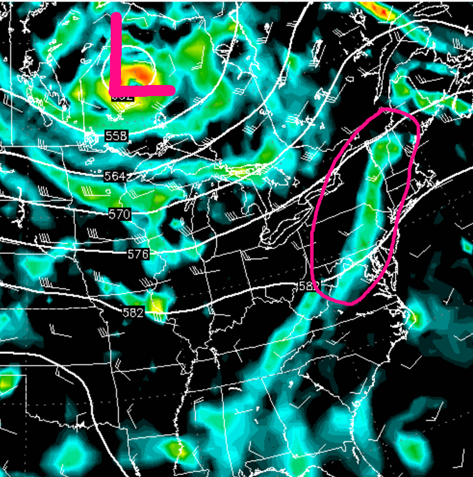
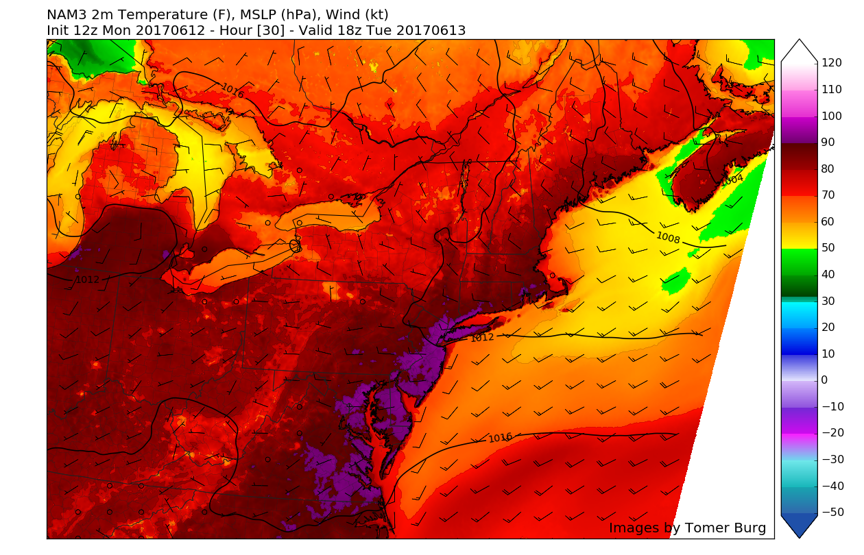
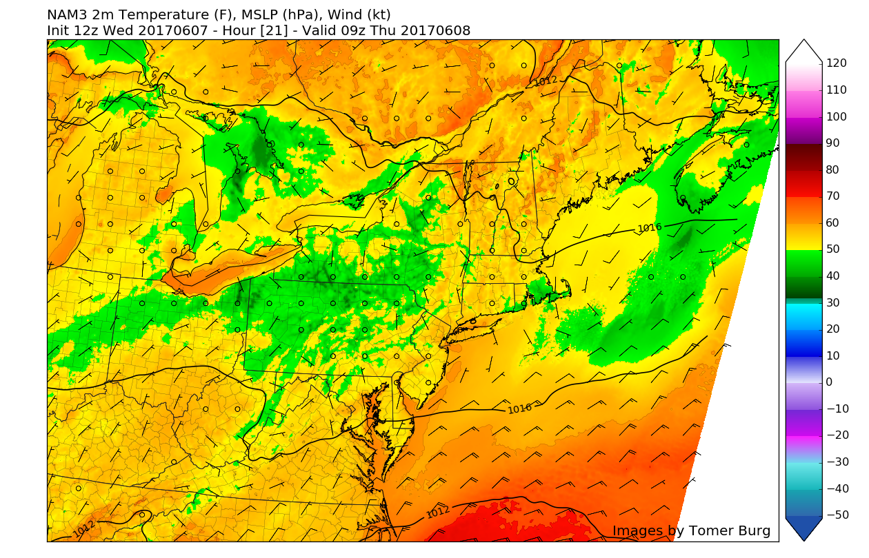
This afternoons latest available high resolution true-color visible satellite imagery, regional radar mosaic, and surface temperatures, showing a rather tranquil and warm late-afternoon (GOES-16 imagery Preliminary and Non-Operational)
As we start the day tomorrow, conditions should be mostly sunny with more concentrated clouds and showers possible over far northwestern New Jersey and Northern Pennsylvania. One thing that will be almost immediately noticeable during the late morning and early afternoon hours tomorrow, will the much lower levels of humidity. The easterly winds being ushered in by an area of high pressure over New England will provide yet another push of stable/maritime air-which should not only limit tomorrows temperatures, but also provide a chance of increasing clouds throughout the day tomorrow as the cool maritime air near the surface runs into increased levels of moisture in the middle layers of the atmosphere. With the maritime airmass in control and the threat of increased cloudiness, high temperatures tomorrow will likely be a good deal lower than they were over the past few day. Highs should range in the middle to upper 70’s-with some locations that see prolonged sun possibly getting into the 80 degree territory.
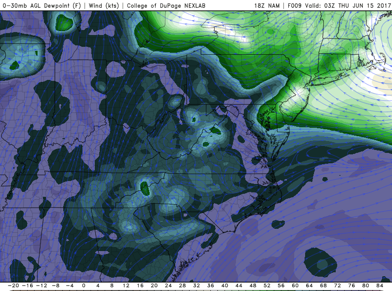
Shower will likely be confined to the far northwestern locations of New Jersey and possibly portions of southern New York, as they will be under less influence from the maritime airamss. Clouds will continue to increase through the evening hours, becoming overcast by late evening. As the area of high pressure over New England begins to retreat east, a frontal boundary over the Delmarva will shift low level winds from the east/east-southeast and usher in some more robust low level moisture. Showers may begin to form along the coast during the evening hours, but these will likely be scattered in nature.

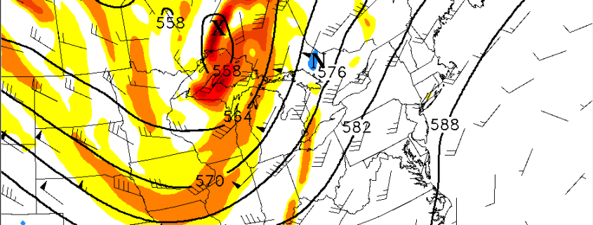
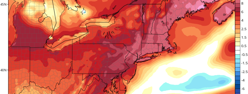
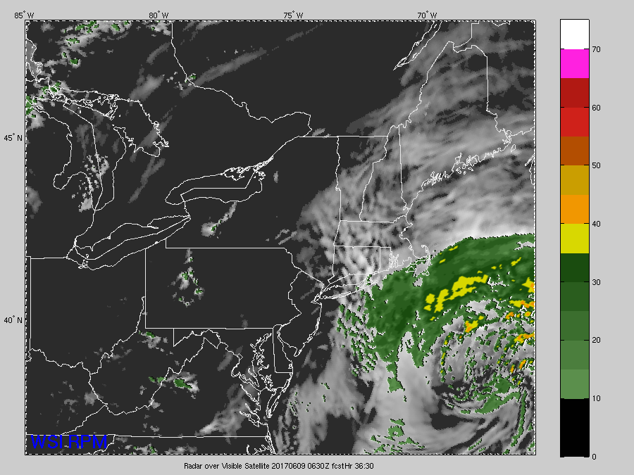
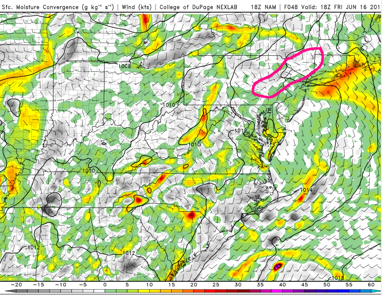
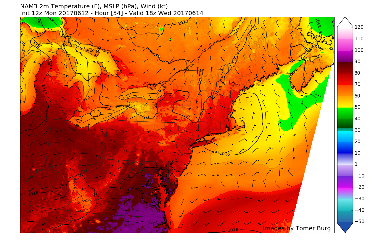
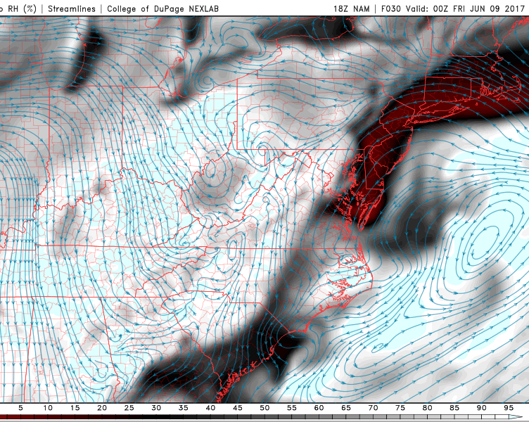
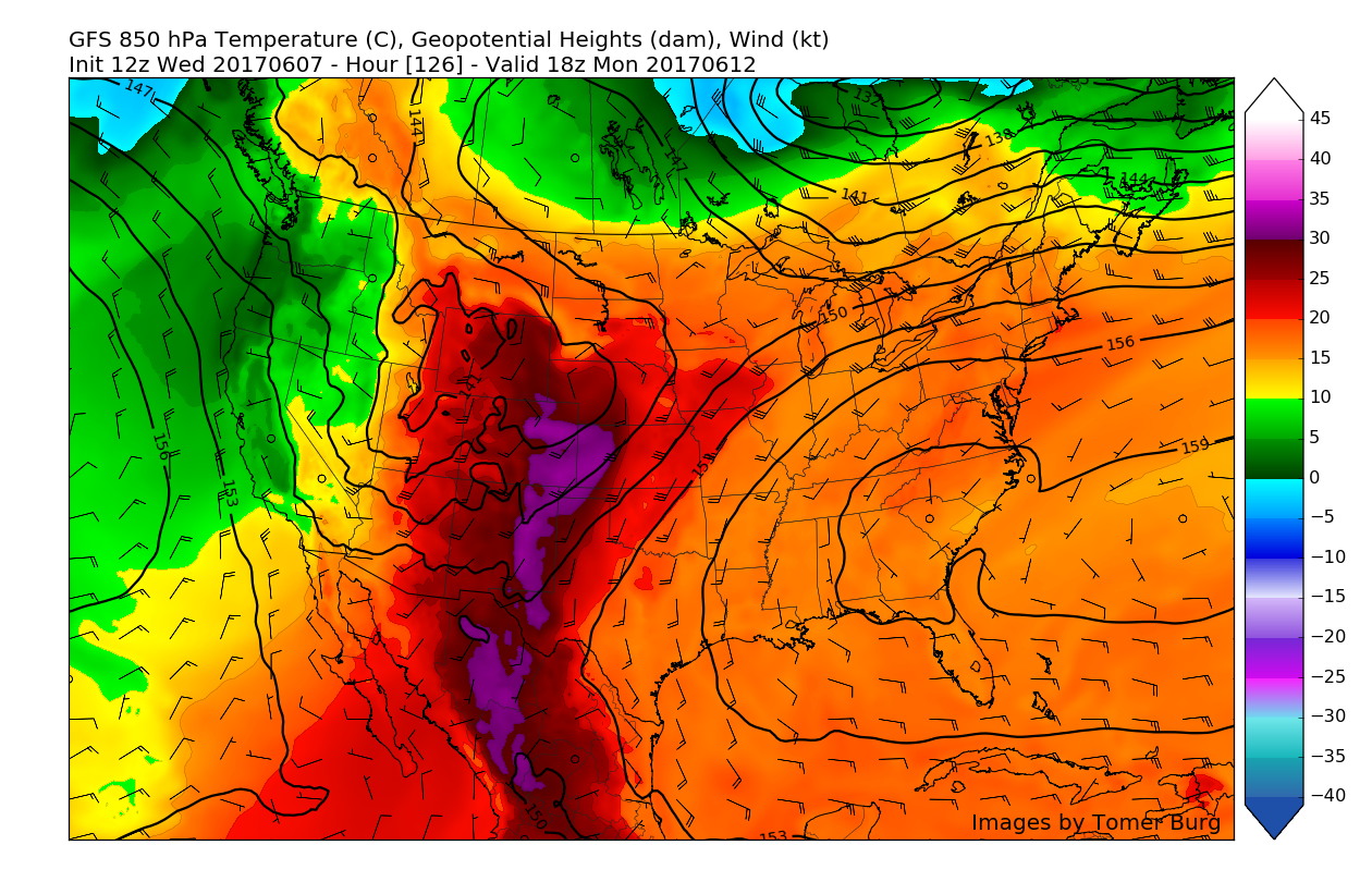
This afternoons GFS model showing the eastward progression of the high pressure system leading to a frontal boundary over the Delmarva peninsula increasing low level easterly/southeasterly winds. At the very least, increased clouds are expected Thursday evening (Courtesy Tomer Burg UAlbany)
Friday Into Saturday
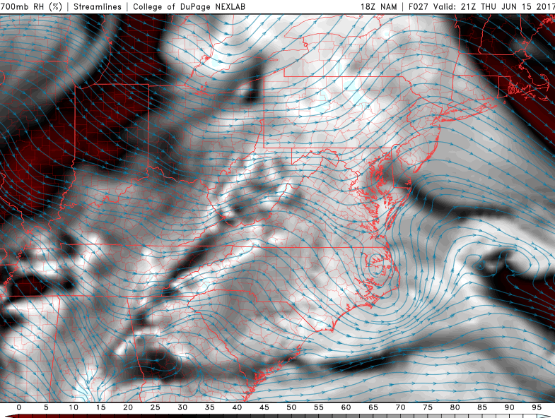
Friday looks to start off rather unsettled and cloudy for most of the area as low level moisture from the south and east continues to increase through the morning hours. As moisture continues to increase, an area of energy associated with a large, but slow-moving upper level low over Canada will begin to move towards the area during the afternoon hours. Though there will be ample moisture in place, and a “trigger” in place to set off any potential showers and thunderstorms, the onshore flow from the Atlantic may act to push the best areas of lift inland over portions of Northwestern New Jersey-possibly even into New York state. The model diverge significantly on where the best moisture convergence/showers will be during the day on Friday, but at this time it appears likely that the best threat for steadier rains will be located just inland over portions of Northeast Pennsylvania, Northwestern New Jersey, and Southern New York. This will likely have to be looked at again tomorrow, as though there is a frontal boundary in place, we have seen the model guidance severely underestimate just how much a maritime airmass can advance, which in turn will determine the location of the best threat of rain.
Any showers that do develop during the day on Friday should move east/northeast during the late afternoon and into the evening hours, gradually diminishing as time progresses. Highs on Friday will be highly dependent on how much cloud cover takes hold, and whether or not sustained precipitation develops, but highs should range in the low to middle 70’s, with some locations not being able to make it out of the 60’s!
Saturday will likely be another unsettled day, as the frontal boundary that was located to our south on Friday, lifts up and over the region as a warm front during the day. This will lead to increase in temperatures, but with ample moisture and weak lift, some showers in the morning and possibly even a thunderstorm will be quite possible during the afternoon hours. Highs will likely make a slight rebound back into the upper 70’s to lower 80’s across much of the region.

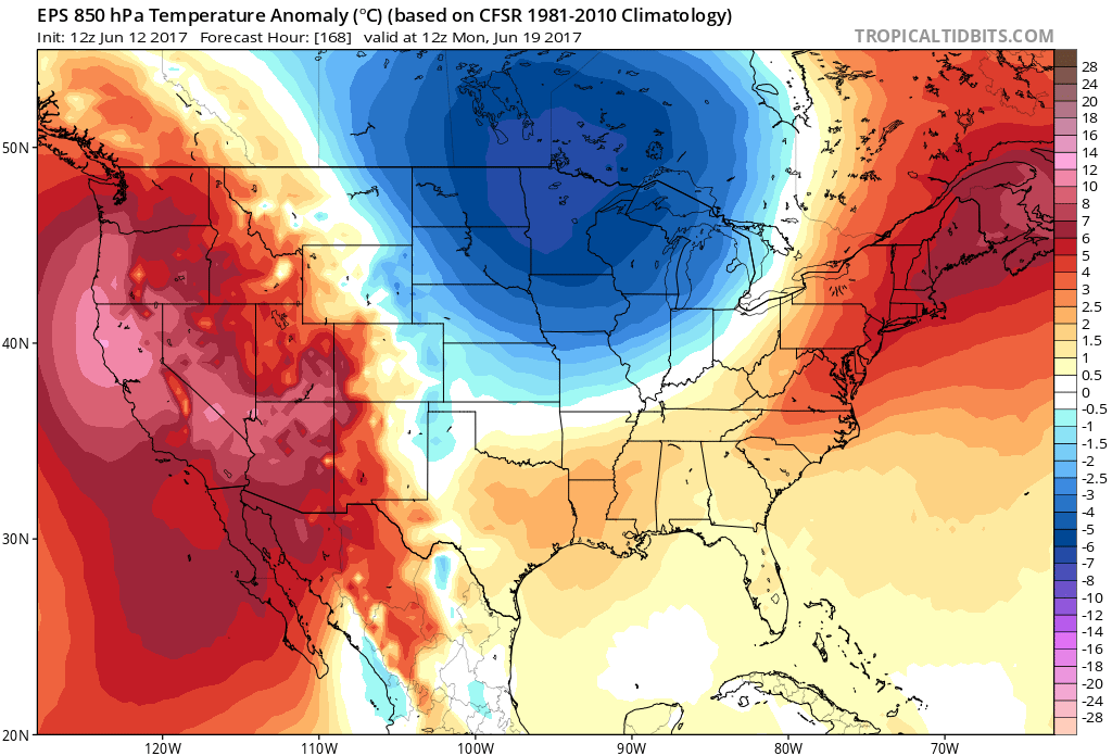
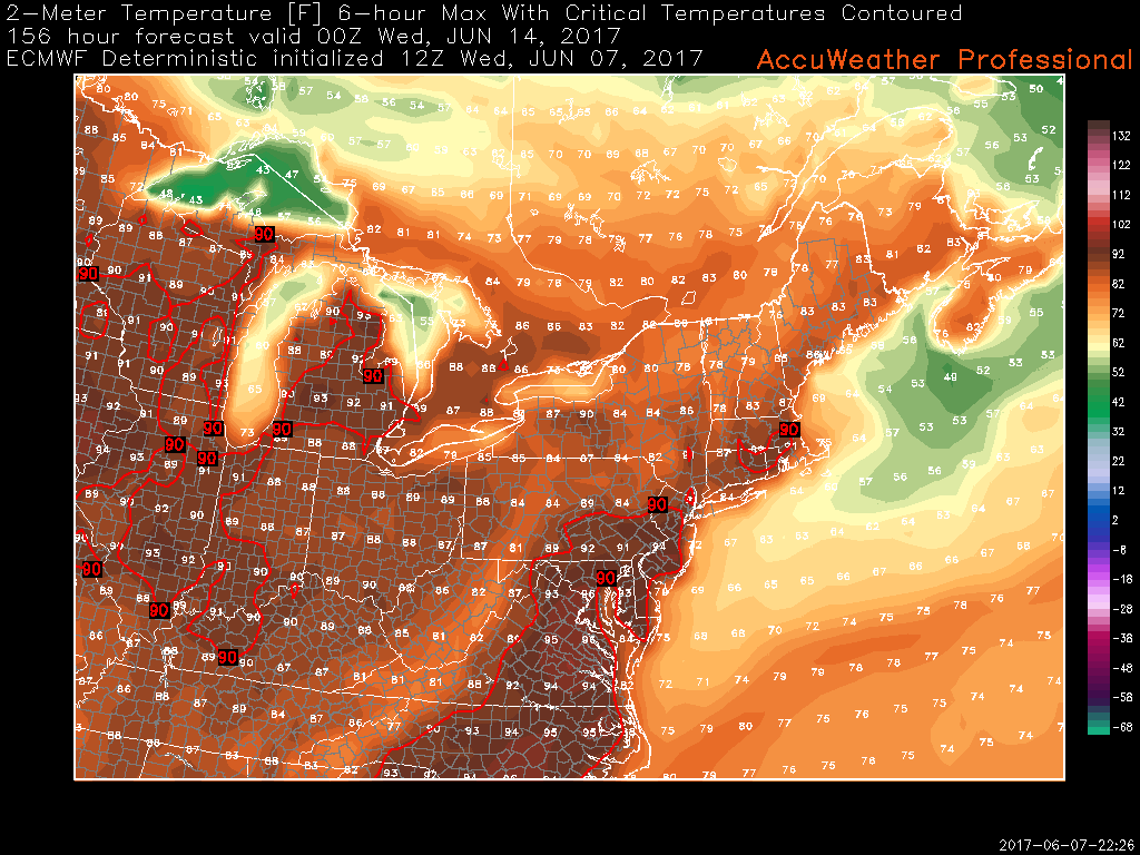
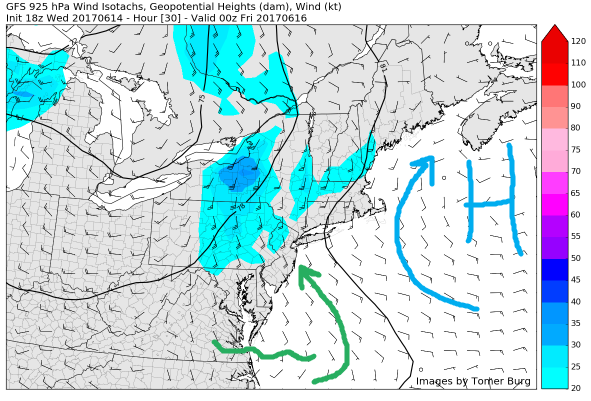
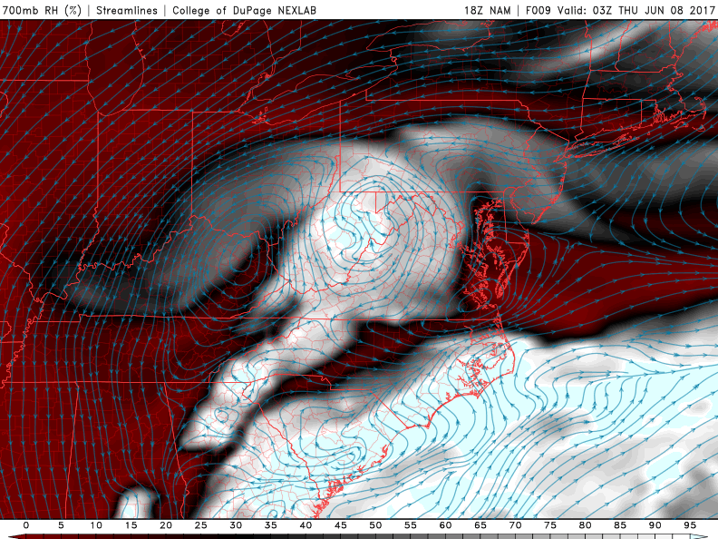
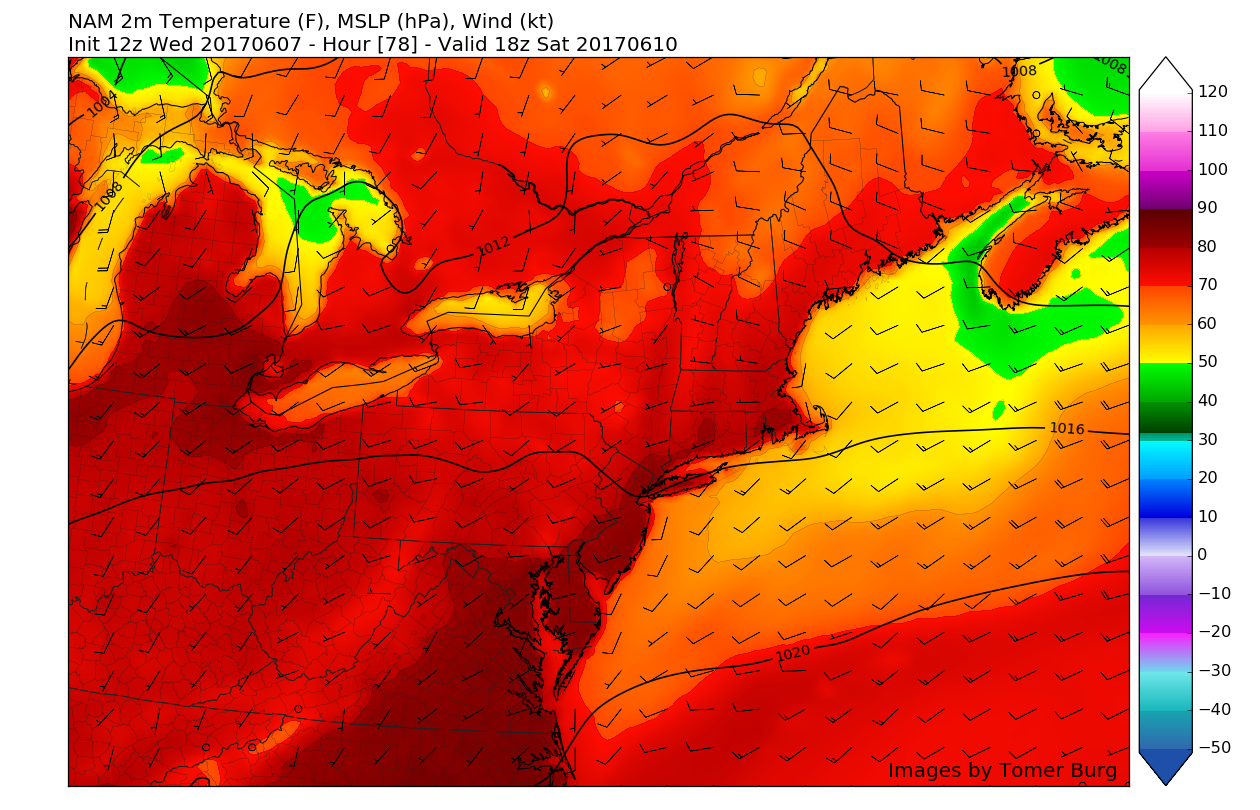
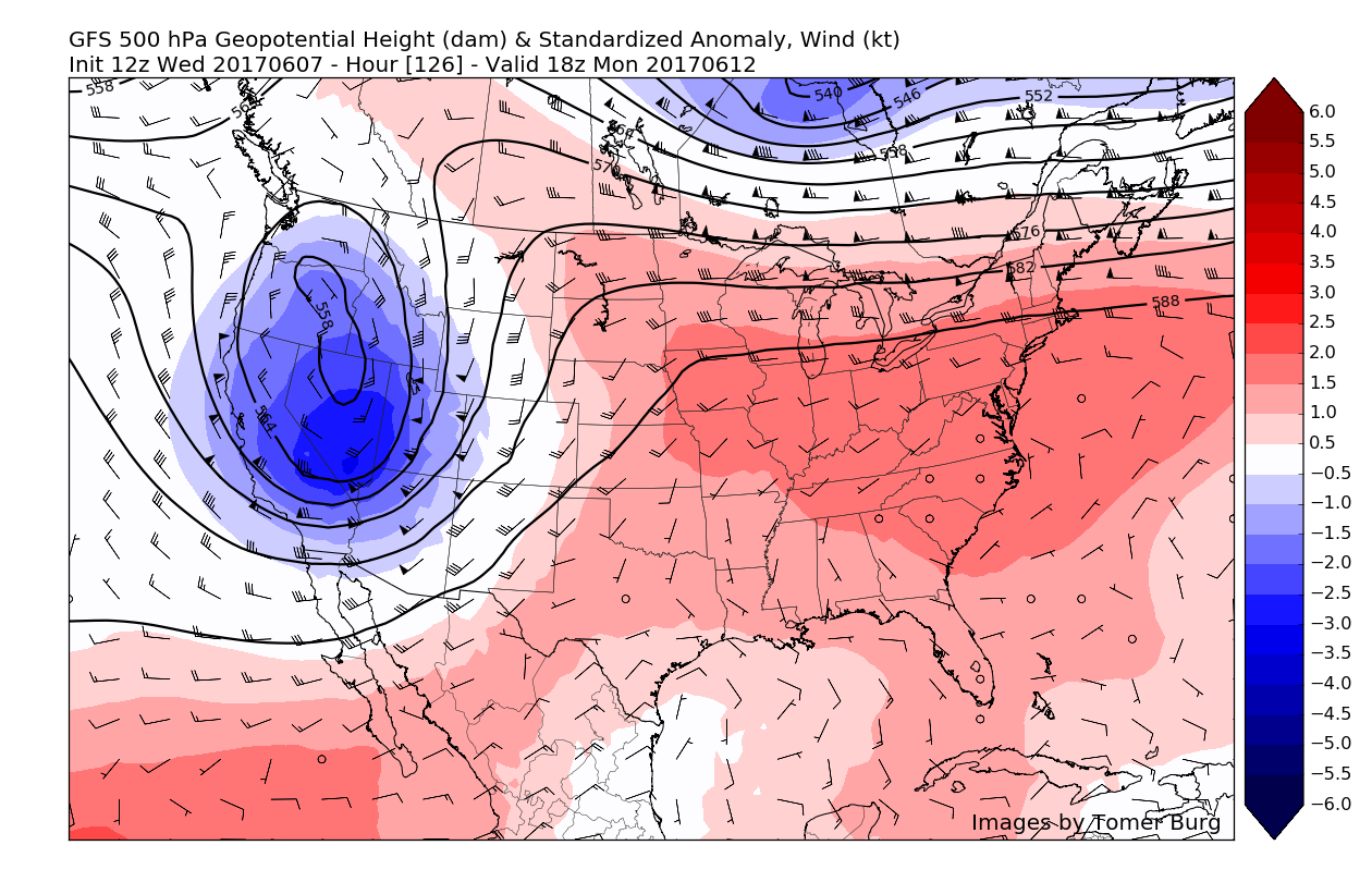
This afternoons European model showing a large upper level trough moving in from the Pacific Northwest , strengthening over the Great Lakes region and providing multiple chances of rain on both Sunday and Monday
Fathers Day and Beyond
During the day on Sunday, a large upper level trough our to west will be heading east/northeast in the Great Lakes region while strengthening. This strengthening area of low pressure will spawn a large cold front that will likely be located far to our west during Sunday. Ahead of this front should exist some more instability over the region, but with the main trigger-the cold front located far to our west, it may be rather hard to get actual showers and thunderstorms to pop during the day. Assuming the front does take its time in getting to the region, skies should generally be sunny during the day, which should allow for highs to reach into the low to middle 80’s.
As the front and the best forcing begins to make its way into the region during the day on Monday, instability and moisture should be more than sufficient for shower and thunderstorm development across the area, with some storms possibly being strong to severe in nature. The overall level of severity will rely strongly on the timing of this front, as strong surface heating and destabilization would lead to stronger storms. At this time, it appears that the main threat with any showers and thunderstorms will be gusty winds and heavy rainfall, but this threat will have to be monitored over the next few days.
For more information and posts like this one, make sure you sign up for Zone Forecasts — where multiple detailed articles, videos, and interactives are posted each day. Also, come interact with our staff and many other weather enthusiasts at 33andrain.com!
Have a great evening!
Steve Copertino
-2")