Afternoon All Zones: Significant snowfall increasingly likely Thursday

Forecast models have trended in favor of a stronger, more impactful storm system moving through the Mid Atlantic states on Thursday, and confidence is increasing in a significant snowstorm for a large majority of the forecast area. The potential exists for 9-12″ of snow in parts of the area, and higher amounts cannot be ruled out where bands of heavier snow develop.

The story of the storm system begins over the Midwest states, where a disturbance in the mid levels of the atmosphere develops on Wednesday. This energy moves eastwards from the Midwest through the Ohio Valley, and eventually to a position off the Mid Atlantic Coast. As it does so, interaction with a disturbance in the northern jet stream will cause the energy to deepen.

Read more

AM All Zones Update on Potential Snowstorm Late Wednesday Night into Thursday

A storm system tracking over the Great Lakes, will bring some periods of rain with possibly freezing rain over Interior this morning. Some very mild and record breaking temperatures also possible on Wednesday. But more attention is already on possible snowstorm starting late Wednesday night and last into Thursday. Details are still yet to be ironed. But confidence is growing on moderate to significant snowfall for parts of the area.

Read more

Zones 3,7,8 Update on Interior Freezing Rain Threat This Morning

Some freezing rain is possible over the inland areas this morning. This is ahead of an approaching warm front from the the south. Warmer air has already intruded aloft. But surface temperatures are in the upper 20s to lower 30s over many of the higher elevations, over Northwest NJ, Lower Hudson Valley and Connecticut. The National Weather Service has issued freezing rain and winter advisories for these areas this morning. Lower dewpoints, may also allow for temperatures currently in middle 30s, a little further south and east, to drop to near freezing briefly, as rain begins this morning.

Read more

2/6 PM All Zones: Update on midweek snow potential

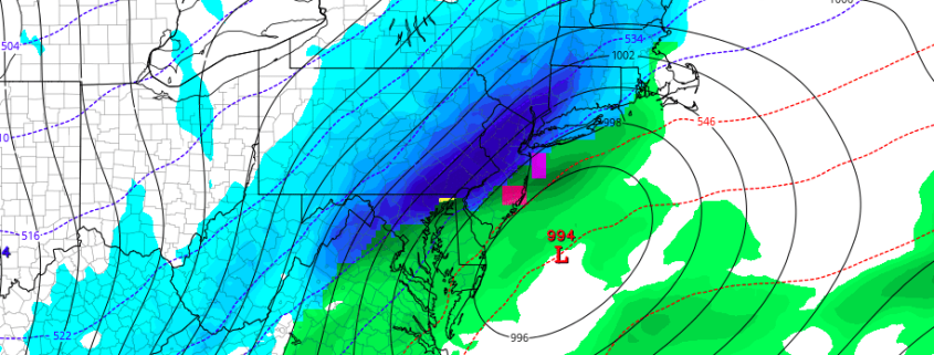
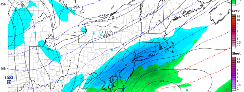
Forecast models have trended toward a more amplified solution with a mid and upper level atmospheric disturbance, which will swing through the Mid Atlantic states on Thursday. A low pressure area at the surface, developing as a result of the disturbance aloft, will move from the Mid Atlantic States to a position south of New England. But its exact track remains highly uncertain, and will determine the sensible weather effects in the Northeast.

Much of the uncertainty stems from the interaction between two disturbances from the northern and southern jet streams in the atmosphere. Both of these disturbances are still very far away from our area — one over Canada and the other in the Pacific. These are critical components to the forecast that likely won’t be resolved for another 24 hours or so. A fast flow in the atmosphere will quickly bring them into the United States this week.

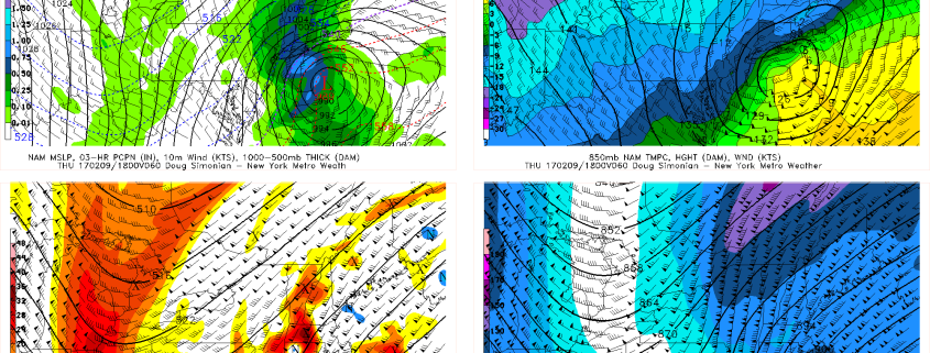
As the disturbances interact, a main mid level disturbance will develop and shift towards the Mid Atlantic coast. As a low pressure system develops, lift for precipitation will strengthen and expand to its northwest. As you can imagine, pinning down exactly where this low pressure tracks will be critical. Some forecast models are still further southeast with the low pressure center, suggesting lesser impacts in the Northeast US — while others are more impactful all around.

While the atmospheric flow is fast and progressive (i.e, no tremendous snow amounts are expected) an impactful storm seems to be an increasing possibility on Thursday. Most model suites and ensemble guidance have converged today on a low pressure track envelope that will ensure at least light impacts — with the potential for more depending on track.

We break down the intricacies of the atmospheric setup in more detail right here in our Premium Zone video discussion: