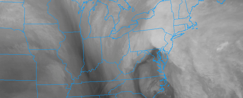
1/24 AM All Zones: Coastal storm offshore, rain lingers

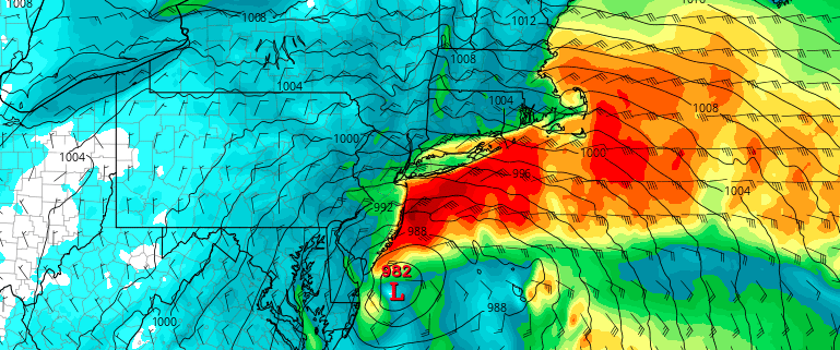
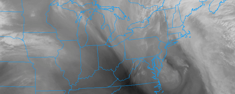
A surface low pressure system, associated with a strong mid and upper level disturbance in the atmosphere, is still off the coast of New Jersey this morning. The storm will linger through early this afternoon as it continues to weaken and shift east/northeast away from the area. Moisture and lift associated with the storm have weakened considerably, but still exist near the area.

Accordingly, bands of rain are continuing to shift into the area, moving east to west from the Atlantic Ocean. These bands will be capable of producing periods of rain throughout the early afternoon hours. In the interior and higher elevations, colder temperatures may allow for periods of sleet or freezing rain which may cause slick roadways.

Read more

Coastal Zones (2,4,5) Update: Rain, strong winds continue

A developing low pressure system along the Delmarva coast will strengthen over the next several hours, shifting north and northwestwards. Initially a few hundred miles offshore, the low pressure will develop to a position very close to the coast of New Jersey by later tonight into Tuesday morning. Bands of heavy precipitation will rotate inland from the Atlantic, with torrential rain likely overnight. Rainfall amounts should exceed 2″ over a large area.

The precipitation is being facilitated by a strong low level jet (transport of wind in the low levels of the atmosphere). This low level jet is bringing anomalous moisture and lift with it, leading to heavy precipitation. In addition to the presence of heavy precipitation, the low level jet is also accompanied by strong winds.

Read more

1/23 AM Coastal Zones Update for High Winds and Coastal Flooding

East to northeast winds this morning have already gusted up to 45 to 50 mph parts of the region, as a significant Nor’easter begins to take shape to our south. These winds also have already lead to some minor coastal flooding at high tides around the region this morning. High wind warnings and coastal flood warnings have been issued by National Weather Service for even stronger winds and more coastal flooding for this afternoon and evening.

Read more

Zone 3/7 (Interior) Update: Wintry weather expected on Monday

A Nor’Easter as unique as it will be strong is expected to develop throughout the Eastern United States on Monday. The storm is already in its developmental stages well to our south, and will shift northward into the Mid Atlantic states through Monday morning. A surface low pressure area is expected to then redevelop off the coast, strengthening near the Delmarva and then shifting eastwards towards the 40/70 Benchmark.

All of these things would bring one to believe a winter storm is on the way. Think again! A warm, modified, Pacific airmass is in place prior to the storms arrival (have you been outside recently?) and the main focus of the storm will be torrential rain and wind near the coasts. However, the storms dynamics and cold air aloft will work to create wintry possibilities inland, even despite the warm air at the surface to start.

Read more