-2")
Forecast Soundings and Radiational Cooling
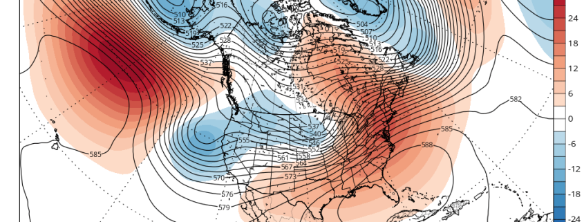
850mb temperatures are only around average or slightly below average. There is a large Southeast ridge with positive 500mb height anomalies. The previously large North Pacific block that generated our cold and snow last week has been replaced by negative height anomalies, cutting off the US from any cold airmass. So why is it so cold tonight? What it essentially comes down to is surface high pressure and radiational cooling.
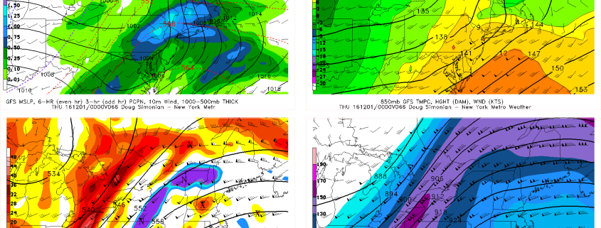
On the heels of the piece of the Tropospheric Polar Vortex that got sent towards the US from the aforementioned North Pacific block was a very large surface high pressure system with Arctic origins. While the Polar Vortex quickly retreated back into the Arctic and the US was being replaced by a much warmer airmass aloft, this surface high pressure system was massive enough and had enough initially very cold source regions to deposit incredibly cold air into the US. The coldest temperatures were to our west in the Central Plains, where places in Texas dropped from the low 80s to the upper 30s within one hour! This cold air got modified somewhat as it headed east, but it still packed quite a cold punch on Monday, as temperatures in NYC did not get out of the 20s during the afternoon.