-2")
Sunday AM Update: Wintry pattern looms
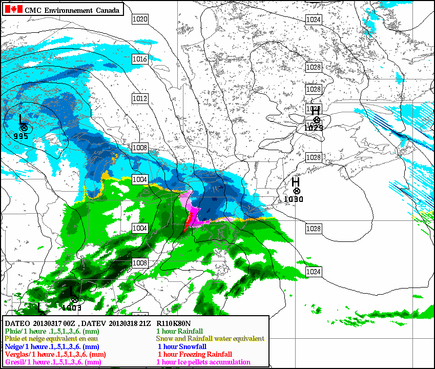
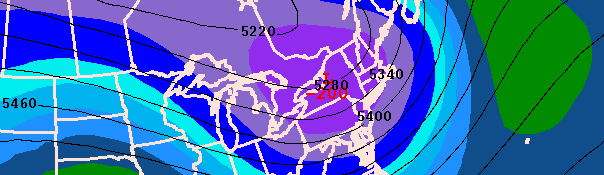
The RGEM model shows moderate snow in the NYC area at 5 p.m. Monday
The NAO blocking has arrived, and much of the area saw periods of snow during the day on Saturday, enough to remind us that winter is still holding its grip on us, despite the calendar turning towards Mid March. We are also following the potential for two storm systems; one for Monday evening through Tuesday morning, and another one as we approach the March 24 period. Monday evening through Tuesday morning looks more rainy and messy than snowy, though further northwest of the city might be able to hold onto enough cold for minor snowfall accumulations along with some ice. However, March 24 is a period that needs to be watched for more serious snowfall potential, albeit it is quite far away, so caution should still be urged.
A stronger storm system will be developing to our west, as energy enters the United States from the Pacific Ocean. Considering we have a decently cold airmass in place right now, the precipitation that moves into our area could start off as snow, as warm, moist air overruns the cold air in place. If enough solid precipitation can break out to the east of the storm system, then we might see precipitation before the warm air advection would settle in. The RGEM model illustrates this well, as it shows a several hour period of snow for the NYC area, and then turning over to sleet.