Over the next 24-48 hours, this page will be continually updated with information on Hurricane Florence. The live blog below serves as a constant feed of information. Check back here for the very latest details as the storm strengthens.
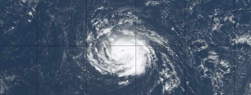
Tropical Storm Florence is getting ready to put on a show. The storm has been floundering for a few days now, battling moderate wind shear and less than ideal water temperatures. It has maintained Tropical Storm status, but has weakened quite a bit with structural deficiencies very apparent on visible satellite imagery as recently as last night. Things have changed quite a bit so far today, with the storm regaining structure and beginning to intensify.
Forecast models are in good agreement that the storm will begin to intensify later today and Sunday, as wind shear weakens and it begins to traverse increasingly warm water. The situation becomes more precarious in the next few days, as the environment around Florence becomes conducive for rapid strengthening. Forecast models suggest the system will restrengthen into a Major Hurricane as it accelerates westward, on a track perilously close to the United States. The NHC is forecasting rapid intensification.
https://www.nymetroweather.com/wp-content/uploads/2018/09/Screen-Shot-2018-09-08-at-1.46.09-PM.png5181239John Homenukhttps://www.nymetroweather.com/wp-content/uploads/2024/02/Empire-2000-x-300-px-2.pngJohn Homenuk2018-09-08 13:58:062018-09-08 13:58:06Florence set to rapidly strengthen, likely to impact East Coast
“What would normally happen in this scenario?” Most meteorologists would be uncomfortable telling you how many times we utter this phrase in our own heads, but the truth is that it happens quite often. In all honesty, this method usually serves as a bit of a reality check; what kind of analog years can we use to compare this upcoming storm to, and how did similar scenarios evolve in the past? This forecasting process isn’t fool proof, but it usually works out – properly weighting past events into forecasts helps produce a more reasonable expectation.
But there are times when it simply doesn’t apply – where model guidance shows a highly unusual pattern ahead, so much so that past events will do no good to help us understand what will evolve. Hurricane Florence may very well be a shining example of just that.
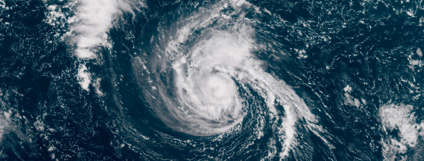
https://www.nymetroweather.com/wp-content/uploads/2018/09/Screen-Shot-2018-09-07-at-8.25.31-AM.png4691047John Homenukhttps://www.nymetroweather.com/wp-content/uploads/2024/02/Empire-2000-x-300-px-2.pngJohn Homenuk2018-09-07 08:32:212018-09-07 08:32:21On Florence, and her uncertain but concerning future
Hurricane Florence is still a few thousand miles away from land in the Atlantic Ocean, but forecast models have been throwing up all kinds of red flags in regards to her potential track – and impacts – over the past 48 hours. The systems eventual evolution remains incredibly complicated, modulated by several different features in the mid and upper levels of the atmosphere – and likely will not become clear for several days. Still, trends and ensemble signals have become more worrisome over the past few days in regards to Florence’s eventual future.
The system is currently located in the open Atlantic Ocean, 1210 miles away from the Northern Leeward islands. Florence is a Category 2 hurricane on the Saffir-Simpson scale, still shy of Major Hurricane status, but strengthening. It is doing so despite a relatively unfavorable environment, with sub-ideal sea surface temperatures and light to moderate wind shear. Forecast models have largely underestimated the systems intensity thus far.
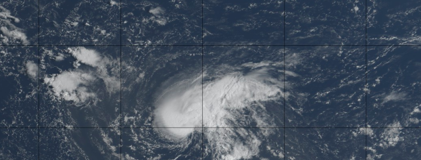
https://www.nymetroweather.com/wp-content/uploads/2018/09/CODGOES16-global-atlantic.truecolor.20180905.121535-overraw-bars.gif9001600John Homenukhttps://www.nymetroweather.com/wp-content/uploads/2024/02/Empire-2000-x-300-px-2.pngJohn Homenuk2018-09-05 08:47:282018-09-05 08:57:27Florence strengthening, track close to USA still possible
Hi friends! Our website uses cookies to provide an optimal browsing experience for you. New "Cookie Consent" laws mandate us to inform you of this. As long as you're cool with it, just hit OK. You'll only see this message once.
We may request cookies to be set on your device. We use cookies to let us know when you visit our websites, how you interact with us, to enrich your user experience, and to customize your relationship with our website.
Click on the different category headings to find out more. You can also change some of your preferences. Note that blocking some types of cookies may impact your experience on our websites and the services we are able to offer.
Essential Website Cookies
These cookies are strictly necessary to provide you with services available through our website and to use some of its features.
Because these cookies are strictly necessary to deliver the website, refusing them will have impact how our site functions. You always can block or delete cookies by changing your browser settings and force blocking all cookies on this website. But this will always prompt you to accept/refuse cookies when revisiting our site.
We fully respect if you want to refuse cookies but to avoid asking you again and again kindly allow us to store a cookie for that. You are free to opt out any time or opt in for other cookies to get a better experience. If you refuse cookies we will remove all set cookies in our domain.
We provide you with a list of stored cookies on your computer in our domain so you can check what we stored. Due to security reasons we are not able to show or modify cookies from other domains. You can check these in your browser security settings.
Other external services
We also use different external services like Google Webfonts, Google Maps, and external Video providers. Since these providers may collect personal data like your IP address we allow you to block them here. Please be aware that this might heavily reduce the functionality and appearance of our site. Changes will take effect once you reload the page.
-2")