A year later, memory of Irene still fresh

Hurricane Irene moving up the East Coast, August 2011.

23 deaths, more than 2 billion dollars in damage, and over 4 million without power. Those are just some brief numbers which remain eye-popping more than a year after Hurricane Irene made its move up the East Coast of the  United States. Although the storm made its second landfall near Little Egg Harbor, New Jersey as only a Tropical Storm, the winds and heavy rain the storm packed with it brought some of the most fierce tropical-conditions that the area has seen in several years. 69 miles per hour were the recorded sustained winds at Irenes second landfall in New Jersey. The storm would make a third landfall near Brooklyn after it re-emerged into the waters off the New Jersey coast, and a fourth in Connecticut after crossing over Long Island.

New York City was prepared in advance of Irene, after evacuating thousands of coastal residences and shutting down the subway transportation system in advance of expected flooding and high winds. But the torrential rains and high winds still caused damage to thousands of trees throughout the area and led to power outages for millions of people throughout the area. Forecasting the hurricane was not an easy task either, with the storm providing a ton of uncertainty as she approached the east coast. Initial forecasts took the storm into the Southeast United States, but as it drew closer it become apparent that the storm would turn northeast towards New Jersey and New York City.

A few days prior to the storms impact, we published an article on our old blog (which you can see a screenshot of here). Forecasting such a prolific event, and using strong wording, isn’t something we like to practice. But in this situatino, it was warranted. Irene will be remembered as one of the more memorable and difficult events to forecast in many of our careers — seeing an expansive and developed Tropical System impact the area is rare enough as it is. Luckily, the storm weakened slightly compared to forecast models were hinting at a few days in advance. Still, the billions of dollars in damage, more than 20 deaths, and duration and expansive coverage of power outages are a testament to the power of the storm.

Isaac passing near Key West, headed towards Gulf

Tropical Storm Isaac continues to churn south of Florida this Sunday afternoon, with maximum sustained winds at 60 miles per hour as of the 200pm intermediate advisory. The West-Northwest movement continues as Isaac shifts north of Cuba and towards the Gulf of Mexico. Tropical Storm Force winds extend outward from the center of the storm, with widespread heavy rain and tropical winsd affecting parts of South Florida this afternoon and continuing into this evening. The latest radar imagery shows the center of circulation passing very near to Key West at 400pm EDT with at least a brief landfall expected along the Florida Keys this evening by the National Hurricane Center. Isaac weakened slightly from Sunday morning through Sunday afternoon, but the improved organization on both radar and satellite suggests the storm will begin to organize as it enters the Gulf.


Read more

Isaac heads towards Carribean, not an East Coast threat

Tropical Storm Isaac strengthened slightly on Friday morning as it continued to churn towards the southern coast of Hispaniola. Maximum sustained winds were at 60 miles per hour, with a continued west-northwest movement around 15 miles per hour. The official forecast from the National Hurricane Center takes the center of Isaac towards Cuba by this weekend, with a prolonged northwest path over the Island. Some weakening and disorganization of the storm is almost guaranteed.

Beyond this, forecast model spread widens a bit as Isaac is expected to make an approach towards the Eastern Gulf of Mexico. Interests from the coast of New Orleans and points east, including Florida, are urged to remain abreast of the situation and to check the latest forecast tracks and information on Isaac. It remains a significant uncertainty how much disorganization and weakening the storm will undergo over Cuba. And although the waters over the Gulf of Mexico are very warm and favorable for storm organizatino, it also remains uncertain if Isaac will have enough time to reorganize to pose a significant hurricane threat to the Gulf Coast states. Still, at this time, the percentage of Tropical Storm impacts somewhere on the Central or Eastern Gulf Coast states is increasing.

For our area, it appears the only impact Isaac may possibly have is in the form of remnant rains, which could ride north and east along a frontal zone during the middle of the week. No direct impacts are forecast in our area from the tropical system. Remember to stay tuned to the National Hurricane Center for updates on the storm this weekend and into next week.

TS Alberto forms off South Carolina Coast

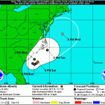
The National Hurricane Center officially declared the formation of Tropical Storm Alberto this afternoon, marking the first named system of the 2012 Alberto 5 Day ConeAtlantic Hurricane Season. The storm system is located off the coast of South Carolina, and is expected to move slowly over the next 24 hours before accelerating northeast up the East Coast (but remaining offshore). Maximum sustained winds as of Saturday afternoon were 40 kts (or 45 miles per hour), and Alberto had a minimum central pressure of 1007 millibars. The system was moving southwest at 3 kts (3 miles per hour). The National Hurricane Center’s cone of uncertainty (right) includes some of the forecast area, including the New Jersey Shore. We aren’t currently expecting the storm system to landfall in our area, but being in the cone of uncertainty generally suggests that interests in that area should keep a very close eye on the forecast over the next few days for any shifts or adjustments.

The expected track of the storm system suggests our forecast area could feel some prolonged impacts from the system. The storm system is not particularly strong, nor is it expected to impact our area directly. However, showers and thunderstorms associated with Alberto are expected to impact the area beginning on Monday. Some periods of heavy rain and gusty winds are certainly possible Monday through Tuesday with the scattered showers/storms. Widespread heavy rain, flooding, or severe weather impacts are not expected.

Stay tuned over the next day or two for constant updates and information on the tropical system and impacts expected in our area.