Growing concern for high impact event as Sandy targets East Coast

GFS Model showing Hurricane Sandy coming ashore in New Jersey on Tuesday as a storm of nearly unprecedented strength, with a minimum pressure of 942 millibars.

Concern continues to grow for East Coast impacts as Hurricane Sandy churns through the Caribbean, now making her move towards the Bahamas this evening. Forecast models have come into better agreement on a track with the tropical system as she moves northwest into the Bahamas, and then northeast out into the open waters of the Southwest Atlantic. Thereafter, the major changes happen which involve the US East Coast and more specifically the Northeast and Mid Atlantic. Over the past few days, we have highlighted the potential impacts from the storm system — while reminding everyone to remain objective to the situation and remember that uncertainty still exists. Much of the same applies today and as we head towards the weekend, but the potential for the storm to curve back and impact the Northeast has dramatically increased. In fact, the out to sea (no impact) solution now seems extremely unlikely. What remains to be determined is the exact track, strength, and landfall of the storm system…which will have dramatic impacts on the eventual hazards in New York, Connecticut, and New Jersey. We again answer all of your questions and give our thoughts on the event below

Keep reading for more details including three potential track scenarios and other preparedness information…

Read more

Concern builds as Tropical Storm Sandy provides forecasting headache

European forecast model showing TS Sandy, phased with a trough over the Central US, as a very strong storm at 933mb just off the New Jersey coast. Such a strong storm is almost unprecedented for our area.

Forecast models continue to waiver with track, intensity, and impacts on a potential major storm system developing off the East Coast at the end of this coming weekend and continuing into early next week. Earlier this week we outlined the potential in the long range for a system, but dismissed the hype which was already growing, with some outlets already talking about wind numbers and rain potential. Now that we are a few days closer to the event, and around 5 days away from potential impacts, we have some slightly increased confidence that the storm will at least have a chance of bringing impacts to our area. In essence, the storm isn’t just a “fantasy land” storm on forecast models anymore — it seems to be a legitimate possibility (not a certainty). So, we’ll lay out all details below with a full explanation of the event in which we try to answer any questions you may have in regards to the storm and it’s impact on the weather in the NYC area.

What’s the deal with this threat, why is it developing in the first place? Tropical Storm Sandy formed a few days ago in the Caribbean. The storm is strengthening a bit and is expected to drift northward over the next day or two, into the Northern Carribean and southwest Atlantic. The pattern over the United States and Northern Atlantic ocean is completely blocked up (i.e, the pattern is very amplified, with unusually deep troughs and ridges thanks to a very low NAO and AO index). This means the steering flow (what guides the tropical storm) will bring it out of the Caribbean and then on a north, possibly northeast heading for a while. More often than not, storms in this position head out to sea. But as you can see in this diagram, there is not much room for Sandy to do that. The ridge axis building over the top of her and to her east over the Atlantic remains strong. And to the west of her, over the Central US, you can see a trough beginning to dive south and east.

Keep reading for details, diagrams, and thoughts on the potential threat…

Read more

Live Blog: Isaac hammering the Gulf Coast after landfall

Hurricane Isaac made landfall last night, early in the evening in far Southeast Louisiana and had been meandering off the coast before making landfall once again overnight. The storm, now inland over parts of the immediate Gulf Coast in Louisiana, has actually seen markedly improved appearance with increasingly strong and organized rain bands. Heavy rain, tropical storm to hurricane force winds, and impressive storm surge has been hammering parts of southern Louisiana since last night and is expected to continue through today as Isaac moves very slowly. In today’s live blog, we will continue to provide updates on Isaac and reports of damage including flooding, wind reports, and pictures and video. As of the morning advisory from the National Hurricane Center, Isaac continues at Category 1 Hurricane status with maximum sustained winds of 75 miles per hour and is moving Northwest at 6 miles per hour.

Click “read more” below to enter our live blog, which will be updated as we receive more news and updates on the storm.


Read more

Live Blog: Isaac now a hurricane, approaching Lousiana landfall

Hurricane Isaac officially strengthened to Category 1 Hurricane strength earlier this afternoon with maximum sustained winds of 75 miles per hour (just barely reaching the threshold for hurricane status). The system continues to organize in the

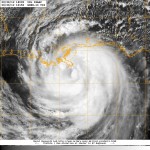
Visible satellite imagery of Isaac around 3pm on Tuesday, August 28th 2012

north-central Gulf of Mexico, and although the winds may not be overly strong (75 miles per hour is still nothing to laugh at), the system is expected to provide a plethora of potential weather hazards to several areas from the Gulf Coast to the Southeast States. Continuing on a northwest heading, the storm is expected to slow down before making landfall in Louisiana on Wednesday.  The slow moving nature of the tropical system will provide a threat for unusually high amounts of rain, which is concerning considering the fact that tropical systems produce very heavy rain amounts as it is.  Heavy rain, resulting flooding, high winds, storm surge, and beach erosion all top the list of potential hazards with the additional threat of isolated tornadoes (see the latest Tornado Watch from the Storm Prediction Center).

Click “read more” below to enter our live blog, which will be updated as we receive more news and updates on the storm.

Read more