-2")
Overview
Briefing
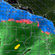
Hot and humid conditions will continue through Tuesday. Chances for showers and t-storms will increase as a cold front approaches on Wednesday. More comfortable warmth and humidity is expected late week.
Forecaster’s Discussion
Last Updated: 9:30am Thursday, July 26th 2019 by MP
Near Term (through tonight)
High pressure will provide mostly sunny skies today. 850mb temperatures around 12-13 C with deep mixing and light northwest downslope winds will support high temperatures closer to normal-in the middle 80s throughout much of the region. Humidity will still be relatively low, which will make for another beautiful mid-summer day.
Tonight, will remain mostly clear with light winds. This will result in more radiation cooling. Low temperatures are likely to in the mid 60s many of suburbs and in upper 60s to near 70 degrees in NYC and urban areas. Some of the far northern Interior valleys will likely drop into the upper 50s to lower 60s.
Hello
Wintry weather potential increases next week
Good evening and happy Friday! Conditions have improved substantially across much of the Northeast this Friday afternoon as a rather weak cold front cleared out any remaining cloudy & unsettled conditions.
Unsettled conditions exit Friday, calm and cool weekend ahead
Good evening! The beautiful spring-like conditions of the past two days have quickly come to an end, and have instead been replaced with a cool and rather unsettled pattern.
Updated: Mild and calm conditions turn unsettled later this week
Good evening! The short-lived, but intense blast of Arctic air last week is now all but a memory as an area of mid-level ridging continues to build over much of the East Coast.