-2")

Public Analysis: Dreary Pattern Finally Breaks, Heat Wave Next Week?
Good Evening!
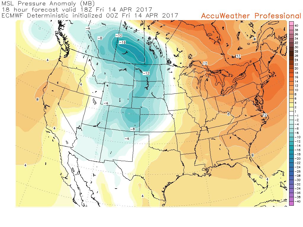
Today was a rather mild and mostly cloudy day across the area, but even this was a pretty sizable improvement compared to what the region saw yesterday when driving rains, cloudy skies, and well-below temperatures dominated the day. The pattern of a weak to moderately negative North Atlantic Oscillation that has been producing dreary conditions and below normal temperatures for the past few weeks will finally begin to break down in quite a big way. Over the next few days, a large upper level trough off of the west coast will replace the large-scale ridge that has almost been a semi-permanent feature this Spring, and as this trough begins to dig in and strengthen, there will likely be some rather significant ramifications for our weather this weekend and into next week.
While all of the models and the overall pattern shaping up in the atmosphere screams that it will indeed get quite warm over the next week, the ceiling for next weeks high temperatures could be quite high-and we may even be talking about a heatwave for portions of the Northeast when all is said and done!
——–
This Evening Into Thursday
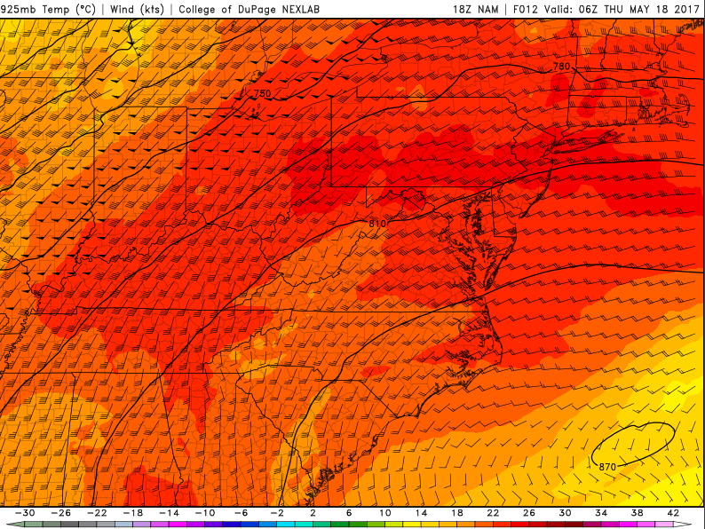
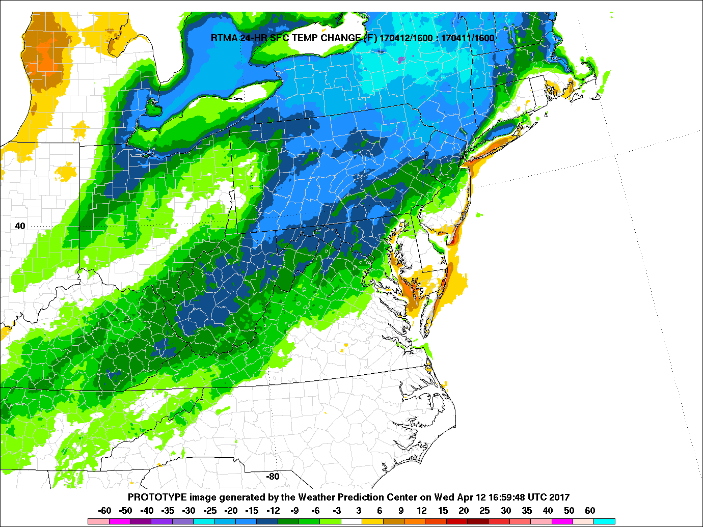
As mentioned above, today was still pretty mild and mostly cloudy by normal standards, but the pattern we have been locked in for the past four weeks or so now has been anything but normal. It may be hard to believe, but temperatures were actually a good 5-15 degrees above what they were yesterday at this time. Some cloudy conditions were observed over much of the area this afternoon as the pesky, lingering upper-level system that brought the heavy rain to the Northeast yesterday still meandered just to the south of the area. Even though there was sufficient energy still in the atmosphere, northerly winds ushered in dry air from Canada pretty much killed any chance of showers this afternoon, and it should remain this way throughout the rest of the day as winds from the north/north east continue. With breaks of sun and more dry air taking over the region, most locations across the entire area saw temperatures get into the upper 60’s and lowers 70’s, with some slightly cooler conditions for those along the coast and under more dense cloud cover.
As we head into the evening hours tonight, increasing dry air from the northeast/east and a weak area of high pressure will take over, which should allow for any lingering clouds to continue to dissipate at a rather steady pace. This will result in mainly clear conditions this evening, and when coupled with the dry air and light winds, radiational cooling will once again take shape this evening, allowing for any heat absorbed at the surface levels this afternoon to be quickly radiated back out into the atmosphere. This will ensure that temperatures once again drop down into the lower to middle 50’s across most of the region, with 40’s possible for some of the more rural sections of New York, Pennsylvania, and New Jersey.

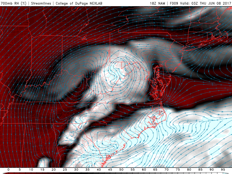
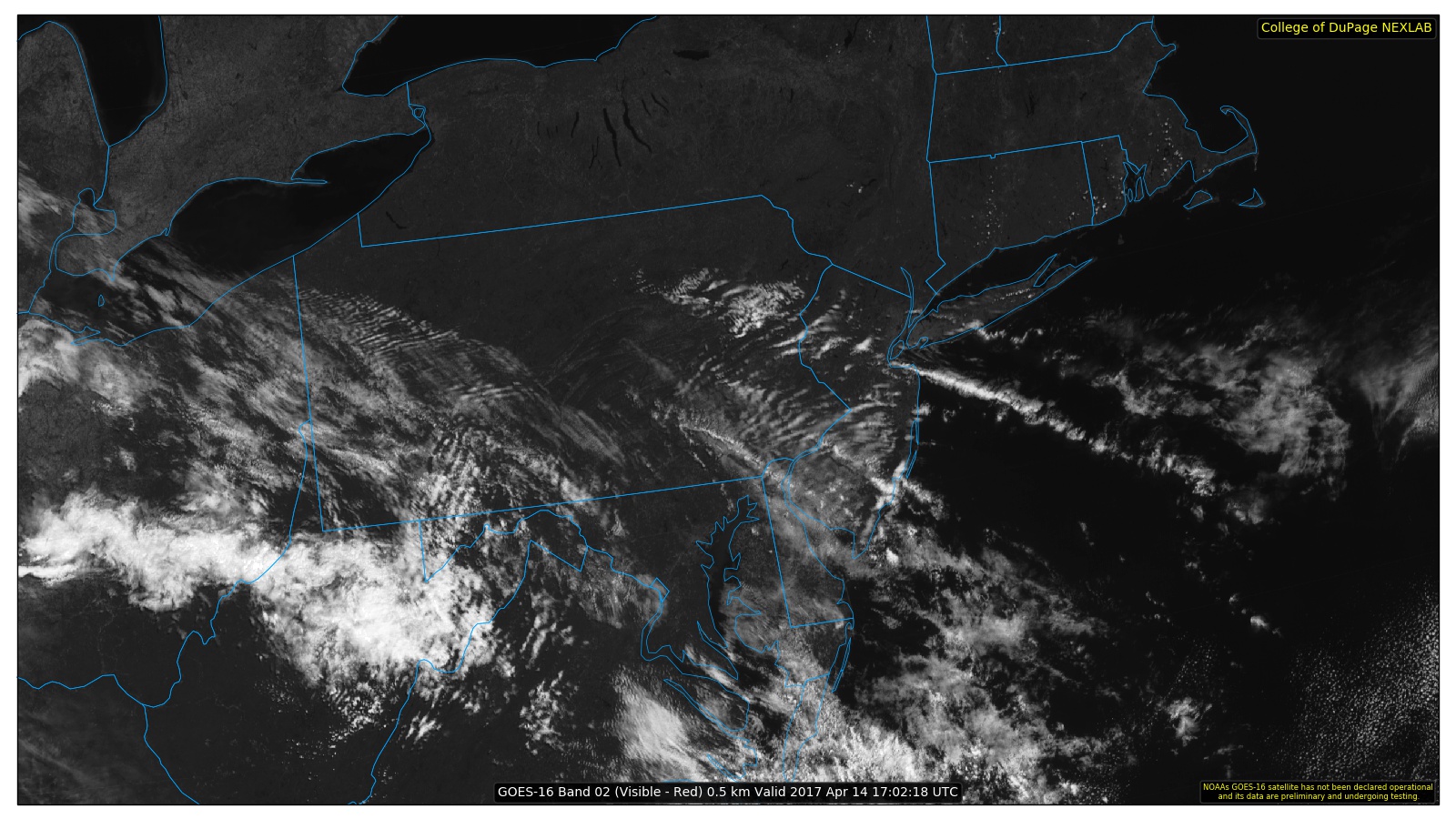
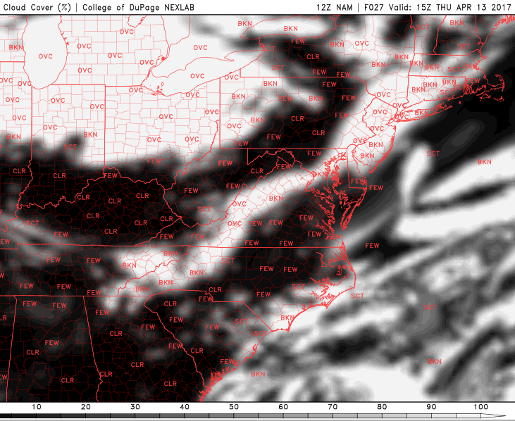
This evenings latest surface observations, visible satellite imagery, and regional radar mosaic, showing rather tranquil and cool conditions over the region (Courtesy of College of DuPage)
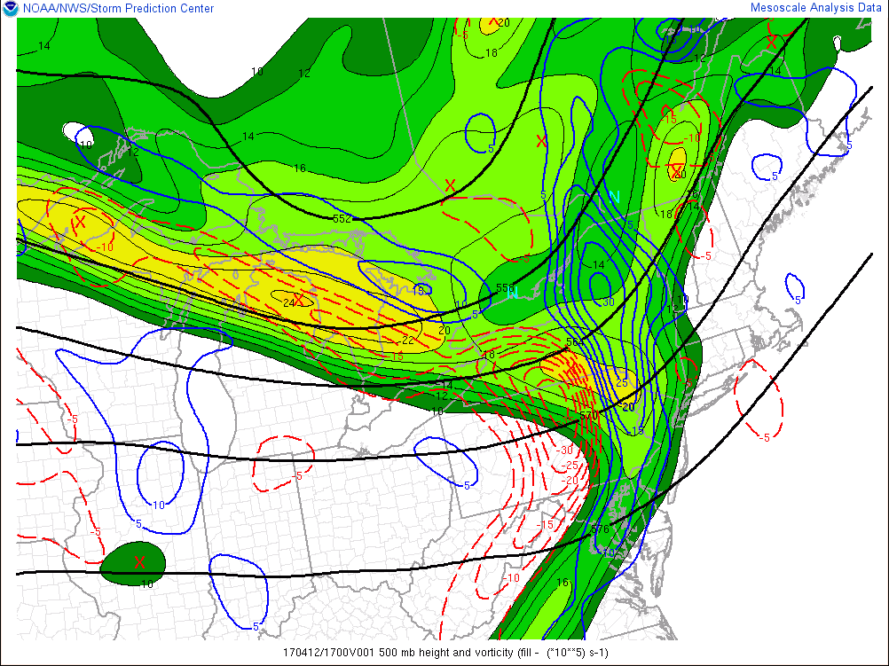
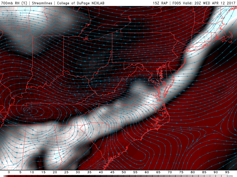
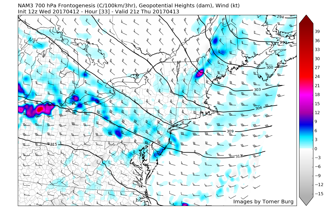
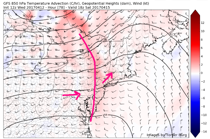
Tomorrow looks to be a rather close call for the area as only a few days ago, the computer models were showing that yet another system with the potential for heavy rain would impact the region. However, as of this afternoon the computer model guidance has backed off this idea significantly and now shows that any potential rain will mainly be located to the east of New York City and should not be all that impactful. This system is just another byproduct of the lingering upper level system over our area that will once again strengthen and in the process, drag energy along the base of the trough from the south.
This energy will then race off the east coast which should result in the development of an area of low pressure near North Carolina during the day tomorrow that will quickly race to the north and east, drawing close to the 40/70 benchmark by the evening hours. The good news about this storm system missing us to the east is that as all of the lift and rainfall heads off near the low pressure system, dry/sinking air will be present over western areas that will promote clear/clearing skies throughout the day.
Overall, tomorrow looks to start off rather clear, becoming cloudier with time from west to east. Additionally, any shower potential will be highest along far eastern portions of Long Island and Connecticut by the late evening hours. High should range in the lower to middle 70’s across the entire region, with the exception of eastern locations under the influence of clouds and potential showers.

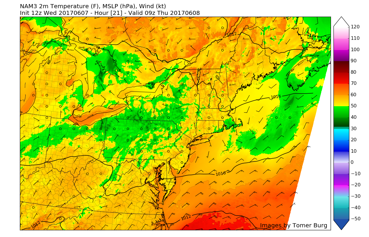
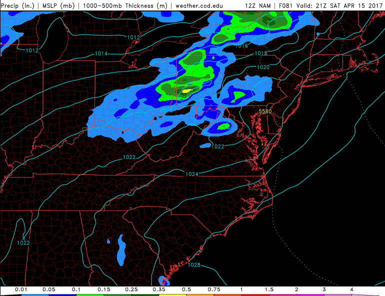
This evenings latest Rapid Precision Model showing the coastal low exiting well to the east of the area, with only the eastern fringes of Long Island and Connecticut seeing any impacts (Courtesy of WSI)
Friday and Saturday
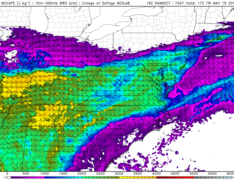
Any lingering showers and associated cloudiness with the area of low pressure moving to the east of our area will likely end early Friday morning, which should give way to clearing skies and light northwesterly winds by early afternoon. With clear skies early on and light winds, temperatures should be able to quickly rebound into the middle 70’s across much of the area, but we may see some cumulus clouds begin to develop as the afternoon marches on due to rather cool upper level temperatures that will provide rapid condensation as the warm air near the surface begins to lift in elevation (steep low level lapse rates). With some weak instability likely present during the day, we may actually see showers and possibly some thunderstorms develop to the west of the immediate NYC area and begin to travel east. While these showers and thunderstorms do not look like they will be widespread and or severe in nature, some storms may produce heavy downpours, gusty winds, and small hail.
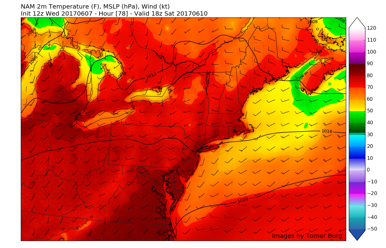
After this brief period of unstable weather, Saturday looks to be near-perfect with drier air feeding into the area, mostly sunny conditions and light winds will allow highs to climb into the low to mid 80’s on Saturday, with some slightly cooler temperatures to the east and along coastal locations.
Sunday and Beyond
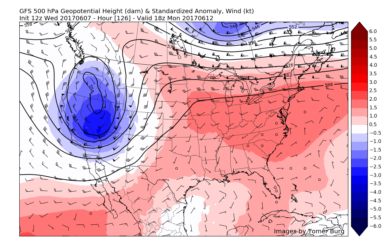
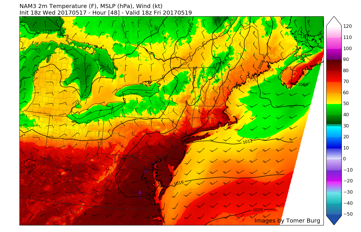
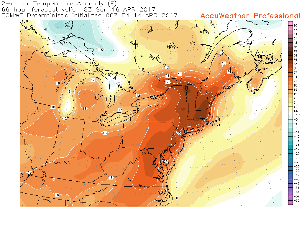
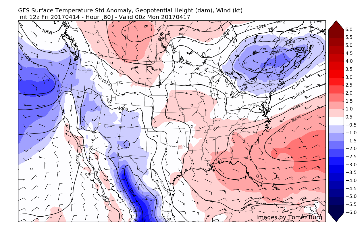
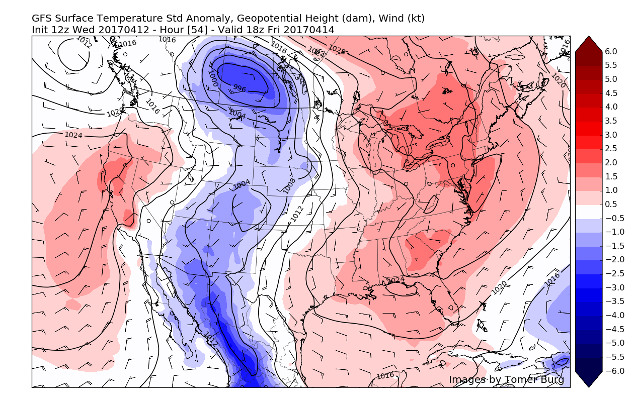
Well the heat certainly looks to begin to build during the later half of the weekend and this is the news that many people have been anxiously awaiting for weeks now. Finally, it does appear that starting on Sunday a large ridge of high pressure will begin to build over the eastern third of the nation and will work to usher in much warmer mid and low level temperatures from the south/southwest. Highs on Sunday may range anywhere from the middle 80’s to lower 90’s, but this may only be the beginning.
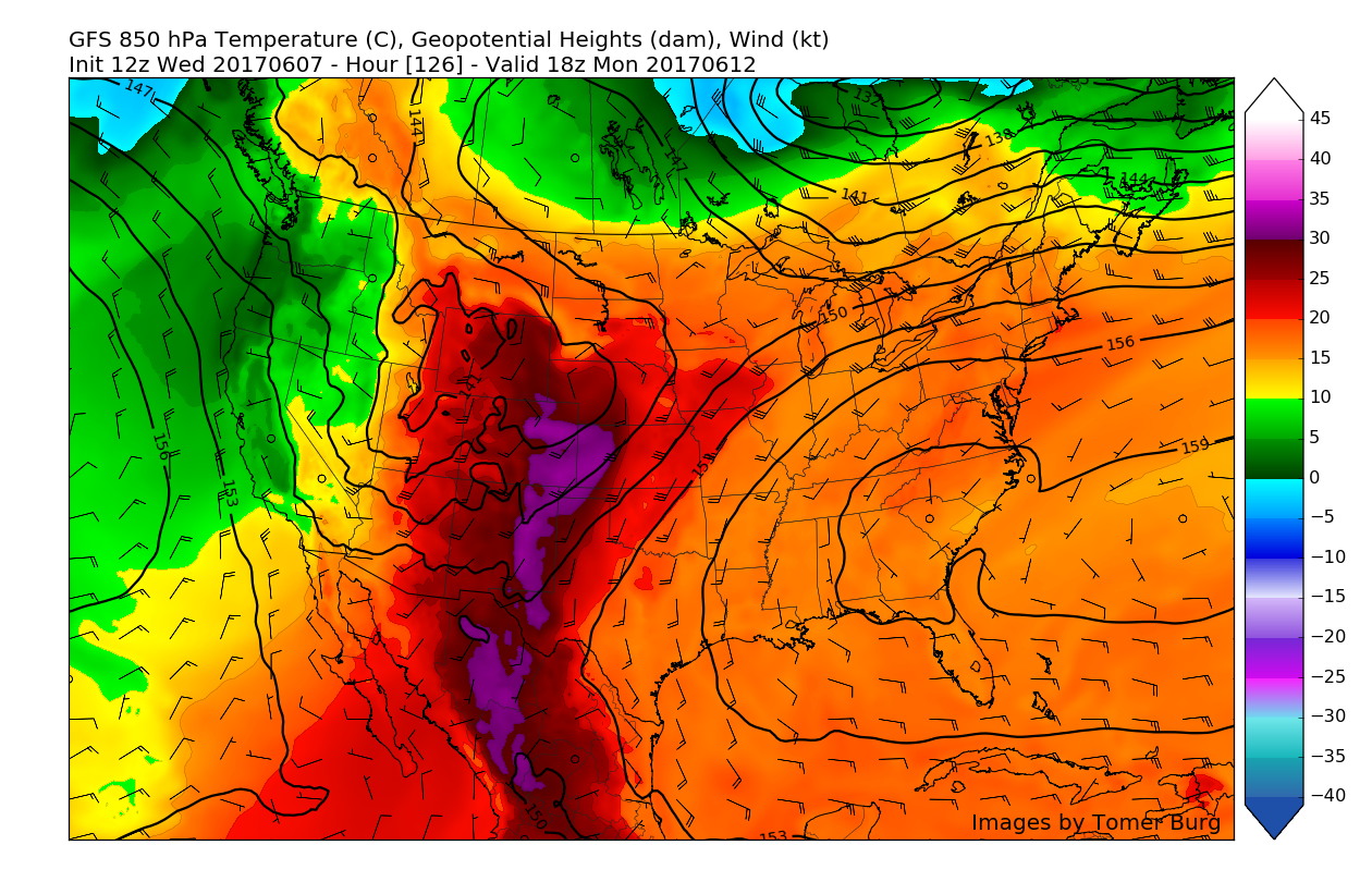
As the ridge continues to flex its muscles again on Monday, more favorable mid level temperatures could allow temperatures to increase in magnitude once again, with highs possibly approaching the mid 90’s! Some uncertainty begins to arise starting Tuesday, as some models have a weak disturbance cooling things down, and another group of models have Tuesday once again reaching into the 90’s-which would make for a heat wave.
On Sunday/Monday/(possibly) Tuesday, we may see heat indices well into the 90’s and possibly even approach the century mark in a few select spots, so make sure to stay tuned for further updates from our forecasters as well as any potential heat advisories/warnings from the National Weather Service!

For more information and posts like this one, make sure you sign up for Zone Forecasts — where multiple detailed articles, videos, and interactives are posted each day. Also, come interact with our staff and many other weather enthusiasts at 33andrain.com!
Have a great evening!
Steve Copertino


