-2")

Public Analysis: Much Cooler Today, Multiple Rain Threats Ahead
Good Afternoon!
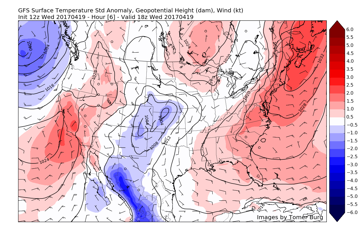
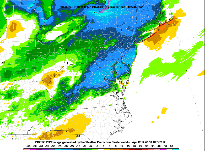
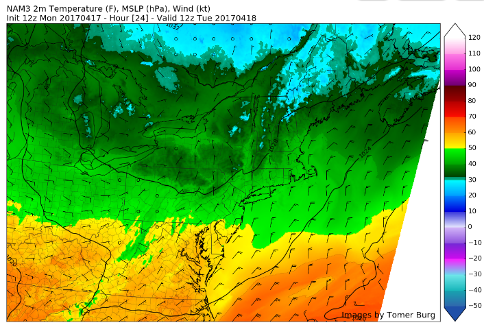
High pressure off of the Canadian maritimes has set up in the perfect position today to usher in cool winds from the Atlantic, keeping temperatures a good 10-12 degrees below what they were just 24 hours ago. In addition to the cooler winds from the southeast, clouds and even some light showers have been noted across the western portions of the area this afternoon. Back to the east, there have been some breaks in the clouds noted on visible satellite imagery over parts of New Jersey and New York. Even with these breaks in the cloud deck temperatures have not been able to get much higher than the low to mid 50’s, with temperatures in the 40’s being reported over portions of Long Island and Connecticut.
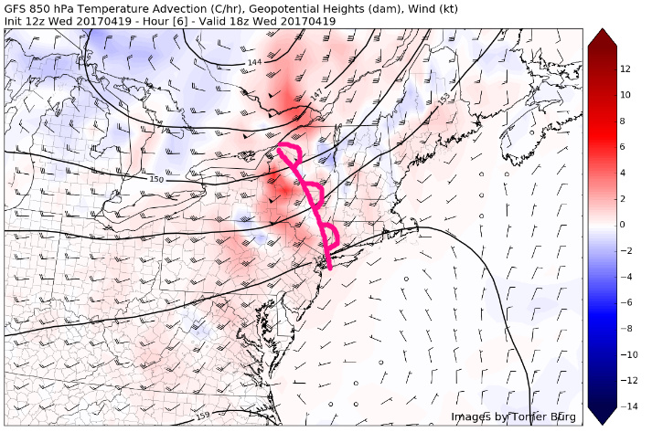
Cloudy skies and cooler temperatures should continue to be the theme for the rest of today as a mid-level warm front begins to approach from the west later this afternoon and into the evening hours. This front will bring increasingly cloudy skies and even the threat of some showers later this evening as available moisture begins to increase in conjunction with the passing of this front.
As the evening progresses onwards, a very weak cold front associated with a disturbance in Canada will pass through the region and bring yet another chance at some more showers as lift with this system is only slightly stronger than the warm front that preceded it. Overall, it should be a rather raw and dreary afternoon and evening as temperatures remain pretty much capped off in the 40’s to low 50’s across the entire area.

Latest visible satellite imagery, surface temperatures, and regional radar mosaic showing a relatively cool Spring day (Courtesy of GREarth)
Thursday into Friday Afternoon
Tomorrow morning should start off with some broken clouds across the metro area as weak upper level energy riding up and over an area of high pressure. At this time it seems that any shower activity should remain quite limited, though some areas of drizzle may be possible along the coast early on in the morning. As tomorrow continues on, a surface warm front looks to move north through the region and provide a renewed chance at some more low to mid-level cloudiness as more warm/moist air begins to work its way in.
There are still some questions as to how much warming occurs tomorrow with the combination of some leftover southeasterly winds off of the Atlantic, as well as increasing cloudiness, but it does look like tomorrow will at least be a warmer day than today. Temperature should be able to rise into the mid to upper 60’s for locations away from the coast, but highs may struggle to get out of the 50’s for coastal sections of New Jersey, Long Island, and Connecticut. Some inland locations of New Jersey and Pennsylvania may have a chance at reaching the low 70’s, but this will be highly dependant on the aforementioned variables.
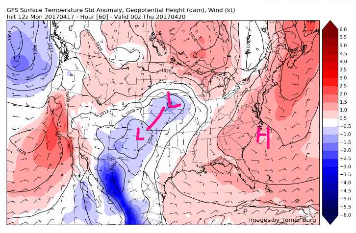
The area of low pressure that we mentioned back in Friday’s discussion will begin to track through the upper Great Lakes region late Thursday afternoon and evening, and this will bring yet another warm front for our area later in the evening. However, confidence decreases significantly as a high pressure system coming down from central Canada and stalling over portions of southeast Canada may work to stall this warm fronts progress. Where this warm front stalls will dictate where cooler temperatures setup Thursday night. Areas north of the front will see lows back into the 40’s and low 50’s. Areas to the south will see temperatures remain in the 50’s to possibly even low 60’s overnight as southerly flow increases.
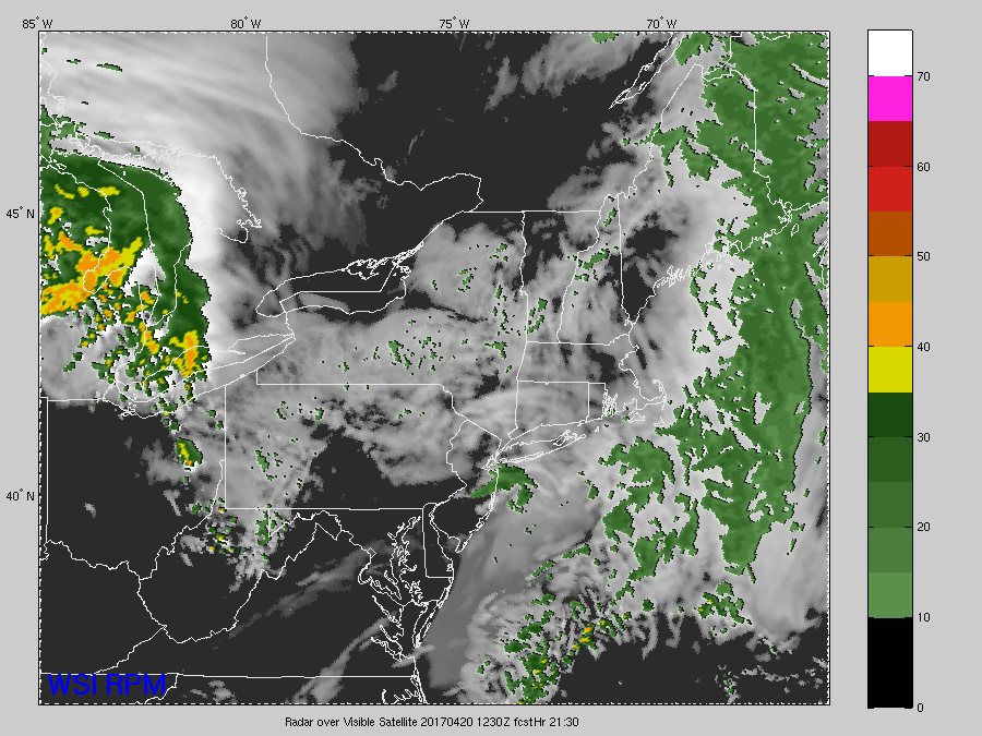
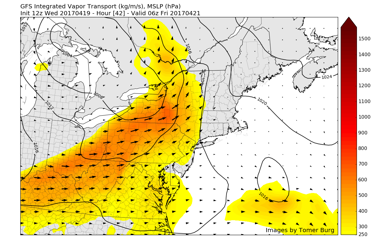
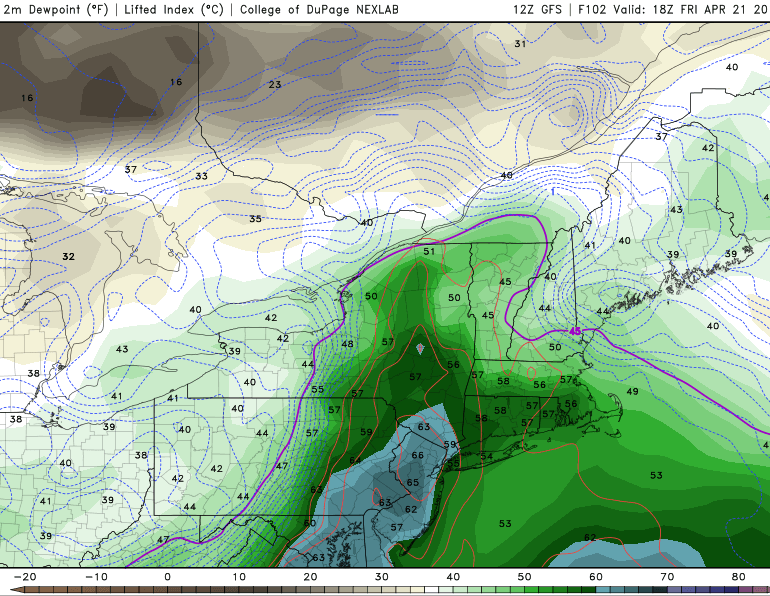
Unlike the warm front passing through this evening, the front tomorrow night and into Friday morning should have enough moisture and dynamics associated with the area of low pressure passing to our north to provide a decent chance at some showers and even thunderstorms. With limited instability, a strong low level flow, and deep moisture transport, it appears that there will be a chance at some convection possibly developing during the evening hours. The main threat with these storms appears to be locally heavy rainfall and possibly some flooding for areas with poor drainage, so make sure to stay up to date on these possible storms over the next 24 hours.

15z Rapid Precession Model showing some heavy showers and thunderstorms developing from west to east on Thursday evening and into Friday (Courtesy of WSI)
Friday Evening and Beyond
Finally, a cold front, will come through later Friday afternoon and evening. But any more showers will be more widely scattered with less lift and instability along and ahead of this front. Skies will finally clear later Friday night and Saturday, as weak high pressure build into the Northeast, behind this storm system. Sunshine with northwest downslope winds on will help temperatures rise into back into the lower to middle 60s on Saturday afternoon.
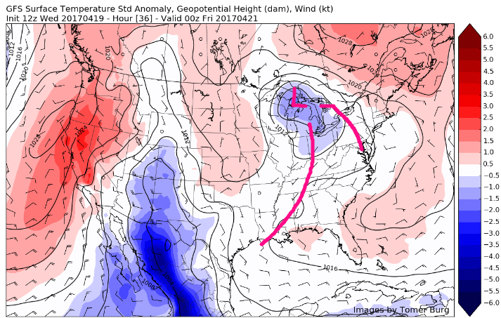
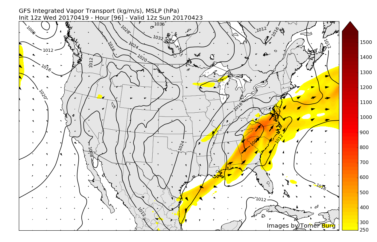
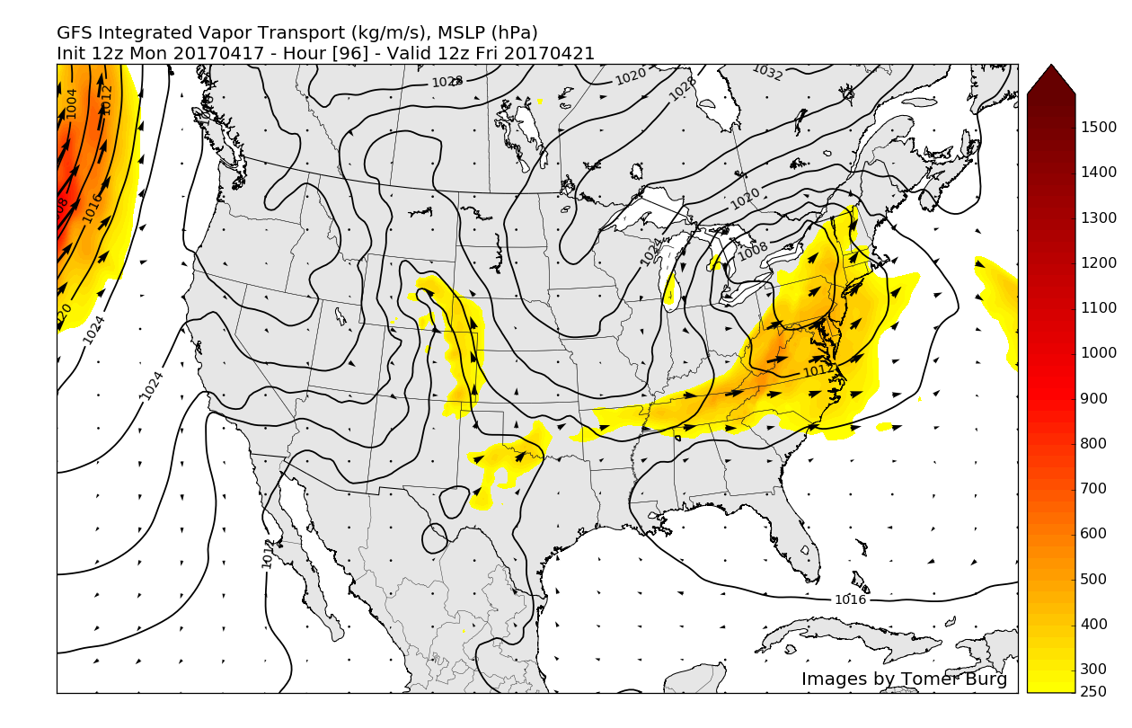
As we continue onwards, the active pattern looks to continue as the computer models are keying in on the potential for a storm system to approach from the southwest on Saturday evening, however they diverge significantly on the strength and timing of this system. As of this afternoon it appears that at least moderate rain appears likely as this system tracks to our south, and then stalls off the Mid Atlantic coast on Sunday.
It is worth noting that this system will be moving across the southern Plains and will have time to take in a considerable amount of water vapor before it reaches our area and it is also important to mention that with a considerable amount of time left in this forecast, there is the potential that this system could trend stronger when it passes to our south as well as potentially stall closer to the coast than what some of the models currently have. This would possibly bring a more significant system for our area on Sunday and possibly into Monday, with heavy rain and even some strong winds possible for the coast.

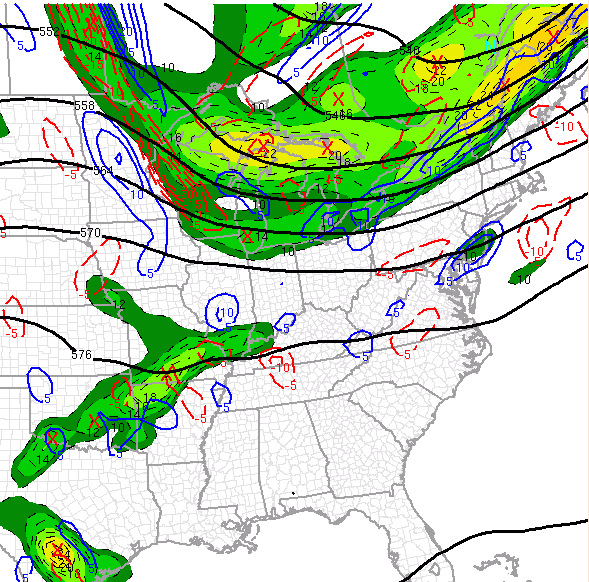
12z European model showing an area of low pressure over the Southeast US states potentially bringing the threat of moderate rains later this weekend (Courtesy of Accuweather Pro)
Make sure to stay tuned over the next few days for updates on the potential storms tomorrow evening, and our next storm chance this weekend!
For more information and posts like this one, make sure you sign up for Zone Forecasts — where multiple detailed articles, videos, and interactives are posted each day. Also, come interact with our staff and many other weather enthusiasts at 33andrain.com!
Have a great evening!
Steve Copertino


