-2")
Snow passes to the south Sunday, cold and calm next week
Good afternoon!
———————–
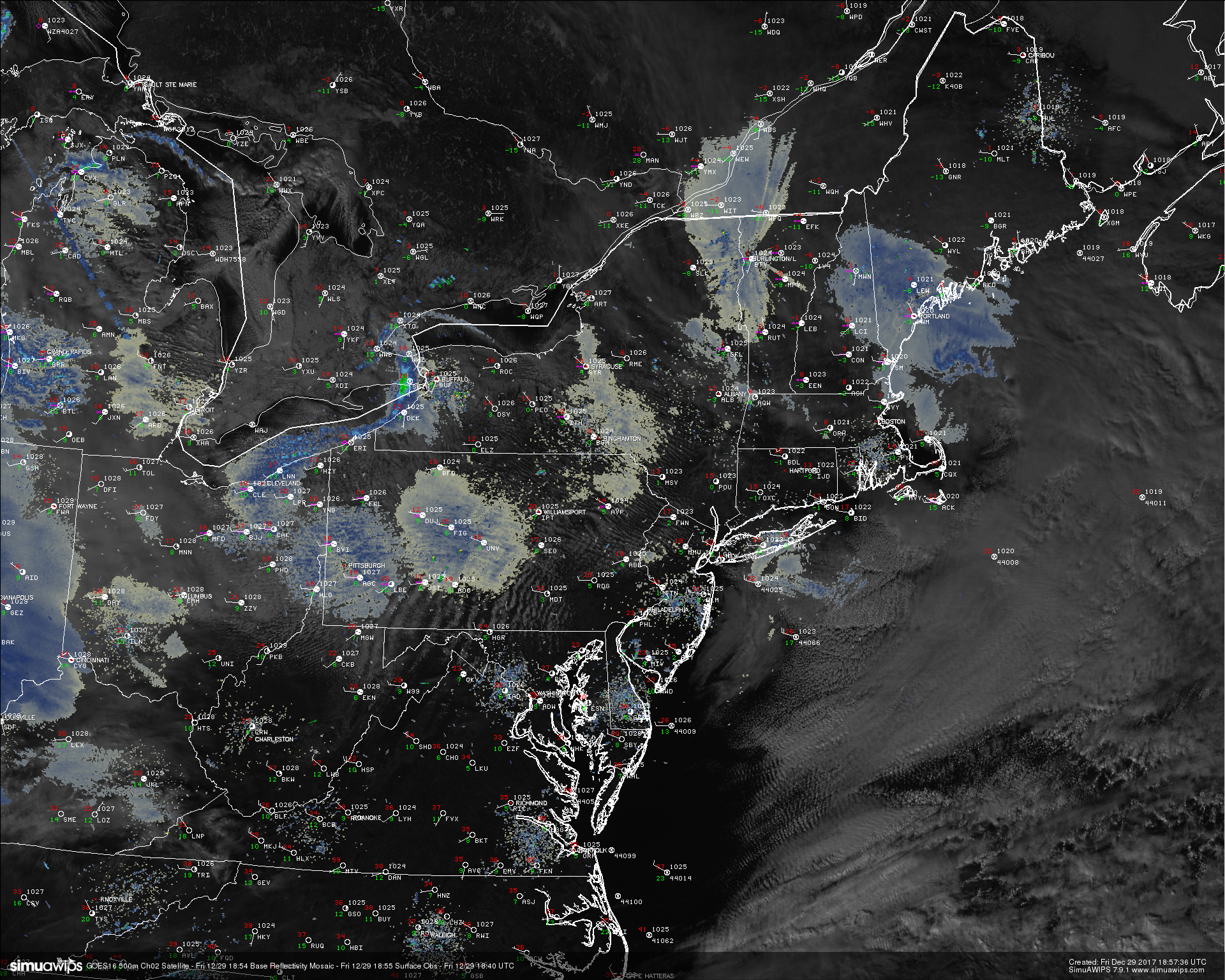
Things have once again turned quite calm over much of the Northeast today after a weak upper level disturbance moved through last night and produced some light snow well to the north and west of the New York City metro. Strong northwesterly flow behind this system has cleared out remaining moisture in the atmosphere and has replaced it with cold, dry Arctic air. Despite the cold mid level temperatures, clear skies have allowed for temperatures to rise into the middle to upper 30’s over much of the Northeast, with lower 40’s showing up in the city and portions of southern New Jersey.
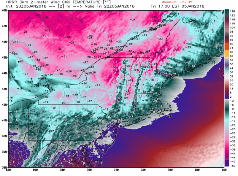
The remainder of this afternoon will feature much of the same, with mostly sunny skies and light winds. There may be a chance at some more isolated snow showers if you’re traveling to eastern Pennsylvania and southern New York, but these should be quite tame. As we head into the evening hours and overnight, yet another Arctic shortwave will be passing to our north, which will provide a fresh injection of very dry and very cold air. Additionally, an area of high pressure will be edging it’s way into the Ohio Valley and Northeast. Given the dry air, fresh cold mid to upper level, and light winds, we fully expect radiational cooling conditions to be near-ideal tonight. This should allow overnight lows to drop well into the 20’s and teens over much of the Northeast, with even some single-digit readings possible. If you’re heading out tonight, definitely bring a heavy coast as it will feel more like January than December!
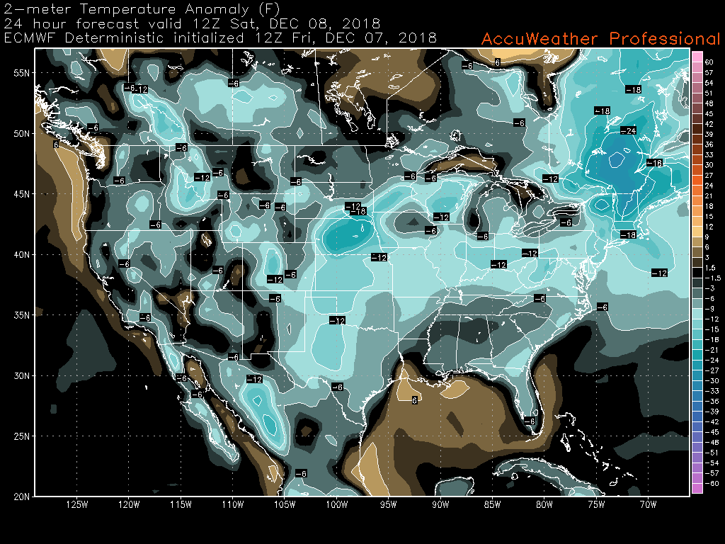
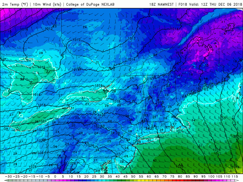
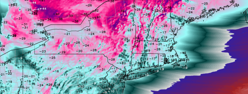
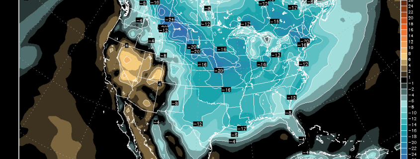
This afternoon’s ECMWF model showing surface temperatures 12-20 degrees below normal Saturday morning (AccuWx Pro)
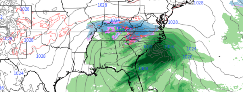
Snowstorm passes well to the south later this weekend
As we talked about back on Wednesday and earlier this week, the storm we have been watching for the better part of the last ten days now appears to slide well to the south of the Northeast during the day on Sunday and into Monday. The models have trended even stronger with the confluence over eastern Canada over the past couple of cycles, which has caused an even greater shift to the south.
It now appears that places like Washington DC are unlikely to see any meaningful precipitation from this storm, while locations in southern Virginia and North Carolina may face a very impactful winter storm, with substantial snowfall and dangerous ice accretion. As of this update, the National Weather Service is forecasting snowfall totals of up to 12-18″, with locations in the mountains of NC likely to see over two feet of snow by Monday. Those who live in this region should be prepared to have normal operations and routines severely disrupted at least through Monday night-if not longer.
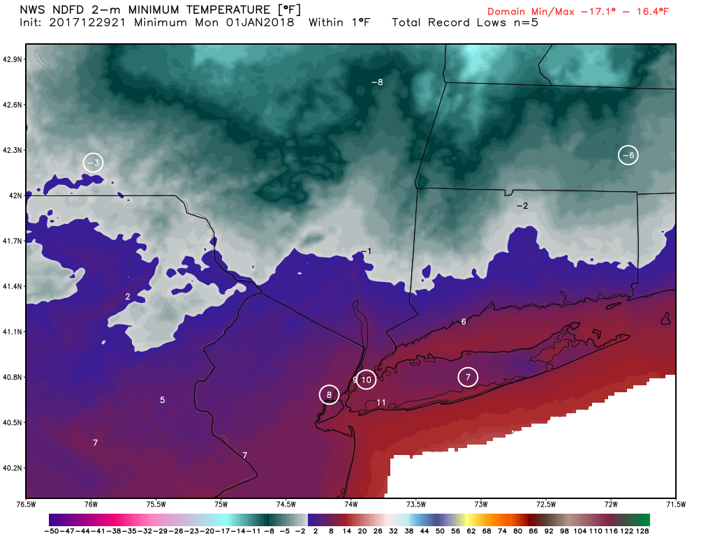
Back up north in our neck of the woods, Sunday should remain cold and clear, with a chance of increasing clouds towards sunset. Both Saturday and Sunday should feature highs in the middle to upper 30’s, with lows well into the 20’s. Locations well to the north and west should even be able to dip back down into the teens Saturday night.
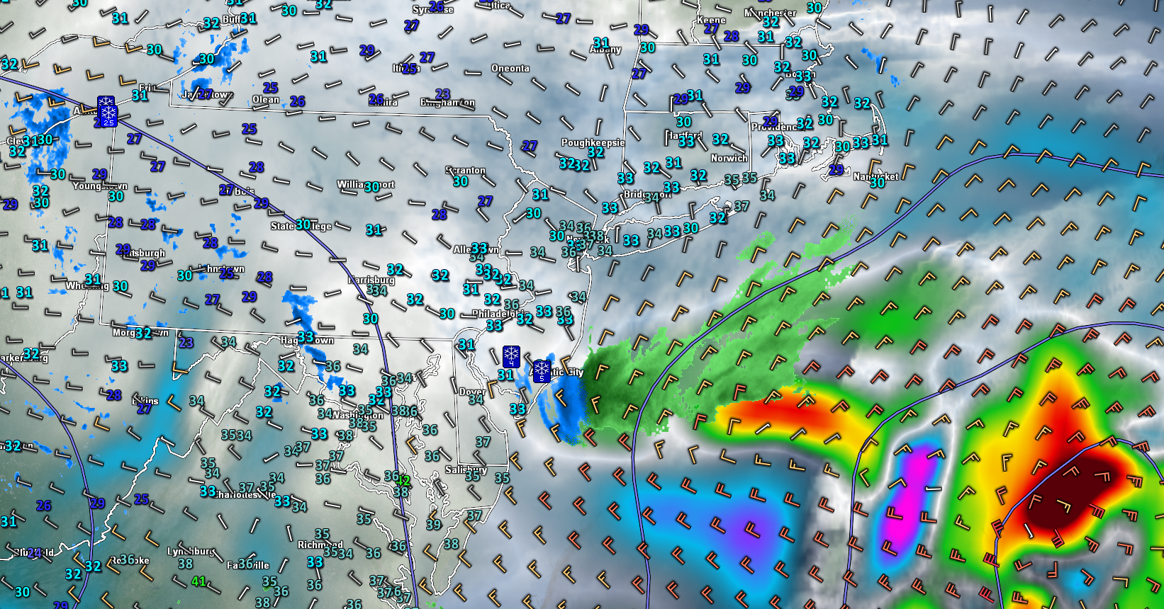
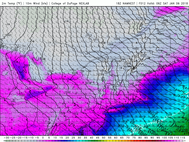
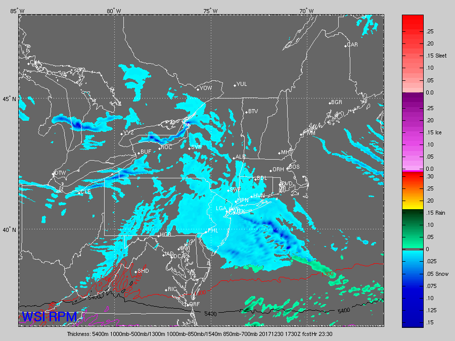
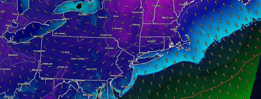
Loop of this afternoons 3km NAM model showing the significant storm passing well to the south of the region this weekend. Heavy snow will be likely for portions of the Mid-Atlantic and Southeast
Quiet conditions and below normal temps persist into next weekend
After this weekend’s storm exits off the Southeast coast Monday night, we should see very quiet and cool conditions for the majority of the next week. Temperatures will likely remain 5-15 degrees below normal along the east through Wednesday, with lows sticking well-below freezing for the Northeast.
However, by the time we get to around Wednesday/Thursday, a large and energetic upper level disturbance will be moving into the Rocky Mountains. This upper level disturbance could be our next shot at some precipitation by the time we get to next weekend. At this time the models are showing an area of low pressure developing over the Midwest, which would bring a significant amount of moisture and warmer air up through the southern states and eventually into the Northeast. This would likely result in an increased chance for rain for the NYC area next weekend, but we’ll certainly be keeping an eye on this potential system during the course of next week.
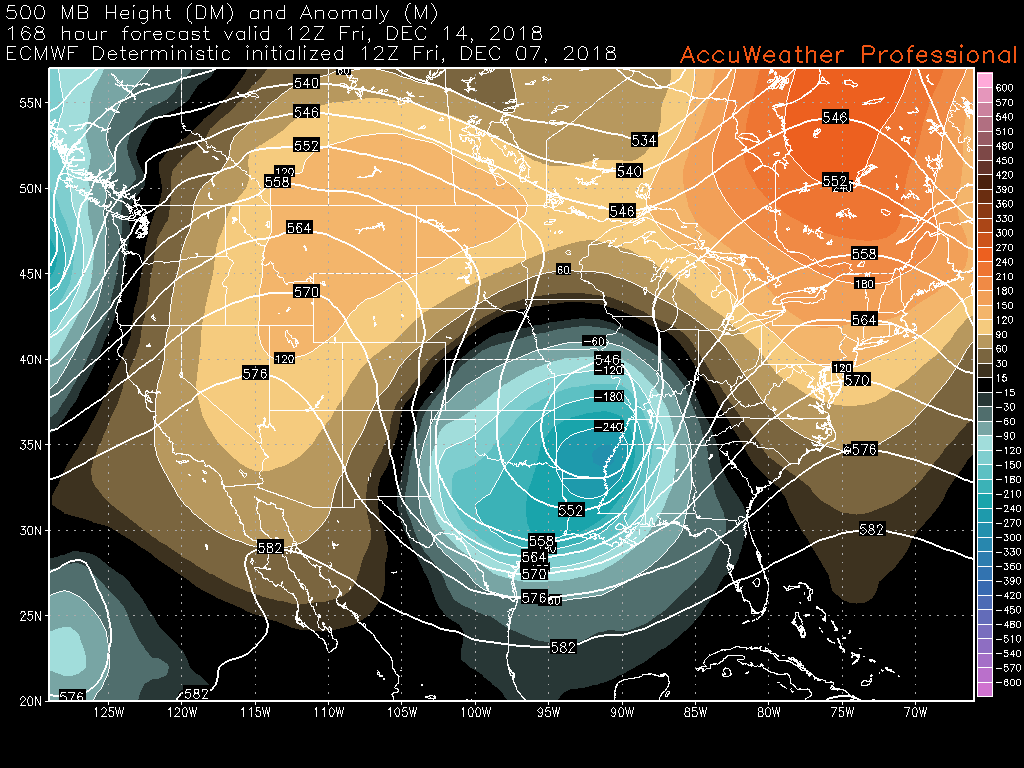
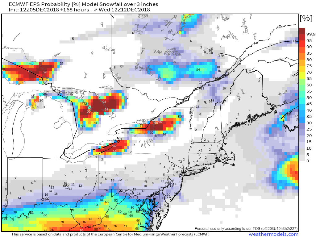
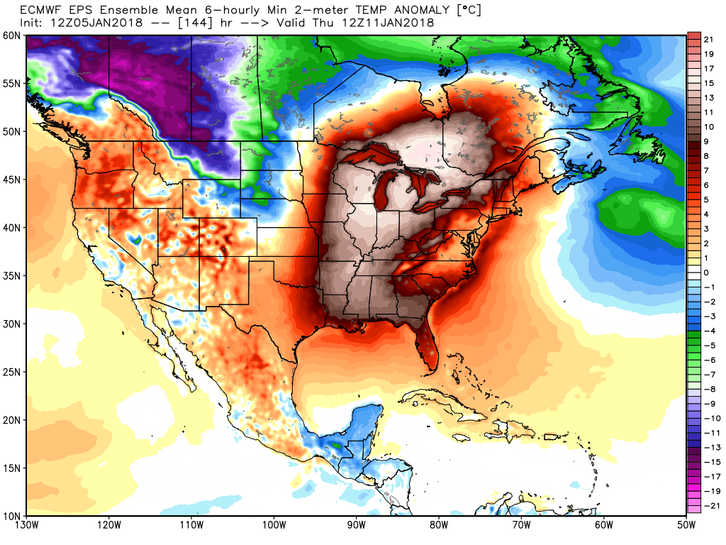
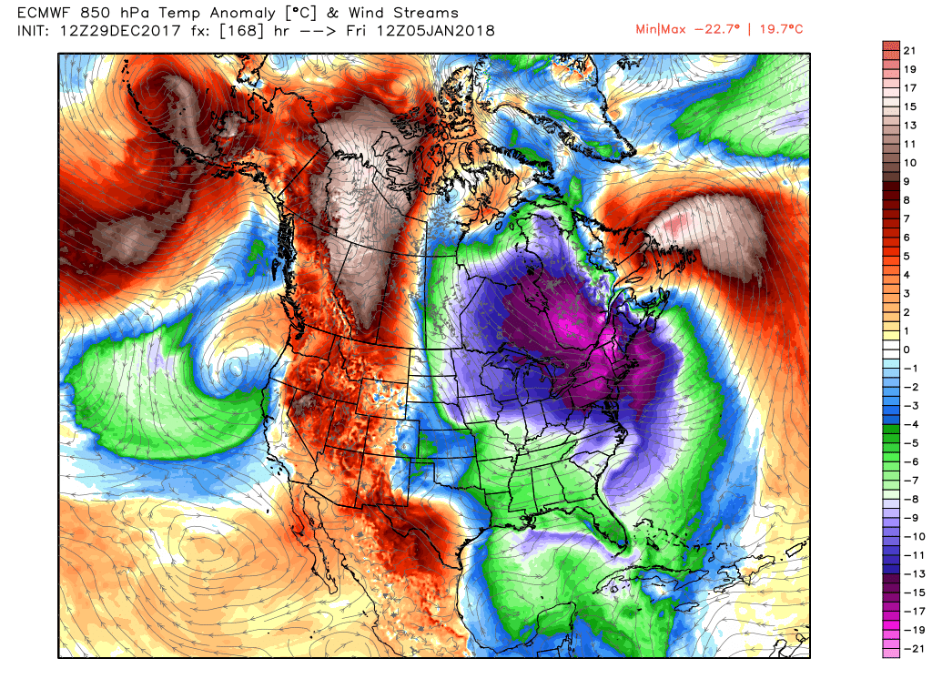
500mb height anomalies from this afternoons ECMWF model showing an unusually deep closed upper level low over the south, with an area of ridging over the East.
Have a great weekend!
Steven Copertino