-2")

Public Analysis: Oppressive Early Week Heat Wave, Relief Coming?
Good Evening!
As promised, yesterday and today have been the exact opposite of last week, with highs well into the 90’s for most locations and rather dry conditions. This heat looks to continue for another day or so, but we may have to deal with some strong thunderstorms tomorrow afternoon across portions of the area. Afterwards, a cold front looks to move through and bring in a much cooler Canadian/maritime airmass towards Wed/Thursday. In the longer range there are some indication that we may once again return to warmer weather, with highs at least in the upper 80’s to lower 90’s by next week, but the computer model guidance this afternoon is diverging on whether or not this next bout of heat will be here to stay, or will be a one or two day event.
———
This Evening
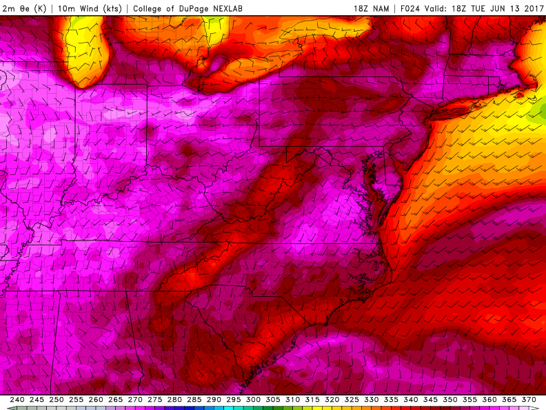
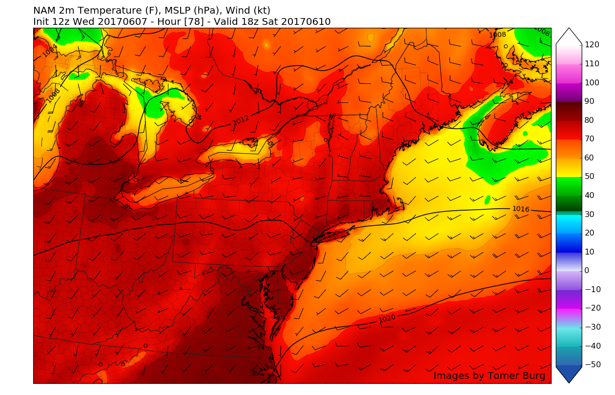
The large ridge of high pressure that was forecast to move over the eastern two thirds of the nation has done just that over the past two days, and it has led to quite the temperature surge over our area. With winds out of the southwest this afternoon and abundant sunshine, we saw highs soar into the low to middle 90’s, with some locations getting all the way up to the upper 90’s. Combined with some modest low level moisture, today definitely had a muggy feel to it, making it rather hard to spend prolonged periods of time outside. In fact the NWS in Upton has issued a Heat Advisory, with the new criteria being “A Heat Advisory is issued when the combination of heat and humidity is expected to make it feel like it is at least 95 degrees for two consecutive days…or 100 degrees for any length of time.”
This evening should continue to be rather hot, with more breezy conditions developing later in the day, in addition to some increase in clouds, but really not enough to make all that much of an impact on the temperatures. As stated, with skies being quite clear, light winds after dark, and an area of high pressure located to our south, conditions should be favorable for some radiational cooling to take place. This will allow lows to drop around 20-25 degrees, into the upper 60’s and lower 70’s for most of the area, with coastal locations getting a few degrees lower.

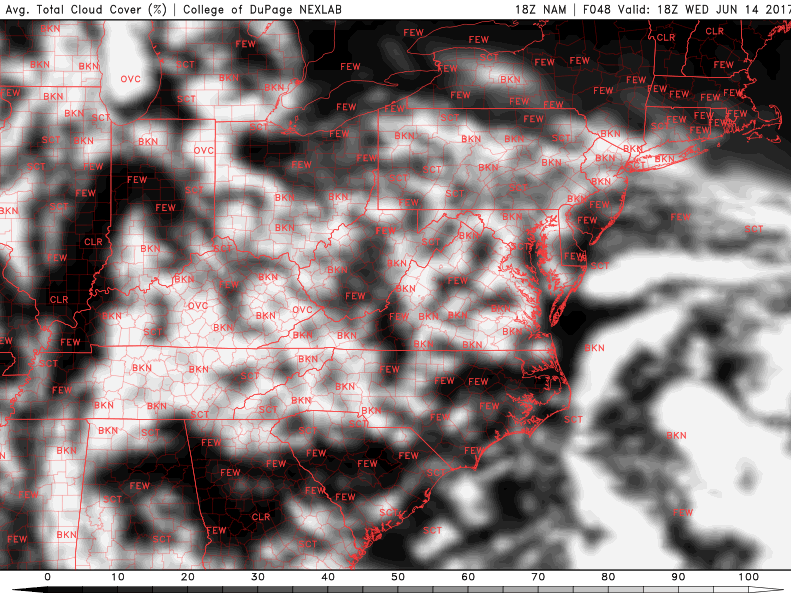
This afternoons latest super high resolution satellite imagery from the GOES-16 Satellite, regional radar mosaic, and surface temperatures showing a rather hot, but start to the work week
Tomorrow Into Tomorrow Evening
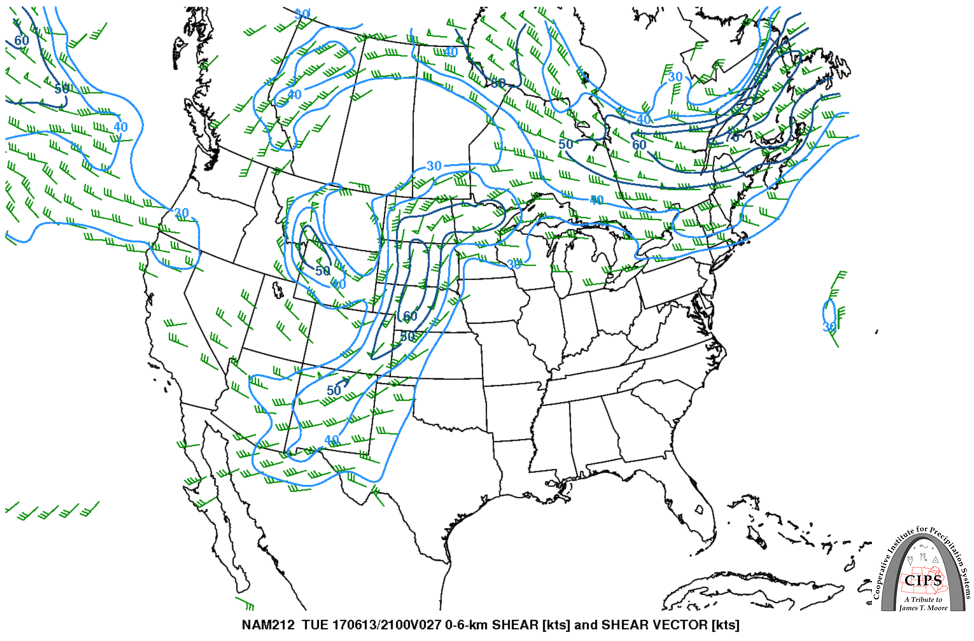
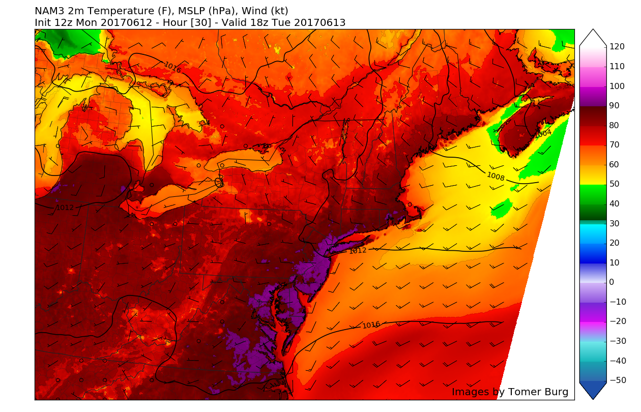
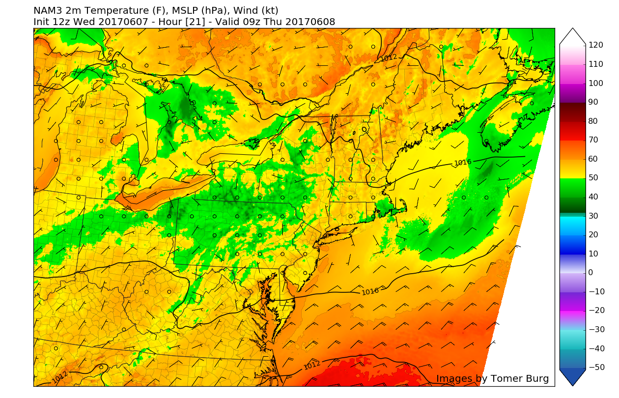
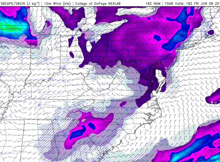
Tomorrow will likely be just as warm, or possibly even a degree or two warmer in some locations as very warm temperatures aloft and southerly/southwesterly winds continue to feed into the area. Tomorrow morning will likely start off quite clear across the area, so temperatures should rise very rapidly as the sun angle increases throughout the early morning and into the afternoon hours. As the afternoon continues on, a cold front will be moving southward across the area and moving into a rather unstable airmass juxtaposed over the region. This cold front will act as a “trigger” and should begin to ignite at least scattered thunderstorms over portions of New York, Pennsylvania, and Connecticut.
While there does appear to be adequate instability for some strong to possibly severe thunderstorms, weak wind shear will prevent any widespread severe thunderstorms from developing, at least south of the New York City area. Additionally, the weaker shear will promote very slow storm motions, so the main hazards with any storms tomorrow appear to be gusty winds, frequent lightning, very heavy rainfall, and possibly some isolated large hail in the strongest of storms.
Otherwise, tomorrow looks to be on track for widespread 90 degree readings over much of the area. Heat indices look to also look to be in the middle to upper 90’s for locations removed from the coasts, so make sure to have plenty of water and take breaks if you are spending prolonged periods of time outside tomorrow! As we head into the evening hours, shower and thunderstorm activity should gradually progress east/southeast and weaken over time as the cold front begins to overtake the area. This will provide cooler temps tomorrow evening and increasing winds from the west/northwest.

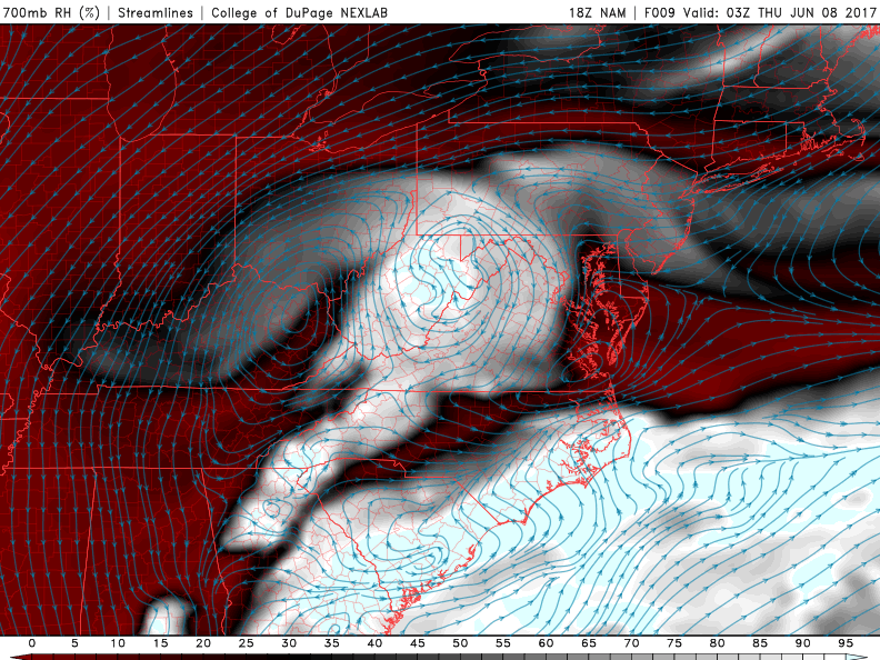
This afternoons Rapid Precision Model showing strong to possibly severe thunderstorms developing tomorrow afternoon due to moderate instability and weak wind shear (Courtesy of WSI)
Wednesday and Beyond
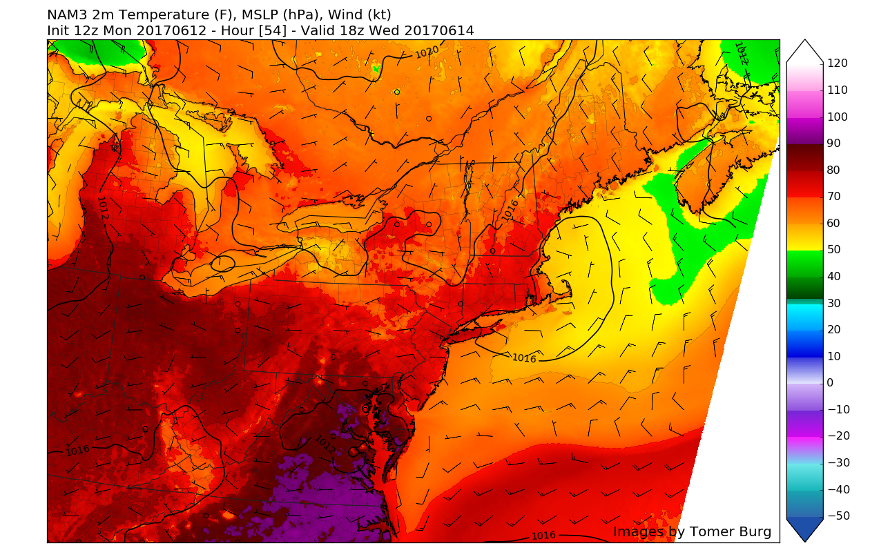
As the cold front begins to push offshore early Wednesday morning, anticyclonic flow will become established over portions of New England that should begin to send winds in from the east over our area. These easterly winds in conjunction with a more moderate Canadian airmass will make for a much more bearable day on Wednesday, with highs likely reaching into the low to mid 80, with broken clouds with some sun peaking through at times.
Thursday should be even cooler than Wednesday as the anticyclone/high pressure area off of Cape Cod really digs in during the day. This will enhance easterly winds over the area, which likely be running into more moist low level air that should promote increased cloudiness and even some patchy shower development during the late morning and into the afternoon hours.
Friday looks to feature the only real threat of rain this week as a weak upper level disturbance moves to the north of the area, and surface trough to our south may try to trigger some showers over the area, with seasonable temperatures expected during the day. As of right now, the heavy rainfall threat is low, though we will continue to provide updates during the week!

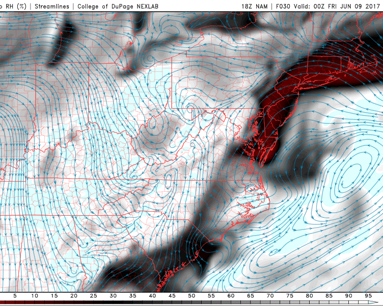
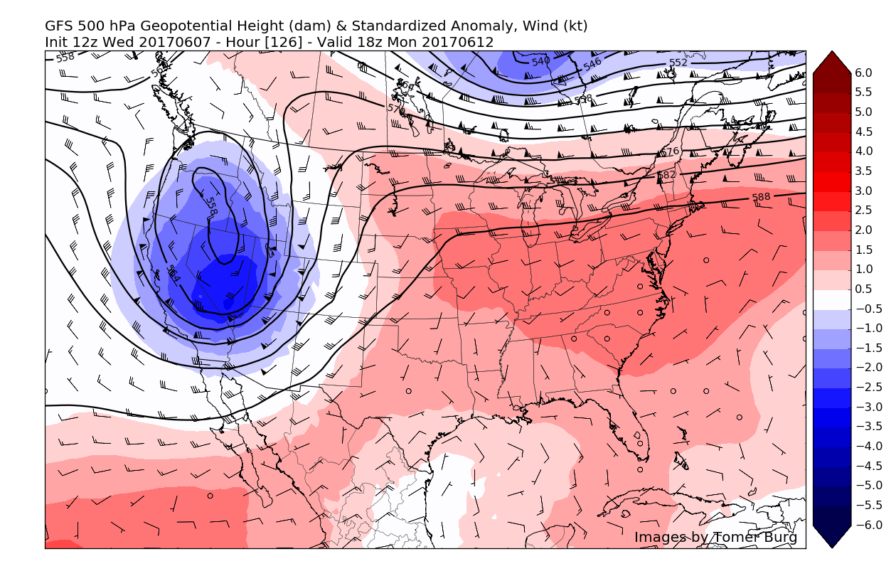
This afternoons European Ensembles Model blend showing the potential for warmer temperatures to once again return, though they may be rather brief this time around
For more information and posts like this one, make sure you sign up for Zone Forecasts — where multiple detailed articles, videos, and interactives are posted each day. Also, come interact with our staff and many other weather enthusiasts at 33andrain.com!
Have a great evening!
Steve Copertino


