-2")

Public Analysis: Oppressive Heat and Humidity, Strong Thunderstorm Threat Thursday and Friday
Good Evening!
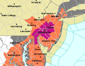
As we stated earlier this week, conditions were once again going to become unstable as a deep tropical airmass works its way over the region over the next few days. This was quite noticeable today as dew points rose into the uncomfortable (66-70) and oppressive (71-75) degree ranges! Coupled with highs in the mid to upper 80’s, heat indices were able to climb into the middle 90’s in some locations, promoting the issuance of a Heat Advisory for counties in Pennsylvania, New Jersey, and New York-for now. A Heat Advisory is issued when the combination of heat and humidity is expected to make it feel like it is 95 to 99 degrees for two or more consecutive days, or 100 to 104 degrees for any length of time.-NWS
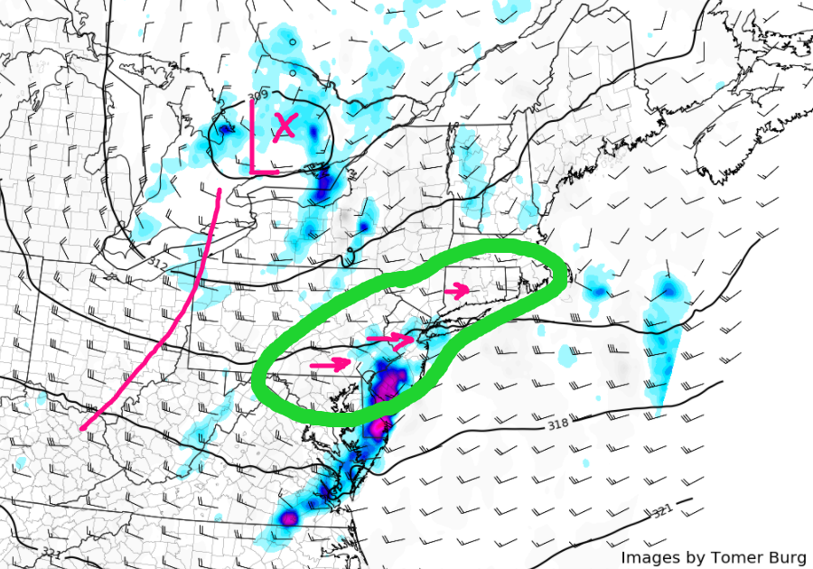
With this increased instability and plentiful moisture trapped in the atmosphere, all we needed today was a little daytime heating to really destabilize the atmosphere. The first in a series of quick-moving shortwaves in a general west to east flow was today’s trigger mechanism that set off numerous strong to severe thunderstorms over portions of southern New England, and even portions of Connecticut. These storms were mainly very heavy rain producers as the atmosphere did not have enough energy in place to keep the significant amount of moisture lofted within the low to mid levels of the atmosphere. As the updrafts that held all of this moisture began to collapse, they created very high rain rates, with some nearing close to 2″/hr! As the more robust updrafts quickly collapsed and the rain cooled air rushed to the ground, this created localized instances of wet microbursts, which were the cause of some tree damage in Connecticut.
As the forcing mechanism for this afternoon convective outbreak begins to quickly move off to our east, showers and thunderstorms should gradually sink further south and east with time. As they do so, they will also encounter a slightly less favorable environment needed to sustain themselves, however it would not be out of the realm of possibilities that a few more short-lived cells go up near sunset, capable of small hail, heavy downpours, and occasional lightning.
The rest of the evening will likely remain quite muggy, as the tropical-like airmass remains locked in place due to rather stout low level winds from the west/southwest. Lows this evening will be lucky to get down into the lower 70’s, so expect a rather muggy night ahead with a slight chance of some showers in the very early morning hours.

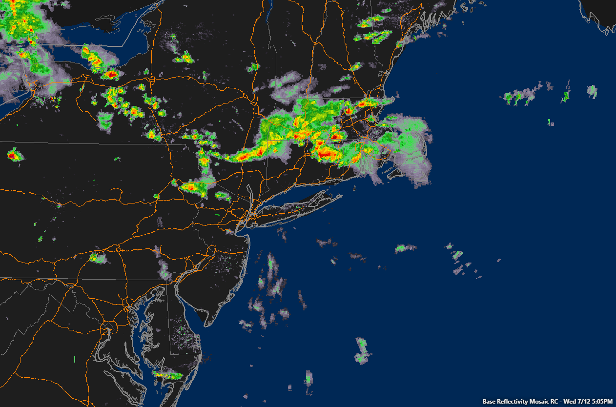
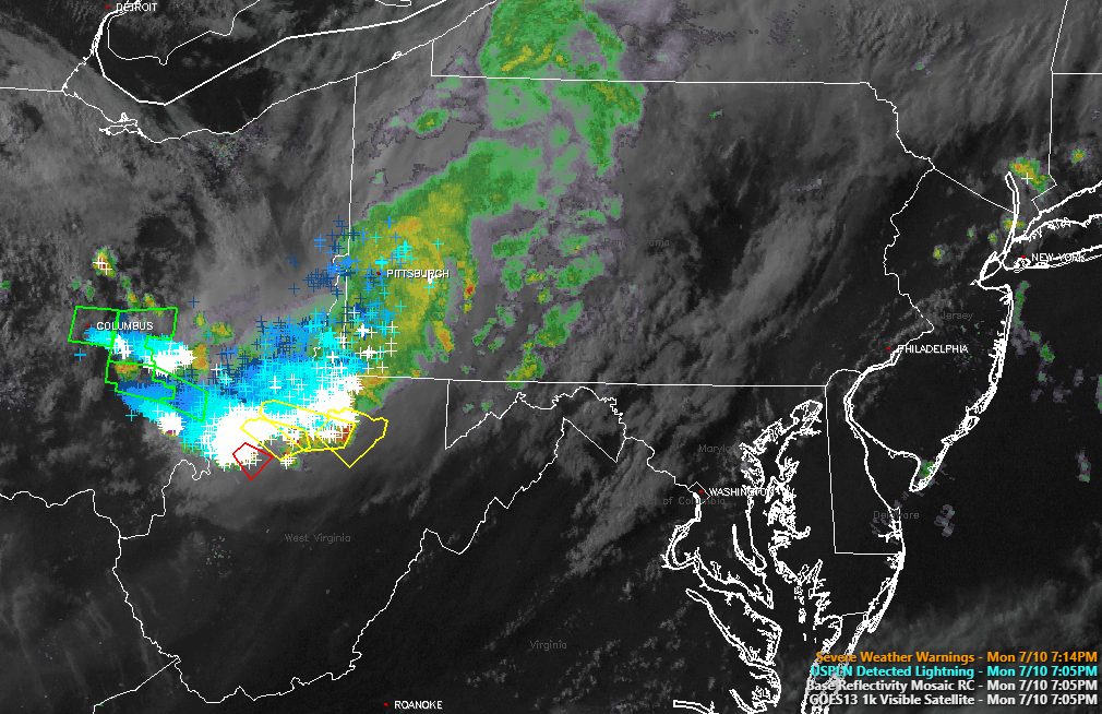
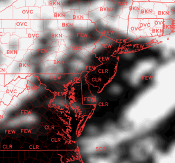
This evenings latest regional radar mosaic, regional surface observations, and high resolution visible satellite imagery, showing left-over showers and thunderstorms over the area gradually moving to the east/southeast (Courtesy of Simuawips.com)
Thursday Into Friday
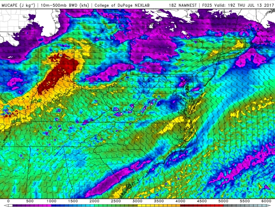
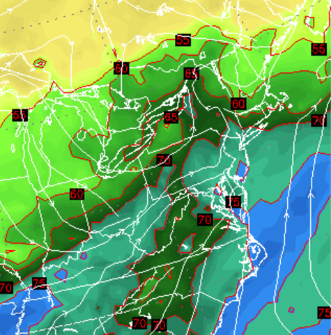
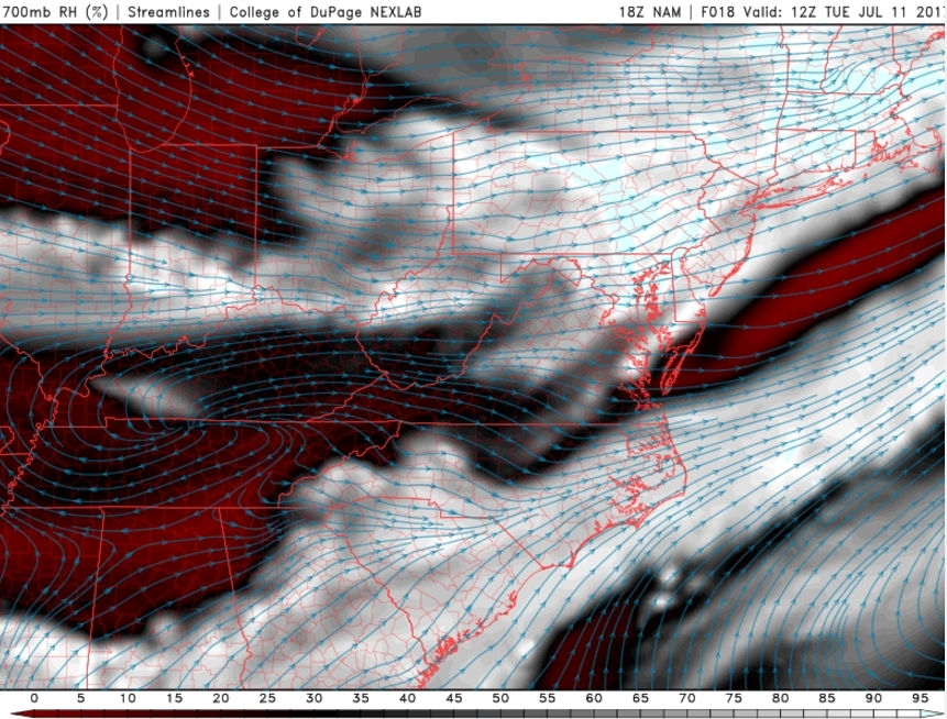
Thursday is likely to start off with a few broken or scattered clouds, with some “hazy” conditions likely as well. As the daytime heating gets off to a rather quick start tomorrow morning, temperatures will quickly shoot into the upper 80’s to lower 90’s once again, and when factoring in the very high dewpoints, conditions will become quite miserable in some locations. Heat indices may swell into the upper 90’s and even into the lower 100’s during the peak heating hours of the afternoon! As another in a series of mid level disturbances rushes over from the Great Lakes region, mid level shear ahead of this wave will begin to increase in earnest, creating a conducive initial environment for afternoon thunderstorms to fire in over the area.
While the initial setup of parameters over the area will be primed and ready for thunderstorm development by the afternoon, the main question is regarding the timing and location of the mid level disturbance that would be able to trigger thunderstorm development. What may wind up happening is that the initial thunderstorms may fire over portions of southern New England (like they have many times this year before) and then begin to sag southward along a frontal boundary to our north. The problem with this is that by the time that the showers and thunderstorms begin to propagate to the south, the best parameters over our area will begin to fade. This would mean that as any storms move south, they would gradually weaken with time, which would mitigate the overall severe threat. Regardless, the setup tomorrow looks to support at least torrential downpours, frequent lightning, gusty winds-with the potential for more damaging wind gusts and hail in the strongest cells.

This afternoons RPM model showing the progression of the frontal boundary tomorrow morning and through the afternoon hours (Courtesy of WSI)
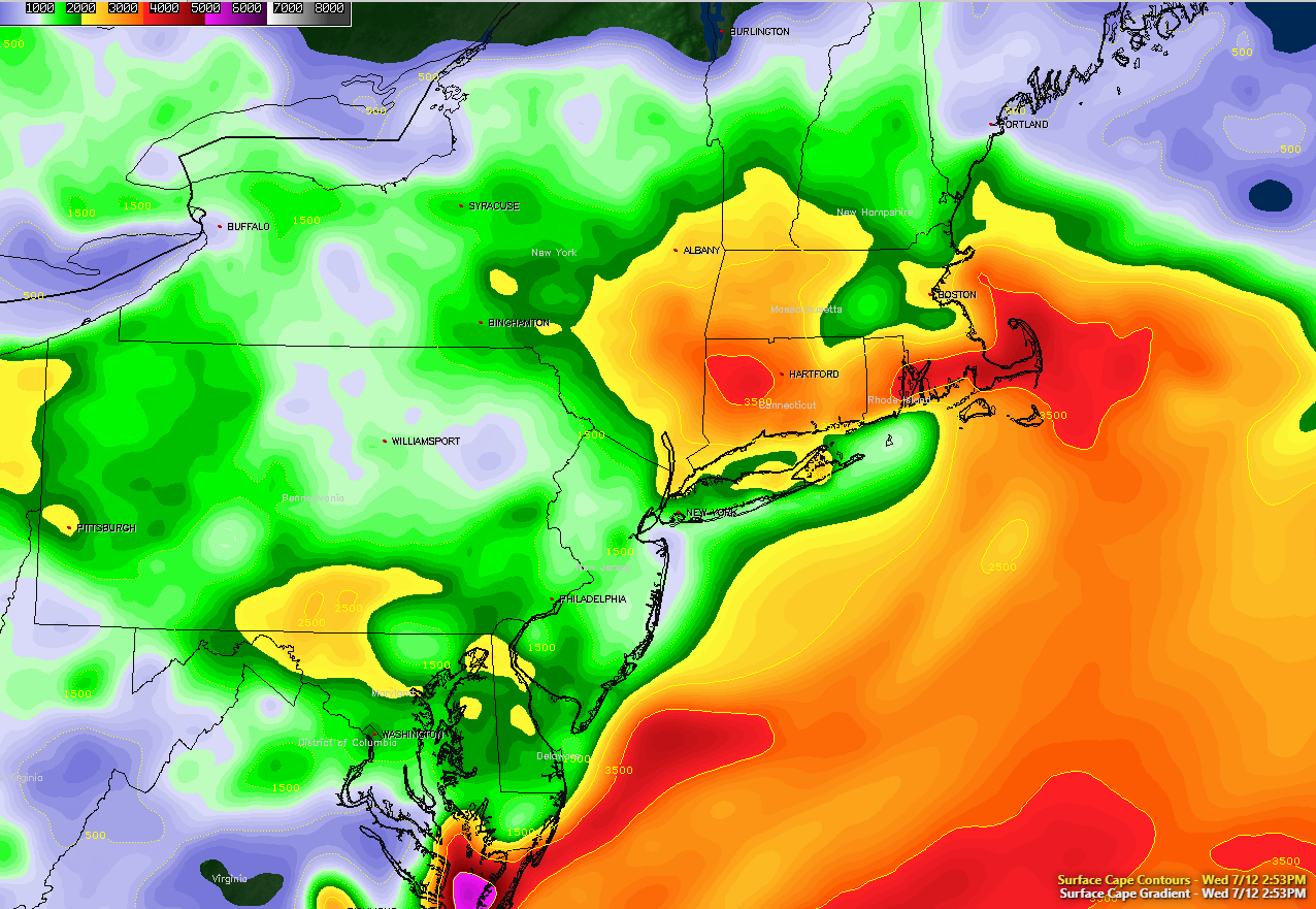
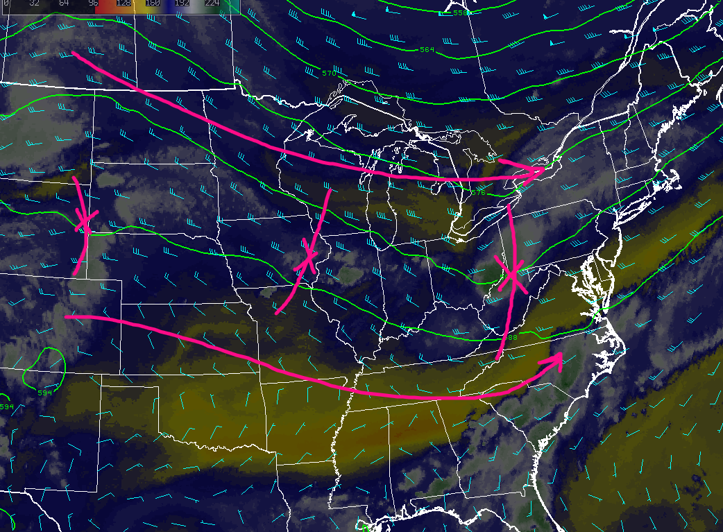
On Friday, a broad area of low pressure will begin to stretch over into our area, likely starting the day off with rather thick cloud cover and cooler temperatures. Though the model diverge on this quite significantly, there does appear to be a rather good chance that a frontal boundary will be stalled somewhere along the Metro area, or just to our north-which will dictate much of Friday’s weather. This stalled frontal boundary will act as a near-perfect source for lift, as deep low-level flow ushers in PWATS of around 2.25″-2.5″. Additionally, CAPE will also become quite plentiful due to this tropical airmass, and this instability will be met with increasing low to mid-level shear from the stalled frontal boundary. Due to the amount of dynamics riding on this frontal boundary, even a small deviation would be able to turn a potential severe weather event into a heavy rain/flooding threat with very little notice-or vice versa.
The first threat of thunderstorm development will likely be in the early afternoon hours, with the second, and more impactful taking place towards the late afternoon/early evening hours. Regardless, all modes of severe weather will be possible on Friday, with damaging wind gusts, large hail, and even an isolated tornado being quite possible. Very heavy rain will also be a large concern as the atmosphere will be “water logged”-for the lack of a better term. Both time frames will likely need adjusting over the next 36 hours or so, so make to stay up to date with our daily updates.

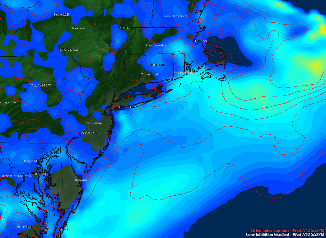
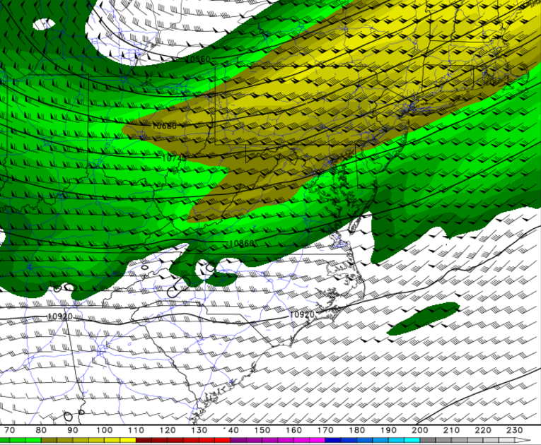
This afternoons European model, showing very high precipitable water vales (PWATS), modest mid level winds, and an approaching mid level trough to help kick off a two-pronged event on Friday with severe weather and localized flooding possible.
This Weekend and Beyond
Improving conditions are looking likely heading into the weekend, with some clouds or showers may linger into Saturday morning as shortwave trough and frontal boundary exits the region. Otherwise high pressure from Ohio Valley builds into region with a drier northwesterly flow, for rest of the weekend. It will be more pleasant, with lower humidity, more sunshine and high temperatures in the lower to middle 80s. Latest GFS and ECMWF models are keeping the next chance of more scattered showers and thunderstorms with cold front and upper-level trough coming from Great Lakes, away until Monday or Tuesday. Temperatures will likely be at seasonable levels through early next week.
For more information and posts like this one, make sure you sign up for Premium Forecasts — where multiple detailed articles, videos, and interactives are posted each day. Also, come interact with our staff and many other weather enthusiasts at 33andrain.com!
Have a great evening!
Steve Copertino & John Homenuk


