-2")

FREE Public Analysis: Damp and Dreary Conditions Gives Way to Above-Normal Temps
Good Afternoon and Happy Friday!
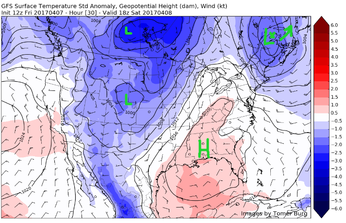
The low pressure that moved just west of our area yesterday has slowly continued on towards the north and east this afternoon, bringing yet another gloomy and day. This low will gradually lift out into eastern Canada by Saturday, but stout northwesterly winds will keep temperatures somewhat below-normal throughout the day. By Sunday, some relief from this cool and gloomy weather should arrive as an area of high pressure builds in from the southwest. As this high locks itself offshore during the beginning of next week, we may see temperatures well-above average for this time of year. The question is, does this warm period last, or is it just a passing tease?
This Afternoon and Evening
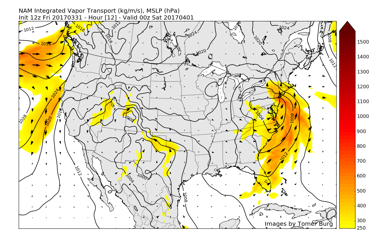
As mentioned, the very energetic area of low pressure that produced heavy rainfall, intense lightning, and even some damaging wind gusts for portions of the New York metro area has lifted into Canada this afternoon, leaving behind much cooler temperatures in its wake. Temperatures have struggled to get out of the mid-upper 40’s this afternoon, which is a good four to six degrees (c) for this time of year. When coupled with wind gusts in the 20-30 mph range, this makes temperatures feel even worse, dropping down into the upper 30’s and low 40’s. These windy conditions are due to the strong area of low pressure exiting to the north east of our area, producing a tight pressure gradient over the region as it presses against a high pressure system currently located over the Mississippi Valley.
Showers have been relatively persistent this afternoon across the area, providing some light rain or drizzle to really put the icing on the miserable conditions of this afternoon. As the last piece of energy associated with Thursday storm swings through, these showers and a weak cold front may bring some more showers towards sunset, with the possibility of a mix of snow and rain in the more inland/elevated locations. These rain or mix showers are expected to be very light in nature and no significant precipitation is expected to fall from these showers as support for their development gradually wanes this afternoon.
Mostly cloudy conditions should persist throughout the rest of the afternoon as the weak front and associated upper level energy wring out the last bit of moisture available in the atmosphere. Once we head into this evening, the remaining showers should die off and skies should gradually clear, leaving temperatures rather cold for this time of year. Most locations should see lows this evening range from the mid 30’s, to low 40’s closer to the coast.
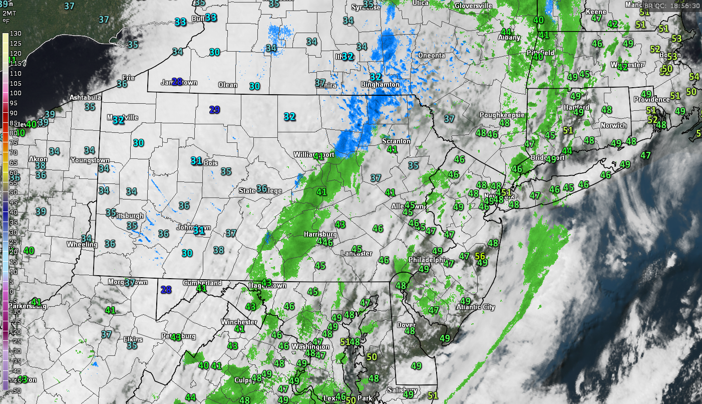
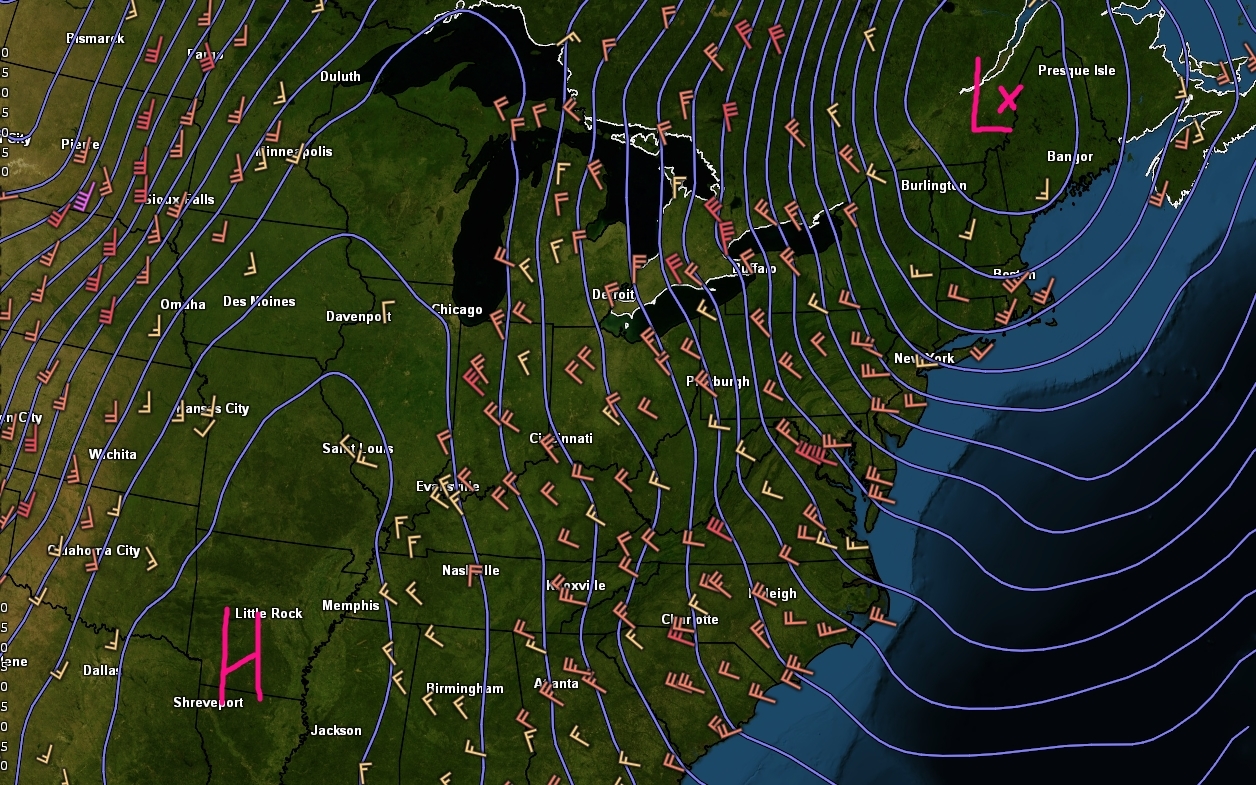
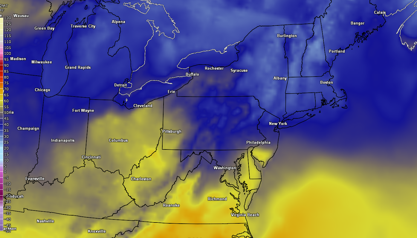
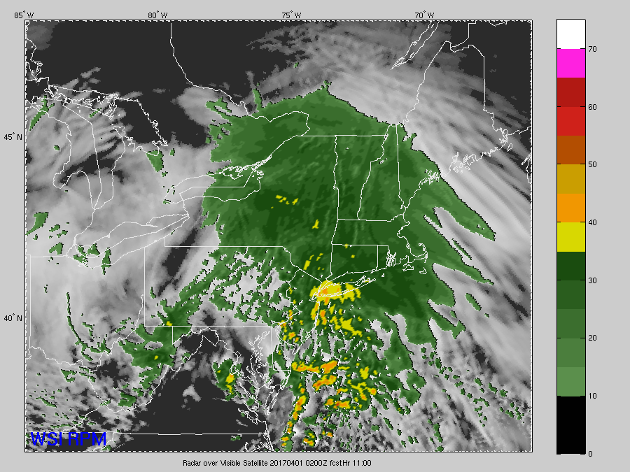
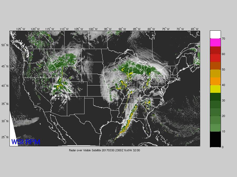
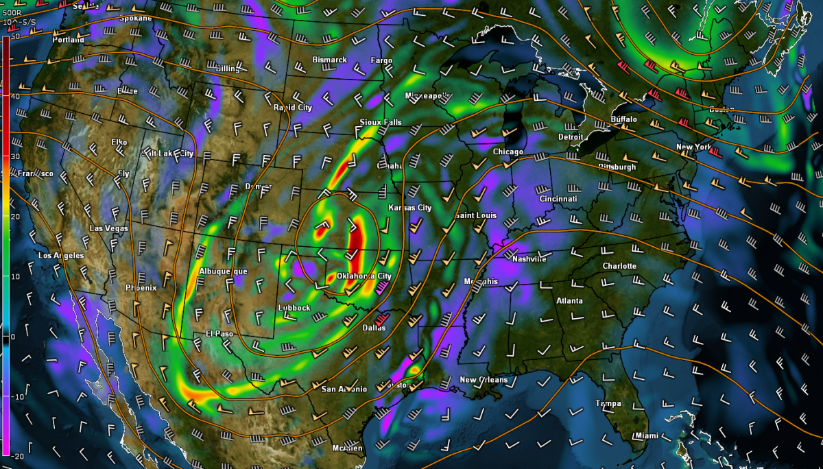
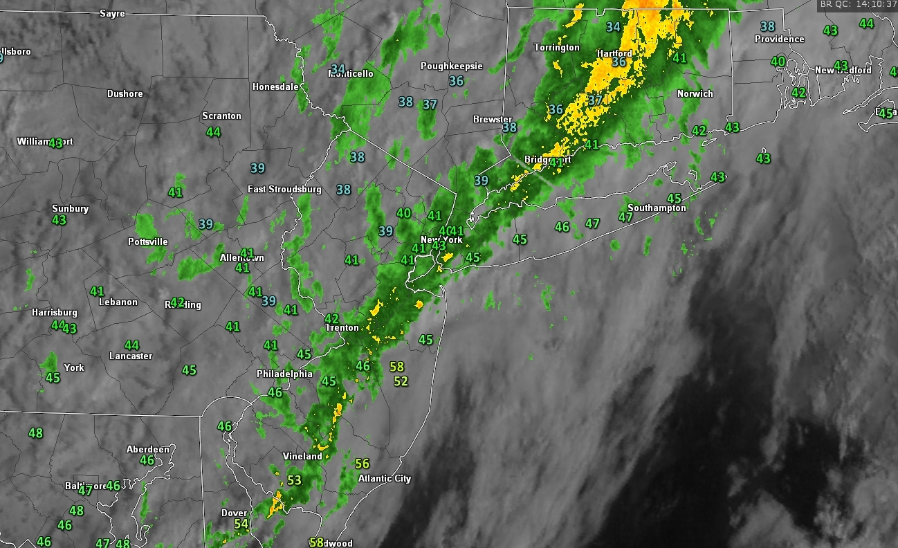
Current surface temperatures, regional radar mosaic, and visible satellite imagery showing relatively cold and damp conditions this afternoon (Courtesy of GREarth)
Saturday and Sunday
As we work our way into Saturday morning, temperatures should be relatively cool to start off the day with 30’s and low 40’s being commonplace across the area. As high pressure begins to establish itself on Saturday afternoon, winds from the northwest will keep things dry, but also relatively cool. Temperatures should be in the low to upper 50’s across the area under mostly sunny skies, however the pressure gradient that was mentioned earlier will still be lingering over the region, so winds of 15-20 mph may make things feel a bit more chilly than they actually are. Overall, Saturday should be an improvement from the past few days, but will ultimately be a few degrees below normal in the end. Saturday evening should feature clear skies with temperatures in the mid 40’s, with upper 30’s possible to the north and west of New York City.
As the high pressure system begins to move to our south on Sunday morning, winds will begin to shift to the south/southwest with somewhat chilly conditions to start off with. As the morning progresses, these southwesterly winds will usher in much warmer conditions by Sunday afternoon. Temperatures should have no problem reaching into the 60’s on Sunday afternoon with clear skies and light southerly winds. This will make Sunday the highlight of the weekend, but this is only the beginning of the above-normal temperature regime!
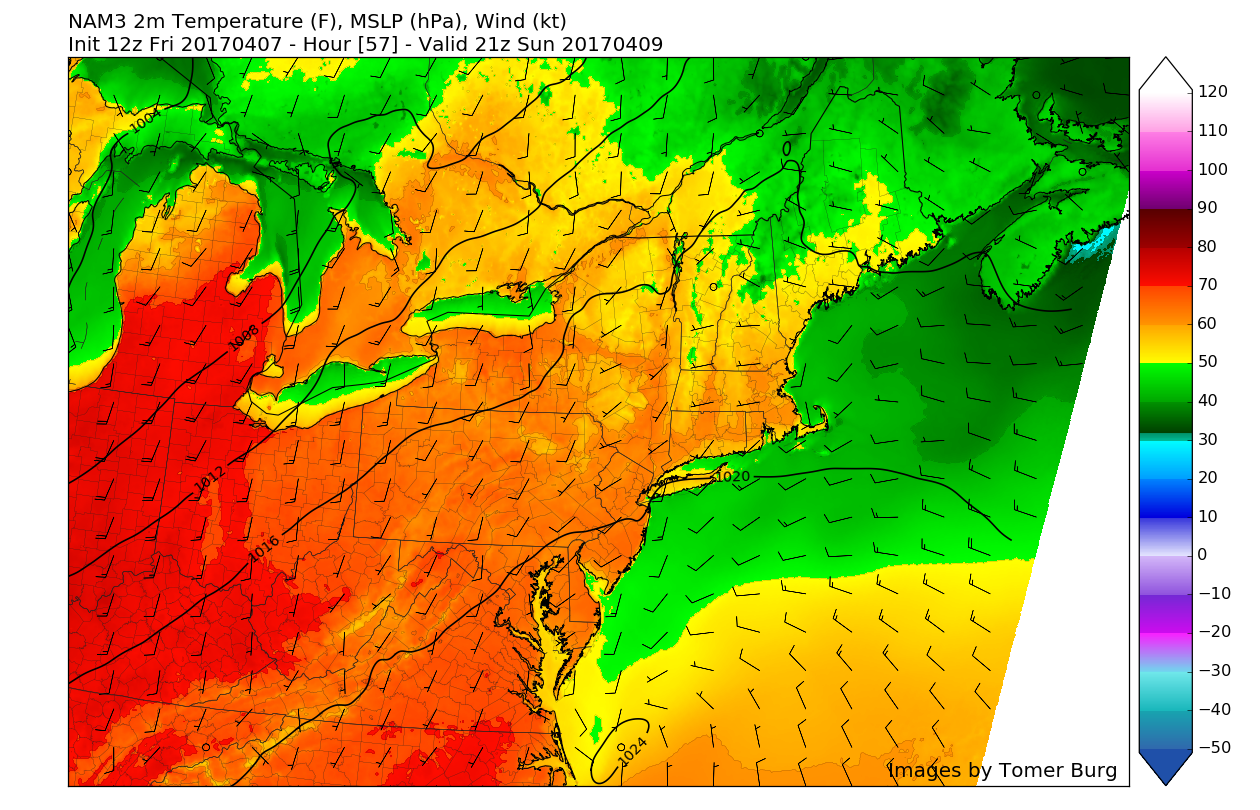
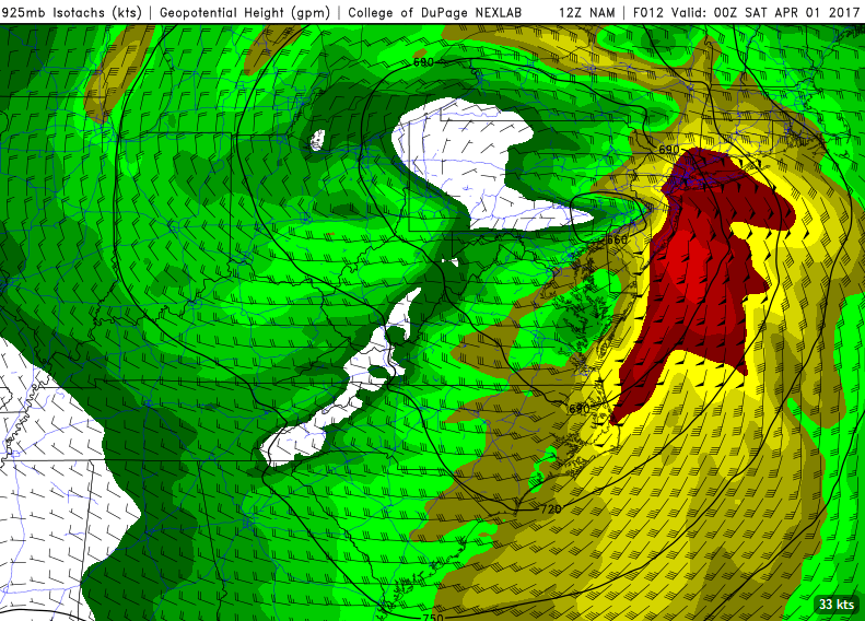
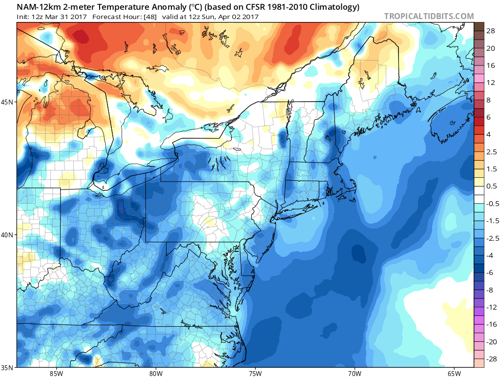
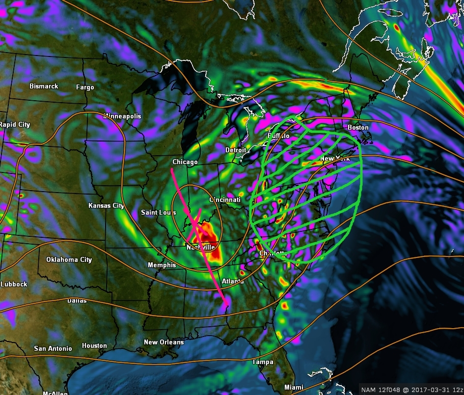
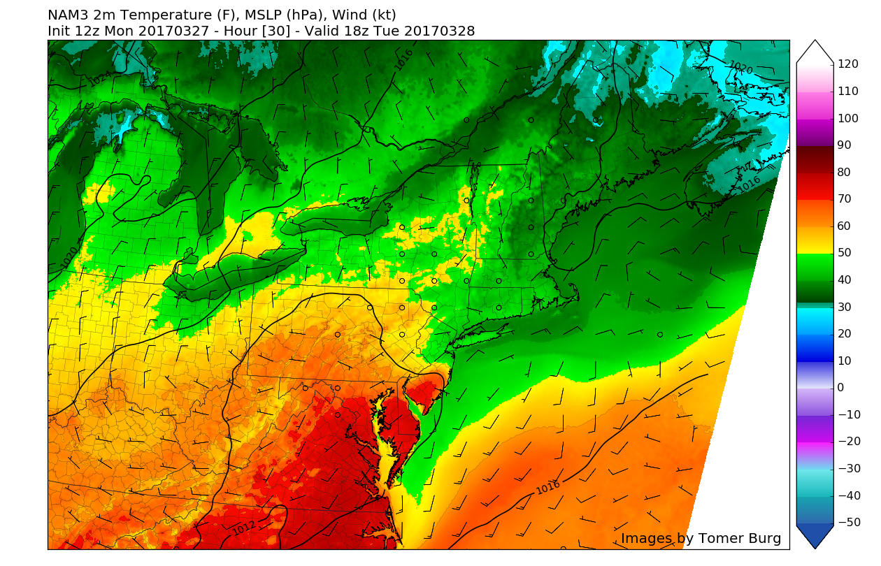
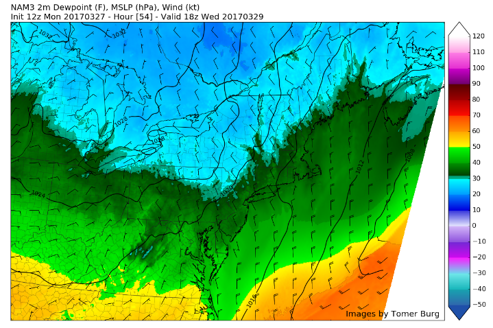
3km NAM showing temperatures reaching at or around 60 degrees areawide on Sunday afternoon (Valid 2pm)
Extended Range (Monday-Friday)
With the area of high pressure centered off of the Mid-Atlantic coast on Monday, warmer temperatures will continue to build throughout the week with increasing, deep southwesterly flow at the surface. This will allow temperatures to reach all the way up into the mid 70’s and possibly even low 80’s for southern locations on Monday and Tuesday. If such temperatures are realized early on in the work week, these would easily be around 12-15 degrees above normal for this time of year, which would be a remarkable contrast to this week’s dreary deluges.
In addition to this period of much warmer weather, conditions should also be much less active for now, as the storm track across the country leads the low pressure track well off to our west.
Temperatures should remain a good 8-15 degrees above normal each day through Thursday afternoon, before a potential disturbance from Canada drops down and brings in a chance at some more unsettled weather and cooler temperatures.
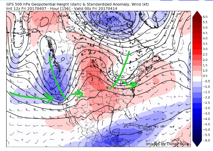
After this period of more calm and dry conditions, the Pacific looks to become much more active once again, so we will have to watch for more stormy conditions on the horizon as multiple systems line up to impact the western US and possibly travel east.
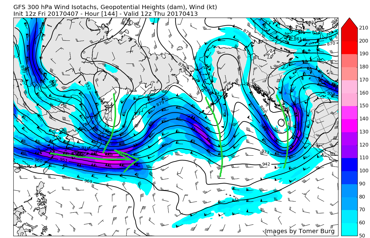
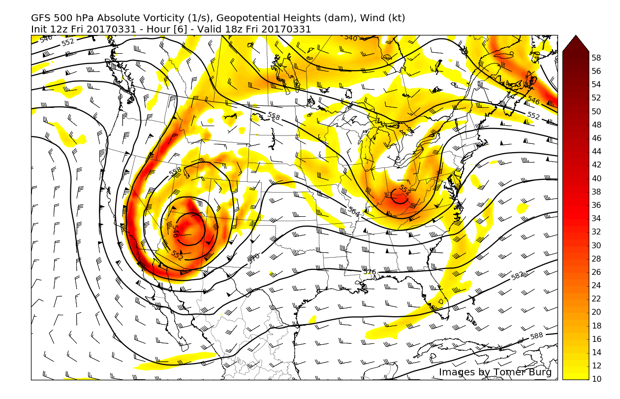
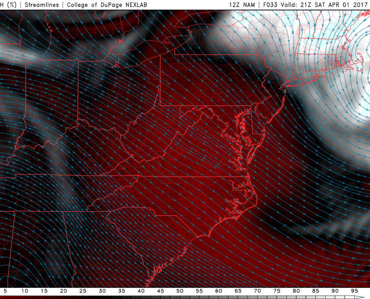
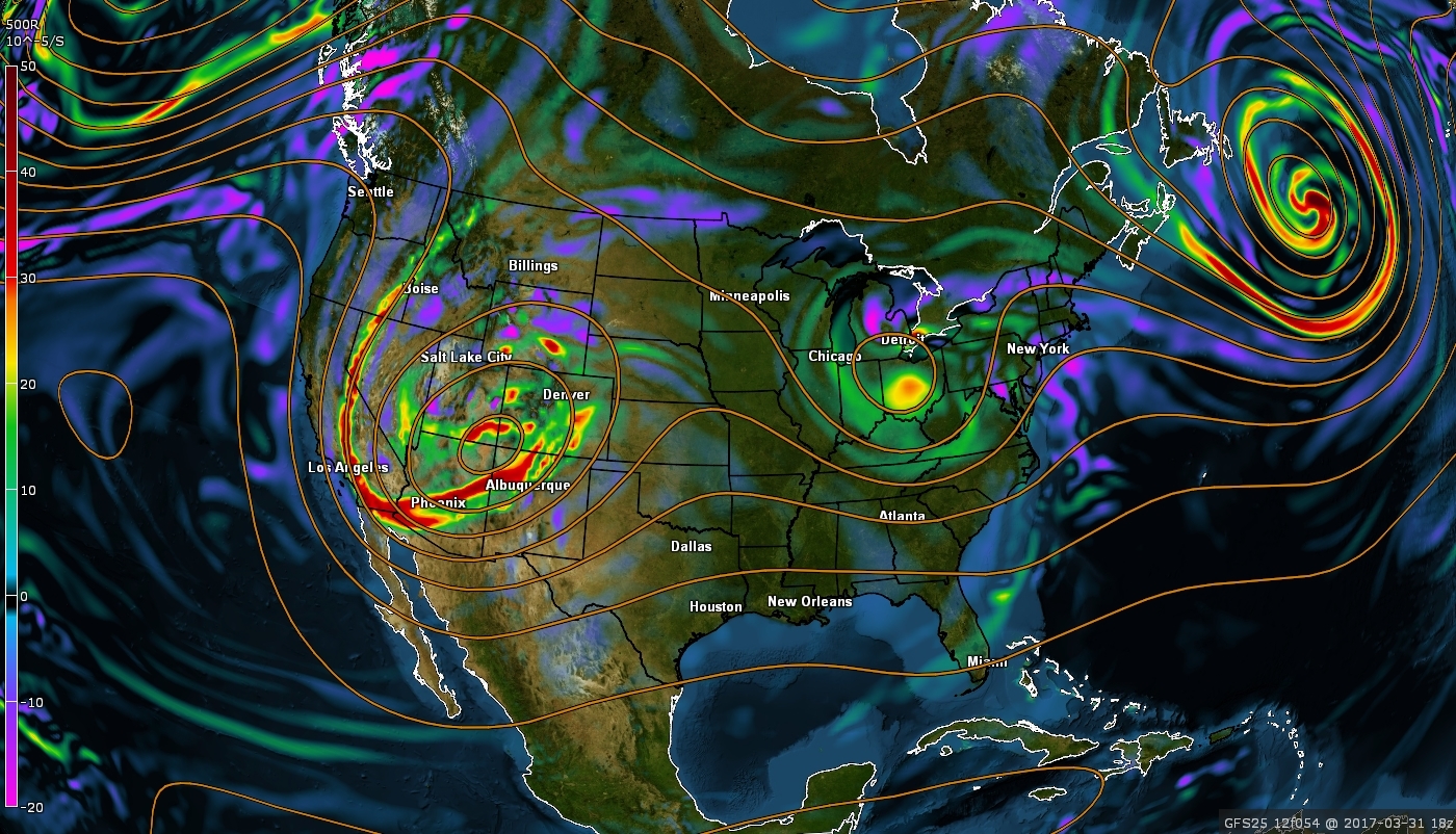
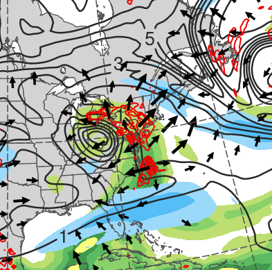
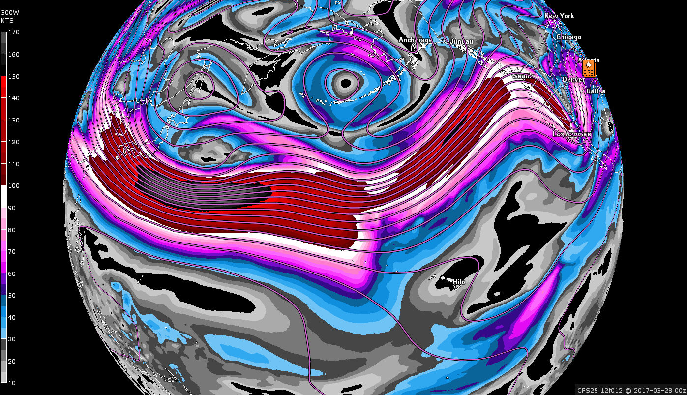
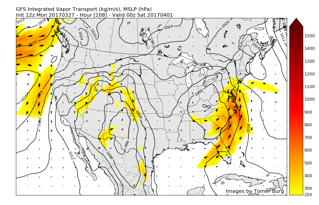
12z GFS upper level winds at 300mb showing a very active potential pattern shaping up over the Pacific, similar to the one that recently provided the severe weather and heavy rains (Valid 8am Thursday)
With some impressive warmth and a potentially more active pattern returning in the long-range, make sure to stay tuned for updates!
For more information and posts like this one, make sure you sign up for Zone Forecasts — where multiple detailed articles, videos, and interactives are posted each day. Also, come interact with our staff and many other weather enthusiasts at 33andrain.com!
Have a great weekend!
Steve Copertino


