Good Evening!
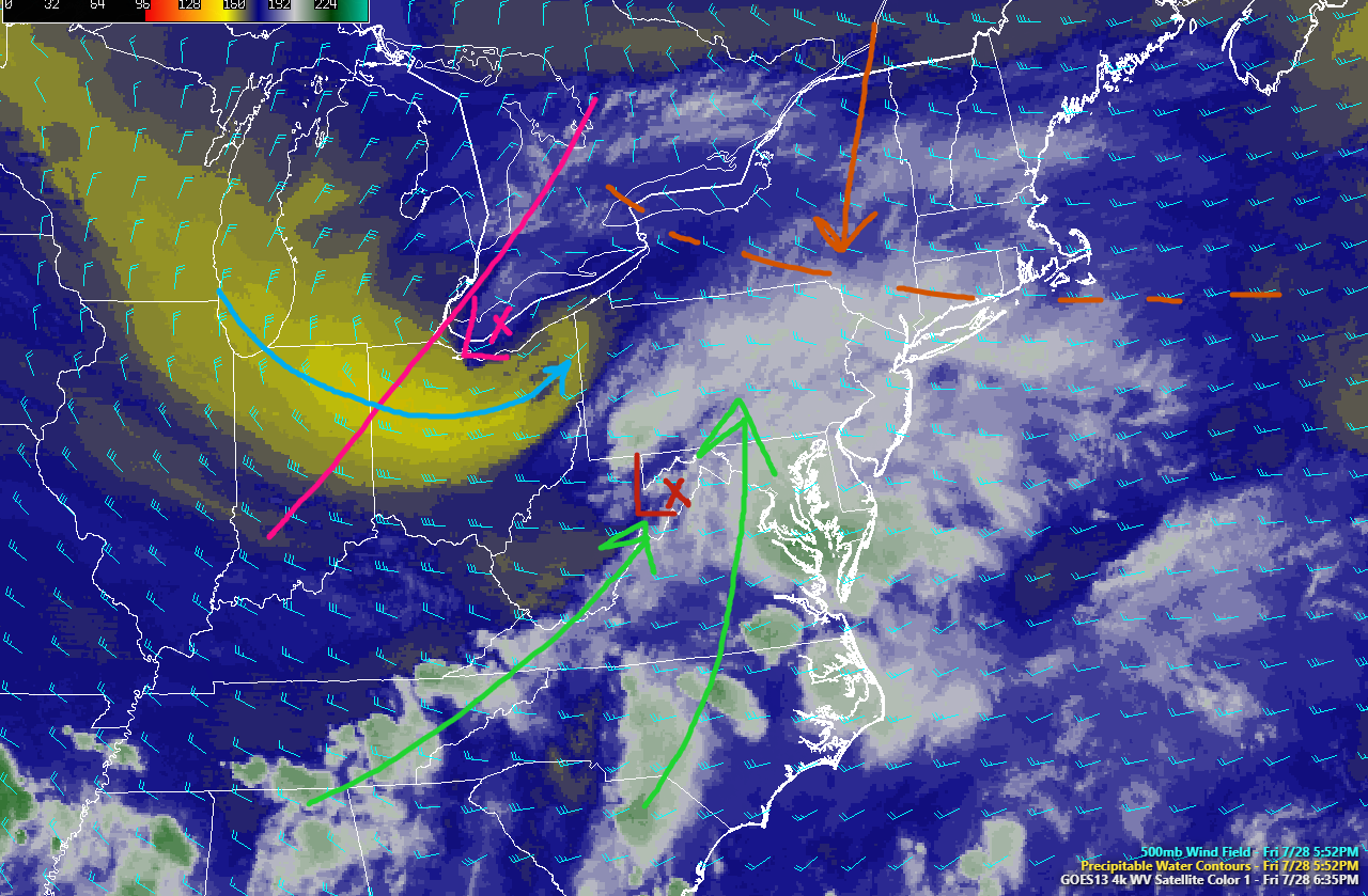
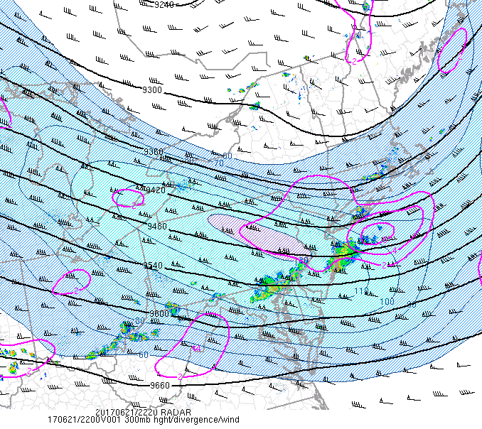
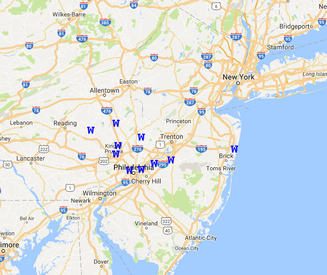
Today started off decently clear and warm over much of the area, but as the day progressed onward, the elongated area of high pressure just to our south began to move offshore. As it did so, this allowed low level moisture and cloudiness to begin to filter over the region, but still allowed conditions to remain slightly below-average, with highs locked in the upper 70’s to lower 80’s. As of this evening, cloudiness has begun to increase in earnest across the area in response to an impulse of mid level energy working its way north and east along mid level trough. In addition to cloudy skies, this impulse of energy has also sparked some showers over the northern portions of the Mid-Atlantic, with sections of Maryland, Delaware, Pennsylvania, and southern New Jersey all reporting light to moderate showers moving across that area this evening. This area of showers should continue to head east-northeast over the next few hours, but may have trouble making too much northern progress as there is some residual mid level dry air over portions of northern NJ and Long Island. This mid level dry air has also been noted on this evenings radar, as numerous areas of virga (rain not able to reach the ground due to dry conditions) popped up and quickly dissipated soon after. Overall, conditions should remain cloudy with a chance of a light shower the further south you go, but with increasing moisture, light southerly winds, and increasing clouds at all levels-radiational cooling will be very hard to come except for locations in northern Pennsylvania as well as central New York. This will keep low temperatures in the mild range of the upper 60’s to lower 70’s, with temperatures around 5 degrees cooler to the north and west.

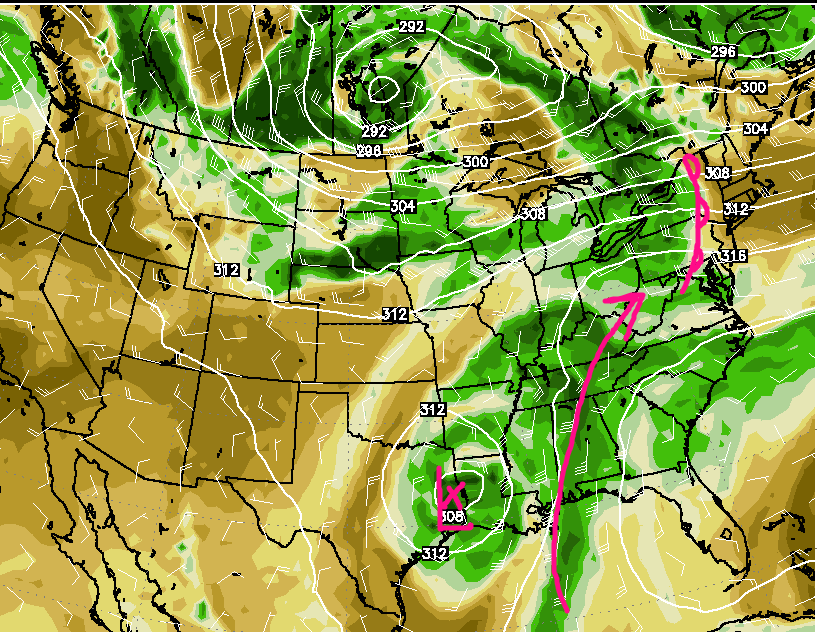
This evenings latest high resolution GEOS 16 visible satellite imagery, regional radar mosaic, surface observations, and WPC frontal locations.
Tuesday Through Friday
Tuesday morning will likely start off with numerous clouds and possible showers over the region, and another shortwave trough begins to move just to the southwest of the area, bringing another new batch of mid level instability and moisture. At this time, it appears that the best chance for steady rain will be tomorrow morning, likely over the southern portions of the New York Metro area, with locally heavy areas of rainfall possible. As the day progresses, the steadiest rain should begin to head east and off the Mid Atlantic coast. This will likely give way to improving conditions by the mid afternoon hours, with some clearing possible the further away from the coast that you area. With the mid level still feeding moisture in from the south and east, any clearing will likely allow for some instability to build up. Though we will have some instability and weak wind shear to work with tomorrow over the interior, the models indicate an area of sinking air associated with a dissipating mid level system to our north. This should greatly reduce the potential for thunderstorm coverage, but in general isolated shower and thunderstorm development is likely across portions of New York and Pennsylvania tomorrow afternoon and into the evening hours. With the lack of severe parameters coming together, the overall threat for severe weather should be quite low tomorrow, but some stronger storms could produce gusty winds, very heavy rainfall, and even small hail.
As we get closer to New York City, cloud cover and much more stable/sinking air over the region should generally limit and thunderstorm development through the evening hours, and any storms that track close to the area should be on the weakening trend and will likely die-off. With winds coming off of the Atlantic, tomorrow evening will likely be another mild and somewhat-muggy one as lows will likely stay in the low 70’s to upper 60’s across much of the area.
Wednesday should be a much more pleasant day across the Northeast, as dry air behind the mid level disturbance begins to overspread the area, knocking out much of the cloud cover during the early morning hours of the day. Mid to upper level ridging will allow for temperatures on Wednesday afternoon to get quite warm, with highs likely reaching up into the upper 80’s and into the lower 90’s across the region. Few clouds are expected through the evening hours, as a backdoor coldfront pushes from north to south across our area, working to lower dewpoints region-wide.
Thursday looks to be relatively nice for the majority of the day, as the backdoor coldfront halts its progress around the Mid Atlantic region, keep the area warm, but less humid during the day. With dry northwesterly flow established, conditions should be mostly clear across the area. This looks to change later in the evening, as a large mid level system over the Great Lakes looks to approach the Northeast after sunset and into Friday. This system will be accompanied by a strong cold front, which could be responsible for shower and thunderstorm development late Thursday and into Friday, but at this time, it does not appear that this system will carry much of a severe weather threat as well as a flooding threat. This will likely have to be reassessed later in the week, so check back for updates!

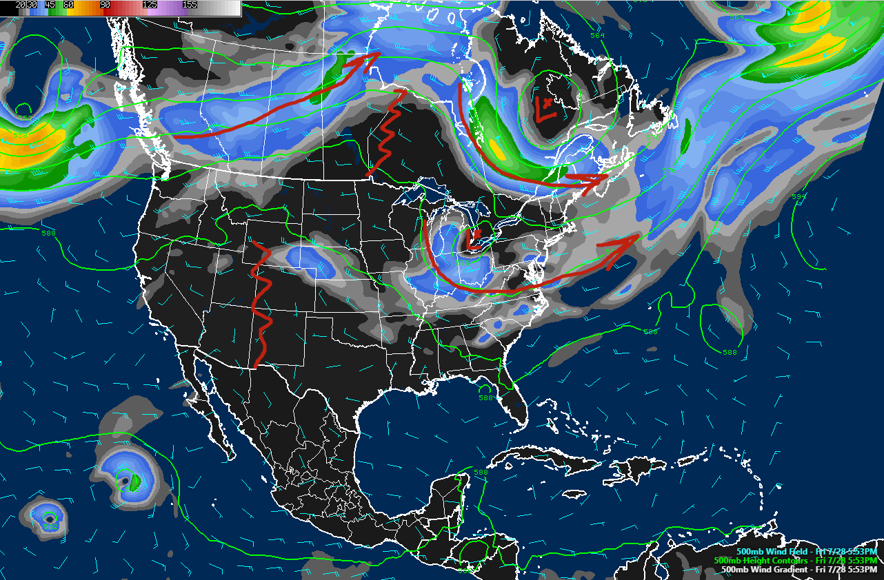
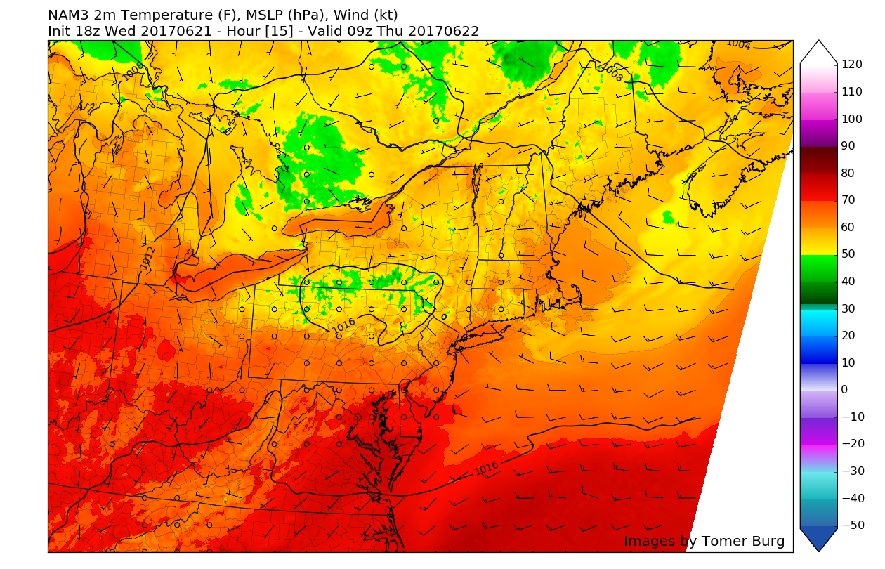
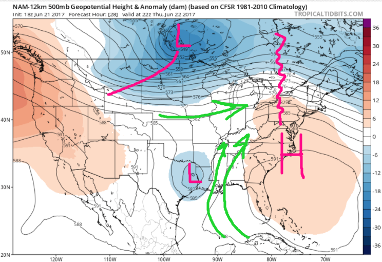
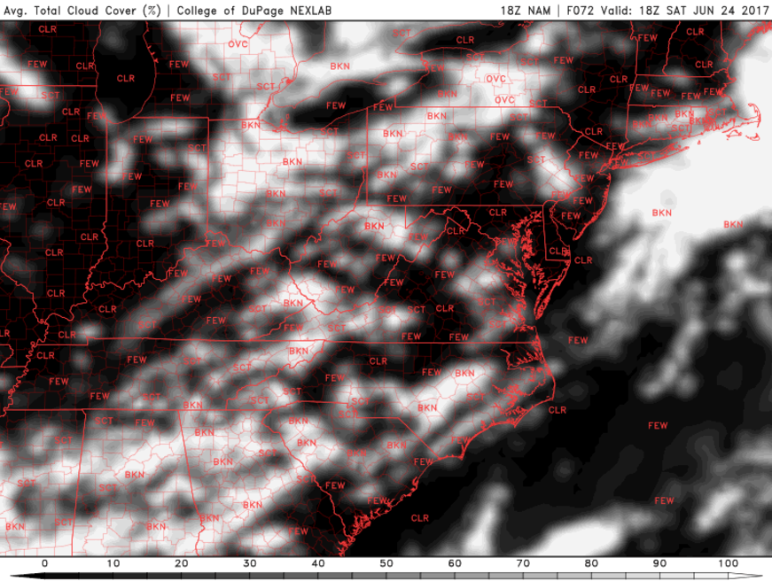
This afternoons NAM model showing the progression of Tropical Storm Gert off the east coast, as well as a mid level system over the central part of the county, which may work to bring showers and thunderstorms over our area later this week
Tropical Storm Gert Nearing Hurricane Intensity
As of 5pm this evening, Tropical Storm Gert was located roughly 450 miles to the west-southwest of Bermuda, and moving north at around 8 miles per hour. Gert has taken advantage of a relatively favorable environment today characterized by low vertical wind shear, very warm sea surface temperatures, moist air, and slow storm motion. This allowed the storm to develop intense thunderstorms near the core of the system, which in turn began a period of intensification to just below hurricane status-at 70 mph. Recent visible satellite images from the GOES-16 satellite showed that the cloud tops of Gert were warming a little, maybe indicating a brief halt in the intensification process, but with the storm located over very warm water and under a favorable environment, it appears quite likely that Gert will become a hurricane within the next 12-18 hours.
Gert will continue to track to the north as it rounds the western edge of the Bermuda high tomorrow, likely continuing to strengthen as it does so. Gert will likely begin to accelerate and take on more of an easterly component later tomorrow, as a shortwave trough moves over the Northeast. As the storm begins to interact with the shortwave trough over the northern Atlantic ocean, it will likely begin its extra-tropical transition by late Wednesday. Thereafter, the storm is likely to remain a powerful extra-tropical system, which may eventually threaten portions of Europe further down the line. Impacts for the east coast will be limited to increased wave swells and a high risk of rip currents. The main risk from Gert will be help by any maritime craft venturing off the east coast this week. Elsewhere in the Atlantic, there is an area of disturbed weather located in the far eastern Atlantic which may try to gradually develop into a tropical cyclone over the next few days as it heads generally WNW at 15mph.

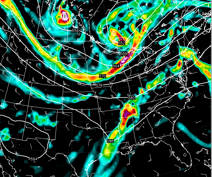
GOES-16 visible satellite imagery of Tropical Storm Gert off of the southeastern coast of the US this evening (Courtesy of simuawips.com)
For more information and posts like this one, make sure you sign up for Premium Forecasts — where multiple detailed articles, videos, and interactives are posted each day. Also, come interact with our staff and many other weather enthusiasts at 33andrain.com!
Have a great evening!
Steve Copertino
-2")


